![](/images/other/stat-length.png)
Rando-échavanne-chateau d''étobon
benoit747
User
![Length](/images/other/stat-length.png)
Length
15.5 km
![Max alt](https://static1.geolcdn.com/siteimages/upload/files/1508320355ic_sort_altitude_max_24dp.png)
Max alt
576 m
![Uphill gradient](https://static1.geolcdn.com/siteimages/upload/files/1508320355ic_sort_den_pos_24dp.png)
Uphill gradient
392 m
![Km-Effort](/images/other/stat-length.png)
Km-Effort
21 km
![Min alt](https://static1.geolcdn.com/siteimages/upload/files/1508320355ic_sort_altitude_min_24dp.png)
Min alt
370 m
![Downhill gradient](https://static1.geolcdn.com/siteimages/upload/files/1508320355ic_sort_den_neg_24dp.png)
Downhill gradient
392 m
![Boucle](https://static1.geolcdn.com/siteimages/upload/files/16400158638029165_repeat_loop_refresh_sync_direction_icon.png)
Boucle
Yes
Creation date :
2014-12-10 00:00:00.0
Updated on :
2018-12-03 10:33:47.578
![Walking](https://static1.geolcdn.com/sitytour/trail-icons/101.png)
4h00
Difficulty : Medium
![Scan this QR Code to open this trail in the SityTrail application](https://capi.geolives.com/qq0zvz2zws4bq2lad0pu/sitytour/trails/100112/qr.png?size=200)
FREE GPS app for hiking
About
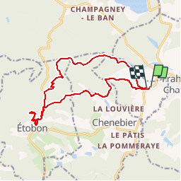
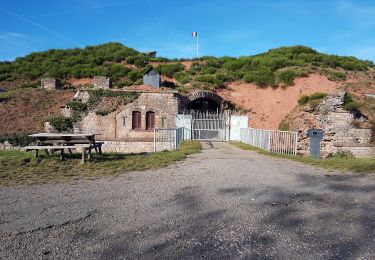
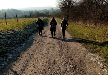
Trail Walking of 15.5 km to be discovered at Bourgogne-Franche-Comté, Haute-Saône, Échavanne. This trail is proposed by benoit747.
Description
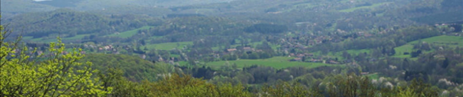
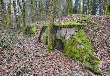
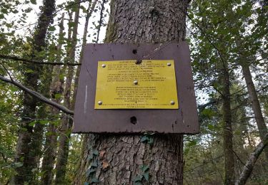
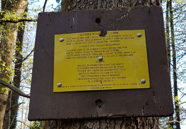
une rando très sympa et bien ombragée. les ruines du chateau sont équipées de bancs et tables pour manger confortablement.
Positioning
Country:
France
Region :
Bourgogne-Franche-Comté
Department/Province :
Haute-Saône
Municipality :
Échavanne
Location:
Unknown
Start:(Dec)
Start:(UTM)
329774 ; 5280717 (32T) N.
Comments
Trails nearby
![Trail Electric bike Châlonvillars - VTT - Châlonvillars - Etobon - Ronchamp - Plancher-Bas - Malsaucy - Photo](https://media.geolcdn.com/t/375/260/0af5e710-b661-426e-a32c-4cb272df7c44.jpg&format=jpg&maxdim=2)
![Electric bike Electric bike](https://static1.geolcdn.com/sitytour/trail-icons/205.png)
VTT - Châlonvillars - Etobon - Ronchamp - Plancher-Bas - Malsaucy
Electric bike
Difficult
Châlonvillars,
Bourgogne-Franche-Comté,
Haute-Saône,
France
![](/images/other/stat-length.png)
71 km | 90 km-effort
5h 50min
![](https://static1.geolcdn.com/siteimages/upload/files/16400158638029165_repeat_loop_refresh_sync_direction_icon.png)
Yes
![Trail Walking Châlonvillars - Châlonvillars - Fort du Salbert - Evette-Salbert - Photo](https://media.geolcdn.com/t/375/260/30a56d40-1ac0-4227-a497-f489c67ce1fe.jpg&format=jpg&maxdim=2)
![Walking Walking](https://static1.geolcdn.com/sitytour/trail-icons/101.png)
Châlonvillars - Fort du Salbert - Evette-Salbert
Walking
Difficult
(1)
Châlonvillars,
Bourgogne-Franche-Comté,
Haute-Saône,
France
![](/images/other/stat-length.png)
11 km | 15.8 km-effort
3h 36min
![](https://static1.geolcdn.com/siteimages/upload/files/16400158638029165_repeat_loop_refresh_sync_direction_icon.png)
Yes
![Trail Mountain bike Châlonvillars - Châlonvillars - Fort Giromagny en passant au milieu des étangs - Photo](https://media.geolcdn.com/t/375/260/4cf742f1-48e3-4bef-b8af-82a52a583623.jpg&format=jpg&maxdim=2)
![Mountain bike Mountain bike](https://static1.geolcdn.com/sitytour/trail-icons/202.png)
Châlonvillars - Fort Giromagny en passant au milieu des étangs
Mountain bike
Very difficult
Châlonvillars,
Bourgogne-Franche-Comté,
Haute-Saône,
France
![](/images/other/stat-length.png)
40 km | 51 km-effort
3h 31min
![](https://static1.geolcdn.com/siteimages/upload/files/16400158638029165_repeat_loop_refresh_sync_direction_icon.png)
Yes
![Trail Mountain bike Châlonvillars - Châlonvillars - Menhir - Mandrevillars - Fort Essert et du Salbert - Photo](https://media.geolcdn.com/t/375/260/0d0bf6fd-2dc2-4259-800b-34db6b624b81.jpg&format=jpg&maxdim=2)
![Mountain bike Mountain bike](https://static1.geolcdn.com/sitytour/trail-icons/202.png)
Châlonvillars - Menhir - Mandrevillars - Fort Essert et du Salbert
Mountain bike
Very difficult
Châlonvillars,
Bourgogne-Franche-Comté,
Haute-Saône,
France
![](/images/other/stat-length.png)
31 km | 42 km-effort
2h 53min
![](https://static1.geolcdn.com/siteimages/upload/files/16400158638029165_repeat_loop_refresh_sync_direction_icon.png)
Yes
![Trail Walking Champagney - Canal souterrain de la Haute-Saône - Photo](https://media.geolcdn.com/t/375/260/04c8dd3d-861a-49bc-aa06-88e783162bdc.jpg&format=jpg&maxdim=2)
![Walking Walking](https://static1.geolcdn.com/sitytour/trail-icons/101.png)
Canal souterrain de la Haute-Saône
Walking
Difficult
Champagney,
Bourgogne-Franche-Comté,
Haute-Saône,
France
![](/images/other/stat-length.png)
10.1 km | 13.4 km-effort
3h 3min
![](https://static1.geolcdn.com/siteimages/upload/files/16400158638029165_repeat_loop_refresh_sync_direction_icon.png)
Yes
![Trail Walking Châlonvillars - Châlonvillars - le mehnir - Mandrevillars - Photo](https://media.geolcdn.com/t/375/260/b30d40ec-93d6-4f7b-887c-caef10825b9c.jpg&format=jpg&maxdim=2)
![Walking Walking](https://static1.geolcdn.com/sitytour/trail-icons/101.png)
Châlonvillars - le mehnir - Mandrevillars
Walking
Medium
Châlonvillars,
Bourgogne-Franche-Comté,
Haute-Saône,
France
![](/images/other/stat-length.png)
13.4 km | 17.1 km-effort
2h 39min
![](https://static1.geolcdn.com/siteimages/upload/files/16400158638029165_repeat_loop_refresh_sync_direction_icon.png)
Yes
![Trail Walking Châlonvillars - Châlonvillars - Mandrevillars - Photo](https://media.geolcdn.com/t/375/260/e4fd3b0e-8b31-475e-ba79-3ca96152b87a.jpg&format=jpg&maxdim=2)
![Walking Walking](https://static1.geolcdn.com/sitytour/trail-icons/101.png)
Châlonvillars - Mandrevillars
Walking
Easy
Châlonvillars,
Bourgogne-Franche-Comté,
Haute-Saône,
France
![](/images/other/stat-length.png)
9.5 km | 11.9 km-effort
1h 33min
![](https://static1.geolcdn.com/siteimages/upload/files/16400158638029165_repeat_loop_refresh_sync_direction_icon.png)
Yes
![Trail Walking Frahier-et-Chatebier - frahier - Photo](https://media.geolcdn.com/t/375/260/95f0d94d-e209-4293-8856-d410c2620589.jpg&format=jpg&maxdim=2)
![Walking Walking](https://static1.geolcdn.com/sitytour/trail-icons/101.png)
frahier
Walking
Medium
(1)
Frahier-et-Chatebier,
Bourgogne-Franche-Comté,
Haute-Saône,
France
![](/images/other/stat-length.png)
5.6 km | 6.8 km-effort
1h 44min
![](https://static1.geolcdn.com/siteimages/upload/files/16400158638029165_repeat_loop_refresh_sync_direction_icon.png)
Yes
![Trail Walking Châlonvillars - Châlonvillars - Mandrevillars par les bois - Photo](https://media.geolcdn.com/t/375/260/fcf7d7d5-1c4d-4be5-898e-203e10c38ac6.jpg&format=jpg&maxdim=2)
![Walking Walking](https://static1.geolcdn.com/sitytour/trail-icons/101.png)
Châlonvillars - Mandrevillars par les bois
Walking
Easy
Châlonvillars,
Bourgogne-Franche-Comté,
Haute-Saône,
France
![](/images/other/stat-length.png)
10.4 km | 12.9 km-effort
1h 40min
![](https://static1.geolcdn.com/siteimages/upload/files/16400158638029165_repeat_loop_refresh_sync_direction_icon.png)
Yes