Point of interest Saint-Genès-Champanelle - Départ - Photo

Départ

Description

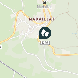
Du parking, monter la petite rue en direction du village et passer devant l'église. A l'abreuvoir-fontaine tourner à gauche. 100 mètres plus loin, prendre à gauche la rue du sabotier. Avant la croix sous les tilleuls, prendre à gauche, puis tout de suite à droite le chemin qui monte jusqu'à la route départementale.

Photos

Départ can be discovered in the following trails...
Trail Walking Saint-Genès-Champanelle - Nadaillat - Photo
Walking
betf

Walking

Easy
Saint-Genès-Champanelle, Auvergne-Rhône-Alpes, Puy-de-Dôme, France
6.8 km | 9.5 km-effort
2h 2min
Yes
 betf
betf

User

© OpenStreetMap contributors

Positioning

Country:
France
Region :
Auvergne-Rhône-Alpes
Department/Province :
Puy-de-Dôme
Municipality :
Saint-Genès-Champanelle
Location:
Unknown
Creation date :
2018-04-16 08:20:51.468
Updated on
2018-04-16 08:20:51.468

(0 Reviews)


Points of interest nearby

Point of interest Saint-Genès-Champanelle - Repère 1 - Photo
betf
SAINT-GENÈS-CHAMPANELLE 
Point of interest Saint-Genès-Champanelle - Repère 3 - Photo
betf
SAINT-GENÈS-CHAMPANELLE 
Point of interest Saint-Genès-Champanelle - point de vue - Photo
tracegps
SAINT-GENÈS-CHAMPANELLE 
Point of interest Aydat - DESCENTE NOW - Photo
DANCHAUD
Point of interest Aydat - Point 2 - Photo
force
AYDAT 
Point of interest Aydat - Repère 2 - Photo
betf
AYDAT 
Point of interest Aydat - Cpg D1 - Photo
adupuped
AYDAT 
Point of interest Aydat - Pique-nique - Photo
tracegps


Close
My subscriptions