Home
World
NEW
Premium
Shop
Trails
Articles
Help and support
Français
English
Nederlands
Español
Italiano
Deutsch
Log in
Home
World
Premium
Shop
Trails
Articles
Help and support
SityTrail
>
Points of interest
>
départ
SityTrail
>
Points of interest
>
départ
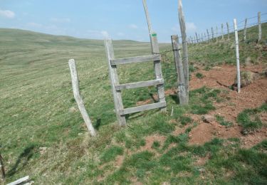
départ
Description
Route
Photos
départ can be discovered in the following trails...
tracegps
La montagne de Courbières - Pradiers
Walking
Medium
Pradiers, Auvergne-Rhône-Alpes, Cantal, France
15.9 km | 21 km-effort
5h 30min
Yes
tracegps
User
©
OpenStreetMap
contributors
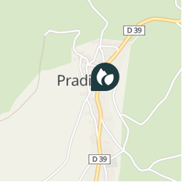
Positioning
Country:
France
Region :
Auvergne-Rhône-Alpes
Department/Province :
Cantal
Municipality :
Pradiers
Location:
Unknown
Positioning
45.2693824 / 2.9241095
Creation date :
2018-04-09 11:49:22.535
Updated on
2018-04-09 11:49:22.535
(0 Reviews)
Comments
Please log in to post a review or rate the element
Points of interest nearby
tracegps
A
VERNOLS
tracegps
7
PEYRUSSE
tracegps
8
PEYRUSSE
tracegps
6
PEYRUSSE
tracegps
9
PEYRUSSE
tracegps
10
PEYRUSSE
tracegps
B
VERNOLS
tracegps
départ
SÉGUR-LES-VILLAS
Close
My subscriptions