Home
World
NEW
Premium
Shop
Trails
Articles
Help and support
Français
English
Nederlands
Español
Italiano
Deutsch
Log in
Home
World
Premium
Shop
Trails
Articles
Help and support
SityTrail
>
Points of interest
>
6
SityTrail
>
Points of interest
>
6
6
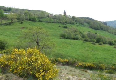
Description
Route et D221
Photos
6 can be discovered in the following trails...
tracegps
La chapelle de Vauclair
Walking
Difficult
Molompize, Auvergne-Rhône-Alpes, Cantal, France
11.2 km | 17.7 km-effort
3h 15min
Yes
tracegps
User
©
OpenStreetMap
contributors
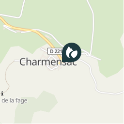
Positioning
Country:
France
Region :
Auvergne-Rhône-Alpes
Department/Province :
Cantal
Municipality :
Charmensac
Location:
Unknown
Positioning
45.2164006 / 3.0880165
Creation date :
2018-04-09 12:23:25.676
Updated on
2018-04-09 12:23:25.676
(0 Reviews)
Comments
Please log in to post a review or rate the element
Points of interest nearby
tracegps
7
CHARMENSAC
tracegps
8
CHARMENSAC
tracegps
départ
MOLOMPIZE
tracegps
5
CHARMENSAC
tracegps
001
CHARMENSAC
tracegps
1
MOLOMPIZE
tracegps
2
MOLOMPIZE
tracegps
4
MOLOMPIZE
Close
My subscriptions