Point of interest Vollore-Montagne - Départ - Photo

Départ

Description

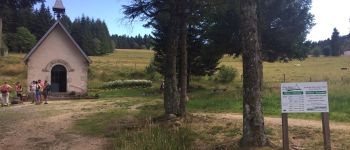
D. Dans le village près du restaurant, au niveau du panneau d'information. Prendre la route  jusqu'au carrefour avec celle de Viscomtat, prendre à droite direction Noirétable et tourner à gauche de l'ancien hôtel du pont. On monte jusqu'à la route que l'on traverse pour continuer à monter (point de vue sur la plaine de la Dore, la Limagne, les buttes volcaniques  de la Comté et au loin la chaîne des Puys, le Massif du Sancy et le Massif du Cantal)

Photos

Départ can be discovered in the following trails...
Trail Other activity Vollore-Montagne - Sans titre - Photo
Other activity
Zeugma13

Other activity

Very easy
Vollore-Montagne, Auvergne-Rhône-Alpes, Puy-de-Dôme, France
15.6 km | 22 km-effort
Unknown
Yes
 Zeugma13
Zeugma13

User

© OpenStreetMap contributors

Positioning

Country:
France
Region :
Auvergne-Rhône-Alpes
Department/Province :
Puy-de-Dôme
Municipality :
Vollore-Montagne
Location:
Unknown
Positioning
Creation date :
2019-01-15 13:58:20.136
Updated on
2019-01-15 13:58:20.136

(0 Reviews)


Points of interest nearby

Point of interest Vollore-Montagne - Point repère 1 - Photo
Zeugma13
VOLLORE-MONTAGNE 
Point of interest Vollore-Ville - 3 - Photo
Zeugma13
VOLLORE-VILLE 
Point of interest Vollore-Montagne - Point repère 4 - Photo
Zeugma13
VOLLORE-MONTAGNE 
Point of interest Vollore-Montagne - Point repère 3 - Photo
Zeugma13
VOLLORE-MONTAGNE 
Point of interest Noirétable - Point repère 2 - Photo
Zeugma13
NOIRÉTABLE 
Point of interest Noirétable - source guerriseuse  - Photo
carolineF11
NOIRÉTABLE 
Point of interest Vollore-Ville - 4 - Photo
Zeugma13
VOLLORE-VILLE 
Point of interest Sainte-Agathe - 2 - Photo
Zeugma13
SAINTE-AGATHE 


Close
My subscriptions