Point of interest Abeilhan - Etape 9 - Photo

Etape 9

Description

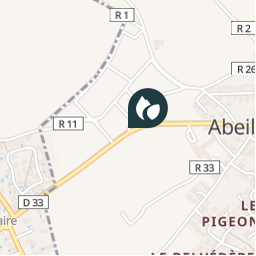
À la croix, prendre la piste de gauche. Au croisement, emprunter la route à droite et rallier la D 33 dans Abeilhan. Traverser, puis la suivre à gauche jusqu’à l’intersection avec la D 146. Monter à droite, puis prendre à gauche le boulevard Louis-Pasteur jusqu’au parking.

Photos

Etape 9 can be discovered in the following trails...
Trail Other activity Abeilhan - RANDONNEE DE LA THONGUE ET SES COTEAUX - Photo
Other activity
Daron34

Other activity

Very easy
Abeilhan, Occitania, Hérault, France
14.7 km | 17.2 km-effort
Unknown
Yes
 Daron34
Daron34

User

© OpenStreetMap contributors

Positioning

Country:
France
Region :
Occitania
Department/Province :
Hérault
Municipality :
Abeilhan
Location:
Unknown
Creation date :
2018-06-26 15:58:11.616
Updated on
2018-06-26 15:58:11.616

(0 Reviews)


Points of interest nearby

Point of interest Abeilhan - Etape 1 - Photo
Daron34
ABEILHAN 
Point of interest Coulobres - Etape 6 - Photo
Daron34
COULOBRES 
Point of interest Coulobres - Etape 8 - Photo
Daron34
COULOBRES 
Point of interest Coulobres - Etape 7 - Photo
Daron34
COULOBRES 
Point of interest Abeilhan - Etape 2 - Photo
Daron34
ABEILHAN 
Point of interest Abeilhan - Etape 4 - Photo
Daron34
ABEILHAN 
Point of interest Pouzolles - Etape 5 - Photo
Daron34
POUZOLLES 
Point of interest Alignan-du-Vent - Etape 3 - Photo
Daron34
ALIGNAN-DU-VENT 


Close
My subscriptions