![](/images/other/stat-length.png)
Sweden: Best trails, routes and walks
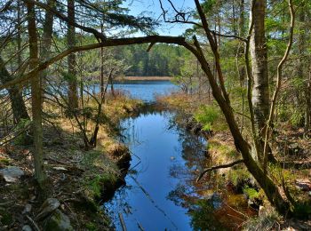
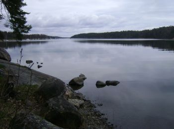
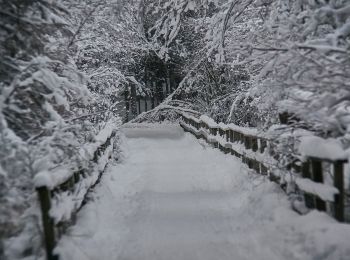
Sweden: Discover the 750 best hiking and cycling trail ideas. Our catalogue, manually prepared by our hikers, contains lots of beautiful landscapes to explore. Download these trails in SityTrail, our free hiking GPS application available on Android and iOS.
The best trails (750)
![Trail On foot - Orrefors vandringsled - Photo](https://media.geolcdn.com/t/350/260/c0c34a27-83f3-4350-a139-b3084ff827bd.jpeg&format=jpg&maxdim=2)
![On foot On foot](https://static1.geolcdn.com/sitytour/trail-icons/100.png)
Km
On foot
![](/images/other/stat-length.png)
![](https://static1.geolcdn.com/siteimages/upload/files/1508320355ic_sort_den_pos_24dp.png)
![](https://static1.geolcdn.com/siteimages/upload/files/1508320355ic_sort_den_neg_24dp.png)
![](https://static1.geolcdn.com/siteimages/upload/files/16400158638029165_repeat_loop_refresh_sync_direction_icon.png)
• För dig som njuter av att vara ute och röra på dig i naturen så vill vi tipsa om att det finns flera härliga vandring...
![Trail On foot - Paddesjöslingan - Photo](https://media.geolcdn.com/t/350/260/63c30cb1-4eeb-4c19-b0f8-770bff861a9a.jpeg&format=jpg&maxdim=2)
![On foot On foot](https://static1.geolcdn.com/sitytour/trail-icons/100.png)
Km
On foot
![](/images/other/stat-length.png)
![](https://static1.geolcdn.com/siteimages/upload/files/1508320355ic_sort_den_pos_24dp.png)
![](https://static1.geolcdn.com/siteimages/upload/files/1508320355ic_sort_den_neg_24dp.png)
![](https://static1.geolcdn.com/siteimages/upload/files/16400158638029165_repeat_loop_refresh_sync_direction_icon.png)
• Trail created by Länsstyrelsen Hallands län.
![Trail On foot Härnösands domkyrkodistrikt - Härnöleden - Photo](https://media.geolcdn.com/t/350/260/b78e02a6-c237-4b66-a6c6-4ecb7a93e416.jpeg&format=jpg&maxdim=2)
![On foot On foot](https://static1.geolcdn.com/sitytour/trail-icons/100.png)
Km
On foot
![](/images/other/stat-length.png)
![](https://static1.geolcdn.com/siteimages/upload/files/1508320355ic_sort_den_pos_24dp.png)
![](https://static1.geolcdn.com/siteimages/upload/files/1508320355ic_sort_den_neg_24dp.png)
![](https://static1.geolcdn.com/siteimages/upload/files/16400158638029165_repeat_loop_refresh_sync_direction_icon.png)
• Trail created by Härnösands Kommun.
![Trail On foot - Hälsans Stig Varberg - Photo](https://media.geolcdn.com/t/350/260/b28cb05a-6982-4abd-8129-901f349327f2.jpeg&format=jpg&maxdim=2)
![On foot On foot](https://static1.geolcdn.com/sitytour/trail-icons/100.png)
Km
On foot
![](/images/other/stat-length.png)
![](https://static1.geolcdn.com/siteimages/upload/files/1508320355ic_sort_den_pos_24dp.png)
![](https://static1.geolcdn.com/siteimages/upload/files/1508320355ic_sort_den_neg_24dp.png)
![](https://static1.geolcdn.com/siteimages/upload/files/16400158638029165_repeat_loop_refresh_sync_direction_icon.png)
• Trail created by Riksförbundet HjärtLung.
![Trail On foot - Havtornsuddslingan - Photo](https://media.geolcdn.com/t/350/260/66dfd570-566a-4005-816a-12347f3b5756.jpeg&format=jpg&maxdim=2)
![On foot On foot](https://static1.geolcdn.com/sitytour/trail-icons/100.png)
Km
On foot
![](/images/other/stat-length.png)
![](https://static1.geolcdn.com/siteimages/upload/files/1508320355ic_sort_den_pos_24dp.png)
![](https://static1.geolcdn.com/siteimages/upload/files/1508320355ic_sort_den_neg_24dp.png)
![](https://static1.geolcdn.com/siteimages/upload/files/16400158638029165_repeat_loop_refresh_sync_direction_icon.png)
• Symbol: blue dot
![Trail On foot - Flottarstigen - Photo](https://media.geolcdn.com/t/350/260/1b62148f-8aec-443d-a9ac-db1a213769ac.jpeg&format=jpg&maxdim=2)
![On foot On foot](https://static1.geolcdn.com/sitytour/trail-icons/100.png)
Km
On foot
![](/images/other/stat-length.png)
![](https://static1.geolcdn.com/siteimages/upload/files/1508320355ic_sort_den_pos_24dp.png)
![](https://static1.geolcdn.com/siteimages/upload/files/1508320355ic_sort_den_neg_24dp.png)
![](https://static1.geolcdn.com/siteimages/upload/files/16400158638029165_repeat_loop_refresh_sync_direction_icon.png)
• Website: http://www.robertsfors.se/kultur-fritid/friluftsliv/vandringsleder/
![Trail On foot - Sjörundan - Photo](https://media.geolcdn.com/t/350/260/393db0f1-c17c-458b-bda0-afa6f4024525.jpeg&format=jpg&maxdim=2)
![On foot On foot](https://static1.geolcdn.com/sitytour/trail-icons/100.png)
Km
On foot
![](/images/other/stat-length.png)
![](https://static1.geolcdn.com/siteimages/upload/files/1508320355ic_sort_den_pos_24dp.png)
![](https://static1.geolcdn.com/siteimages/upload/files/1508320355ic_sort_den_neg_24dp.png)
![](https://static1.geolcdn.com/siteimages/upload/files/16400158638029165_repeat_loop_refresh_sync_direction_icon.png)
• Löp eller vandra det drygt elva kilometer långa varvet runt Södra Bergundasjön. I så fall har du sällskap av en mängd...
![Trail On foot - Marialeden - Photo](https://media.geolcdn.com/t/350/260/b75d9c4c-3d0a-45f2-8921-fd19215a26d5.jpeg&format=jpg&maxdim=2)
![On foot On foot](https://static1.geolcdn.com/sitytour/trail-icons/100.png)
Km
On foot
![](/images/other/stat-length.png)
![](https://static1.geolcdn.com/siteimages/upload/files/1508320355ic_sort_den_pos_24dp.png)
![](https://static1.geolcdn.com/siteimages/upload/files/1508320355ic_sort_den_neg_24dp.png)
![](https://static1.geolcdn.com/siteimages/upload/files/16400158638029165_repeat_loop_refresh_sync_direction_icon.png)
• Marialeden är en 8 mil lång pilgrimsled mellan Tegelsmora och Gamla Uppsala. Website: https://www.svenskakyrkan.se/...
![Trail On foot - Tvåälvsleden - Photo](https://media.geolcdn.com/t/350/260/d0c06773-ed39-4576-acb1-fd1f444386a4.jpeg&format=jpg&maxdim=2)
![On foot On foot](https://static1.geolcdn.com/sitytour/trail-icons/100.png)
Km
On foot
![](/images/other/stat-length.png)
![](https://static1.geolcdn.com/siteimages/upload/files/1508320355ic_sort_den_pos_24dp.png)
![](https://static1.geolcdn.com/siteimages/upload/files/1508320355ic_sort_den_neg_24dp.png)
![](https://static1.geolcdn.com/siteimages/upload/files/16400158638029165_repeat_loop_refresh_sync_direction_icon.png)
• Trail created by Vindelns kommun.
![Trail On foot - Åvaleden - Photo](https://media.geolcdn.com/t/350/260/6c68b8f4-d233-4646-b028-09c42ae7739e.jpeg&format=jpg&maxdim=2)
![On foot On foot](https://static1.geolcdn.com/sitytour/trail-icons/100.png)
Km
On foot
![](/images/other/stat-length.png)
![](https://static1.geolcdn.com/siteimages/upload/files/1508320355ic_sort_den_pos_24dp.png)
![](https://static1.geolcdn.com/siteimages/upload/files/1508320355ic_sort_den_neg_24dp.png)
![](https://static1.geolcdn.com/siteimages/upload/files/16400158638029165_repeat_loop_refresh_sync_direction_icon.png)
• Trail created by Tyresta nationalpark.
![Trail On foot - Sjöarna runt - Photo](https://media.geolcdn.com/t/350/260/cf90954d-f7d4-4d7b-99ef-29bb924d70b7.jpeg&format=jpg&maxdim=2)
![On foot On foot](https://static1.geolcdn.com/sitytour/trail-icons/100.png)
Km
On foot
![](/images/other/stat-length.png)
![](https://static1.geolcdn.com/siteimages/upload/files/1508320355ic_sort_den_pos_24dp.png)
![](https://static1.geolcdn.com/siteimages/upload/files/1508320355ic_sort_den_neg_24dp.png)
![](https://static1.geolcdn.com/siteimages/upload/files/16400158638029165_repeat_loop_refresh_sync_direction_icon.png)
• Trail created by Tyresta nationalpark.
![Trail On foot - Barnvagnsslingan - Photo](https://media.geolcdn.com/t/350/260/09bee64c-c4a6-4806-98a5-af92ab49a89b.jpeg&format=jpg&maxdim=2)
![On foot On foot](https://static1.geolcdn.com/sitytour/trail-icons/100.png)
Km
On foot
![](/images/other/stat-length.png)
![](https://static1.geolcdn.com/siteimages/upload/files/1508320355ic_sort_den_pos_24dp.png)
![](https://static1.geolcdn.com/siteimages/upload/files/1508320355ic_sort_den_neg_24dp.png)
![](https://static1.geolcdn.com/siteimages/upload/files/16400158638029165_repeat_loop_refresh_sync_direction_icon.png)
• Trail created by Tyresta nationalpark.
![Trail On foot - Åvaträskslingan - Photo](https://media.geolcdn.com/t/350/260/c1185afe-15bd-41f5-9bda-bbc4d0df5215.jpeg&format=jpg&maxdim=2)
![On foot On foot](https://static1.geolcdn.com/sitytour/trail-icons/100.png)
Km
On foot
![](/images/other/stat-length.png)
![](https://static1.geolcdn.com/siteimages/upload/files/1508320355ic_sort_den_pos_24dp.png)
![](https://static1.geolcdn.com/siteimages/upload/files/1508320355ic_sort_den_neg_24dp.png)
![](https://static1.geolcdn.com/siteimages/upload/files/16400158638029165_repeat_loop_refresh_sync_direction_icon.png)
• Trail created by Tyresta naturreservat.
![Trail On foot - Kustleden - Photo](https://media.geolcdn.com/t/350/260/0c270590-840a-4dea-96e8-98e8bcdc824a.jpeg&format=jpg&maxdim=2)
![On foot On foot](https://static1.geolcdn.com/sitytour/trail-icons/100.png)
Km
On foot
![](/images/other/stat-length.png)
![](https://static1.geolcdn.com/siteimages/upload/files/1508320355ic_sort_den_pos_24dp.png)
![](https://static1.geolcdn.com/siteimages/upload/files/1508320355ic_sort_den_neg_24dp.png)
![](https://static1.geolcdn.com/siteimages/upload/files/16400158638029165_repeat_loop_refresh_sync_direction_icon.png)
• Trail created by Tyresta naturreservat.
![Trail On foot - Hällmarksslingan - Photo](https://media.geolcdn.com/t/350/260/d172c898-3a3b-4b08-87bd-bc9dabe6fd56.jpeg&format=jpg&maxdim=2)
![On foot On foot](https://static1.geolcdn.com/sitytour/trail-icons/100.png)
Km
On foot
![](/images/other/stat-length.png)
![](https://static1.geolcdn.com/siteimages/upload/files/1508320355ic_sort_den_pos_24dp.png)
![](https://static1.geolcdn.com/siteimages/upload/files/1508320355ic_sort_den_neg_24dp.png)
![](https://static1.geolcdn.com/siteimages/upload/files/16400158638029165_repeat_loop_refresh_sync_direction_icon.png)
• Trail created by Tyresta nationalpark.
![Trail On foot - Norrlandets kustled - Photo](https://media.geolcdn.com/t/350/260/1ce7729c-36bb-457c-ade1-03249bcc6cee.jpeg&format=jpg&maxdim=2)
![On foot On foot](https://static1.geolcdn.com/sitytour/trail-icons/100.png)
Km
On foot
![](/images/other/stat-length.png)
![](https://static1.geolcdn.com/siteimages/upload/files/1508320355ic_sort_den_pos_24dp.png)
![](https://static1.geolcdn.com/siteimages/upload/files/1508320355ic_sort_den_neg_24dp.png)
![](https://static1.geolcdn.com/siteimages/upload/files/16400158638029165_repeat_loop_refresh_sync_direction_icon.png)
• Norrlandets kustled är en vandringsled på ca 15 km som sträcker sig mellan Engeltofta och Marskärsudden, där du kan v...
![Trail On foot - Dundretleden - Photo](https://media.geolcdn.com/t/350/260/031a1dda-405b-4665-93d8-3337bd4ad506.jpeg&format=jpg&maxdim=2)
![On foot On foot](https://static1.geolcdn.com/sitytour/trail-icons/100.png)
Km
On foot
![](/images/other/stat-length.png)
![](https://static1.geolcdn.com/siteimages/upload/files/1508320355ic_sort_den_pos_24dp.png)
![](https://static1.geolcdn.com/siteimages/upload/files/1508320355ic_sort_den_neg_24dp.png)
![](https://static1.geolcdn.com/siteimages/upload/files/16400158638029165_repeat_loop_refresh_sync_direction_icon.png)
• Symbol: orange signs
![Trail On foot - Aspens naturstig - Photo](https://media.geolcdn.com/t/350/260/22207f21-453d-4f86-86f9-3b1f1a99bb9c.jpeg&format=jpg&maxdim=2)
![On foot On foot](https://static1.geolcdn.com/sitytour/trail-icons/100.png)
Km
On foot
![](/images/other/stat-length.png)
![](https://static1.geolcdn.com/siteimages/upload/files/1508320355ic_sort_den_pos_24dp.png)
![](https://static1.geolcdn.com/siteimages/upload/files/1508320355ic_sort_den_neg_24dp.png)
![](https://static1.geolcdn.com/siteimages/upload/files/16400158638029165_repeat_loop_refresh_sync_direction_icon.png)
• Symbol: orange dot
![Trail On foot - Nyckelviken Blå spåret - Photo](https://media.geolcdn.com/t/350/260/2e85a71c-4469-4d05-acd5-f51939c936a6.jpeg&format=jpg&maxdim=2)
![On foot On foot](https://static1.geolcdn.com/sitytour/trail-icons/100.png)
Km
On foot
![](/images/other/stat-length.png)
![](https://static1.geolcdn.com/siteimages/upload/files/1508320355ic_sort_den_pos_24dp.png)
![](https://static1.geolcdn.com/siteimages/upload/files/1508320355ic_sort_den_neg_24dp.png)
![](https://static1.geolcdn.com/siteimages/upload/files/16400158638029165_repeat_loop_refresh_sync_direction_icon.png)
• Trail created by Nacka kommun. Symbol: blue dot
![Trail On foot Unknown - Flämsjön runt - Photo](https://media.geolcdn.com/t/350/260/c7cabfb3-16bc-4b03-81b8-b504bdcbdf16.jpeg&format=jpg&maxdim=2)
![On foot On foot](https://static1.geolcdn.com/sitytour/trail-icons/100.png)
Km
On foot
![](/images/other/stat-length.png)
![](https://static1.geolcdn.com/siteimages/upload/files/1508320355ic_sort_den_pos_24dp.png)
![](https://static1.geolcdn.com/siteimages/upload/files/1508320355ic_sort_den_neg_24dp.png)
![](https://static1.geolcdn.com/siteimages/upload/files/16400158638029165_repeat_loop_refresh_sync_direction_icon.png)
• Leder i skiftande landskap Website: https://www.vastsverige.com/skara/produkter/vandra-i-valle/
20 trails displayed on 750
FREE GPS app for hiking
Activities
Nearby regions
- Blekinge County
- Dalecarlia
- Gävleborg County
- Gotland County
- Halland County
- Jämtland County
- Jönköping County
- Kalmar County
- Kronoberg County
- Norrbotten County
- Örebro County
- Östergötland County
- Skåne County
- Södermanland County
- Stockholm County
- Uppsala County
- Värmland County
- Västerbotten County
- Västernorrland County
- Västmanland County
- Västra Götaland County