![](/images/other/stat-length.png)
Azores, Portugal: Best trails, routes and walks
Azores: Discover the best trails: 184 hiking trails. All these trails, routes and outdoor activities are available in our SityTrail applications for smartphones and tablets.
The best trails (264)
![Trail Walking - São Jorge-Ponta dos Rosais 30-06-2018 - Photo](https://media.geolcdn.com/t/350/260/ext.jpg?maxdim=2&url=https%3A%2F%2Fstatic1.geolcdn.com%2Fsiteimages%2Fupload%2Ffiles%2F1553511878bg_sport_marche.png)
![Walking Walking](https://static1.geolcdn.com/sitytour/trail-icons/101.png)
Km
Walking
![](/images/other/stat-length.png)
![](https://static1.geolcdn.com/siteimages/upload/files/1508320355ic_sort_den_pos_24dp.png)
![](https://static1.geolcdn.com/siteimages/upload/files/1508320355ic_sort_den_neg_24dp.png)
![](https://static1.geolcdn.com/siteimages/upload/files/16400158638029165_repeat_loop_refresh_sync_direction_icon.png)
• Pistes et route !
![Trail On foot Vila do Porto - GR1SMA Great Route of Santa Maria - Photo](https://media.geolcdn.com/t/350/260/30041937-659f-4033-9ee1-495b89947eb8.jpeg&format=jpg&maxdim=2)
![On foot On foot](https://static1.geolcdn.com/sitytour/trail-icons/100.png)
Km
On foot
![](/images/other/stat-length.png)
![](https://static1.geolcdn.com/siteimages/upload/files/1508320355ic_sort_den_pos_24dp.png)
![](https://static1.geolcdn.com/siteimages/upload/files/1508320355ic_sort_den_neg_24dp.png)
![](https://static1.geolcdn.com/siteimages/upload/files/16400158638029165_repeat_loop_refresh_sync_direction_icon.png)
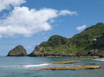
• Discover the hiking route Great Route of Santa Maria. View the map and download the GPS track. Website: http://trail...
![Trail On foot Santa Bárbara - PR6SMA Areia Branca - Photo](https://media.geolcdn.com/t/350/260/35da17b0-7cf5-4908-83a0-9c2ddfe62e3f.jpeg&format=jpg&maxdim=2)
![On foot On foot](https://static1.geolcdn.com/sitytour/trail-icons/100.png)
Km
On foot
![](/images/other/stat-length.png)
![](https://static1.geolcdn.com/siteimages/upload/files/1508320355ic_sort_den_pos_24dp.png)
![](https://static1.geolcdn.com/siteimages/upload/files/1508320355ic_sort_den_neg_24dp.png)
![](https://static1.geolcdn.com/siteimages/upload/files/16400158638029165_repeat_loop_refresh_sync_direction_icon.png)
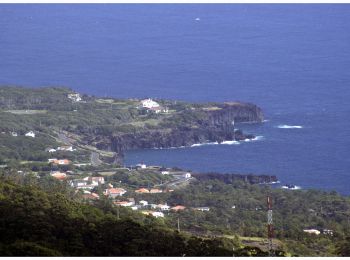
• This linear route connects Praia Formosa (south coast) to Baía of São Lourenço (northeast coast), making the connecti...
![Trail On foot Santo Amaro - PT-Leads to Velas - Photo](https://media.geolcdn.com/t/350/260/8a4925be-64ae-4978-a350-ab3708e36aa5.jpeg&format=jpg&maxdim=2)
![On foot On foot](https://static1.geolcdn.com/sitytour/trail-icons/100.png)
Km
On foot
![](/images/other/stat-length.png)
![](https://static1.geolcdn.com/siteimages/upload/files/1508320355ic_sort_den_pos_24dp.png)
![](https://static1.geolcdn.com/siteimages/upload/files/1508320355ic_sort_den_neg_24dp.png)
![](https://static1.geolcdn.com/siteimages/upload/files/16400158638029165_repeat_loop_refresh_sync_direction_icon.png)
• Leads to Velas
![Trail On foot Ribeirinha - Ribeirinha - Photo](https://media.geolcdn.com/t/350/260/039145e2-8a2f-49fd-b687-e10b9575ceab.jpeg&format=jpg&maxdim=2)
![On foot On foot](https://static1.geolcdn.com/sitytour/trail-icons/100.png)
Km
On foot
![](/images/other/stat-length.png)
![](https://static1.geolcdn.com/siteimages/upload/files/1508320355ic_sort_den_pos_24dp.png)
![](https://static1.geolcdn.com/siteimages/upload/files/1508320355ic_sort_den_neg_24dp.png)
![](https://static1.geolcdn.com/siteimages/upload/files/16400158638029165_repeat_loop_refresh_sync_direction_icon.png)
• This circular route in the village of Ribeirinha evolves partially in the protected area for habitats and species man...
![Trail On foot Achadinha - PRC38SMI Lomba D’El Rei - Photo](https://media.geolcdn.com/t/350/260/1023db09-886c-47eb-a5f7-74a0e1e018f1.jpeg&format=jpg&maxdim=2)
![On foot On foot](https://static1.geolcdn.com/sitytour/trail-icons/100.png)
Km
On foot
![](/images/other/stat-length.png)
![](https://static1.geolcdn.com/siteimages/upload/files/1508320355ic_sort_den_pos_24dp.png)
![](https://static1.geolcdn.com/siteimages/upload/files/1508320355ic_sort_den_neg_24dp.png)
![](https://static1.geolcdn.com/siteimages/upload/files/16400158638029165_repeat_loop_refresh_sync_direction_icon.png)
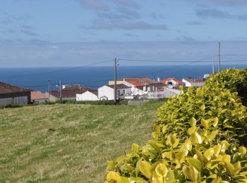
• Discover the hiking route PRC38SMI Lomba D'EL Rei. View the map and download the GPS track. Website: http://trails.v...
![Trail On foot Achadinha - PR21SMI Padrão das Alminhas - Salto da Farinha - Photo](https://media.geolcdn.com/t/350/260/1023db09-886c-47eb-a5f7-74a0e1e018f1.jpeg&format=jpg&maxdim=2)
![On foot On foot](https://static1.geolcdn.com/sitytour/trail-icons/100.png)
Km
On foot
![](/images/other/stat-length.png)
![](https://static1.geolcdn.com/siteimages/upload/files/1508320355ic_sort_den_pos_24dp.png)
![](https://static1.geolcdn.com/siteimages/upload/files/1508320355ic_sort_den_neg_24dp.png)
![](https://static1.geolcdn.com/siteimages/upload/files/16400158638029165_repeat_loop_refresh_sync_direction_icon.png)
• Discover the hiking route PR21SMI Padrão das Alminhas - Salto da Farinha. View the map and download the GPS track. W...

![Trail On foot Ribeiras - Quintas e Ribeiras - Photo](https://media.geolcdn.com/t/350/260/b8e2caea-74d6-4594-869b-13f20f7dd01e.jpeg&format=jpg&maxdim=2)
![On foot On foot](https://static1.geolcdn.com/sitytour/trail-icons/100.png)
Km
On foot
![](/images/other/stat-length.png)
![](https://static1.geolcdn.com/siteimages/upload/files/1508320355ic_sort_den_pos_24dp.png)
![](https://static1.geolcdn.com/siteimages/upload/files/1508320355ic_sort_den_neg_24dp.png)
![](https://static1.geolcdn.com/siteimages/upload/files/16400158638029165_repeat_loop_refresh_sync_direction_icon.png)
• Symbol: Yellow over Red
![Trail On foot Calheta de Nesquim - Calheta do Nesquim - Photo](https://media.geolcdn.com/t/350/260/8c6ce430-c20b-4f1d-a70a-ddf3f4f8b5a6.jpeg&format=jpg&maxdim=2)
![On foot On foot](https://static1.geolcdn.com/sitytour/trail-icons/100.png)
Km
On foot
![](/images/other/stat-length.png)
![](https://static1.geolcdn.com/siteimages/upload/files/1508320355ic_sort_den_pos_24dp.png)
![](https://static1.geolcdn.com/siteimages/upload/files/1508320355ic_sort_den_neg_24dp.png)
![](https://static1.geolcdn.com/siteimages/upload/files/16400158638029165_repeat_loop_refresh_sync_direction_icon.png)
• Descubra o percurso pedestre PRC11PIC Calheta do Nesquim. Consulte o Mapa e faça download do GPS. Website: http://tr...
![Trail On foot Horta (Angústias) - Entre Montes - Photo](https://media.geolcdn.com/t/350/260/a201cd14-c523-494c-a3e2-1951df78b0f9.jpeg&format=jpg&maxdim=2)
![On foot On foot](https://static1.geolcdn.com/sitytour/trail-icons/100.png)
Km
On foot
![](/images/other/stat-length.png)
![](https://static1.geolcdn.com/siteimages/upload/files/1508320355ic_sort_den_pos_24dp.png)
![](https://static1.geolcdn.com/siteimages/upload/files/1508320355ic_sort_den_neg_24dp.png)
![](https://static1.geolcdn.com/siteimages/upload/files/16400158638029165_repeat_loop_refresh_sync_direction_icon.png)
• Symbol: Yellow over Red
![Trail On foot Maia - PRC36SMI Pedra Queimada - Lajinha - Degredo - Photo](https://media.geolcdn.com/t/350/260/82fef8b6-934c-4ba6-8ffd-ec02151b3df6.jpeg&format=jpg&maxdim=2)
![On foot On foot](https://static1.geolcdn.com/sitytour/trail-icons/100.png)
Km
On foot
![](/images/other/stat-length.png)
![](https://static1.geolcdn.com/siteimages/upload/files/1508320355ic_sort_den_pos_24dp.png)
![](https://static1.geolcdn.com/siteimages/upload/files/1508320355ic_sort_den_neg_24dp.png)
![](https://static1.geolcdn.com/siteimages/upload/files/16400158638029165_repeat_loop_refresh_sync_direction_icon.png)
• Discover the hiking route PRC36SMI Pedra Queimada - Lajinha - Degredo. View the map and download the GPS track. Webs...

![Trail On foot Ribeira Quente - PR12SMI Agrião - Photo](https://media.geolcdn.com/t/350/260/4fa09008-ef7c-491e-8281-6f91d9fb5234.jpeg&format=jpg&maxdim=2)
![On foot On foot](https://static1.geolcdn.com/sitytour/trail-icons/100.png)
Km
On foot
![](/images/other/stat-length.png)
![](https://static1.geolcdn.com/siteimages/upload/files/1508320355ic_sort_den_pos_24dp.png)
![](https://static1.geolcdn.com/siteimages/upload/files/1508320355ic_sort_den_neg_24dp.png)
![](https://static1.geolcdn.com/siteimages/upload/files/16400158638029165_repeat_loop_refresh_sync_direction_icon.png)
• Discover the hiking route PR12SMI Trilho do Agrião. View the map and download the GPS track. Website: http://trails....
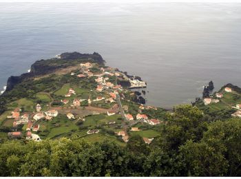
![Trail On foot Norte Pequeno - Norte Pequeno - Photo](https://media.geolcdn.com/t/350/260/a4806193-b5dc-492d-8525-4fb788968b7e.jpeg&format=jpg&maxdim=2)
![On foot On foot](https://static1.geolcdn.com/sitytour/trail-icons/100.png)
Km
On foot
![](/images/other/stat-length.png)
![](https://static1.geolcdn.com/siteimages/upload/files/1508320355ic_sort_den_pos_24dp.png)
![](https://static1.geolcdn.com/siteimages/upload/files/1508320355ic_sort_den_neg_24dp.png)
![](https://static1.geolcdn.com/siteimages/upload/files/16400158638029165_repeat_loop_refresh_sync_direction_icon.png)
• Discover the hiking route PRC6SJO Trilho do Norte Pequeno. View the map and download the GPS track. Website: http://...
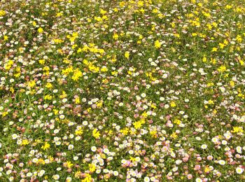
![Trail On foot Norte Grande (Neves) - Pico do Pedro – Pico da Esperança – Fajã do Ouvidor - Photo](https://media.geolcdn.com/t/350/260/48464034-51de-4a3e-8c06-29ad05645f0e.jpeg&format=jpg&maxdim=2)
![On foot On foot](https://static1.geolcdn.com/sitytour/trail-icons/100.png)
Km
On foot
![](/images/other/stat-length.png)
![](https://static1.geolcdn.com/siteimages/upload/files/1508320355ic_sort_den_pos_24dp.png)
![](https://static1.geolcdn.com/siteimages/upload/files/1508320355ic_sort_den_neg_24dp.png)
![](https://static1.geolcdn.com/siteimages/upload/files/16400158638029165_repeat_loop_refresh_sync_direction_icon.png)
• Discover the hiking route PR4SJO Pico do Pedro – Pico da Esperança – Fajã do Ouvidor. View the map and download the G...
![Trail On foot - Santana – Lajido - Photo](https://media.geolcdn.com/t/350/260/d634ac51-148c-4222-9ff4-aa19feb90ec5.jpeg&format=jpg&maxdim=2)
![On foot On foot](https://static1.geolcdn.com/sitytour/trail-icons/100.png)
Km
On foot
![](/images/other/stat-length.png)
![](https://static1.geolcdn.com/siteimages/upload/files/1508320355ic_sort_den_pos_24dp.png)
![](https://static1.geolcdn.com/siteimages/upload/files/1508320355ic_sort_den_neg_24dp.png)
![](https://static1.geolcdn.com/siteimages/upload/files/16400158638029165_repeat_loop_refresh_sync_direction_icon.png)
• Discover the hiking route PR10PIC Santana – Lajido. View the map and download the GPS track. Website: http://trails....
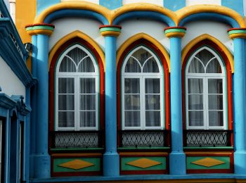
![Trail On foot São João - Mistérios do Sul do Pico - Photo](https://media.geolcdn.com/t/350/260/5216573e-87d6-4f6e-bf4f-be66d5131340.jpeg&format=jpg&maxdim=2)
![On foot On foot](https://static1.geolcdn.com/sitytour/trail-icons/100.png)
Km
On foot
![](/images/other/stat-length.png)
![](https://static1.geolcdn.com/siteimages/upload/files/1508320355ic_sort_den_pos_24dp.png)
![](https://static1.geolcdn.com/siteimages/upload/files/1508320355ic_sort_den_neg_24dp.png)
![](https://static1.geolcdn.com/siteimages/upload/files/16400158638029165_repeat_loop_refresh_sync_direction_icon.png)
• Discover the hiking route PR15PIC Mistérios do Sul do Pico. View the map and download the GPS track. Website: http:/...
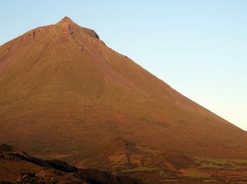
![Trail On foot São Roque do Pico - Lagoa do Capitão - Photo](https://media.geolcdn.com/t/350/260/75e970a1-be1c-448e-8612-b96d8c22d45a.jpeg&format=jpg&maxdim=2)
![On foot On foot](https://static1.geolcdn.com/sitytour/trail-icons/100.png)
Km
On foot
![](/images/other/stat-length.png)
![](https://static1.geolcdn.com/siteimages/upload/files/1508320355ic_sort_den_pos_24dp.png)
![](https://static1.geolcdn.com/siteimages/upload/files/1508320355ic_sort_den_neg_24dp.png)
![](https://static1.geolcdn.com/siteimages/upload/files/16400158638029165_repeat_loop_refresh_sync_direction_icon.png)
• Discover the hiking route PR13PIC Lagoa do Capitão. View the map and download the GPS track. Website: http://trails....
![Trail On foot Santa Luzia - Caminhos de Santa Luzia - Photo](https://media.geolcdn.com/t/350/260/fceb8377-de69-488c-8799-8c494ef72164.jpeg&format=jpg&maxdim=2)
![On foot On foot](https://static1.geolcdn.com/sitytour/trail-icons/100.png)
Km
On foot
![](/images/other/stat-length.png)
![](https://static1.geolcdn.com/siteimages/upload/files/1508320355ic_sort_den_pos_24dp.png)
![](https://static1.geolcdn.com/siteimages/upload/files/1508320355ic_sort_den_neg_24dp.png)
![](https://static1.geolcdn.com/siteimages/upload/files/16400158638029165_repeat_loop_refresh_sync_direction_icon.png)
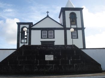
• Discover the hiking route PR1PIC Caminhos de Santa Luzia. View the map and download the GPS track. Website: http://t...
![Trail On foot Prainha - Caminho dos Burros - Vertente Norte - Photo](https://media.geolcdn.com/t/350/260/6f27c975-2ad9-431d-8af8-2de31b487623.jpeg&format=jpg&maxdim=2)
![On foot On foot](https://static1.geolcdn.com/sitytour/trail-icons/100.png)
Km
On foot
![](/images/other/stat-length.png)
![](https://static1.geolcdn.com/siteimages/upload/files/1508320355ic_sort_den_pos_24dp.png)
![](https://static1.geolcdn.com/siteimages/upload/files/1508320355ic_sort_den_neg_24dp.png)
![](https://static1.geolcdn.com/siteimages/upload/files/16400158638029165_repeat_loop_refresh_sync_direction_icon.png)
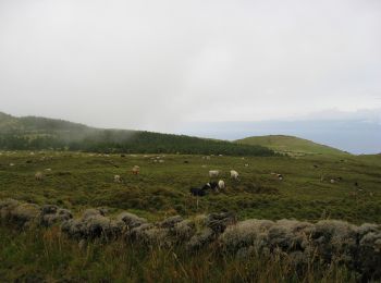
• Discover the hiking route PR2PIC Caminho dos Burros: vertente Norte. View the map and download the GPS track. Websit...
![Trail On foot São Roque do Pico - Caminho das Lagoas - Photo](https://media.geolcdn.com/t/350/260/90bf9d93-151d-4f77-932f-b7106031c39b.jpeg&format=jpg&maxdim=2)
![On foot On foot](https://static1.geolcdn.com/sitytour/trail-icons/100.png)
Km
On foot
![](/images/other/stat-length.png)
![](https://static1.geolcdn.com/siteimages/upload/files/1508320355ic_sort_den_pos_24dp.png)
![](https://static1.geolcdn.com/siteimages/upload/files/1508320355ic_sort_den_neg_24dp.png)
![](https://static1.geolcdn.com/siteimages/upload/files/16400158638029165_repeat_loop_refresh_sync_direction_icon.png)
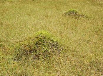
• Discover the hiking route PR7PIC Caminho das Voltas. View the map and download the GPS track. Website: http://trails...
20 trails displayed on 264
FREE GPS app for hiking