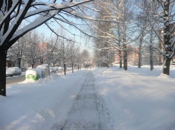
![](/images/other/stat-length.png)
- Trails
- Outdoor
- Poland
- Silesian Voivodeship
- Cieszyn County
Cieszyn County, Silesian Voivodeship: Best trails, routes and walks
Cieszyn County: Discover the best trails: 16 hiking trails. All these trails, routes and outdoor activities are available in our SityTrail applications for smartphones and tablets.
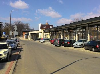
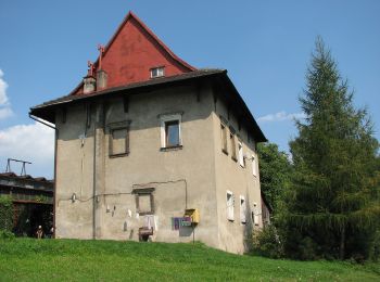
The best trails (16)
![Trail On foot Goleszów - Przyroda nie zna granic / Přiroda nezná hranic - Photo](https://media.geolcdn.com/t/350/260/130a23d1-04a7-4d5c-9d2f-567885f68c11.jpeg&format=jpg&maxdim=2)
![On foot On foot](https://static1.geolcdn.com/sitytour/trail-icons/100.png)
Km
On foot
![](/images/other/stat-length.png)
![](https://static1.geolcdn.com/siteimages/upload/files/1508320355ic_sort_den_pos_24dp.png)
![](https://static1.geolcdn.com/siteimages/upload/files/1508320355ic_sort_den_neg_24dp.png)
![](https://static1.geolcdn.com/siteimages/upload/files/16400158638029165_repeat_loop_refresh_sync_direction_icon.png)
• Trail created by Obce Vendryně / UG Goleszów.
![Trail On foot - Knight's path - Photo](https://media.geolcdn.com/t/350/260/d59ec0a9-990a-44bf-a8ea-28188364c2e6.jpeg&format=jpg&maxdim=2)
![On foot On foot](https://static1.geolcdn.com/sitytour/trail-icons/100.png)
Km
On foot
![](/images/other/stat-length.png)
![](https://static1.geolcdn.com/siteimages/upload/files/1508320355ic_sort_den_pos_24dp.png)
![](https://static1.geolcdn.com/siteimages/upload/files/1508320355ic_sort_den_neg_24dp.png)
![](https://static1.geolcdn.com/siteimages/upload/files/16400158638029165_repeat_loop_refresh_sync_direction_icon.png)
• Symbol: zielony rycerz z flagą na białym tle
![Trail On foot Brenna - Szlak Drwali oraz Pstrąga Górskiego - Photo](https://media.geolcdn.com/t/350/260/443cfb9e-5a66-4019-990c-56821f4ad495.jpeg&format=jpg&maxdim=2)
![On foot On foot](https://static1.geolcdn.com/sitytour/trail-icons/100.png)
Km
On foot
![](/images/other/stat-length.png)
![](https://static1.geolcdn.com/siteimages/upload/files/1508320355ic_sort_den_pos_24dp.png)
![](https://static1.geolcdn.com/siteimages/upload/files/1508320355ic_sort_den_neg_24dp.png)
![](https://static1.geolcdn.com/siteimages/upload/files/16400158638029165_repeat_loop_refresh_sync_direction_icon.png)
• Symbol: green arrow
![Trail On foot Brenna - Szlak Harcerski - Photo](https://media.geolcdn.com/t/350/260/443cfb9e-5a66-4019-990c-56821f4ad495.jpeg&format=jpg&maxdim=2)
![On foot On foot](https://static1.geolcdn.com/sitytour/trail-icons/100.png)
Km
On foot
![](/images/other/stat-length.png)
![](https://static1.geolcdn.com/siteimages/upload/files/1508320355ic_sort_den_pos_24dp.png)
![](https://static1.geolcdn.com/siteimages/upload/files/1508320355ic_sort_den_neg_24dp.png)
![](https://static1.geolcdn.com/siteimages/upload/files/16400158638029165_repeat_loop_refresh_sync_direction_icon.png)
• Trail created by ZHP. Symbol: Zielone H na białym polu
![Trail On foot - Szlak Habsburgów - Photo](https://media.geolcdn.com/t/350/260/6a42b5e1-0217-4ce3-a0c7-500152292092.jpeg&format=jpg&maxdim=2)
![On foot On foot](https://static1.geolcdn.com/sitytour/trail-icons/100.png)
Km
On foot
![](/images/other/stat-length.png)
![](https://static1.geolcdn.com/siteimages/upload/files/1508320355ic_sort_den_pos_24dp.png)
![](https://static1.geolcdn.com/siteimages/upload/files/1508320355ic_sort_den_neg_24dp.png)
![](https://static1.geolcdn.com/siteimages/upload/files/16400158638029165_repeat_loop_refresh_sync_direction_icon.png)
• Symbol: brown H letter with crown on white background
![Trail On foot - Szlak Widokowy - Photo](https://media.geolcdn.com/t/350/260/38472786-ebc8-4495-b4b8-761f0d2bf69d.jpeg&format=jpg&maxdim=2)
![On foot On foot](https://static1.geolcdn.com/sitytour/trail-icons/100.png)
Km
On foot
![](/images/other/stat-length.png)
![](https://static1.geolcdn.com/siteimages/upload/files/1508320355ic_sort_den_pos_24dp.png)
![](https://static1.geolcdn.com/siteimages/upload/files/1508320355ic_sort_den_neg_24dp.png)
![](https://static1.geolcdn.com/siteimages/upload/files/16400158638029165_repeat_loop_refresh_sync_direction_icon.png)
• Trail created by Urząd Miejski w Ustroniu. Website: http://www.beskidslaski.pl/Ustron/szlakispacer.html#widokowy
![Trail On foot - Wisła Dworzec PKS – Wisła Centrum przez Bukową - Photo](https://media.geolcdn.com/t/350/260/4857be43-6f34-453e-87f0-06174a5e34bf.jpeg&format=jpg&maxdim=2)
![On foot On foot](https://static1.geolcdn.com/sitytour/trail-icons/100.png)
Km
On foot
![](/images/other/stat-length.png)
![](https://static1.geolcdn.com/siteimages/upload/files/1508320355ic_sort_den_pos_24dp.png)
![](https://static1.geolcdn.com/siteimages/upload/files/1508320355ic_sort_den_neg_24dp.png)
![](https://static1.geolcdn.com/siteimages/upload/files/16400158638029165_repeat_loop_refresh_sync_direction_icon.png)
• Trail created by Urząd Miejski w Wiśle. Website: http://beskidslaski.pl/wisla-szlaki-spacerowe/#zolty1
![Trail On foot Górki Wielkie - Ścieżka przyrodniczo-dydaktyczna](https://media.geolcdn.com/t/350/260/f394a12d-0b06-444f-b3df-bd89bf0e150c.jpeg&format=jpg&maxdim=2)
![On foot On foot](https://static1.geolcdn.com/sitytour/trail-icons/100.png)
Km
On foot
![](/images/other/stat-length.png)
![](https://static1.geolcdn.com/siteimages/upload/files/1508320355ic_sort_den_pos_24dp.png)
![](https://static1.geolcdn.com/siteimages/upload/files/1508320355ic_sort_den_neg_24dp.png)
![](https://static1.geolcdn.com/siteimages/upload/files/16400158638029165_repeat_loop_refresh_sync_direction_icon.png)
• Trail created by Urząd Gminy w Brennej. Website: https://www.brenna.org.pl/sciezka_dydaktyczno_przyrodnicza_po_gor...
![Trail On foot Goleszów - Szlak spacerowy](https://media.geolcdn.com/t/350/260/356a1c45-c2f3-4ed1-a626-eb96207734ed.jpeg&format=jpg&maxdim=2)
![On foot On foot](https://static1.geolcdn.com/sitytour/trail-icons/100.png)
Km
On foot
![](/images/other/stat-length.png)
![](https://static1.geolcdn.com/siteimages/upload/files/1508320355ic_sort_den_pos_24dp.png)
![](https://static1.geolcdn.com/siteimages/upload/files/1508320355ic_sort_den_neg_24dp.png)
![](https://static1.geolcdn.com/siteimages/upload/files/16400158638029165_repeat_loop_refresh_sync_direction_icon.png)
• Website: http://www.goleszow.pl/szlak-jasieniowa
![Trail On foot - Trasa spacerowa widokowa - Photo](https://media.geolcdn.com/t/350/260/099022b6-42d6-455f-b3b9-f4fccbc0f374.jpeg&format=jpg&maxdim=2)
![On foot On foot](https://static1.geolcdn.com/sitytour/trail-icons/100.png)
Km
On foot
![](/images/other/stat-length.png)
![](https://static1.geolcdn.com/siteimages/upload/files/1508320355ic_sort_den_pos_24dp.png)
![](https://static1.geolcdn.com/siteimages/upload/files/1508320355ic_sort_den_neg_24dp.png)
![](https://static1.geolcdn.com/siteimages/upload/files/16400158638029165_repeat_loop_refresh_sync_direction_icon.png)
• Oficjalny serwis informacyjny miasta Cieszyn. Wiadomości, kalendarium imprez, wydarzenia sportowe, turystyka, kultura...
![Trail On foot - Trasa spacerowa Bobrecka - Photo](https://media.geolcdn.com/t/350/260/099022b6-42d6-455f-b3b9-f4fccbc0f374.jpeg&format=jpg&maxdim=2)
![On foot On foot](https://static1.geolcdn.com/sitytour/trail-icons/100.png)
Km
On foot
![](/images/other/stat-length.png)
![](https://static1.geolcdn.com/siteimages/upload/files/1508320355ic_sort_den_pos_24dp.png)
![](https://static1.geolcdn.com/siteimages/upload/files/1508320355ic_sort_den_neg_24dp.png)
![](https://static1.geolcdn.com/siteimages/upload/files/16400158638029165_repeat_loop_refresh_sync_direction_icon.png)
• Oficjalny serwis informacyjny miasta Cieszyn. Wiadomości, kalendarium imprez, wydarzenia sportowe, turystyka, kultura...
![Trail On foot - Trasa spacerowa krawędziowa - Photo](https://media.geolcdn.com/t/350/260/83fa9367-ea7d-4d88-9369-88b9a5adb77d.jpeg&format=jpg&maxdim=2)
![On foot On foot](https://static1.geolcdn.com/sitytour/trail-icons/100.png)
Km
On foot
![](/images/other/stat-length.png)
![](https://static1.geolcdn.com/siteimages/upload/files/1508320355ic_sort_den_pos_24dp.png)
![](https://static1.geolcdn.com/siteimages/upload/files/1508320355ic_sort_den_neg_24dp.png)
![](https://static1.geolcdn.com/siteimages/upload/files/16400158638029165_repeat_loop_refresh_sync_direction_icon.png)
• Oficjalny serwis informacyjny miasta Cieszyn. Wiadomości, kalendarium imprez, wydarzenia sportowe, turystyka, kultura...
![Trail On foot - Trasa spacerowa osiedlowa - Photo](https://media.geolcdn.com/t/350/260/976b0740-d273-400a-9c66-50909775cb7a.jpeg&format=jpg&maxdim=2)
![On foot On foot](https://static1.geolcdn.com/sitytour/trail-icons/100.png)
Km
On foot
![](/images/other/stat-length.png)
![](https://static1.geolcdn.com/siteimages/upload/files/1508320355ic_sort_den_pos_24dp.png)
![](https://static1.geolcdn.com/siteimages/upload/files/1508320355ic_sort_den_neg_24dp.png)
![](https://static1.geolcdn.com/siteimages/upload/files/16400158638029165_repeat_loop_refresh_sync_direction_icon.png)
• Oficjalny serwis informacyjny miasta Cieszyn. Wiadomości, kalendarium imprez, wydarzenia sportowe, turystyka, kultura...
![Trail On foot - The Nature Reserves Walk - Photo](https://media.geolcdn.com/t/350/260/099022b6-42d6-455f-b3b9-f4fccbc0f374.jpeg&format=jpg&maxdim=2)
![On foot On foot](https://static1.geolcdn.com/sitytour/trail-icons/100.png)
Km
On foot
![](/images/other/stat-length.png)
![](https://static1.geolcdn.com/siteimages/upload/files/1508320355ic_sort_den_pos_24dp.png)
![](https://static1.geolcdn.com/siteimages/upload/files/1508320355ic_sort_den_neg_24dp.png)
![](https://static1.geolcdn.com/siteimages/upload/files/16400158638029165_repeat_loop_refresh_sync_direction_icon.png)
• Oficjalny serwis informacyjny miasta Cieszyn. Wiadomości, kalendarium imprez, wydarzenia sportowe, turystyka, kultura...
![Trail On foot Brenna - Bajkowy Szlak Utopca - Photo](https://media.geolcdn.com/t/350/260/5f61ab17-f898-4d9c-ac56-6191ce4a5ca3.jpeg&format=jpg&maxdim=2)
![On foot On foot](https://static1.geolcdn.com/sitytour/trail-icons/100.png)
Km
On foot
![](/images/other/stat-length.png)
![](https://static1.geolcdn.com/siteimages/upload/files/1508320355ic_sort_den_pos_24dp.png)
![](https://static1.geolcdn.com/siteimages/upload/files/1508320355ic_sort_den_neg_24dp.png)
![](https://static1.geolcdn.com/siteimages/upload/files/16400158638029165_repeat_loop_refresh_sync_direction_icon.png)
![Trail On foot Leszna Górna - Szlak Partyzancki - Photo](https://media.geolcdn.com/t/350/260/ext.jpg?maxdim=2&url=https%3A%2F%2Fstatic1.geolcdn.com%2Fsiteimages%2Fupload%2Ffiles%2F1545311037marcheuse_200dpi.jpg)
![On foot On foot](https://static1.geolcdn.com/sitytour/trail-icons/100.png)
Km
On foot
![](/images/other/stat-length.png)
![](https://static1.geolcdn.com/siteimages/upload/files/1508320355ic_sort_den_pos_24dp.png)
![](https://static1.geolcdn.com/siteimages/upload/files/1508320355ic_sort_den_neg_24dp.png)
![](https://static1.geolcdn.com/siteimages/upload/files/16400158638029165_repeat_loop_refresh_sync_direction_icon.png)
• Trail created by Urząd Gminy w Goleszowie. Website: http://www.goleszow.pl/szlak-partyzancki
16 trails displayed on 16
FREE GPS app for hiking