![](/images/other/stat-length.png)
Sondrio, Lombardy: Best trails, routes and walks
Sondrio: Discover the best trails: 62 hiking trails and 3 bike and mountain-bike routes. All these trails, routes and outdoor activities are available in our SityTrail applications for smartphones and tablets.
The best trails (71)
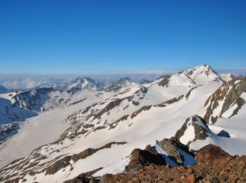
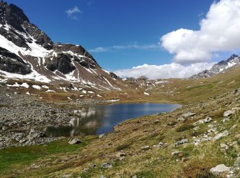
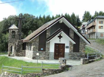
![Trail On foot Valdidentro - (SI D35N) Rifugio Monte alle Scale (Cancano) - Rifugio Campo - Photo](https://media.geolcdn.com/t/350/260/56e4aa90-e065-4f18-833b-8b99173ff4f4.jpeg&format=jpg&maxdim=2)
![On foot On foot](https://static1.geolcdn.com/sitytour/trail-icons/100.png)
Km
On foot
![](/images/other/stat-length.png)
![](https://static1.geolcdn.com/siteimages/upload/files/1508320355ic_sort_den_pos_24dp.png)
![](https://static1.geolcdn.com/siteimages/upload/files/1508320355ic_sort_den_neg_24dp.png)
![](https://static1.geolcdn.com/siteimages/upload/files/16400158638029165_repeat_loop_refresh_sync_direction_icon.png)
• Sentiero Italia CAI 2019
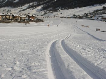
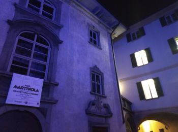
![Trail On foot Valfurva - (SI D36N) Rifugio Campo - Rifugio Branca - Photo](https://media.geolcdn.com/t/350/260/5330d4df-747e-4321-a1f7-aa955f8cd20e.jpeg&format=jpg&maxdim=2)
![On foot On foot](https://static1.geolcdn.com/sitytour/trail-icons/100.png)
Km
On foot
![](/images/other/stat-length.png)
![](https://static1.geolcdn.com/siteimages/upload/files/1508320355ic_sort_den_pos_24dp.png)
![](https://static1.geolcdn.com/siteimages/upload/files/1508320355ic_sort_den_neg_24dp.png)
![](https://static1.geolcdn.com/siteimages/upload/files/16400158638029165_repeat_loop_refresh_sync_direction_icon.png)
• Sentiero Italia CAI 2019
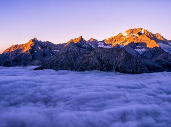
![Trail On foot Valfurva - (SI D37N) Rifugio Branca - Passo di Gavia - Photo](https://media.geolcdn.com/t/350/260/c5a6064a-238a-4eda-aa6c-5d8be64c3d27.jpeg&format=jpg&maxdim=2)
![On foot On foot](https://static1.geolcdn.com/sitytour/trail-icons/100.png)
Km
On foot
![](/images/other/stat-length.png)
![](https://static1.geolcdn.com/siteimages/upload/files/1508320355ic_sort_den_pos_24dp.png)
![](https://static1.geolcdn.com/siteimages/upload/files/1508320355ic_sort_den_neg_24dp.png)
![](https://static1.geolcdn.com/siteimages/upload/files/16400158638029165_repeat_loop_refresh_sync_direction_icon.png)
• Sentiero Italia CAI 2019
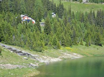
![Trail On foot Valfurva - (SI D38N) Passo di Gavia - Rifugio Angelino Bozzi al Montozzo - Photo](https://media.geolcdn.com/t/350/260/982d1542-55a2-4ef6-9fcf-9cc9e01ef22e.jpeg&format=jpg&maxdim=2)
![On foot On foot](https://static1.geolcdn.com/sitytour/trail-icons/100.png)
Km
On foot
![](/images/other/stat-length.png)
![](https://static1.geolcdn.com/siteimages/upload/files/1508320355ic_sort_den_pos_24dp.png)
![](https://static1.geolcdn.com/siteimages/upload/files/1508320355ic_sort_den_neg_24dp.png)
![](https://static1.geolcdn.com/siteimages/upload/files/16400158638029165_repeat_loop_refresh_sync_direction_icon.png)
• Sentiero Italia CAI 2019
![Trail On foot Grosotto - (SI D31N) Alpe Salina - Malghera - Photo](https://media.geolcdn.com/t/350/260/dbf1d713-bfa0-43ef-bba8-d99618e6e373.jpeg&format=jpg&maxdim=2)
![On foot On foot](https://static1.geolcdn.com/sitytour/trail-icons/100.png)
Km
On foot
![](/images/other/stat-length.png)
![](https://static1.geolcdn.com/siteimages/upload/files/1508320355ic_sort_den_pos_24dp.png)
![](https://static1.geolcdn.com/siteimages/upload/files/1508320355ic_sort_den_neg_24dp.png)
![](https://static1.geolcdn.com/siteimages/upload/files/16400158638029165_repeat_loop_refresh_sync_direction_icon.png)
• Sentiero Italia CAI 2019
![Trail On foot Grosio - (SI D32N) Malghera - Rifugio Val Viola - Photo](https://media.geolcdn.com/t/350/260/3982027b-3f84-42b4-bb6e-35439dba1552.jpeg&format=jpg&maxdim=2)
![On foot On foot](https://static1.geolcdn.com/sitytour/trail-icons/100.png)
Km
On foot
![](/images/other/stat-length.png)
![](https://static1.geolcdn.com/siteimages/upload/files/1508320355ic_sort_den_pos_24dp.png)
![](https://static1.geolcdn.com/siteimages/upload/files/1508320355ic_sort_den_neg_24dp.png)
![](https://static1.geolcdn.com/siteimages/upload/files/16400158638029165_repeat_loop_refresh_sync_direction_icon.png)
• Sentiero Italia CAI 2019
![Trail On foot Valdidentro - (SI D33N) Rifugio Val Viola - Livigno - Photo](https://media.geolcdn.com/t/350/260/2c58f667-13da-47b3-a0c2-8d31a18a74c3.jpeg&format=jpg&maxdim=2)
![On foot On foot](https://static1.geolcdn.com/sitytour/trail-icons/100.png)
Km
On foot
![](/images/other/stat-length.png)
![](https://static1.geolcdn.com/siteimages/upload/files/1508320355ic_sort_den_pos_24dp.png)
![](https://static1.geolcdn.com/siteimages/upload/files/1508320355ic_sort_den_neg_24dp.png)
![](https://static1.geolcdn.com/siteimages/upload/files/16400158638029165_repeat_loop_refresh_sync_direction_icon.png)
• Sentiero Italia CAI 2019
![Trail On foot Teglio - (SI D29N) Prato Valentino - Madonna di Tirano - Photo](https://media.geolcdn.com/t/350/260/d139811c-83e2-4137-b6fd-9fd2e8960da0.jpeg&format=jpg&maxdim=2)
![On foot On foot](https://static1.geolcdn.com/sitytour/trail-icons/100.png)
Km
On foot
![](/images/other/stat-length.png)
![](https://static1.geolcdn.com/siteimages/upload/files/1508320355ic_sort_den_pos_24dp.png)
![](https://static1.geolcdn.com/siteimages/upload/files/1508320355ic_sort_den_neg_24dp.png)
![](https://static1.geolcdn.com/siteimages/upload/files/16400158638029165_repeat_loop_refresh_sync_direction_icon.png)
• Sentiero Italia CAI 2019
![Trail On foot Tirano - (SI D30N) Madonna di Tirano - Alpe Salina - Photo](https://media.geolcdn.com/t/350/260/2ff23860-cfa8-474f-9561-8c80d987430f.jpeg&format=jpg&maxdim=2)
![On foot On foot](https://static1.geolcdn.com/sitytour/trail-icons/100.png)
Km
On foot
![](/images/other/stat-length.png)
![](https://static1.geolcdn.com/siteimages/upload/files/1508320355ic_sort_den_pos_24dp.png)
![](https://static1.geolcdn.com/siteimages/upload/files/1508320355ic_sort_den_neg_24dp.png)
![](https://static1.geolcdn.com/siteimages/upload/files/16400158638029165_repeat_loop_refresh_sync_direction_icon.png)
• Sentiero Italia CAI 2019
![Trail On foot Chiuro - (SI D28N) Rifugio Cederna Maffina - Prato Valentino - Photo](https://media.geolcdn.com/t/350/260/ca558386-872d-4ac3-ad8a-5d64fd6a2615.jpeg&format=jpg&maxdim=2)
![On foot On foot](https://static1.geolcdn.com/sitytour/trail-icons/100.png)
Km
On foot
![](/images/other/stat-length.png)
![](https://static1.geolcdn.com/siteimages/upload/files/1508320355ic_sort_den_pos_24dp.png)
![](https://static1.geolcdn.com/siteimages/upload/files/1508320355ic_sort_den_neg_24dp.png)
![](https://static1.geolcdn.com/siteimages/upload/files/16400158638029165_repeat_loop_refresh_sync_direction_icon.png)
• Sentiero Italia CAI 2019
![Trail On foot Castione Andevenno - Valtellina wine trail Sassella trail 12km - Photo](https://media.geolcdn.com/t/350/260/8963a6f7-1d63-4de4-8583-d978e58cc6fc.jpeg&format=jpg&maxdim=2)
![On foot On foot](https://static1.geolcdn.com/sitytour/trail-icons/100.png)
Km
On foot
![](/images/other/stat-length.png)
![](https://static1.geolcdn.com/siteimages/upload/files/1508320355ic_sort_den_pos_24dp.png)
![](https://static1.geolcdn.com/siteimages/upload/files/1508320355ic_sort_den_neg_24dp.png)
![](https://static1.geolcdn.com/siteimages/upload/files/16400158638029165_repeat_loop_refresh_sync_direction_icon.png)
• Valtellina Wine Trail, una gara spettacolare fra i terrazzamenti dei vigneti della Valtellina. Non una semplice gara ...
![Trail On foot Lanzada - (SI D27N) Rifugio Cristina all'Alpe Prabello - Rifugio Cederna Maffina - Photo](https://media.geolcdn.com/t/350/260/183b458f-a077-409f-be44-59e6e5c9c885.jpeg&format=jpg&maxdim=2)
![On foot On foot](https://static1.geolcdn.com/sitytour/trail-icons/100.png)
Km
On foot
![](/images/other/stat-length.png)
![](https://static1.geolcdn.com/siteimages/upload/files/1508320355ic_sort_den_pos_24dp.png)
![](https://static1.geolcdn.com/siteimages/upload/files/1508320355ic_sort_den_neg_24dp.png)
![](https://static1.geolcdn.com/siteimages/upload/files/16400158638029165_repeat_loop_refresh_sync_direction_icon.png)
• Sentiero Italia CAI 2019
![Trail On foot Chiesa in Valmalenco - (SI D23N) Rifugio Gerli Porro all' Alpe Ventina - Rifugio Longoni - Photo](https://media.geolcdn.com/t/350/260/d8f951e0-7309-486e-ac7b-869408bc195f.jpeg&format=jpg&maxdim=2)
![On foot On foot](https://static1.geolcdn.com/sitytour/trail-icons/100.png)
Km
On foot
![](/images/other/stat-length.png)
![](https://static1.geolcdn.com/siteimages/upload/files/1508320355ic_sort_den_pos_24dp.png)
![](https://static1.geolcdn.com/siteimages/upload/files/1508320355ic_sort_den_neg_24dp.png)
![](https://static1.geolcdn.com/siteimages/upload/files/16400158638029165_repeat_loop_refresh_sync_direction_icon.png)
• Sentiero Italia CAI 2019
![Trail On foot Chiesa in Valmalenco - (SI D24N) Rifugio Longoni - Rifugio Palù - Photo](https://media.geolcdn.com/t/350/260/f8959ed0-ea28-49c9-b4f4-185f68073fa4.jpeg&format=jpg&maxdim=2)
![On foot On foot](https://static1.geolcdn.com/sitytour/trail-icons/100.png)
Km
On foot
![](/images/other/stat-length.png)
![](https://static1.geolcdn.com/siteimages/upload/files/1508320355ic_sort_den_pos_24dp.png)
![](https://static1.geolcdn.com/siteimages/upload/files/1508320355ic_sort_den_neg_24dp.png)
![](https://static1.geolcdn.com/siteimages/upload/files/16400158638029165_repeat_loop_refresh_sync_direction_icon.png)
• Sentiero Italia CAI 2019
![Trail On foot Chiesa in Valmalenco - (SI D25N) Rifugio Palù - Rifugio Marinelli Bombardieri - Photo](https://media.geolcdn.com/t/350/260/d863dd3a-eb74-47a3-809f-7bc98356b6a7.jpeg&format=jpg&maxdim=2)
![On foot On foot](https://static1.geolcdn.com/sitytour/trail-icons/100.png)
Km
On foot
![](/images/other/stat-length.png)
![](https://static1.geolcdn.com/siteimages/upload/files/1508320355ic_sort_den_pos_24dp.png)
![](https://static1.geolcdn.com/siteimages/upload/files/1508320355ic_sort_den_neg_24dp.png)
![](https://static1.geolcdn.com/siteimages/upload/files/16400158638029165_repeat_loop_refresh_sync_direction_icon.png)
• Sentiero Italia CAI 2019
![Trail On foot Chiuro - Valtellina wine trail half trail 21km - Photo](https://media.geolcdn.com/t/350/260/ed521116-aebf-41aa-87bf-87ca4329c623.jpeg&format=jpg&maxdim=2)
![On foot On foot](https://static1.geolcdn.com/sitytour/trail-icons/100.png)
Km
On foot
![](/images/other/stat-length.png)
![](https://static1.geolcdn.com/siteimages/upload/files/1508320355ic_sort_den_pos_24dp.png)
![](https://static1.geolcdn.com/siteimages/upload/files/1508320355ic_sort_den_neg_24dp.png)
![](https://static1.geolcdn.com/siteimages/upload/files/16400158638029165_repeat_loop_refresh_sync_direction_icon.png)
• Valtellina Wine Trail, una gara spettacolare fra i terrazzamenti dei vigneti della Valtellina. Non una semplice gara ...
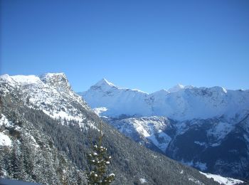
![Trail On foot Chiesa in Valmalenco - IT-334 - Photo](https://media.geolcdn.com/t/350/260/6b1668e2-39d3-48ad-936f-360bae509433.jpeg&format=jpg&maxdim=2)
![On foot On foot](https://static1.geolcdn.com/sitytour/trail-icons/100.png)
Km
On foot
![](/images/other/stat-length.png)
![](https://static1.geolcdn.com/siteimages/upload/files/1508320355ic_sort_den_pos_24dp.png)
![](https://static1.geolcdn.com/siteimages/upload/files/1508320355ic_sort_den_neg_24dp.png)
![](https://static1.geolcdn.com/siteimages/upload/files/16400158638029165_repeat_loop_refresh_sync_direction_icon.png)
• Club Alpino Italiano Sezione di SEREGNO
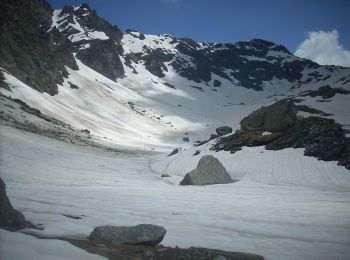
![Trail On foot Chiesa in Valmalenco - Chiareggio-Rifugio Longoni-Alpe Sasso Nero-Rifugio Palù- Alta Via 4° tappa - Photo](https://media.geolcdn.com/t/350/260/e0338ecd-3f6a-4638-9a73-b9b2ef7e89f4.jpeg&format=jpg&maxdim=2)
![On foot On foot](https://static1.geolcdn.com/sitytour/trail-icons/100.png)
Km
On foot
![](/images/other/stat-length.png)
![](https://static1.geolcdn.com/siteimages/upload/files/1508320355ic_sort_den_pos_24dp.png)
![](https://static1.geolcdn.com/siteimages/upload/files/1508320355ic_sort_den_neg_24dp.png)
![](https://static1.geolcdn.com/siteimages/upload/files/16400158638029165_repeat_loop_refresh_sync_direction_icon.png)
• Club Alpino Italiano Sezione di SEREGNO
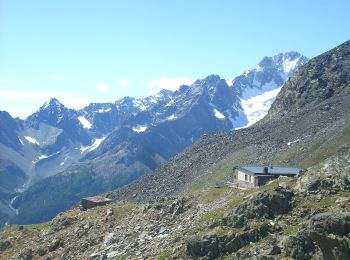
![Trail On foot Chiesa in Valmalenco - Chiareggio-Passo del Muretto-Sentiero Rusca - Photo](https://media.geolcdn.com/t/350/260/df2b3fd9-64c6-4ee1-a2d9-36a324e11b66.jpeg&format=jpg&maxdim=2)
![On foot On foot](https://static1.geolcdn.com/sitytour/trail-icons/100.png)
Km
On foot
![](/images/other/stat-length.png)
![](https://static1.geolcdn.com/siteimages/upload/files/1508320355ic_sort_den_pos_24dp.png)
![](https://static1.geolcdn.com/siteimages/upload/files/1508320355ic_sort_den_neg_24dp.png)
![](https://static1.geolcdn.com/siteimages/upload/files/16400158638029165_repeat_loop_refresh_sync_direction_icon.png)
• Club Alpino Italiano Sezione di SEREGNO
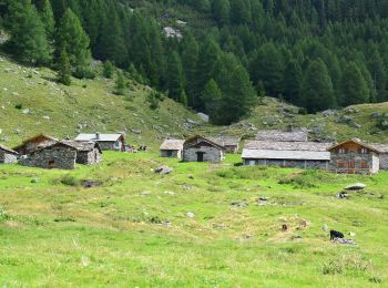
![Trail On foot Chiesa in Valmalenco - Sentiero accesso RIFUGIO ANTONIO ED ELIA LONGONI - Photo](https://media.geolcdn.com/t/350/260/96c9c862-669b-4c8b-adfb-f0b5c5c20d0c.jpeg&format=jpg&maxdim=2)
![On foot On foot](https://static1.geolcdn.com/sitytour/trail-icons/100.png)
Km
On foot
![](/images/other/stat-length.png)
![](https://static1.geolcdn.com/siteimages/upload/files/1508320355ic_sort_den_pos_24dp.png)
![](https://static1.geolcdn.com/siteimages/upload/files/1508320355ic_sort_den_neg_24dp.png)
![](https://static1.geolcdn.com/siteimages/upload/files/16400158638029165_repeat_loop_refresh_sync_direction_icon.png)
• Club Alpino Italiano Sezione di SEREGNO
20 trails displayed on 71
FREE GPS app for hiking
Activities
Nearby regions
- Berbenno di Valtellina
- Bormio
- Caiolo
- Campodolcino
- Caspoggio
- Castione Andevenno
- Chiavenna
- Chiesa in Valmalenco
- Chiuro
- Cosio Valtellino
- Dubino
- Fusine
- Gerola Alta
- Grosio
- Grosotto
- Lanzada
- Livigno
- Madesimo
- Mello
- Morbegno
- Novate Mezzola
- Piantedo
- Piateda
- Piuro
- Ponte in Valtellina
- Postalesio
- Samolaco
- San Giacomo Filippo
- Sernio
- Sondrio
- Tartano
- Teglio
- Tirano
- Torre di Santa Maria
- Val Masino
- Valdidentro
- Valfurva
- Verceia
- Vervio