Champorcher, Unknown: Best trails, routes and walks

Champorcher: Discover the best trails: 4 hiking trails. All these trails, routes and outdoor activities are available in our SityTrail applications for smartphones and tablets.


The best trails (4)
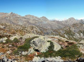
Trail On foot Champorcher - Alta Via n. 2 della Valle d'Aosta - Tappa 12 - Photo
On foot 8.772
Km
PRO

On foot

Easy
Champorcher, Aosta Valley, Unknown, Italy
8.8 km | 11.9 km-effort
2h 42min
40 m
813 m
No
SityTrail - itinéraires balisés pédestres

• Rifugio Dondena - Champorcher Alte Vie Website: http://www.lovevda.it/it/banca-dati/7/alte-vie/valle-d-aosta/rifugi...

Trail On foot Champorcher - Alta Via n. 2 della Valle d'Aosta - Tappa 13 - Photo
On foot 14.724
Km
PRO

On foot

Difficult
Champorcher, Aosta Valley, Unknown, Italy
14.7 km | 33 km-effort
7h 29min
1303 m
1561 m
No
SityTrail - itinéraires balisés pédestres

• Champorcher - Crest Alte Vie Website: http://www.lovevda.it/it/banca-dati/7/alte-vie/valle-d-aosta/champorcher-cres...

Trail On foot Champorcher - Sentiero 5C - Cuneu-Col Fussy - Photo
On foot 3.224
Km
PRO

On foot

Easy
Champorcher, Aosta Valley, Unknown, Italy
3.2 km | 5.7 km-effort
1h 18min
0 m
756 m
No
SityTrail - itinéraires balisés pédestres

Trail Walking Champorcher - Alta via val d’Aoste2 etape8 (Champorcher-Crest) - Photo
Walking 18.694
Km

Walking

Very difficult
Champorcher, Aosta Valley, Unknown, Italy
18.7 km | 39 km-effort
6h 9min
1417 m
1702 m
No
philvidal

4 trails displayed on 4

FREE GPS app for hiking

Logo SityTrail SityTrail

IGN / Geographical institutes

Download SityTrail from the App Store Download SityTrail from Google Play

Logo SityTrail SityTrail World

The world is yours!

Download SityTrail from the App Store Download SityTrail from Google Play Download SityTrail on Huawei AppGallery

Activities

Close
My subscriptions