![](/images/other/stat-length.png)
- Trails
- Outdoor
- France
- Occitania
- Hautespyrenees
- Sassis
Sassis, Hautespyrenees: Best trails, routes and walks
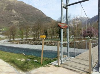
Sassis: Discover the best trails: 5 hiking trails. All these trails, routes and outdoor activities are available in our SityTrail applications for smartphones and tablets.
The best trails (4)
![Trail On foot Sassis - SASSIS les chemins de l agnouede fait G3 le 28/02/2020 - Photo](https://media.geolcdn.com/t/350/260/6f6c3b1a-9cea-4f2c-a1da-77e7c1b7b423.jpg&format=jpg&maxdim=2)
![On foot On foot](https://static1.geolcdn.com/sitytour/trail-icons/100.png)
Km
#1 - SASSIS les chemins de l agnouede fait G3 le 28/02/2020
On foot
Medium
Sassis,
Occitania,
Hautespyrenees,
France
![](/images/other/stat-length.png)
8.9 km | 14.8 km-effort
Unknown
![](https://static1.geolcdn.com/siteimages/upload/files/1508320355ic_sort_den_pos_24dp.png)
443 m
![](https://static1.geolcdn.com/siteimages/upload/files/1508320355ic_sort_den_neg_24dp.png)
444 m
![](https://static1.geolcdn.com/siteimages/upload/files/16400158638029165_repeat_loop_refresh_sync_direction_icon.png)
Yes
marmotte65
![Trail Walking Sassis - 2020-02-28 15:05:04 - Photo](https://media.geolcdn.com/t/350/260/ext.jpg?maxdim=2&url=https%3A%2F%2Fstatic1.geolcdn.com%2Fsiteimages%2Fupload%2Ffiles%2F1553511878bg_sport_marche.png)
![Walking Walking](https://static1.geolcdn.com/sitytour/trail-icons/101.png)
Km
#2 - 2020-02-28 15:05:04
Walking
Difficult
Sassis,
Occitania,
Hautespyrenees,
France
![](/images/other/stat-length.png)
9.7 km | 15.6 km-effort
3h 12min
![](https://static1.geolcdn.com/siteimages/upload/files/1508320355ic_sort_den_pos_24dp.png)
442 m
![](https://static1.geolcdn.com/siteimages/upload/files/1508320355ic_sort_den_neg_24dp.png)
442 m
![](https://static1.geolcdn.com/siteimages/upload/files/16400158638029165_repeat_loop_refresh_sync_direction_icon.png)
Yes
jysc238
![Trail Walking Sassis - SityTrail - 2291778 - -luzx-sassis-chemin-de-l-agnouede-sazos-509m-g3x-fait-tc (1) - Photo](https://media.geolcdn.com/t/350/260/ext.jpg?maxdim=2&url=https%3A%2F%2Fstatic1.geolcdn.com%2Fsiteimages%2Fupload%2Ffiles%2F1553511878bg_sport_marche.png)
![Walking Walking](https://static1.geolcdn.com/sitytour/trail-icons/101.png)
Km
#3 - SityTrail - 2291778 - -luzx-sassis-chemin-de-l-agnouede-sazos-509m-g3x-fait-t...
Walking
Difficult
Sassis,
Occitania,
Hautespyrenees,
France
![](/images/other/stat-length.png)
8.9 km | 14.8 km-effort
3h 22min
![](https://static1.geolcdn.com/siteimages/upload/files/1508320355ic_sort_den_pos_24dp.png)
442 m
![](https://static1.geolcdn.com/siteimages/upload/files/1508320355ic_sort_den_neg_24dp.png)
442 m
![](https://static1.geolcdn.com/siteimages/upload/files/16400158638029165_repeat_loop_refresh_sync_direction_icon.png)
Yes
mitch1952
• a faire et a refaire sans modération superbe balade pendant laqiuelle Jesus est venu nous faire un petit coucou
![Trail Walking Sassis - agnouede Lue - Photo](https://media.geolcdn.com/t/350/260/ext.jpg?maxdim=2&url=https%3A%2F%2Fstatic1.geolcdn.com%2Fsiteimages%2Fupload%2Ffiles%2F1553511878bg_sport_marche.png)
![Walking Walking](https://static1.geolcdn.com/sitytour/trail-icons/101.png)
Km
#4 - agnouede Lue
Walking
Very easy
Sassis,
Occitania,
Hautespyrenees,
France
![](/images/other/stat-length.png)
9 km | 15 km-effort
5h 9min
![](https://static1.geolcdn.com/siteimages/upload/files/1508320355ic_sort_den_pos_24dp.png)
449 m
![](https://static1.geolcdn.com/siteimages/upload/files/1508320355ic_sort_den_neg_24dp.png)
450 m
![](https://static1.geolcdn.com/siteimages/upload/files/16400158638029165_repeat_loop_refresh_sync_direction_icon.png)
Yes
JACQUESD
4 trails displayed on 4
FREE GPS app for hiking