Villefranche-de-Lauragais, Haute-Garonne: Best trails, routes and walks

Villefranche-de-Lauragais: Discover the best trails: 8 hiking trails and 1 bike and mountain-bike routes. All these trails, routes and outdoor activities are available in our SityTrail applications for smartphones and tablets.


The best trails (9)
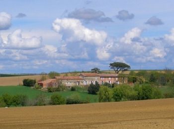
Trail Walking Villefranche-de-Lauragais - Tour du Télégraphe à Villefranche de Lauragais - Photo
Walking 12.615
Km

Walking

Medium
Villefranche-de-Lauragais, Occitania, Haute-Garonne, France
12.6 km | 15.3 km-effort
3h 10min
202 m
199 m
Yes
tracegps

Trail On foot Villefranche-de-Lauragais - 10805672-Villefranche-de-Lauragais
On foot 11.625
Km

On foot

Easy
Villefranche-de-Lauragais, Occitania, Haute-Garonne, France
11.6 km | 14.1 km-effort
2h 40min
184 m
183 m
Yes
pidjam

Trail On foot Villefranche-de-Lauragais - 8779037-Villefranche-L tour télégraf - Photo
On foot 11.926
Km

On foot

Easy
Villefranche-de-Lauragais, Occitania, Haute-Garonne, France
11.9 km | 14.3 km-effort
3h 0min
182 m
179 m
Yes
pidjam

Trail Walking Villefranche-de-Lauragais - 2018  JUIN 04 - Photo
Walking 12.187
Km

Walking

Medium
Villefranche-de-Lauragais, Occitania, Haute-Garonne, France
12.2 km | 14.7 km-effort
2h 52min
191 m
192 m
Yes
FLOCON

• Villefranche de Lauragais <-->Montgaillad de Lauragais 23 RANDONNEURS TEMPS SEC

Trail Walking Villefranche-de-Lauragais - villrf telef fait  - Photo
Walking 11.777
Km

Walking

Easy
Villefranche-de-Lauragais, Occitania, Haute-Garonne, France
11.8 km | 14.2 km-effort
2h 51min
183 m
182 m
Yes
pidjam

Trail Road bike Villefranche-de-Lauragais - Villefranche  Baziege - Photo
Road bike 14.061
Km

Road bike

Very easy
Villefranche-de-Lauragais, Occitania, Haute-Garonne, France
14.1 km | 15.2 km-effort
1h 10min
82 m
98 m
No
jlbossuet

Trail Walking Villefranche-de-Lauragais - Villefranche de lauragais - Photo
Walking 11.846
Km

Walking

Medium
Villefranche-de-Lauragais, Occitania, Haute-Garonne, France
11.8 km | 14.3 km-effort
3h 2min
183 m
183 m
Yes
FLOCON

Trail Walking Villefranche-de-Lauragais - TOUR DU TELEGRAPHE VILLEFRANCHE DE L. - Photo
Walking 12.615
Km

Walking

Very easy
Villefranche-de-Lauragais, Occitania, Haute-Garonne, France
12.6 km | 15.3 km-effort
3h 20min
202 m
199 m
Yes
CANON2

Trail Walking Villefranche-de-Lauragais - S-J-VILLEFRANCHE-BAZIEGE - Photo
Walking 16.754
Km

Walking

Easy
Villefranche-de-Lauragais, Occitania, Haute-Garonne, France
16.8 km | 20 km-effort
4h 0min
273 m
295 m
No
CANON2

9 trails displayed on 9

FREE GPS app for hiking

Logo SityTrail SityTrail

IGN / Geographical institutes

Download SityTrail from the App Store Download SityTrail from Google Play

Logo SityTrail SityTrail World

The world is yours!

Download SityTrail from the App Store Download SityTrail from Google Play Download SityTrail on Huawei AppGallery

Activities

Close
My subscriptions