


16.8 km | 21 km-effort
Carennac: Discover the best trails: 17 hiking trails and 1 bike and mountain-bike routes. All these trails, routes and outdoor activities are available in our SityTrail applications for smartphones and tablets.

Walking


Walking
Walking
• promenade sur le causse

Walking

Walking

Walking
Walking
• nombreux sentiers ombragés.
Walking
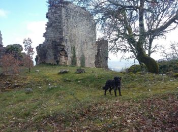
• From carennac gite trail goes above river through woods. Some parts steep. We didn't take the side trip to mezels. Up...
Walking
Walking

Motorbike

 18.753
sport
Walking
Walking

Mountain bike
Walking
Walking
• From carennac gite trail goes above river through woods. Some parts steep. We didn't take the side trip to mezels. Up...
Walking
Walking
Walking
20 trails displayed on 20
FREE GPS app for hiking
 SityTrail
IGN / Geographical institutes
SityTrail World
The world is yours!