Saint-Martin-de-Queyrières, Hautes-Alpes: Best trails, routes and walks

1 comments

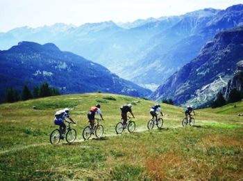
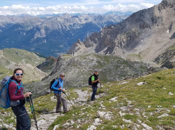
Saint-Martin-de-Queyrières: Discover the best trails: 18 hiking trails, 7 bike and mountain-bike routes and 1 equestrian circuits. All these trails, routes and outdoor activities are available in our SityTrail applications for smartphones and tablets.


The best trails (28)

Trail Walking Saint-Martin-de-Queyrières - Tête du Puy (Argentière La Bessée) - Photo
Walking 11.313
Km

Walking

Very difficult
Saint-Martin-de-Queyrières, Provence-Alpes-Côte d'Azur, Hautes-Alpes, France
11.3 km | 25 km-effort
6h 11min
1036 m
1024 m
Yes
PapouBertrand

Trail Walking Saint-Martin-de-Queyrières - croix Salcette - Photo
Walking 11.081
Km

Walking

Very difficult
Saint-Martin-de-Queyrières, Provence-Alpes-Côte d'Azur, Hautes-Alpes, France
11.1 km | 22 km-effort
3h 45min
840 m
841 m
Yes
MauriceJardret

Trail Walking Saint-Martin-de-Queyrières - Antecime Pic de Monbrison  - Photo
Walking 9.053
Km
GUIDE

Walking

Difficult
Saint-Martin-de-Queyrières, Provence-Alpes-Côte d'Azur, Hautes-Alpes, France
9.1 km | 23 km-effort
6h 58min
1028 m
1032 m
Yes
orsel

Trail Walking Saint-Martin-de-Queyrières - 20190819 - A - Bouchier  - Briançon  - Photo
Walking 12.246
Km

Walking

Easy
Saint-Martin-de-Queyrières, Provence-Alpes-Côte d'Azur, Hautes-Alpes, France
12.2 km | 15.7 km-effort
3h 52min
177 m
504 m
No
Phil13-Rufus

Trail Walking Saint-Martin-de-Queyrières - CR_Domitia_DA_22_St-Martin-Queyrieres_Val-Des-Pres_20180904 - Photo
Walking 13.523
Km

Walking

Difficult
Saint-Martin-de-Queyrières, Provence-Alpes-Côte d'Azur, Hautes-Alpes, France
13.5 km | 19.2 km-effort
4h 13min
482 m
263 m
No
patrickdanilo

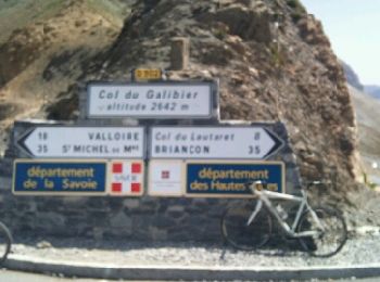
Trail Cycle Saint-Martin-de-Queyrières - briançon, col du galibier  - Photo
Cycle 42.377
Km

Cycle

Very difficult
Saint-Martin-de-Queyrières, Provence-Alpes-Côte d'Azur, Hautes-Alpes, France
42 km | 59 km-effort
2h 30min
1609 m
125 m
No
francislassauce

Trail Mountain bike Saint-Martin-de-Queyrières - Espace VTT FFC Pays des Ecrins - Circuit n°02 - Chapelle St-Ours - Photo
Mountain bike 6.472
Km

Mountain bike

Medium
Saint-Martin-de-Queyrières, Provence-Alpes-Côte d'Azur, Hautes-Alpes, France
6.5 km | 9.7 km-effort
40min
244 m
240 m
Yes
tracegps

Trail Mountain bike Saint-Martin-de-Queyrières - Espace VTT FFC Pays des Ecrins - Circuit n°01 - Le Poux - Photo
Mountain bike 9.073
Km

Mountain bike

Very difficult
Saint-Martin-de-Queyrières, Provence-Alpes-Côte d'Azur, Hautes-Alpes, France
9.1 km | 16.1 km-effort
1h 0min
527 m
526 m
Yes
tracegps

Trail Walking Saint-Martin-de-Queyrières - croix de sulcette - Photo
Walking 8.009
Km

Walking

Easy
Saint-Martin-de-Queyrières, Provence-Alpes-Côte d'Azur, Hautes-Alpes, France
8 km | 16.2 km-effort
3h 47min
565 m
765 m
No
gibello

Trail Walking Saint-Martin-de-Queyrières - 2021-08-02 Condamine - Photo
Walking 13.753
Km

Walking

Difficult
Saint-Martin-de-Queyrières, Provence-Alpes-Côte d'Azur, Hautes-Alpes, France
13.8 km | 29 km-effort
7h 40min
1192 m
1006 m
No
guyverot

Trail Walking Saint-Martin-de-Queyrières - Crête de l’Alpavin (05) - Photo
Walking 19.507
Km

Walking

Very difficult
Saint-Martin-de-Queyrières, Provence-Alpes-Côte d'Azur, Hautes-Alpes, France
19.5 km | 40 km-effort
6h 52min
1549 m
1544 m
Yes
djrem971

Trail Walking Saint-Martin-de-Queyrières - 20190819 Bouchier Briancon  - Photo
Walking 11.61
Km

Walking

Medium
Saint-Martin-de-Queyrières, Provence-Alpes-Côte d'Azur, Hautes-Alpes, France
11.6 km | 15.1 km-effort
3h 49min
177 m
503 m
No
Childebert

Trail Walking Saint-Martin-de-Queyrières - 2 - Compostelle/Bouchier - Mont-Dauphin 020719 - Photo
Walking 33.061
Km
GUIDE

Walking

Very difficult
Saint-Martin-de-Queyrières, Provence-Alpes-Côte d'Azur, Hautes-Alpes, France
33 km | 48 km-effort
10h 7min
1010 m
1502 m
No
R@ph

Trail Walking Saint-Martin-de-Queyrières - le poux  - Photo
Walking 6.914
Km

Walking

Easy
(1)
Saint-Martin-de-Queyrières, Provence-Alpes-Côte d'Azur, Hautes-Alpes, France
6.9 km | 13.9 km-effort
2h 17min
528 m
527 m
No
stephaneaznar

• le poux depuis saint martin de queyriere

Trail Cycle Saint-Martin-de-Queyrières - briançon, col d'isoard, casse deserte - Photo
Cycle 28.841
Km

Cycle

Very difficult
Saint-Martin-de-Queyrières, Provence-Alpes-Côte d'Azur, Hautes-Alpes, France
29 km | 44 km-effort
1h 49min
1397 m
339 m
No
francislassauce

Trail Walking Saint-Martin-de-Queyrières - balade - Photo
Walking 17.315
Km

Walking

Easy
Saint-Martin-de-Queyrières, Provence-Alpes-Côte d'Azur, Hautes-Alpes, France
17.3 km | 30 km-effort
4h 1min
939 m
959 m
Yes
tchoua

Trail Climbing Saint-Martin-de-Queyrières - tenaille de Montbrison  - Photo
Climbing 36.38
Km

Climbing

Difficult
Saint-Martin-de-Queyrières, Provence-Alpes-Côte d'Azur, Hautes-Alpes, France
36 km | 56 km-effort
14h 30min
1458 m
1520 m
No
jfcontour

Trail Walking Saint-Martin-de-Queyrières - 2022-07-25 Cretes de l'Alpavin - Photo
Walking 8.836
Km

Walking

Difficult
Saint-Martin-de-Queyrières, Provence-Alpes-Côte d'Azur, Hautes-Alpes, France
8.8 km | 18.6 km-effort
4h 35min
733 m
724 m
Yes
guyverot

Trail Walking Saint-Martin-de-Queyrières - 2022-03-22 Ratiere - Photo
Walking 7.456
Km

Walking

Difficult
Saint-Martin-de-Queyrières, Provence-Alpes-Côte d'Azur, Hautes-Alpes, France
7.5 km | 15.5 km-effort
5h 22min
606 m
606 m
Yes
guyverot

Trail Mountain bike Saint-Martin-de-Queyrières - Montee haute Alpes - Photo
Mountain bike 3.718
Km

Mountain bike

Saint-Martin-de-Queyrières, Provence-Alpes-Côte d'Azur, Hautes-Alpes, France
3.7 km | 4.4 km-effort
14min
3 m
195 m
No
ben

20 trails displayed on 28

FREE GPS app for hiking

Logo SityTrail SityTrail

IGN / Geographical institutes

Download SityTrail from the App Store Download SityTrail from Google Play

Logo SityTrail SityTrail World

The world is yours!

Download SityTrail from the App Store Download SityTrail from Google Play Download SityTrail on Huawei AppGallery

Activities

Close
My subscriptions