Ceillac, Hautes-Alpes: Best trails, routes and walks

31 comments

Ceillac: Discover the best trails: 335 hiking trails, 9 bike and mountain-bike routes and 2 equestrian circuits. All these trails, routes and outdoor activities are available in our SityTrail applications for smartphones and tablets.


The best trails (440)

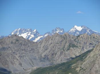
Trail Walking Ceillac - Crêtes de Chambrettes - Photo
Walking 13.447
Km
GUIDE

Walking

Medium
(1)
Ceillac, Provence-Alpes-Côte d'Azur, Hautes-Alpes, France
13.4 km | 26 km-effort
5h 53min
905 m
903 m
Yes
amiral13

Trail Walking Ceillac - 05 Tour Font Sancte - étape 1 - Photo
Walking 16.547
Km

Walking

Very difficult
(1)
Ceillac, Provence-Alpes-Côte d'Azur, Hautes-Alpes, France
16.5 km | 36 km-effort
8h 9min
1480 m
1366 m
No
Maryma

Trail Walking Ceillac - Col Girardin - Photo
Walking 14.498
Km
GUIDE

Walking

Very difficult
Ceillac, Provence-Alpes-Côte d'Azur, Hautes-Alpes, France
14.5 km | 29 km-effort
6h 32min
1070 m
1070 m
Yes
Marco05

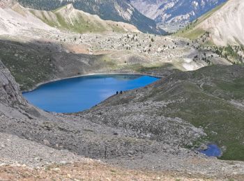
Trail Walking Ceillac - Queyras_lac de Clausis - Photo
Walking 13.124
Km

Walking

Very easy
(1)
Ceillac, Provence-Alpes-Côte d'Azur, Hautes-Alpes, France
13.1 km | 26 km-effort
2h 59min
944 m
944 m
Yes
MartinBraudThierry

Trail Walking Ceillac - Ceillac - St Véran - Photo
Walking 13.482
Km
GUIDE

Walking

Medium
Ceillac, Provence-Alpes-Côte d'Azur, Hautes-Alpes, France
13.5 km | 28 km-effort
7h 22min
1192 m
815 m
No
romanceline

• Tour du

Trail Other activity Ceillac - Col de la petite Par. Col Girardin  - Photo
Other activity 13.918
Km
GUIDE

Other activity

Difficult
Ceillac, Provence-Alpes-Côte d'Azur, Hautes-Alpes, France
13.9 km | 32 km-effort
7h 36min
1341 m
1342 m
Yes
nadd73

• Départ après Ceillac La vallée du Melezet au fond garer la voiture. Et monter au lac St Anne.... course à faire av...
Trail Walking Ceillac - le Longet ou tête du Rissace - Photo
Walking 13.042
Km
GUIDE

Walking

Medium
Ceillac, Provence-Alpes-Côte d'Azur, Hautes-Alpes, France
13 km | 25 km-effort
6h 26min
891 m
887 m
Yes
amiral13

Trail Walking Ceillac - la pointe de la Saume (traversée) - Photo
Walking 14.993
Km
GUIDE

Walking

Difficult
Ceillac, Provence-Alpes-Côte d'Azur, Hautes-Alpes, France
15 km | 34 km-effort
6h 43min
1474 m
1407 m
No
amiral13

Trail Walking Ceillac - Lac Ste Anne et Tête de Girardin - Photo
Walking 14.433
Km
GUIDE

Walking

Medium
Ceillac, Provence-Alpes-Côte d'Azur, Hautes-Alpes, France
14.4 km | 27 km-effort
5h 48min
952 m
951 m
Yes
amiral13

Trail Walking Ceillac - lac Sainte Anne - Photo
Walking 10.709
Km

Walking

Easy
(2)
Ceillac, Provence-Alpes-Côte d'Azur, Hautes-Alpes, France
10.7 km | 17.9 km-effort
5h 16min
530 m
566 m
No
griffet

• En descendant par le lac Miroir

Trail Walking Ceillac - Queyras - Photo
Walking 105.11
Km

Walking

Difficult
Ceillac, Provence-Alpes-Côte d'Azur, Hautes-Alpes, France
105 km | 201 km-effort
50h 0min
7194 m
7196 m
No
ARVIEU

Trail Walking Ceillac - cols Tronchet et Girardin  - Photo
Walking 13.818
Km
GUIDE

Walking

Medium
Ceillac, Provence-Alpes-Côte d'Azur, Hautes-Alpes, France
13.8 km | 27 km-effort
7h 56min
1019 m
1018 m
Yes
orsel

Trail Walking Ceillac - #1 Queyras 3j étape 1 Ceillac - Lac de Roue - Photo
Walking 16.715
Km

Walking

Very difficult
Ceillac, Provence-Alpes-Côte d'Azur, Hautes-Alpes, France
16.7 km | 33 km-effort
7h 34min
1297 m
1085 m
No
Liobric

Trail Snowshoes Ceillac - ceillac ravin du clos des oiseaux 11kms 506m  - Photo
Snowshoes 9.726
Km
GUIDE

Snowshoes

Difficult
Ceillac, Provence-Alpes-Côte d'Azur, Hautes-Alpes, France
9.7 km | 16.5 km-effort
6h 39min
511 m
497 m
Yes
Danielba

Trail Snowshoes Ceillac - ceillac ste Anne lac mirroir 11kms 486m - Photo
Snowshoes 9.719
Km
GUIDE

Snowshoes

Medium
Ceillac, Provence-Alpes-Côte d'Azur, Hautes-Alpes, France
9.7 km | 16.5 km-effort
6h 57min
410 m
818 m
No
Danielba

Trail Snowshoes Ceillac - Ceillac tronchet 11kms 586m - Photo
Snowshoes 10.518
Km
GUIDE

Snowshoes

Medium
Ceillac, Provence-Alpes-Côte d'Azur, Hautes-Alpes, France
10.5 km | 18.3 km-effort
6h 36min
586 m
583 m
Yes
Danielba

Trail Walking Ceillac - Pas de la Cula depuis la bergerie du bois noir  - Photo
Walking 15.334
Km
GUIDE

Walking

Medium
Ceillac, Provence-Alpes-Côte d'Azur, Hautes-Alpes, France
15.3 km | 30 km-effort
7h 15min
1126 m
1122 m
Yes
orsel

Trail Walking Ceillac - crête du Riou vert  - Photo
Walking 14.034
Km
GUIDE

Walking

Medium
Ceillac, Provence-Alpes-Côte d'Azur, Hautes-Alpes, France
14 km | 25 km-effort
6h 35min
845 m
848 m
Yes
orsel

Trail Walking Ceillac - Arvieux Randonnée - Photo
Walking 137.798
Km

Walking

Very difficult
Ceillac, Provence-Alpes-Côte d'Azur, Hautes-Alpes, France
138 km | 250 km-effort
56h 55min
8448 m
8448 m
Yes
choumac08

Trail Walking Ceillac - circuit des fours à chaux - Photo
Walking 6.951
Km

Walking

Easy
Ceillac, Provence-Alpes-Côte d'Azur, Hautes-Alpes, France
7 km | 9.3 km-effort
2h 27min
174 m
197 m
No
marchev

20 trails displayed on 440

FREE GPS app for hiking

Logo SityTrail SityTrail

IGN / Geographical institutes

Download SityTrail from the App Store Download SityTrail from Google Play

Logo SityTrail SityTrail World

The world is yours!

Download SityTrail from the App Store Download SityTrail from Google Play Download SityTrail on Huawei AppGallery

Activities

Close
My subscriptions