Ribiers, Val-Buëch-Méouge: Best trails, routes and walks

Ribiers: Discover the best trails: 9 hiking trails and 1 bike and mountain-bike routes. All these trails, routes and outdoor activities are available in our SityTrail applications for smartphones and tablets.


The best trails (9)
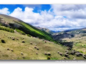
Trail Walking Val-Buëch-Méouge - Crête de l'âne, des Planes et Roc de Gloritte Via Plaugiers - Photo
Walking 11.075
Km

Walking

Very difficult
Val-Buëch-Méouge, Provence-Alpes-Côte d'Azur, Hautes-Alpes, France
11.1 km | 23 km-effort
5h 19min
869 m
879 m
Yes
PapouBertrand

Trail Walking Val-Buëch-Méouge - Col de blauge - Photo
Walking 9.704
Km

Walking

Medium
Val-Buëch-Méouge, Provence-Alpes-Côte d'Azur, Hautes-Alpes, France
9.7 km | 17.5 km-effort
2h 7min
582 m
583 m
Yes
antoinemcb

Trail Walking Val-Buëch-Méouge - RIBIERS,  col de Blauges . crêtes des Planes n - Photo
Walking 8.893
Km

Walking

Medium
Val-Buëch-Méouge, Provence-Alpes-Côte d'Azur, Hautes-Alpes, France
8.9 km | 17.5 km-effort
4h 39min
643 m
653 m
Yes
RobinMicheline

Trail On foot Val-Buëch-Méouge - Roc De Gloritte depart Plaugiers  642+ - Photo
On foot 8.449
Km

On foot

Easy
Val-Buëch-Méouge, Provence-Alpes-Côte d'Azur, Hautes-Alpes, France
8.4 km | 17 km-effort
3h 52min
642 m
650 m
Yes
claude nier

Trail Walking Val-Buëch-Méouge - Cette de Rougnouse - Photo
Walking 11.972
Km

Walking

Medium
Val-Buëch-Méouge, Provence-Alpes-Côte d'Azur, Hautes-Alpes, France
12 km | 18.9 km-effort
5h 36min
522 m
521 m
Yes
claude nier

Trail Walking Val-Buëch-Méouge - Sisteron: Col de blauge - Photo
Walking 9.704
Km

Walking

Medium
Val-Buëch-Méouge, Provence-Alpes-Côte d'Azur, Hautes-Alpes, France
9.7 km | 17.5 km-effort
3h 32min
582 m
583 m
Yes
lviallet

Trail Walking Val-Buëch-Méouge - le Grand Roc Noir - Photo
Walking 25.944
Km

Walking

Medium
Val-Buëch-Méouge, Provence-Alpes-Côte d'Azur, Hautes-Alpes, France
26 km | 0 m-effort
4h 35min
0 m
0 m
No
PatriceCocuaud

Trail Walking Val-Buëch-Méouge - la plate, travers, crête de l'âne  - Photo
Walking 17.868
Km

Walking

Difficult
Val-Buëch-Méouge, Provence-Alpes-Côte d'Azur, Hautes-Alpes, France
17.9 km | 35 km-effort
7h 38min
1273 m
1281 m
Yes
radisnoir

Trail Walking Val-Buëch-Méouge - crêtes âne travers platte - Photo
Walking 18.707
Km

Walking

Very easy
Val-Buëch-Méouge, Provence-Alpes-Côte d'Azur, Hautes-Alpes, France
18.7 km | 36 km-effort
8h 49min
1299 m
1312 m
No
radisnoir

9 trails displayed on 9

FREE GPS app for hiking

Logo SityTrail SityTrail

IGN / Geographical institutes

Download SityTrail from the App Store Download SityTrail from Google Play

Logo SityTrail SityTrail World

The world is yours!

Download SityTrail from the App Store Download SityTrail from Google Play Download SityTrail on Huawei AppGallery

Activities

Close
My subscriptions