Eyguians, Garde-Colombe: Best trails, routes and walks

Eyguians: Discover the best trails: 6 hiking trails and 2 bike and mountain-bike routes. All these trails, routes and outdoor activities are available in our SityTrail applications for smartphones and tablets.


The best trails (8)
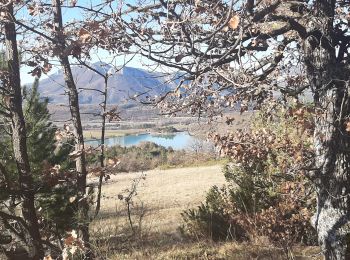
Trail Walking Garde-Colombe - SAINT GENIS Dep lac du Riou . Forte Sereine  gorges du Riou o m s    - Photo
Walking 10.622
Km

Walking

Medium
Garde-Colombe, Provence-Alpes-Côte d'Azur, Hautes-Alpes, France
10.6 km | 17.4 km-effort
3h 10min
502 m
513 m
Yes
RobinMicheline

Trail Electric bike Garde-Colombe - St genis jubeo - Photo
Electric bike 40.509
Km
GUIDE

Electric bike

Medium
Garde-Colombe, Provence-Alpes-Côte d'Azur, Hautes-Alpes, France
41 km | 51 km-effort
5h 40min
808 m
802 m
Yes
Danielba

Trail Walking Garde-Colombe - Garde-Colombe St genis savournon jubeo VTT 40k 729m - Photo
Walking 16.997
Km
GUIDE

Walking

Easy
Garde-Colombe, Provence-Alpes-Côte d'Azur, Hautes-Alpes, France
17 km | 23 km-effort
5h 58min
433 m
440 m
Yes
Danielba

Trail On foot Garde-Colombe - Boucle de Serre De Criau - Photo
On foot 12.784
Km

On foot

Medium
Garde-Colombe, Provence-Alpes-Côte d'Azur, Hautes-Alpes, France
12.8 km | 22 km-effort
Unknown
721 m
723 m
Yes
claude nier

Trail On foot Garde-Colombe - Sommet du Javanon depart Lac du Riou - Photo
On foot 11.084
Km

On foot

Medium
Garde-Colombe, Provence-Alpes-Côte d'Azur, Hautes-Alpes, France
11.1 km | 16.1 km-effort
Unknown
375 m
375 m
Yes
claude nier

Trail Walking Garde-Colombe - Sommet de Javanon - Photo
Walking 13.823
Km

Walking

Medium
Garde-Colombe, Provence-Alpes-Côte d'Azur, Hautes-Alpes, France
13.8 km | 19.4 km-effort
4h 2min
422 m
421 m
Yes
rigol05

Trail Walking Garde-Colombe - Riou - Porte Sereine - Gorges - Photo
Walking 14.159
Km

Walking

Difficult
Garde-Colombe, Provence-Alpes-Côte d'Azur, Hautes-Alpes, France
14.2 km | 23 km-effort
3h 45min
688 m
688 m
Yes
jlv05

Trail Mountain bike Garde-Colombe - 20 oct - Photo
Mountain bike 10.833
Km

Mountain bike

Very easy
Garde-Colombe, Provence-Alpes-Côte d'Azur, Hautes-Alpes, France
10.8 km | 12.7 km-effort
46min
153 m
105 m
No
Denis05

8 trails displayed on 8

FREE GPS app for hiking

Logo SityTrail SityTrail

IGN / Geographical institutes

Download SityTrail from the App Store Download SityTrail from Google Play

Logo SityTrail SityTrail World

The world is yours!

Download SityTrail from the App Store Download SityTrail from Google Play Download SityTrail on Huawei AppGallery

Activities

Close
My subscriptions