Saint-Apollinaire, Hautes-Alpes: Best trails, routes and walks

3 comments

Saint-Apollinaire: Discover the best trails: 20 hiking trails and 1 bike and mountain-bike routes. All these trails, routes and outdoor activities are available in our SityTrail applications for smartphones and tablets.


The best trails (23)
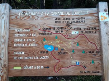
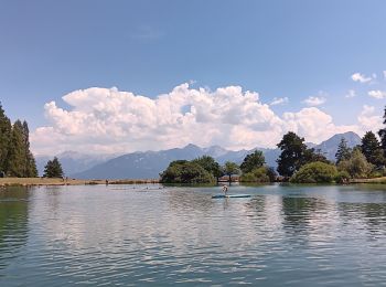
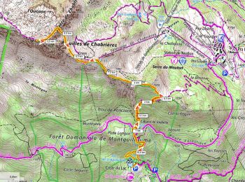
Trail Walking Saint-Apollinaire - Aiguilles Chabrieres 08/08/18 - Photo
Walking 10.958
Km
GUIDE

Walking

Medium
Saint-Apollinaire, Provence-Alpes-Côte d'Azur, Hautes-Alpes, France
11 km | 24 km-effort
4h 42min
978 m
977 m
Yes
R@ph

Trail Walking Saint-Apollinaire - Aiguilles de Chabrières - Photo
Walking 13.056
Km

Walking

Medium
(1)
Saint-Apollinaire, Provence-Alpes-Côte d'Azur, Hautes-Alpes, France
13.1 km | 26 km-effort
4h 47min
968 m
977 m
Yes
DaumasChris

• par St Apollinaire

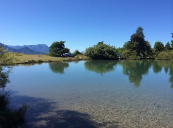
Trail Walking Saint-Apollinaire - lac St apollinaire . Realon / retour - Photo
Walking 9.296
Km
GUIDE

Walking

Easy
Saint-Apollinaire, Provence-Alpes-Côte d'Azur, Hautes-Alpes, France
9.3 km | 13.7 km-effort
2h 50min
334 m
331 m
Yes
stef789

Trail Walking Saint-Apollinaire - lac St appolinaire  - Photo
Walking 2.81
Km

Walking

Very easy
(1)
Saint-Apollinaire, Provence-Alpes-Côte d'Azur, Hautes-Alpes, France
2.8 km | 4.5 km-effort
1h 32min
129 m
130 m
Yes
lpratz

Trail Walking Saint-Apollinaire - SityTrail - Sommet Aiguilles Chabrieres - Photo
Walking 10.961
Km

Walking

Very difficult
Saint-Apollinaire, Provence-Alpes-Côte d'Azur, Hautes-Alpes, France
11 km | 24 km-effort
5h 25min
970 m
969 m
Yes
ericberlin

• Départ du lac de St Appolinaire avec un passage par la cabane de Joubelle et sa source rafraichissante. On rejoint le...
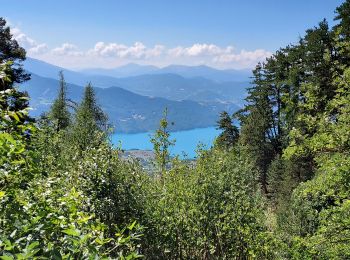
Trail Walking Saint-Apollinaire - Lac St Apollinaire - Photo
Walking 2.979
Km
GUIDE

Walking

Medium
Saint-Apollinaire, Provence-Alpes-Côte d'Azur, Hautes-Alpes, France
3 km | 6 km-effort
3h 42min
256 m
143 m
No
Specialized77

Trail Walking Saint-Apollinaire - tour des Faysses - Photo
Walking 9.482
Km

Walking

Easy
(1)
Saint-Apollinaire, Provence-Alpes-Côte d'Azur, Hautes-Alpes, France
9.5 km | 14.5 km-effort
3h 11min
381 m
370 m
Yes
miloudominique

Trail Walking Saint-Apollinaire - serre du mouton  - Photo
Walking 10.233
Km
GUIDE

Walking

Easy
Saint-Apollinaire, Provence-Alpes-Côte d'Azur, Hautes-Alpes, France
10.2 km | 17.3 km-effort
4h 53min
522 m
547 m
No
orsel

Trail Walking Saint-Apollinaire - Aiguilles de Chabrière - Photo
Walking 16.613
Km
GUIDE

Walking

Medium
Saint-Apollinaire, Provence-Alpes-Côte d'Azur, Hautes-Alpes, France
16.6 km | 30 km-effort
7h 14min
1030 m
1030 m
Yes
orsel

Trail Walking Saint-Apollinaire - Domaine skiable - vue panoramique sur Lac SP + lac des truites - Photo
Walking 10.025
Km

Walking

Medium
Saint-Apollinaire, Provence-Alpes-Côte d'Azur, Hautes-Alpes, France
10 km | 14.7 km-effort
2h 43min
353 m
354 m
Yes
Maca8284

Trail Walking Saint-Apollinaire - Aiguilles de Chabrières depuis le lac de St Apo - Photo
Walking 15.912
Km
GUIDE

Walking

Medium
Saint-Apollinaire, Provence-Alpes-Côte d'Azur, Hautes-Alpes, France
15.9 km | 29 km-effort
7h 30min
983 m
1091 m
No
orsel

Trail Snowshoes Saint-Apollinaire - Table d'orientation Au pied des aiguilles de Chabrière - Photo
Snowshoes 10.669
Km
GUIDE

Snowshoes

Medium
Saint-Apollinaire, Provence-Alpes-Côte d'Azur, Hautes-Alpes, France
10.7 km | 21 km-effort
3h 11min
769 m
777 m
Yes
orsel

Trail Walking Saint-Apollinaire - les circuits des oucanes - Photo
Walking 12.491
Km

Walking

Medium
Saint-Apollinaire, Provence-Alpes-Côte d'Azur, Hautes-Alpes, France
12.5 km | 23 km-effort
7h 27min
725 m
990 m
No
anonymous_0a50d3ca6f

• Avec bivouac cabane forestière Joubelle

Trail Walking Saint-Apollinaire - Aiguilles de Chabriere. - Photo
Walking 11.406
Km

Walking

Difficult
Saint-Apollinaire, Provence-Alpes-Côte d'Azur, Hautes-Alpes, France
11.4 km | 23 km-effort
4h 38min
870 m
871 m
Yes
Dervalmarc

Trail Walking Saint-Apollinaire - Chabrières par Saint Apollinaire - Photo
Walking 5.388
Km

Walking

Very easy
Saint-Apollinaire, Provence-Alpes-Côte d'Azur, Hautes-Alpes, France
5.4 km | 14.2 km-effort
Unknown
885 m
3 m
No
felfra

Trail Walking Saint-Apollinaire - Lac saint appolinaire - Photo
Walking 8.384
Km

Walking

Medium
Saint-Apollinaire, Provence-Alpes-Côte d'Azur, Hautes-Alpes, France
8.4 km | 12.5 km-effort
2h 55min
313 m
306 m
Yes
Isabelle C.

Trail Mountain bike Saint-Apollinaire - tour Reallon - Photo
Mountain bike 27.694
Km

Mountain bike

Very difficult
Saint-Apollinaire, Provence-Alpes-Côte d'Azur, Hautes-Alpes, France
28 km | 44 km-effort
3h 10min
1253 m
1253 m
Yes
Paslatek

Trail sport Saint-Apollinaire - Cabane de joubelle - Photo
sport 1.836
Km

sport

Very easy
Saint-Apollinaire, Provence-Alpes-Côte d'Azur, Hautes-Alpes, France
1.8 km | 3.9 km-effort
Unknown
208 m
9 m
No
b.vroye

Trail Trail Saint-Apollinaire - chorges-aiguilles de chabrières - Photo
Trail 17.511
Km

Trail

Medium
Saint-Apollinaire, Provence-Alpes-Côte d'Azur, Hautes-Alpes, France
17.5 km | 31 km-effort
Unknown
1036 m
1039 m
Yes
Titinechris

Trail Walking Saint-Apollinaire - serre du mouton,   belvédère croix du vallon,  - Photo
Walking 8.247
Km

Walking

Difficult
Saint-Apollinaire, Provence-Alpes-Côte d'Azur, Hautes-Alpes, France
8.2 km | 17.1 km-effort
6h 19min
661 m
660 m
Yes
jmgeffrin

20 trails displayed on 23

FREE GPS app for hiking

Logo SityTrail SityTrail

IGN / Geographical institutes

Download SityTrail from the App Store Download SityTrail from Google Play

Logo SityTrail SityTrail World

The world is yours!

Download SityTrail from the App Store Download SityTrail from Google Play Download SityTrail on Huawei AppGallery

Activities

Close
My subscriptions