Saint-Léger-les-Mélèzes, Hautes-Alpes: Best trails, routes and walks

3 comments

Saint-Léger-les-Mélèzes: Discover the best trails: 13 hiking trails and 6 bike and mountain-bike routes. All these trails, routes and outdoor activities are available in our SityTrail applications for smartphones and tablets.


The best trails (27)
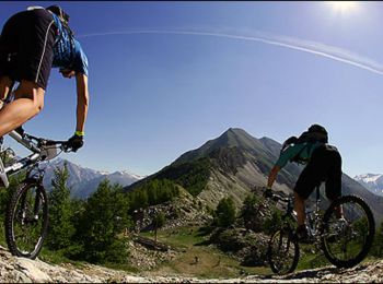
Trail Mountain bike Saint-Léger-les-Mélèzes - Espace VTT FFC du Champsaur - Circuit n°12 - Sous la Hêtraie - Photo
Mountain bike 9.937
Km

Mountain bike

Medium
Saint-Léger-les-Mélèzes, Provence-Alpes-Côte d'Azur, Hautes-Alpes, France
9.9 km | 13.2 km-effort
1h 0min
243 m
246 m
Yes
tracegps

Trail Mountain bike Saint-Léger-les-Mélèzes - St leger 12 08 2022 - Photo
Mountain bike 21.695
Km

Mountain bike

Medium
Saint-Léger-les-Mélèzes, Provence-Alpes-Côte d'Azur, Hautes-Alpes, France
22 km | 30 km-effort
3h 31min
614 m
615 m
Yes
jeanguil

Trail Walking Saint-Léger-les-Mélèzes - Le Cuchon - Photo
Walking 10.819
Km

Walking

Medium
Saint-Léger-les-Mélèzes, Provence-Alpes-Côte d'Azur, Hautes-Alpes, France
10.8 km | 20 km-effort
4h 47min
725 m
726 m
Yes
pourrier

Trail Mountain bike Saint-Léger-les-Mélèzes - Sous Faudon - Photo
Mountain bike 45.138
Km

Mountain bike

Very difficult
Saint-Léger-les-Mélèzes, Provence-Alpes-Côte d'Azur, Hautes-Alpes, France
45 km | 62 km-effort
4h 1min
1286 m
1287 m
Yes
ericf64

Trail Snowshoes Saint-Léger-les-Mélèzes - cuchon d ancelle - Photo
Snowshoes 12.592
Km

Snowshoes

Difficult
Saint-Léger-les-Mélèzes, Provence-Alpes-Côte d'Azur, Hautes-Alpes, France
12.6 km | 23 km-effort
5h 27min
746 m
746 m
Yes
gibello

Trail Snowshoes Saint-Léger-les-Mélèzes - Raquette 3 St Lègers les Mélèzes - Photo
Snowshoes 8.792
Km

Snowshoes

Very easy
Saint-Léger-les-Mélèzes, Provence-Alpes-Côte d'Azur, Hautes-Alpes, France
8.8 km | 18.6 km-effort
Unknown
732 m
735 m
Yes
loloetienne

Trail Snowshoes Saint-Léger-les-Mélèzes - Raquette 2 St Léger Les Mélèzes - Photo
Snowshoes 9.042
Km

Snowshoes

Very easy
Saint-Léger-les-Mélèzes, Provence-Alpes-Côte d'Azur, Hautes-Alpes, France
9 km | 19 km-effort
Unknown
742 m
747 m
Yes
loloetienne

Trail Snowshoes Saint-Léger-les-Mélèzes - RAquette 1 St Légers les Mélèzes - Photo
Snowshoes 10.243
Km

Snowshoes

Very easy
Saint-Léger-les-Mélèzes, Provence-Alpes-Côte d'Azur, Hautes-Alpes, France
10.2 km | 23 km-effort
Unknown
962 m
958 m
Yes
loloetienne

Trail Walking Saint-Léger-les-Mélèzes - Saint léger,aqueduc,canal - Photo
Walking 12.788
Km

Walking

Easy
Saint-Léger-les-Mélèzes, Provence-Alpes-Côte d'Azur, Hautes-Alpes, France
12.8 km | 17.3 km-effort
4h 36min
342 m
339 m
Yes
aldojubru

• balade tranquille dans les bois

Trail Walking Saint-Léger-les-Mélèzes - Petite Autane - Photo
Walking 7.294
Km

Walking

Difficult
Saint-Léger-les-Mélèzes, Provence-Alpes-Côte d'Azur, Hautes-Alpes, France
7.3 km | 17.2 km-effort
5h 3min
738 m
748 m
Yes
Orage

• boucle retour par le Cuchon

Trail Walking Saint-Léger-les-Mélèzes - St Leger les Melezes - Cabane de tante Yvonne - Photo
Walking 10.786
Km
GUIDE

Walking

Difficult
(1)
Saint-Léger-les-Mélèzes, Provence-Alpes-Côte d'Azur, Hautes-Alpes, France
10.8 km | 18.1 km-effort
3h 54min
546 m
562 m
Yes
R@ph

Trail Mountain bike Saint-Léger-les-Mélèzes -  Espace VTT FFC du Champsaur - Circuit n°16 : Sous combeau - Photo
Mountain bike 23.522
Km

Mountain bike

Very difficult
Saint-Léger-les-Mélèzes, Provence-Alpes-Côte d'Azur, Hautes-Alpes, France
24 km | 36 km-effort
2h 9min
963 m
965 m
Yes
tracegps

Trail Mountain bike Saint-Léger-les-Mélèzes - Saint Léger Les Mélèzes - Photo
Mountain bike 15.05
Km

Mountain bike

Medium
Saint-Léger-les-Mélèzes, Provence-Alpes-Côte d'Azur, Hautes-Alpes, France
15.1 km | 20 km-effort
1h 0min
393 m
401 m
Yes
tracegps

Trail Walking Saint-Léger-les-Mélèzes - grande boucle du cuchon - Photo
Walking 15.195
Km

Walking

Very difficult
Saint-Léger-les-Mélèzes, Provence-Alpes-Côte d'Azur, Hautes-Alpes, France
15.2 km | 24 km-effort
5h 29min
675 m
675 m
Yes
CASSISFRAMBOISE

Trail Walking Saint-Léger-les-Mélèzes - cruchon - Photo
Walking 10.625
Km

Walking

Very difficult
Saint-Léger-les-Mélèzes, Provence-Alpes-Côte d'Azur, Hautes-Alpes, France
10.6 km | 22 km-effort
3h 25min
828 m
829 m
Yes
Djebel

Trail Mountain bike Saint-Léger-les-Mélèzes - Sous la Moraine: circuit VTT N°13 - Photo
Mountain bike 23.695
Km

Mountain bike

Difficult
Saint-Léger-les-Mélèzes, Provence-Alpes-Côte d'Azur, Hautes-Alpes, France
24 km | 33 km-effort
2h 7min
732 m
726 m
Yes
gougou

Trail sport Saint-Léger-les-Mélèzes - 2022-06-05_17h01m36_9557956 - Photo
sport 11.123
Km

sport

Very easy
Saint-Léger-les-Mélèzes, Provence-Alpes-Côte d'Azur, Hautes-Alpes, France
11.1 km | 21 km-effort
Unknown
718 m
718 m
Yes
Cecile Grubbs

Trail Walking Saint-Léger-les-Mélèzes - balade tte anna - Photo
Walking 7.909
Km

Walking

Easy
Saint-Léger-les-Mélèzes, Provence-Alpes-Côte d'Azur, Hautes-Alpes, France
7.9 km | 9.7 km-effort
1h 50min
134 m
136 m
Yes
Rangabe

Trail Walking Saint-Léger-les-Mélèzes - petite Autane depuis le rocher Poligny en boucle  - Photo
Walking 6.267
Km

Walking

Medium
Saint-Léger-les-Mélèzes, Provence-Alpes-Côte d'Azur, Hautes-Alpes, France
6.3 km | 16.4 km-effort
6h 16min
761 m
765 m
Yes
Orage

Trail Walking Saint-Léger-les-Mélèzes - st leger - Photo
Walking 5.19
Km

Walking

Difficult
(1)
Saint-Léger-les-Mélèzes, Provence-Alpes-Côte d'Azur, Hautes-Alpes, France
5.2 km | 12.5 km-effort
3h 12min
727 m
2 m
No
Abigail

20 trails displayed on 27

FREE GPS app for hiking

Logo SityTrail SityTrail

IGN / Geographical institutes

Download SityTrail from the App Store Download SityTrail from Google Play

Logo SityTrail SityTrail World

The world is yours!

Download SityTrail from the App Store Download SityTrail from Google Play Download SityTrail on Huawei AppGallery

Activities

Close
My subscriptions