- Trails
- Outdoor
- France
- Grand Est
- Haute-Marne
- Nogent
Nogent, Haute-Marne: Best trails, routes and walks
Nogent: Discover the best trails: 5 hiking trails. All these trails, routes and outdoor activities are available in our SityTrail applications for smartphones and tablets.
The best trails (5)

Km
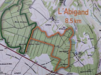
#1 - Nogent l'abigand


Walking
Medium
Nogent,
Grand Est,
Haute-Marne,
France

8.5 km | 9.7 km-effort
2h 44min

93 m

91 m
Yes
Nicole SIMONNET

Km
#2 - Le cut de sac


Walking
Nogent,
Grand Est,
Haute-Marne,
France

12.4 km | 13.9 km-effort
2h 28min

112 m

115 m
Yes
Jean-baptiste Jeaugey

Km
#3 - Bois de Nogent Le Cul de Sac


Walking
Medium
Nogent,
Grand Est,
Haute-Marne,
France

9.6 km | 10.8 km-effort
2h 27min

90 m

93 m
Yes
irenep52

Km
#4 - Bois de Nogent l'Abigand, parking parcours de santé


Walking
Medium
Nogent,
Grand Est,
Haute-Marne,
France

9.1 km | 10.5 km-effort
2h 23min

105 m

103 m
Yes
irenep52

Km
#5 - Forêt de l'Abondace Is-en-Bassigny


Walking
Medium
Nogent,
Grand Est,
Haute-Marne,
France

10.4 km | 12.7 km-effort
2h 43min

167 m

167 m
Yes
irenep52
5 trails displayed on 5
FREE GPS app for hiking


 SityTrail


