
Moselle, Grand Est: Best trails, routes and walks
Moselle: Discover the best trails: 1,637 hiking trails, 576 bike and mountain-bike routes and 429 equestrian circuits. All these trails, routes and outdoor activities are available in our SityTrail applications for smartphones and tablets.
The best trails (2774)
Km
Walking


Km
Walking


Km
Walking


• Faite le 05/05/2016 avec notre fils de 11 ans. D'après "Passion Vosges - Autour des abbayes du massif vosgien" N°4 : ...
Km
Walking


• Faite le 30/12/2015 avec notre fils de 11 ans et nos amis Eléonore et Bernard.
Km
Walking


Km
Walking


Km
Walking


Km
Walking


Km
Walking


Km
Walking


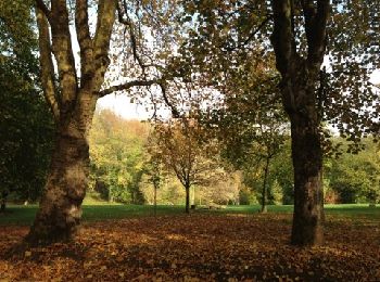
• Départ Arboretum de Plappeville, col de Lessy pour le Mont Saint-Quentin, avec un beau panorama sur Metz. Ensuite, on...
Km
Walking


Km
Walking


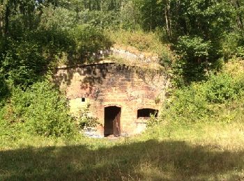
• Départ salle polyvalente de Plappeville, on passe par la mairie, puis le lavoir, pour se diriger vers le fort de Plap...
Km
Walking


Km
Walking


Km
Walking


Km
Walking


Km
Mountain bike


Km
Walking


Km
Walking


Km
Road bike


20 trails displayed on 2774
FREE GPS app for hiking
Activities
Nearby regions
- Aboncourt
- Aboncourt-sur-Seille
- Abreschviller
- Achen
- Ajoncourt
- Alaincourt-la-Côte
- Albestroff
- Algrange
- Alsting
- Altrippe
- Alzing
- Amanvillers
- Amelécourt
- Amnéville
- Ancerville
- Ancy-Dornot
- Angevillers
- Anzeling
- Apach
- Argancy
- Arriance
- Arry
- Ars-Laquenexy
- Ars-sur-Moselle
- Arzviller
- Aspach
- Assenoncourt
- Attilloncourt
- Aube
- Audun-le-Tiche
- Augny
- Aulnois-sur-Seille
- Aumetz
- Avricourt
- Ay-sur-Moselle
- Azoudange
- Bacourt
- Baerenthal
- Bambiderstroff
- Bannay
- Barst
- Basse-Ham
- Basse-Rentgen
- Bassing
- Bazoncourt
- Bébing
- Behren-lès-Forbach
- Belles-Forêts
- Bénestroff
- Berg-sur-Moselle
- Berling
- Berthelming
- Bertrange
- Berviller-en-Moselle
- Bettelainville
- Betting
- Beyren-lès-Sierck
- Bibiche
- Biding
- Bining
- Bioncourt
- Bisten-en-Lorraine
- Bistroff
- Bitche
- Blanche-Église
- Blies-Guersviller
- Bliesbruck
- Boucheporn
- Boulange
- Boulay-Moselle
- Bourgaltroff
- Bousbach
- Bousse
- Bousseviller
- Boust
- Boustroff
- Bouzonville
- Breistroff-la-Grande
- Brettnach
- Bronvaux
- Brouderdorff
- Buchy
- Buding
- Budling
- Buhl-Lorraine
- Burtoncourt
- Cappel
- Carling
- Cattenom
- Chailly-lès-Ennery
- Chambrey
- Chanville
- Charleville-sous-Bois
- Charly-Oradour
- Château-Rouge
- Château-Salins
- Château-Voué
- Châtel-Saint-Germain
- Chémery-les-Deux
- Cheminot
- Chérisey
- Chesny
- Chieulles
- Clouange
- Cocheren
- Coin-lès-Cuvry
- Coincy
- Colligny-Maizery
- Condé-Northen
- Contz-les-Bains
- Corny-sur-Moselle
- Coume
- Courcelles-Chaussy
- Courcelles-sur-Nied
- Créhange
- Creutzwald
- Cuvry
- Dabo
- Dalem
- Dalstein
- Danne-et-Quatre-Vents
- Delme
- Denting
- Desseling
- Destry
- Diane-Capelle
- Diebling
- Diesen
- Dieuze
- Distroff
- Dolving
- Donnelay
- Ébersviller
- Éguelshardt
- Eincheville
- Elvange
- Elzange
- Enchenberg
- Ennery
- Entrange
- Escherange
- Etzling
- Failly
- Falck
- Fameck
- Farschviller
- Faulquemont
- Fénétrange
- Fèves
- Féy
- Filstroff
- Fixem
- Flastroff
- Flétrange
- Fleury
- Florange
- Folkling
- Folschviller
- Fonteny
- Fontoy
- Forbach
- Fossieux
- Foulcrey
- Fouligny
- Francaltroff
- Fraquelfing
- Frauenberg
- Freistroff
- Fresnes-en-Saulnois
- Freyming-Merlebach
- Fribourg
- Gandrange
- Garrebourg
- Gavisse
- Gelucourt
- Goetzenbruck
- Goin
- Gomelange
- Gondrexange
- Gorze
- Gosselming
- Gravelotte
- Grémecey
- Gros-Réderching
- Grosbliederstroff
- Grostenquin
- Guebenhouse
- Guéblange-lès-Dieuze
- Guénange
- Guenviller
- Guermange
- Guerstling
- Guerting
- Guessling-Hémering
- Guinglange
- Guinkirchen
- Guntzviller
- Haboudange
- Hagen
- Hagondange
- Halstroff
- Ham-sous-Varsberg
- Hambach
- Hampont
- Han-sur-Nied
- Hangviller
- Hanviller
- Haraucourt-sur-Seille
- Hargarten-aux-Mines
- Harprich
- Harreberg
- Hartzviller
- Haselbourg
- Haspelschiedt
- Hattigny
- Hauconcourt
- Haute-Kontz
- Haute-Vigneulles
- Havange
- Hayange
- Hayes
- Heining-lès-Bouzonville
- Helstroff
- Hémilly
- Héming
- Henridorff
- Hermelange
- Herny
- Hertzing
- Hesse
- Hestroff
- Hettange-Grande
- Hilsprich
- Holling
- Holving
- Hombourg-Budange
- Hombourg-Haut
- Hommert
- Hoste
- Hottviller
- Hultehouse
- Hunting
- Illange
- Imling
- Inglange
- Insming
- Ippling
- Jallaucourt
- Jouy-aux-Arches
- Jury
- Jussy
- Juville
- Kalhausen
- Kappelkinger
- Kédange-sur-Canner
- Kemplich
- Kerbach
- Kerling-lès-Sierck
- Kerprich-aux-Bois
- Kirsch-lès-Sierck
- Kirschnaumen
- Klang
- Knutange
- Kuntzig
- Kœnigsmacker
- L'Hôpital
- La Maxe
- Lafrimbolle
- Lagarde
- Lambach
- Landange
- Landroff
- Laneuveville-lès-Lorquin
- Langatte
- Languimberg
- Laquenexy
- Laudrefang
- Laumesfeld
- Launstroff
- Le Ban-Saint-Martin
- Le Val-de-Guéblange
- Lemberg
- Lemud
- Lengelsheim
- Léning
- Les Étangs
- Lesse
- Lessy
- Leyviller
- Lidrezing
- Liederschiedt
- Lindre-Basse
- Lindre-Haute
- Liocourt
- Lixing-lès-Rouhling
- Lommerange
- Longeville-lès-Metz
- Longeville-lès-Saint-Avold
- Lorquin
- Lorry-Mardigny
- Lorry-lès-Metz
- Loudrefing
- Loupershouse
- Louvigny
- Lubécourt
- Lucy
- Luttange
- Lutzelbourg
- Macheren
- Mainvillers
- Maizeroy
- Maizières-lès-Metz
- Maizières-lès-Vic
- Malaucourt-sur-Seille
- Malling
- Malroy
- Manderen-Ritzing
- Manhoué
- Manom
- Many
- Marange-Silvange
- Marieulles
- Marly
- Marsal
- Maxstadt
- Mécleuves
- Meisenthal
- Menskirch
- Merschweiller
- Merten
- Métairies-Saint-Quirin
- Metz
- Metzeresche
- Metzervisse
- Metzing
- Mey
- Mittelbronn
- Mittersheim
- Momerstroff
- Moncheux
- Mondelange
- Mondorff
- Monneren
- Montbronn
- Montdidier
- Montenach
- Montigny-lès-Metz
- Montois-la-Montagne
- Morhange
- Morsbach
- Morville-lès-Vic
- Moulins-lès-Metz
- Moussey
- Mouterhouse
- Moyenvic
- Moyeuvre-Grande
- Moyeuvre-Petite
- Mulcey
- Munster
- Narbéfontaine
- Nébing
- Neufchef
- Neufgrange
- Neunkirchen-lès-Bouzonville
- Niderhoff
- Niderviller
- Niederstinzel
- Niedervisse
- Nilvange
- Nitting
- Noisseville
- Norroy-le-Veneur
- Nouilly
- Nousseviller-Saint-Nabor
- Novéant-sur-Moselle
- Oberstinzel
- Ogy-Montoy-Flanville
- Ommeray
- Ormersviller
- Oron
- Ottange
- Ottonville
- Oudrenne
- Pange
- Peltre
- Petit-Réderching
- Petite-Rosselle
- Pettoncourt
- Phalsbourg
- Philippsbourg
- Piblange
- Pierrevillers
- Plaine-de-Walsch
- Plappeville
- Plesnois
- Pommérieux
- Pontpierre
- Porcelette
- Postroff
- Pouilly
- Pournoy-la-Chétive
- Pournoy-la-Grasse
- Prévocourt
- Puttelange-aux-Lacs
- Puttelange-lès-Thionville
- Puzieux
- Rahling
- Ranguevaux
- Réchicourt-le-Château
- Rédange
- Réding
- Rémelfang
- Rémelfing
- Rémering-lès-Puttelange
- Rémilly
- Réning
- Retonfey
- Rettel
- Reyersviller
- Rezonville-Vionville
- Rhodes
- Richemont
- Rimling
- Rochonvillers
- Rodemack
- Rohrbach-lès-Bitche
- Rombas
- Roncourt
- Roppeviller
- Rorbach-lès-Dieuze
- Rosbruck
- Rosselange
- Rouhling
- Roupeldange
- Roussy-le-Village
- Rozérieulles
- Rurange-lès-Thionville
- Rustroff
- Sailly-Achâtel
- Saint-Avold
- Saint-François-Lacroix
- Saint-Georges
- Saint-Hubert
- Saint-Jean-Kourtzerode
- Saint-Jean-Rohrbach
- Saint-Jean-de-Bassel
- Saint-Julien-lès-Metz
- Saint-Louis
- Saint-Louis-lès-Bitche
- Saint-Médard
- Saint-Privat-la-Montagne
- Saint-Quirin
- Sainte-Barbe
- Sainte-Marie-aux-Chênes
- Salonnes
- Sanry-lès-Vigy
- Sanry-sur-Nied
- Sarralbe
- Sarraltroff
- Sarrebourg
- Sarreguemines
- Sarreinsming
- Saulny
- Schorbach
- Schwerdorff
- Schœneck
- Scy-Chazelles
- Secourt
- Seingbouse
- Semécourt
- Serémange-Erzange
- Servigny-lès-Raville
- Servigny-lès-Sainte-Barbe
- Sierck-les-Bains
- Siersthal
- Sillegny
- Silly-sur-Nied
- Sorbey
- Soucht
- Spicheren
- Stiring-Wendel
- Stuckange
- Sturzelbronn
- Suisse
- Talange
- Tarquimpol
- Tenteling
- Terville
- Téterchen
- Teting-sur-Nied
- Théding
- Thicourt
- Thionville
- Tincry
- Tragny
- Trémery
- Tressange
- Tritteling-Redlach
- Troisfontaines
- Tromborn
- Turquestein-Blancrupt
- Uckange
- Vahl-Ebersing
- Vahl-lès-Bénestroff
- Vahl-lès-Faulquemont
- Val-de-Bride
- Vallerange
- Valmestroff
- Valmont
- Valmunster
- Vannecourt
- Vantoux
- Vany
- Varize-Vaudoncourt
- Varsberg
- Vasperviller
- Vatimont
- Vaudreching
- Vaux
- Vaxy
- Veckring
- Velving
- Vergaville
- Vernéville
- Verny
- Vibersviller
- Vic-sur-Seille
- Vigny
- Vigy
- Viller
- Villers-Stoncourt
- Villing
- Vilsberg
- Vitry-sur-Orne
- Vittoncourt
- Viviers
- Voimhaut
- Volmerange-lès-Boulay
- Volmerange-les-Mines
- Volmunster
- Voyer
- Vry
- Vulmont
- Waldhambach
- Waldhouse
- Waldweistroff
- Walschbronn
- Walscheid
- Waltembourg
- Wiesviller
- Willerwald
- Wittring
- Woippy
- Woustviller
- Wœlfling-lès-Sarreguemines
- Xanrey
- Xocourt
- Xouaxange
- Yutz
- Zetting
- Zimming
- Zommange
- Zoufftgen
- Œting


 SityTrail


