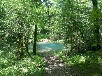
Maizières, Meurthe-et-Moselle: Best trails, routes and walks

4 comments

Maizières: Discover the best trails: 5 hiking trails and 6 bike and mountain-bike routes. All these trails, routes and outdoor activities are available in our SityTrail applications for smartphones and tablets.


The best trails (16)
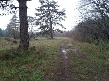
Trail Walking Maizières - viterne du 14.12.2013 - Photo
Walking 7.638
Km

Walking

Easy
(2)
Maizières, Grand Est, Meurthe-et-Moselle, France
7.6 km | 9.5 km-effort
2h 6min
121 m
197 m
No
castelli

• good

Trail Walking Maizières - Randoguide - Photo
Walking 9.427
Km

Walking

Medium
(2)
Maizières, Grand Est, Meurthe-et-Moselle, France
9.4 km | 12.9 km-effort
2h 19min
257 m
257 m
Yes
virginieHurpeau

Trail Mountain bike Maizières - Deuille en gué ;-)) - Photo
Mountain bike 47.138
Km

Mountain bike

Medium
Maizières, Grand Est, Meurthe-et-Moselle, France
47 km | 57 km-effort
4h 1min
732 m
729 m
Yes
virginieHurpeau

Trail Mountain bike Maizières - petit tour  - Photo
Mountain bike 32.342
Km

Mountain bike

Very easy
Maizières, Grand Est, Meurthe-et-Moselle, France
32 km | 40 km-effort
2h 33min
545 m
546 m
Yes
virginieHurpeau

Trail Mountain bike Maizières - bref - Photo
Mountain bike 33.149
Km

Mountain bike

Very easy
Maizières, Grand Est, Meurthe-et-Moselle, France
33 km | 40 km-effort
3h 7min
498 m
499 m
Yes
virginieHurpeau

Trail Mountain bike Maizières - 40° - Photo
Mountain bike 37.817
Km

Mountain bike

Medium
Maizières, Grand Est, Meurthe-et-Moselle, France
38 km | 46 km-effort
4h 53min
610 m
607 m
Yes
virginieHurpeau

Trail Walking Maizières - 2011-11-29 17h53m01 - Photo
Walking 20.049
Km

Walking

Very easy
Maizières, Grand Est, Meurthe-et-Moselle, France
20 km | 25 km-effort
4h 5min
385 m
384 m
Yes
virginieHurpeau

Trail Walking Maizières - Randonné des croix - Photo
Walking 24.197
Km

Walking

Difficult
Maizières, Grand Est, Meurthe-et-Moselle, France
24 km | 31 km-effort
Unknown
519 m
519 m
Yes
virginieHurpeau

• Tour des croix du coin

Trail Walking Maizières - plateau  - Photo
Walking 8.088
Km

Walking

Easy
Maizières, Grand Est, Meurthe-et-Moselle, France
8.1 km | 9.3 km-effort
2h 3min
89 m
90 m
Yes
Sky Ap

Trail Other activity Maizières - 2012-02-04 14h06m12 - Photo
Other activity 24.082
Km

Other activity

Very easy
Maizières, Grand Est, Meurthe-et-Moselle, France
24 km | 30 km-effort
1h 56min
410 m
409 m
Yes
virginieHurpeau

Trail Other activity Maizières - 2012-05-01 13h58m15 - Photo
Other activity 39.008
Km

Other activity

Very easy
Maizières, Grand Est, Meurthe-et-Moselle, France
39 km | 45 km-effort
2h 46min
429 m
426 m
Yes
virginieHurpeau

Trail Other activity Maizières - 2012-02-04 17h32m05 - Photo
Other activity 3.568
Km

Other activity

Very easy
Maizières, Grand Est, Meurthe-et-Moselle, France
3.6 km | 4.3 km-effort
1h 1min
23 m
148 m
No
virginieHurpeau

Trail Other activity Maizières - 2012-05-01 13h58m15 - Photo
Other activity 39.008
Km

Other activity

Very easy
Maizières, Grand Est, Meurthe-et-Moselle, France
39 km | 45 km-effort
2h 46min
429 m
426 m
Yes
virginieHurpeau

Trail Other activity Maizières - 2012-02-04 14h06m12 - Photo
Other activity 24.082
Km

Other activity

Very easy
Maizières, Grand Est, Meurthe-et-Moselle, France
24 km | 30 km-effort
1h 56min
410 m
409 m
Yes
virginieHurpeau

Trail Mountain bike Maizières - Randoguide - Photo
Mountain bike 39.008
Km

Mountain bike

Very easy
Maizières, Grand Est, Meurthe-et-Moselle, France
39 km | 45 km-effort
2h 46min
429 m
426 m
Yes
virginieHurpeau

Trail Mountain bike Maizières - Randoguide - Photo
Mountain bike 24.082
Km

Mountain bike

Very easy
Maizières, Grand Est, Meurthe-et-Moselle, France
24 km | 30 km-effort
1h 56min
410 m
409 m
Yes
virginieHurpeau

16 trails displayed on 16

FREE GPS app for hiking

Logo SityTrail SityTrail

IGN / Geographical institutes

Download SityTrail from the App Store Download SityTrail from Google Play

Logo SityTrail SityTrail World

The world is yours!

Download SityTrail from the App Store Download SityTrail from Google Play Download SityTrail on Huawei AppGallery

Activities

Close
My subscriptions