Gerbamont, Vosges: Best trails, routes and walks

2 comments

Gerbamont: Discover the best trails: 13 hiking trails, 4 bike and mountain-bike routes and 2 equestrian circuits. All these trails, routes and outdoor activities are available in our SityTrail applications for smartphones and tablets.


The best trails (19)
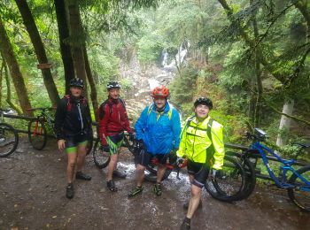
Trail Horseback riding Gerbamont - 2022-06-05 Rando CVA Gerbamont Dommartin les Remiremont - Photo
Horseback riding 23.957
Km
GUIDE

Horseback riding

Difficult
Gerbamont, Grand Est, Vosges, France
24 km | 34 km-effort
5h 10min
703 m
945 m
No
holtzv

Trail Horseback riding Gerbamont - 2022-06-04 Rando CVA Gerbamont Boucle Foret de Noire Goutte - Photo
Horseback riding 30.515
Km
GUIDE

Horseback riding

Very difficult
Gerbamont, Grand Est, Vosges, France
31 km | 43 km-effort
6h 2min
899 m
902 m
Yes
holtzv

Trail Walking Gerbamont - cascadu bouchot vosges - Photo
Walking 7.896
Km

Walking

Medium
(1)
Gerbamont, Grand Est, Vosges, France
7.9 km | 10.5 km-effort
2h 23min
198 m
198 m
Yes
ghislaine61

Trail Walking Gerbamont - vagney sapois  - Photo
Walking 7.133
Km
GUIDE

Walking

Very easy
Gerbamont, Grand Est, Vosges, France
7.1 km | 10.5 km-effort
2h 31min
256 m
255 m
Yes
raline

Trail Walking Gerbamont - chez Nadège et Jean Noël  - Photo
Walking 3.27
Km
GUIDE

Walking

Very easy
Gerbamont, Grand Est, Vosges, France
3.3 km | 5 km-effort
1h 20min
128 m
135 m
Yes
raline

Trail Walking Gerbamont - Promenade fouchure - Photo
Walking 4.112
Km

Walking

Medium
Gerbamont, Grand Est, Vosges, France
4.1 km | 6.4 km-effort
1h 29min
174 m
174 m
Yes
Emmanuel Remy

Trail Walking Gerbamont - Le Mettey - Photo
Walking 5.078
Km

Walking

Easy
Gerbamont, Grand Est, Vosges, France
5.1 km | 7.3 km-effort
1h 59min
170 m
167 m
Yes
masson.luc

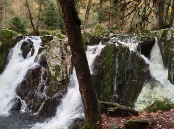
Trail Walking Gerbamont - cascade du Bouchot  - Photo
Walking 10.191
Km

Walking

Easy
Gerbamont, Grand Est, Vosges, France
10.2 km | 14.3 km-effort
2h 46min
296 m
333 m
No
Jackoyo

Trail Walking Gerbamont - 2017 09 22 piquante pierre - Photo
Walking 15.791
Km

Walking

Medium
(1)
Gerbamont, Grand Est, Vosges, France
15.8 km | 24 km-effort
5h 6min
650 m
648 m
Yes
michelbauby

Trail Walking Gerbamont - Contonne - Haut du Roc - Photo
Walking 19.687
Km

Walking

Medium
Gerbamont, Grand Est, Vosges, France
19.7 km | 30 km-effort
7h 4min
793 m
793 m
Yes
masson.luc

Trail Walking Gerbamont - sapois jonquilles 2022 - Photo
Walking 12.656
Km

Walking

Medium
Gerbamont, Grand Est, Vosges, France
12.7 km | 17.2 km-effort
3h 53min
340 m
341 m
Yes
lacote

Trail Mountain bike Gerbamont - sortie gerbamont  - Photo
Mountain bike 13.834
Km

Mountain bike

Very easy
Gerbamont, Grand Est, Vosges, France
13.8 km | 18.4 km-effort
1h 52min
344 m
349 m
Yes
joelbouclainville

Trail Walking Gerbamont - Gerbamont 2 - Photo
Walking 12.076
Km

Walking

Medium
Gerbamont, Grand Est, Vosges, France
12.1 km | 15.9 km-effort
3h 0min
287 m
287 m
Yes
Philippe Brandenbourger

Trail Walking Gerbamont - Gerbamont 1 - Photo
Walking 5.229
Km

Walking

Easy
Gerbamont, Grand Est, Vosges, France
5.2 km | 7.7 km-effort
1h 30min
185 m
183 m
Yes
Philippe Brandenbourger

Trail Mountain bike Gerbamont - sortie bouchot 26 juillet  - Photo
Mountain bike 25.728
Km

Mountain bike

Difficult
Gerbamont, Grand Est, Vosges, France
26 km | 38 km-effort
3h 30min
889 m
889 m
Yes
joelbouclainville

Trail Mountain bike Gerbamont - reconnait trace pour le samedi gerbamont  - Photo
Mountain bike 29.902
Km

Mountain bike

Difficult
Gerbamont, Grand Est, Vosges, France
30 km | 45 km-effort
4h 43min
1154 m
1157 m
Yes
joelbouclainville

Trail Mountain bike Gerbamont - rando depart moulin des courbieres  - Photo
Mountain bike 29.657
Km

Mountain bike

Difficult
Gerbamont, Grand Est, Vosges, France
30 km | 44 km-effort
2h 47min
1064 m
1064 m
Yes
joelbouclainville

Trail Walking Gerbamont - Saut du Bouchot Rochesson - Photo
Walking 16.152
Km

Walking

Medium
Gerbamont, Grand Est, Vosges, France
16.2 km | 24 km-effort
23min
597 m
592 m
Yes
BernardHumeau

Trail Walking Gerbamont - piquante pierre  - Photo
Walking 16.131
Km

Walking

Medium
Gerbamont, Grand Est, Vosges, France
16.1 km | 25 km-effort
4h 39min
670 m
669 m
Yes
lacote

19 trails displayed on 19

FREE GPS app for hiking

Logo SityTrail SityTrail

IGN / Geographical institutes

Download SityTrail from the App Store Download SityTrail from Google Play

Logo SityTrail SityTrail World

The world is yours!

Download SityTrail from the App Store Download SityTrail from Google Play Download SityTrail on Huawei AppGallery

Activities

Close
My subscriptions