![](/images/other/stat-length.png)
- Trails
- Outdoor
- France
- Auvergne-Rhône-Alpes
- Allier
Allier, Auvergne-Rhône-Alpes: Best trails, routes and walks
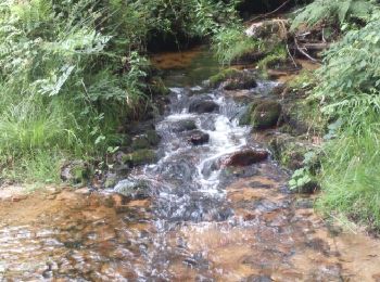
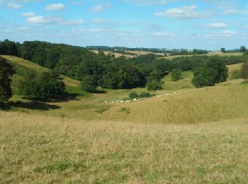
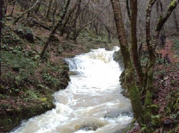
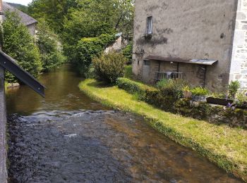
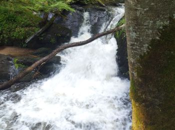
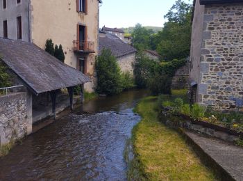
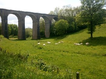
Allier: Discover the best trails: 516 hiking trails, 242 bike and mountain-bike routes and 41 equestrian circuits. All these trails, routes and outdoor activities are available in our SityTrail applications for smartphones and tablets.
The best trails (918)
![Trail Walking Saint-Nicolas-des-Biefs - Ronde boisée des rochers et des ruisseaux - La Verrerie - Photo](https://media.geolcdn.com/t/350/260/ext.jpg?maxdim=2&url=https%3A%2F%2Fservices.sitytrail.com%2FGeolivesWS%2FDownloadMedia.ashx%3FTrailID%3D317633%26Media%3D16900_4.jpg)
![Walking Walking](https://static1.geolcdn.com/sitytour/trail-icons/101.png)
Km
Walking
![](/images/other/stat-length.png)
![](https://static1.geolcdn.com/siteimages/upload/files/1508320355ic_sort_den_pos_24dp.png)
![](https://static1.geolcdn.com/siteimages/upload/files/1508320355ic_sort_den_neg_24dp.png)
![](https://static1.geolcdn.com/siteimages/upload/files/16400158638029165_repeat_loop_refresh_sync_direction_icon.png)
![Trail Walking Saint-Sauvier - Circuit de la chapelle Saint Rémi - Saint Sauvier - Photo](https://media.geolcdn.com/t/350/260/ext.jpg?maxdim=2&url=https%3A%2F%2Fservices.sitytrail.com%2FGeolivesWS%2FDownloadMedia.ashx%3FTrailID%3D118832%26Media%3D13046_6.jpg)
![Walking Walking](https://static1.geolcdn.com/sitytour/trail-icons/101.png)
Km
Walking
![](/images/other/stat-length.png)
![](https://static1.geolcdn.com/siteimages/upload/files/1508320355ic_sort_den_pos_24dp.png)
![](https://static1.geolcdn.com/siteimages/upload/files/1508320355ic_sort_den_neg_24dp.png)
![](https://static1.geolcdn.com/siteimages/upload/files/16400158638029165_repeat_loop_refresh_sync_direction_icon.png)
![Trail Walking Billy - Circuit Le Renard - Billy en Bourbonnais - Photo](https://media.geolcdn.com/t/350/260/ext.jpg?maxdim=2&url=https%3A%2F%2Fservices.sitytrail.com%2FGeolivesWS%2FDownloadMedia.ashx%3FTrailID%3D112779%26Media%3D12342_6.jpg)
![Walking Walking](https://static1.geolcdn.com/sitytour/trail-icons/101.png)
Km
Walking
![](/images/other/stat-length.png)
![](https://static1.geolcdn.com/siteimages/upload/files/1508320355ic_sort_den_pos_24dp.png)
![](https://static1.geolcdn.com/siteimages/upload/files/1508320355ic_sort_den_neg_24dp.png)
![](https://static1.geolcdn.com/siteimages/upload/files/16400158638029165_repeat_loop_refresh_sync_direction_icon.png)
![Trail Walking Marigny - Marigny circuit bleu - Photo](https://media.geolcdn.com/t/350/260/ext.jpg?maxdim=2&url=https%3A%2F%2Fservices.sitytrail.com%2FGeolivesWS%2FDownloadMedia.ashx%3FTrailID%3D112724%26Media%3D11653_3.jpg)
![Walking Walking](https://static1.geolcdn.com/sitytour/trail-icons/101.png)
Km
Walking
![](/images/other/stat-length.png)
![](https://static1.geolcdn.com/siteimages/upload/files/1508320355ic_sort_den_pos_24dp.png)
![](https://static1.geolcdn.com/siteimages/upload/files/1508320355ic_sort_den_neg_24dp.png)
![](https://static1.geolcdn.com/siteimages/upload/files/16400158638029165_repeat_loop_refresh_sync_direction_icon.png)
![Trail Walking Chemilly - Circuit Les Vignes court - Chemilly - Photo](https://media.geolcdn.com/t/350/260/ext.jpg?maxdim=2&url=https%3A%2F%2Fservices.sitytrail.com%2FGeolivesWS%2FDownloadMedia.ashx%3FTrailID%3D112712%26Media%3D11621_4.jpg)
![Walking Walking](https://static1.geolcdn.com/sitytour/trail-icons/101.png)
Km
Walking
![](/images/other/stat-length.png)
![](https://static1.geolcdn.com/siteimages/upload/files/1508320355ic_sort_den_pos_24dp.png)
![](https://static1.geolcdn.com/siteimages/upload/files/1508320355ic_sort_den_neg_24dp.png)
![](https://static1.geolcdn.com/siteimages/upload/files/16400158638029165_repeat_loop_refresh_sync_direction_icon.png)
![Trail Walking Marigny - Marigny, circuit Jaune - Photo](https://media.geolcdn.com/t/350/260/ext.jpg?maxdim=2&url=https%3A%2F%2Fservices.sitytrail.com%2FGeolivesWS%2FDownloadMedia.ashx%3FTrailID%3D106898%26Media%3D11654_3.jpg)
![Walking Walking](https://static1.geolcdn.com/sitytour/trail-icons/101.png)
Km
Walking
![](/images/other/stat-length.png)
![](https://static1.geolcdn.com/siteimages/upload/files/1508320355ic_sort_den_pos_24dp.png)
![](https://static1.geolcdn.com/siteimages/upload/files/1508320355ic_sort_den_neg_24dp.png)
![](https://static1.geolcdn.com/siteimages/upload/files/16400158638029165_repeat_loop_refresh_sync_direction_icon.png)
![Trail Mountain bike Isserpent - VTT à Isserpent - Photo](https://media.geolcdn.com/t/350/260/ext.jpg?maxdim=2&url=https%3A%2F%2Fservices.sitytrail.com%2FGeolivesWS%2FDownloadMedia.ashx%3FTrailID%3D106779%26Media%3D11466_6.jpg)
![Mountain bike Mountain bike](https://static1.geolcdn.com/sitytour/trail-icons/202.png)
Km
Mountain bike
![](/images/other/stat-length.png)
![](https://static1.geolcdn.com/siteimages/upload/files/1508320355ic_sort_den_pos_24dp.png)
![](https://static1.geolcdn.com/siteimages/upload/files/1508320355ic_sort_den_neg_24dp.png)
![](https://static1.geolcdn.com/siteimages/upload/files/16400158638029165_repeat_loop_refresh_sync_direction_icon.png)
![Trail On foot Noyant-d'Allier - Noyant les cotes Matra - Photo](https://media.geolcdn.com/t/350/260/b513a07a-8606-4ffd-bc44-7003b2896df3.jpg&format=jpg&maxdim=2)
![On foot On foot](https://static1.geolcdn.com/sitytour/trail-icons/100.png)
Km
On foot
![](/images/other/stat-length.png)
![](https://static1.geolcdn.com/siteimages/upload/files/1508320355ic_sort_den_pos_24dp.png)
![](https://static1.geolcdn.com/siteimages/upload/files/1508320355ic_sort_den_neg_24dp.png)
![](https://static1.geolcdn.com/siteimages/upload/files/16400158638029165_repeat_loop_refresh_sync_direction_icon.png)
![Trail Walking Saint-Nicolas-des-Biefs - St Nicolas- circuit du Barbenan - Photo](https://media.geolcdn.com/t/350/260/ext.jpg?maxdim=2&url=https%3A%2F%2Fservices.sitytrail.com%2FGeolivesWS%2FDownloadMedia.ashx%3FTrailID%3D606892%26Media%3Dfix__20160731170655.jpg)
![Walking Walking](https://static1.geolcdn.com/sitytour/trail-icons/101.png)
Km
Walking
![](/images/other/stat-length.png)
![](https://static1.geolcdn.com/siteimages/upload/files/1508320355ic_sort_den_pos_24dp.png)
![](https://static1.geolcdn.com/siteimages/upload/files/1508320355ic_sort_den_neg_24dp.png)
![](https://static1.geolcdn.com/siteimages/upload/files/16400158638029165_repeat_loop_refresh_sync_direction_icon.png)
![Trail Walking Bert - Boucle du Roc - BERT - Photo](https://media.geolcdn.com/t/350/260/ext.jpg?maxdim=2&url=https%3A%2F%2Fservices.sitytrail.com%2FGeolivesWS%2FDownloadMedia.ashx%3FTrailID%3D592542%26Media%3Dfix__20160703174517.jpg)
![Walking Walking](https://static1.geolcdn.com/sitytour/trail-icons/101.png)
Km
Walking
![](/images/other/stat-length.png)
![](https://static1.geolcdn.com/siteimages/upload/files/1508320355ic_sort_den_pos_24dp.png)
![](https://static1.geolcdn.com/siteimages/upload/files/1508320355ic_sort_den_neg_24dp.png)
![](https://static1.geolcdn.com/siteimages/upload/files/16400158638029165_repeat_loop_refresh_sync_direction_icon.png)
• Attention passage difficile dans les bois après l'étang des Gouttes (sentier non entretenu) le reste, ok.
![Trail Other activity Arronnes - GC Mayet Ferrière - Photo](https://media.geolcdn.com/t/350/260/ext.jpg?maxdim=2&url=https%3A%2F%2Fservices.sitytrail.com%2FGeolivesWS%2FDownloadMedia.ashx%3FTrailID%3D176637%26Media%3Dfa7faa2a-0934-48f6-9bd7-2ad505607f45.gif)
![Other activity Other activity](https://static1.geolcdn.com/sitytour/trail-icons/900.png)
Km
Other activity
![](/images/other/stat-length.png)
![](https://static1.geolcdn.com/siteimages/upload/files/1508320355ic_sort_den_pos_24dp.png)
![](https://static1.geolcdn.com/siteimages/upload/files/1508320355ic_sort_den_neg_24dp.png)
![](https://static1.geolcdn.com/siteimages/upload/files/16400158638029165_repeat_loop_refresh_sync_direction_icon.png)
![Trail Walking Ferrières-sur-Sichon - Balade autour de Ferrières sur Sichon - Photo](https://media.geolcdn.com/t/350/260/ext.jpg?maxdim=2&url=https%3A%2F%2Fservices.sitytrail.com%2FGeolivesWS%2FDownloadMedia.ashx%3FTrailID%3D107641%26Media%3D12629_1.jpg)
![Walking Walking](https://static1.geolcdn.com/sitytour/trail-icons/101.png)
Km
Walking
![](/images/other/stat-length.png)
![](https://static1.geolcdn.com/siteimages/upload/files/1508320355ic_sort_den_pos_24dp.png)
![](https://static1.geolcdn.com/siteimages/upload/files/1508320355ic_sort_den_neg_24dp.png)
![](https://static1.geolcdn.com/siteimages/upload/files/16400158638029165_repeat_loop_refresh_sync_direction_icon.png)
![Trail Walking Ferrières-sur-Sichon - Arboretum - Photo](https://media.geolcdn.com/t/350/260/fe93d646-9efb-43e9-aec5-f16b1537551d.jpg&format=jpg&maxdim=2)
![Walking Walking](https://static1.geolcdn.com/sitytour/trail-icons/101.png)
Km
Walking
![](/images/other/stat-length.png)
![](https://static1.geolcdn.com/siteimages/upload/files/1508320355ic_sort_den_pos_24dp.png)
![](https://static1.geolcdn.com/siteimages/upload/files/1508320355ic_sort_den_neg_24dp.png)
![](https://static1.geolcdn.com/siteimages/upload/files/16400158638029165_repeat_loop_refresh_sync_direction_icon.png)
![Trail Walking Ferrières-sur-Sichon - Grotte des fées y cascade - Photo](https://media.geolcdn.com/t/350/260/ef8e8d52-f895-455d-a25d-963d7668436d.jpg&format=jpg&maxdim=2)
![Walking Walking](https://static1.geolcdn.com/sitytour/trail-icons/101.png)
Km
Walking
![](/images/other/stat-length.png)
![](https://static1.geolcdn.com/siteimages/upload/files/1508320355ic_sort_den_pos_24dp.png)
![](https://static1.geolcdn.com/siteimages/upload/files/1508320355ic_sort_den_neg_24dp.png)
![](https://static1.geolcdn.com/siteimages/upload/files/16400158638029165_repeat_loop_refresh_sync_direction_icon.png)
![Trail Trail Ferrières-sur-Sichon - circuit du moulin neuf - Photo](https://media.geolcdn.com/t/350/260/beb3bba3-aa51-4c33-bd90-480ca60c9eae.jpg&format=jpg&maxdim=2)
![Trail Trail](https://static1.geolcdn.com/sitytour/trail-icons/104.png)
Km
Trail
![](/images/other/stat-length.png)
![](https://static1.geolcdn.com/siteimages/upload/files/1508320355ic_sort_den_pos_24dp.png)
![](https://static1.geolcdn.com/siteimages/upload/files/1508320355ic_sort_den_neg_24dp.png)
![](https://static1.geolcdn.com/siteimages/upload/files/16400158638029165_repeat_loop_refresh_sync_direction_icon.png)
![Trail On foot Lavoine - Le Puy de Montoncel - Photo](https://media.geolcdn.com/t/350/260/ce3ba7c9-fa72-4795-886f-e43e7d26901e.jpeg&format=jpg&maxdim=2)
![On foot On foot](https://static1.geolcdn.com/sitytour/trail-icons/100.png)
Km
On foot
![](/images/other/stat-length.png)
![](https://static1.geolcdn.com/siteimages/upload/files/1508320355ic_sort_den_pos_24dp.png)
![](https://static1.geolcdn.com/siteimages/upload/files/1508320355ic_sort_den_neg_24dp.png)
![](https://static1.geolcdn.com/siteimages/upload/files/16400158638029165_repeat_loop_refresh_sync_direction_icon.png)
• Trail created by CD63.
![Trail Walking Droiturier - Droiturier-CircuitDuBalaisBiot-12km - Photo](https://media.geolcdn.com/t/350/260/ext.jpg?maxdim=2&url=https%3A%2F%2Fservices.sitytrail.com%2FGeolivesWS%2FDownloadMedia.ashx%3FTrailID%3D961144%26Media%3Dfix__20180508151711.jpg)
![Walking Walking](https://static1.geolcdn.com/sitytour/trail-icons/101.png)
Km
Walking
![](/images/other/stat-length.png)
![](https://static1.geolcdn.com/siteimages/upload/files/1508320355ic_sort_den_pos_24dp.png)
![](https://static1.geolcdn.com/siteimages/upload/files/1508320355ic_sort_den_neg_24dp.png)
![](https://static1.geolcdn.com/siteimages/upload/files/16400158638029165_repeat_loop_refresh_sync_direction_icon.png)
![Trail Mountain bike Prémilhat - Boucle Étang de Sault. Domerat - Photo](https://media.geolcdn.com/t/350/260/ext.jpg?maxdim=2&url=https%3A%2F%2Fstatic1.geolcdn.com%2Fsiteimages%2Fupload%2Ffiles%2F1524743154velo.jpg)
![Mountain bike Mountain bike](https://static1.geolcdn.com/sitytour/trail-icons/202.png)
Km
Mountain bike
![](/images/other/stat-length.png)
![](https://static1.geolcdn.com/siteimages/upload/files/1508320355ic_sort_den_pos_24dp.png)
![](https://static1.geolcdn.com/siteimages/upload/files/1508320355ic_sort_den_neg_24dp.png)
![](https://static1.geolcdn.com/siteimages/upload/files/16400158638029165_repeat_loop_refresh_sync_direction_icon.png)
![Trail Mountain bike Montluçon - petit canal - Photo](https://media.geolcdn.com/t/350/260/ext.jpg?maxdim=2&url=https%3A%2F%2Fstatic1.geolcdn.com%2Fsiteimages%2Fupload%2Ffiles%2F1524743154velo.jpg)
![Mountain bike Mountain bike](https://static1.geolcdn.com/sitytour/trail-icons/202.png)
Km
Mountain bike
![](/images/other/stat-length.png)
![](https://static1.geolcdn.com/siteimages/upload/files/1508320355ic_sort_den_pos_24dp.png)
![](https://static1.geolcdn.com/siteimages/upload/files/1508320355ic_sort_den_neg_24dp.png)
![](https://static1.geolcdn.com/siteimages/upload/files/16400158638029165_repeat_loop_refresh_sync_direction_icon.png)
![Trail Mountain bike Chazemais - Rando VTT Chazemais - Photo](https://media.geolcdn.com/t/350/260/ext.jpg?maxdim=2&url=https%3A%2F%2Fstatic1.geolcdn.com%2Fsiteimages%2Fupload%2Ffiles%2F1524743154velo.jpg)
![Mountain bike Mountain bike](https://static1.geolcdn.com/sitytour/trail-icons/202.png)
Km
Mountain bike
![](/images/other/stat-length.png)
![](https://static1.geolcdn.com/siteimages/upload/files/1508320355ic_sort_den_pos_24dp.png)
![](https://static1.geolcdn.com/siteimages/upload/files/1508320355ic_sort_den_neg_24dp.png)
![](https://static1.geolcdn.com/siteimages/upload/files/16400158638029165_repeat_loop_refresh_sync_direction_icon.png)
20 trails displayed on 918
FREE GPS app for hiking
Activities
Nearby regions
- Abrest
- Agonges
- Ainay-le-Château
- Andelaroche
- Archignat
- Arfeuilles
- Arpheuilles-Saint-Priest
- Arronnes
- Aubigny
- Audes
- Aurouër
- Autry-Issards
- Avermes
- Avrilly
- Bagneux
- Barberier
- Barrais-Bussolles
- Bayet
- Beaulon
- Beaune-d'Allier
- Bègues
- Bellenaves
- Bellerive-sur-Allier
- Bert
- Bessay-sur-Allier
- Besson
- Bézenet
- Billezois
- Billy
- Biozat
- Bizeneuille
- Blomard
- Bost
- Boucé
- Bourbon-l'Archambault
- Braize
- Bransat
- Bresnay
- Bressolles
- Broût-Vernet
- Brugheas
- Busset
- Buxières-les-Mines
- Cérilly
- Cesset
- Chambérat
- Chamblet
- Chantelle
- Chapeau
- Chappes
- Chareil-Cintrat
- Charmeil
- Charmes
- Charroux
- Chassenard
- Château-sur-Allier
- Châtel-Montagne
- Châtel-de-Neuvre
- Châtelus
- Châtillon
- Chavenon
- Chavroches
- Chazemais
- Chemilly
- Chevagnes
- Chezelle
- Chézy
- Chirat-l'Église
- Chouvigny
- Cognat-Lyonne
- Colombier
- Commentry
- Contigny
- Cosne-d'Allier
- Coulandon
- Coulanges
- Couleuvre
- Courçais
- Coutansouze
- Couzon
- Créchy
- Cressanges
- Creuzier-le-Neuf
- Creuzier-le-Vieux
- Cusset
- Deneuille-lès-Chantelle
- Deneuille-les-Mines
- Désertines
- Deux-Chaises
- Diou
- Domérat
- Dompierre-sur-Besbre
- Doyet
- Droiturier
- Durdat-Larequille
- Ébreuil
- Échassières
- Escurolles
- Espinasse-Vozelle
- Estivareilles
- Étroussat
- Ferrières-sur-Sichon
- Fleuriel
- Fourilles
- Franchesse
- Gannat
- Gannay-sur-Loire
- Garnat-sur-Engièvre
- Gennetines
- Gipcy
- Gouise
- Haut-Bocage
- Hauterive
- Hérisson
- Huriel
- Hyds
- Isle-et-Bardais
- Isserpent
- Jaligny-sur-Besbre
- Jenzat
- La Celle
- La Chabanne
- La Chapelaude
- La Chapelle
- La Chapelle-aux-Chasses
- La Ferté-Hauterive
- La Guillermie
- La Petite-Marche
- Laféline
- Lalizolle
- Lamaids
- Langy
- Lapalisse
- Laprugne
- Lavault-Sainte-Anne
- Lavoine
- Le Bouchaud
- Le Brethon
- Le Breuil
- Le Donjon
- Le Mayet-de-Montagne
- Le Montet
- Le Theil
- Le Vernet
- Le Veurdre
- Le Vilhain
- Lételon
- Liernolles
- Lignerolles
- Limoise
- Loddes
- Loriges
- Louchy-Montfand
- Louroux-Bourbonnais
- Louroux-de-Beaune
- Louroux-de-Bouble
- Luneau
- Lurcy-Lévis
- Lusigny
- Magnet
- Malicorne
- Marcenat
- Marcillat-en-Combraille
- Marigny
- Mariol
- Mazerier
- Mazirat
- Meaulne-Vitray
- Meillard
- Meillers
- Mesples
- Molinet
- Molles
- Monestier
- Monétay-sur-Allier
- Monétay-sur-Loire
- Montaigu-le-Blin
- Montaiguët-en-Forez
- Montbeugny
- Montcombroux-les-Mines
- Monteignet-sur-l'Andelot
- Montilly
- Montluçon
- Montmarault
- Montoldre
- Montord
- Montvicq
- Moulins
- Murat
- Nades
- Nassigny
- Naves
- Néris-les-Bains
- Neuilly-le-Réal
- Neuvy
- Nizerolles
- Noyant-d'Allier
- Paray-le-Frésil
- Périgny
- Pierrefitte-sur-Loire
- Poëzat
- Pouzy-Mésangy
- Prémilhat
- Quinssaines
- Reugny
- Rocles
- Rongères
- Ronnet
- Saint-Angel
- Saint-Aubin-le-Monial
- Saint-Bonnet-Tronçais
- Saint-Bonnet-de-Four
- Saint-Bonnet-de-Rochefort
- Saint-Christophe
- Saint-Clément
- Saint-Désiré
- Saint-Didier-en-Donjon
- Saint-Didier-la-Forêt
- Saint-Éloy-d'Allier
- Saint-Ennemond
- Saint-Étienne-de-Vicq
- Saint-Fargeol
- Saint-Félix
- Saint-Genest
- Saint-Gérand-de-Vaux
- Saint-Gérand-le-Puy
- Saint-Germain-de-Salles
- Saint-Germain-des-Fossés
- Saint-Hilaire
- Saint-Léger-sur-Vouzance
- Saint-Léon
- Saint-Léopardin-d'Augy
- Saint-Loup
- Saint-Marcel-en-Marcillat
- Saint-Marcel-en-Murat
- Saint-Martin-des-Lais
- Saint-Martinien
- Saint-Menoux
- Saint-Nicolas-des-Biefs
- Saint-Palais
- Saint-Pierre-Laval
- Saint-Plaisir
- Saint-Pont
- Saint-Pourçain-sur-Besbre
- Saint-Pourçain-sur-Sioule
- Saint-Priest-d'Andelot
- Saint-Priest-en-Murat
- Saint-Rémy-en-Rollat
- Saint-Sauvier
- Saint-Sornin
- Saint-Victor
- Saint-Voir
- Saint-Yorre
- Sainte-Thérence
- Saligny-sur-Roudon
- Sanssat
- Saulcet
- Saulzet
- Sauvagny
- Sazeret
- Serbannes
- Seuillet
- Sorbier
- Souvigny
- Sussat
- Taxat-Senat
- Teillet-Argenty
- Terjat
- Theneuille
- Thiel-sur-Acolin
- Thionne
- Tortezais
- Toulon-sur-Allier
- Treban
- Treignat
- Treteau
- Trévol
- Trézelles
- Tronget
- Urçay
- Ussel-d'Allier
- Valignat
- Valigny
- Vallon-en-Sully
- Varennes-sur-Allier
- Vaux
- Veauce
- Venas
- Vendat
- Verneix
- Verneuil-en-Bourbonnais
- Vernusse
- Vichy
- Vicq
- Vieure
- Villebret
- Villefranche-d'Allier
- Villeneuve-sur-Allier
- Viplaix
- Voussac
- Ygrande
- Yzeure