La Tronche, Isère: Best trails, routes and walks

1 comments

La Tronche: Discover the best trails: 17 hiking trails and 2 bike and mountain-bike routes. All these trails, routes and outdoor activities are available in our SityTrail applications for smartphones and tablets.


The best trails (19)
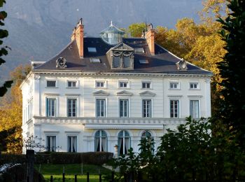
Trail On foot La Tronche - Grande Traverse de Meylan - Photo
On foot 5.614
Km
GUIDE+

On foot

Easy
La Tronche, Auvergne-Rhône-Alpes, Isère, France
5.6 km | 6.5 km-effort
1h 28min
70 m
60 m
No
SityTrail - itinéraires balisés pédestres

• Trail created by Ville de Meylan.

Trail Mountain bike La Tronche - bastille vtt - Photo
Mountain bike 11.13
Km

Mountain bike

Medium
(1)
La Tronche, Auvergne-Rhône-Alpes, Isère, France
11.1 km | 19.6 km-effort
24min
634 m
631 m
Yes
virtumanu

Trail Walking La Tronche - Rachais - Photo
Walking 7.129
Km

Walking

Easy
La Tronche, Auvergne-Rhône-Alpes, Isère, France
7.1 km | 12.5 km-effort
2h 40min
399 m
419 m
No
bobol3140

Trail Walking La Tronche - Rachat Jonquilles  - Photo
Walking 4.761
Km

Walking

Very easy
La Tronche, Auvergne-Rhône-Alpes, Isère, France
4.8 km | 8.6 km-effort
1h 17min
284 m
304 m
No
doumeherve

Trail Walking La Tronche - Mont Jalla - Photo
Walking 8.085
Km

Walking

Easy
La Tronche, Auvergne-Rhône-Alpes, Isère, France
8.1 km | 14.5 km-effort
2h 56min
484 m
486 m
Yes
ranchoup

Trail Running La Tronche - bastille  - Photo
Running 3.621
Km

Running

Medium
La Tronche, Auvergne-Rhône-Alpes, Isère, France
3.6 km | 6.5 km-effort
24min
279 m
24 m
No
virtumanu

Trail Walking La Tronche - Rachais post apero - Photo
Walking 14.121
Km

Walking

Very difficult
La Tronche, Auvergne-Rhône-Alpes, Isère, France
14.1 km | 26 km-effort
5h 8min
907 m
927 m
No
domtrassy

Trail Walking La Tronche - 5 octobre - Photo
Walking 11.563
Km

Walking

Very difficult
La Tronche, Auvergne-Rhône-Alpes, Isère, France
11.6 km | 24 km-effort
5h 12min
889 m
917 m
No
domtrassy

Trail Walking La Tronche - reprise !  - Photo
Walking 11.724
Km

Walking

Very difficult
La Tronche, Auvergne-Rhône-Alpes, Isère, France
11.7 km | 23 km-effort
4h 27min
862 m
863 m
Yes
jcaufin

Trail Walking La Tronche - La Tronche - Bastille - Arête Sud - Chasseurs de Lapins - Photo
Walking 8.525
Km

Walking

Easy
La Tronche, Auvergne-Rhône-Alpes, Isère, France
8.5 km | 15 km-effort
4h 18min
487 m
492 m
No
bruno.saget

Trail Walking La Tronche - Bec du corbeau - Photo
Walking 8.954
Km

Walking

Easy
La Tronche, Auvergne-Rhône-Alpes, Isère, France
9 km | 17.4 km-effort
2h 26min
618 m
666 m
No
Lesprit

Trail Walking La Tronche -  CHartreuse  Mont Rachais 2 chemin inconnus - Photo
Walking 14.997
Km

Walking

Easy
La Tronche, Auvergne-Rhône-Alpes, Isère, France
15 km | 28 km-effort
6h 12min
966 m
970 m
No
c.gourme

Trail Walking La Tronche - crêtes du mont Rachais - Photo
Walking 15.762
Km

Walking

Medium
La Tronche, Auvergne-Rhône-Alpes, Isère, France
15.8 km | 28 km-effort
4h 21min
937 m
963 m
No
CABERMAT

Trail Walking La Tronche - coteau  Corenc  - Photo
Walking 8.177
Km

Walking

Very easy
La Tronche, Auvergne-Rhône-Alpes, Isère, France
8.2 km | 11.2 km-effort
2h 46min
230 m
229 m
Yes
alic38

Trail On foot La Tronche - hôpital de Grenoble- la vierge Noire- Corenc- Meylan - Photo
On foot 7.285
Km

On foot

Easy
La Tronche, Auvergne-Rhône-Alpes, Isère, France
7.3 km | 10.7 km-effort
Unknown
256 m
251 m
No
elibon

Trail Nordic walking La Tronche - Bastille et berges - Photo
Nordic walking 13.693
Km

Nordic walking

Very easy
La Tronche, Auvergne-Rhône-Alpes, Isère, France
13.7 km | 18.6 km-effort
2h 31min
372 m
365 m
No
sabine38

Trail Running La Tronche - boucle jalla - Photo
Running 13.123
Km

Running

Medium
La Tronche, Auvergne-Rhône-Alpes, Isère, France
13.1 km | 26 km-effort
1h 36min
929 m
942 m
Yes
mx.guillet

Trail Cycle La Tronche - Test - La Tronche - Col de Porte - Photo
Cycle 15.096
Km

Cycle

Very easy
La Tronche, Auvergne-Rhône-Alpes, Isère, France
15.1 km | 27 km-effort
1h 37min
1163 m
87 m
No
lviallet

Trail Walking La Tronche - ent 1 - Photo
Walking 1.877
Km

Walking

Easy
La Tronche, Auvergne-Rhône-Alpes, Isère, France
1.9 km | 2.2 km-effort
55min
18 m
35 m
No
Albert.GAILLARD

19 trails displayed on 19

FREE GPS app for hiking

Logo SityTrail SityTrail

IGN / Geographical institutes

Download SityTrail from the App Store Download SityTrail from Google Play

Logo SityTrail SityTrail World

The world is yours!

Download SityTrail from the App Store Download SityTrail from Google Play Download SityTrail on Huawei AppGallery

Activities

Close
My subscriptions