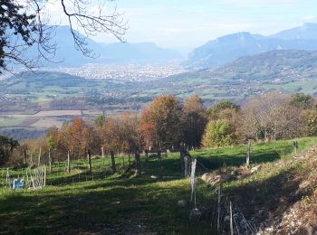
Vaulnaveys-le-Bas, Isère: Best trails, routes and walks

Vaulnaveys-le-Bas: Discover the best trails: 5 hiking trails and 1 bike and mountain-bike routes. All these trails, routes and outdoor activities are available in our SityTrail applications for smartphones and tablets.


The best trails (6)

Trail Walking Vaulnaveys-le-Bas - Montchaffrey/chartreuse de premol - Photo
Walking 15.032
Km

Walking

Very difficult
Vaulnaveys-le-Bas, Auvergne-Rhône-Alpes, Isère, France
15 km | 23 km-effort
3h 54min
631 m
630 m
Yes
Youcef Atallah

Trail Walking Vaulnaveys-le-Bas - Les Balcons de Belledonne au dėpart de Montchaffrey - Photo
Walking 15.833
Km

Walking

Medium
Vaulnaveys-le-Bas, Auvergne-Rhône-Alpes, Isère, France
15.8 km | 25 km-effort
6h 13min
659 m
659 m
Yes
Emelle

Trail Electric bike Vaulnaveys-le-Bas - lac Luitel - Photo
Electric bike 25.561
Km

Electric bike

Medium
Vaulnaveys-le-Bas, Auvergne-Rhône-Alpes, Isère, France
26 km | 42 km-effort
2h 23min
1199 m
1203 m
No
ericf64

Trail Walking Vaulnaveys-le-Bas - montchafrey - Luitel - Photo
Walking 13.261
Km

Walking

Very difficult
Vaulnaveys-le-Bas, Auvergne-Rhône-Alpes, Isère, France
13.3 km | 21 km-effort
3h 58min
609 m
612 m
Yes
lionelnottat

Trail Walking Vaulnaveys-le-Bas - luitel - Photo
Walking 15.967
Km

Walking

Very difficult
Vaulnaveys-le-Bas, Auvergne-Rhône-Alpes, Isère, France
16 km | 25 km-effort
7h 23min
662 m
664 m
Yes
Liebeaux

Trail Walking Vaulnaveys-le-Bas - montchaffrey - Photo
Walking 16.809
Km

Walking

Very easy
Vaulnaveys-le-Bas, Auvergne-Rhône-Alpes, Isère, France
16.8 km | 26 km-effort
5h 33min
653 m
660 m
Yes
sabine38

6 trails displayed on 6

FREE GPS app for hiking

Logo SityTrail SityTrail

IGN / Geographical institutes

Download SityTrail from the App Store Download SityTrail from Google Play

Logo SityTrail SityTrail World

The world is yours!

Download SityTrail from the App Store Download SityTrail from Google Play Download SityTrail on Huawei AppGallery

Activities

Close
My subscriptions