Aoste, Isère: Best trails, routes and walks

Aoste: Discover the best trails: 2 hiking trails, 3 bike and mountain-bike routes and 1 equestrian circuits. All these trails, routes and outdoor activities are available in our SityTrail applications for smartphones and tablets.


The best trails (7)

Trail Walking Aoste - tour aoste granieu - Photo
Walking 8.151
Km

Walking

Very easy
Aoste, Auvergne-Rhône-Alpes, Isère, France
8.2 km | 8.8 km-effort
1h 39min
49 m
49 m
Yes
Claude DONNADIEU

Trail Walking Aoste - Aoste - Photo
Walking 13.726
Km

Walking

Difficult
Aoste, Auvergne-Rhône-Alpes, Isère, France
13.7 km | 14.9 km-effort
3h 56min
94 m
75 m
No
lilloue

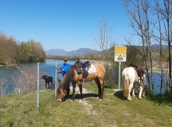
Trail Horseback riding Aoste - st didier st genix champagneux breigner  - Photo
Horseback riding 16.377
Km

Horseback riding

Easy
Aoste, Auvergne-Rhône-Alpes, Isère, France
16.4 km | 18.2 km-effort
5h 10min
139 m
137 m
No
Nolene

Trail Cycle Aoste - St Genix - Château de Mandrin - Photo
Cycle 24.533
Km

Cycle

Medium
Aoste, Auvergne-Rhône-Alpes, Isère, France
25 km | 32 km-effort
1h 49min
569 m
569 m
Yes
leeho

Trail Cycle Aoste - St Genix - Groslée - Photo
Cycle 53.283
Km

Cycle

Easy
Aoste, Auvergne-Rhône-Alpes, Isère, France
53 km | 58 km-effort
3h 27min
372 m
372 m
Yes
leeho

Trail Cycle Aoste - St Genix - La Balme - Photo
Cycle 42.038
Km

Cycle

Easy
Aoste, Auvergne-Rhône-Alpes, Isère, France
42 km | 48 km-effort
2h 49min
456 m
455 m
Yes
leeho

Trail Quad Aoste - rando entre les vignes - Photo
Quad 105.781
Km

Quad

Very easy
Aoste, Auvergne-Rhône-Alpes, Isère, France
106 km | 135 km-effort
3h 51min
2206 m
2193 m
No
Fabrice Vernay

7 trails displayed on 7

FREE GPS app for hiking

Logo SityTrail SityTrail

IGN / Geographical institutes

Download SityTrail from the App Store Download SityTrail from Google Play

Logo SityTrail SityTrail World

The world is yours!

Download SityTrail from the App Store Download SityTrail from Google Play Download SityTrail on Huawei AppGallery

Activities

Close
My subscriptions