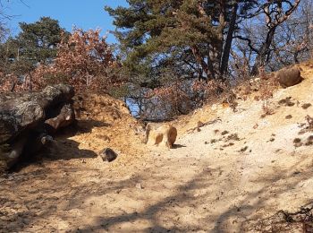
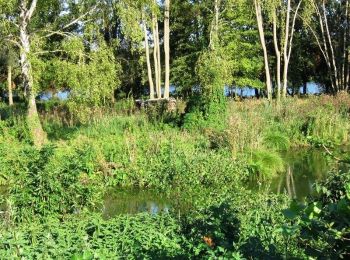
Baulne, Essonne: Best trails, routes and walks

3 comments

Baulne: Discover the best trails: 29 hiking trails and 1 bike and mountain-bike routes. All these trails, routes and outdoor activities are available in our SityTrail applications for smartphones and tablets.


The best trails (29)
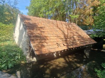
Trail Walking Baulne - De La Ferté Alais à Mennecy - Photo
Walking 20.44
Km
GUIDE

Walking

Very easy
Baulne, Ile-de-France, Essonne, France
20 km | 23 km-effort
4h 31min
203 m
215 m
No
chessyca

Trail Mountain bike Baulne - Les Marais de l'Essonne 29,5 km - Photo
Mountain bike 29.642
Km

Mountain bike

Easy
(1)
Baulne, Ile-de-France, Essonne, France
30 km | 33 km-effort
2h 12min
273 m
274 m
Yes
Bastet

Trail Walking Baulne - Baulne Mondeville - Photo
Walking 21.016
Km

Walking

Medium
Baulne, Ile-de-France, Essonne, France
21 km | 26 km-effort
5h 25min
362 m
358 m
Yes
marianne guichoux

Trail Walking Baulne - La Ferté-Alais Itteville Ballancourt - Photo
Walking 13.688
Km

Walking

Difficult
Baulne, Ile-de-France, Essonne, France
13.7 km | 16.2 km-effort
3h 0min
186 m
189 m
Yes
tracegps

Trail Walking Baulne - Tracé actuel: 25 FEV 2018 08:47 - Photo
Walking 22.728
Km

Walking

Very difficult
Baulne, Ile-de-France, Essonne, France
23 km | 27 km-effort
6h 4min
301 m
303 m
Yes
JacquesMARQUET

Trail Walking Baulne - la fierté alais - Photo
Walking 12.432
Km

Walking

Easy
Baulne, Ile-de-France, Essonne, France
12.4 km | 15 km-effort
3h 32min
195 m
195 m
Yes
raffalliphilippe

Trail Walking Baulne - Test  - Photo
Walking 7.453
Km

Walking

Very easy
Baulne, Ile-de-France, Essonne, France
7.5 km | 8 km-effort
1h 52min
43 m
39 m
Yes
philippevh

Trail Walking Baulne - LaFerteAlaisSR280419 - Photo
Walking 23.433
Km

Walking

Medium
Baulne, Ile-de-France, Essonne, France
23 km | 28 km-effort
7h 14min
361 m
360 m
Yes
fmg

Trail Walking Baulne - la ferté alais la sablière - Photo
Walking 11.298
Km

Walking

Medium
Baulne, Ile-de-France, Essonne, France
11.3 km | 13.7 km-effort
3h 15min
179 m
178 m
Yes
mdsaintjalmes

Trail Walking Baulne - 2017-03-01 Rando Baulne - Photo
Walking 11.776
Km

Walking

Easy
Baulne, Ile-de-France, Essonne, France
11.8 km | 13.8 km-effort
3h 2min
153 m
153 m
Yes
jchezlemas

• Rando de Martine et Alain Gauthier Office de Tourisme de l'Arpajonnais http://ot-arpajonnais.fr/

Trail Walking Baulne - Baulne Mondeville - Photo
Walking 22.781
Km

Walking

Medium
Baulne, Ile-de-France, Essonne, France
23 km | 27 km-effort
4h 31min
345 m
346 m
Yes
marianne guichoux

Trail Walking Baulne - baulne - Photo
Walking 29.069
Km

Walking

Very difficult
Baulne, Ile-de-France, Essonne, France
29 km | 35 km-effort
7h 11min
474 m
474 m
Yes
aucamus

Trail On foot Baulne - Boigny - Photo
On foot 27.448
Km

On foot

Difficult
(1)
Baulne, Ile-de-France, Essonne, France
27 km | 34 km-effort
7h 40min
472 m
472 m
Yes
aucamus

Trail Walking Baulne - fermé alais - Photo
Walking 12.311
Km

Walking

Difficult
Baulne, Ile-de-France, Essonne, France
12.3 km | 13.8 km-effort
3h 14min
113 m
106 m
No
Delmasjacques

Trail On foot Baulne - la Ferte-Allais Mennecy - Photo
On foot 21.577
Km

On foot

Medium
Baulne, Ile-de-France, Essonne, France
22 km | 25 km-effort
5h 39min
247 m
256 m
No
Annie Leduc

Trail Walking Baulne - Mennecy la Ferté  - Photo
Walking 20.22
Km

Walking

Very difficult
Baulne, Ile-de-France, Essonne, France
20 km | 23 km-effort
5h 57min
210 m
215 m
No
Corinne.nordique

Trail Walking Baulne - AVF beaulne - Photo
Walking 17.374
Km

Walking

Very difficult
Baulne, Ile-de-France, Essonne, France
17.4 km | 21 km-effort
4h 36min
237 m
239 m
Yes
tempao

Trail Walking Baulne - baulneles étangs - Photo
Walking 6.74
Km

Walking

Medium
Baulne, Ile-de-France, Essonne, France
6.7 km | 7.4 km-effort
1h 47min
47 m
47 m
Yes
SUPERMAMINOU2004

Trail Walking Baulne - baulne la ferte alais  - Photo
Walking 19.737
Km

Walking

Easy
Baulne, Ile-de-France, Essonne, France
19.7 km | 24 km-effort
5h 39min
299 m
299 m
Yes
DUGAEL

Trail Walking Baulne - Chapelle St Blaise Douce - Photo
Walking 7.847
Km

Walking

Medium
Baulne, Ile-de-France, Essonne, France
7.8 km | 8.7 km-effort
1h 44min
64 m
65 m
Yes
philippevh

20 trails displayed on 29

FREE GPS app for hiking

Logo SityTrail SityTrail

IGN / Geographical institutes

Download SityTrail from the App Store Download SityTrail from Google Play

Logo SityTrail SityTrail World

The world is yours!

Download SityTrail from the App Store Download SityTrail from Google Play Download SityTrail on Huawei AppGallery

Activities

Close
My subscriptions