![](/images/other/stat-length.png)
Finland: Best trails, routes and walks
Finland: Discover the 222 best hiking and cycling trail ideas. Our catalogue, manually prepared by our hikers, contains lots of beautiful landscapes to explore. Download these trails in SityTrail, our free hiking GPS application available on Android and iOS.
The best trails (222)
![Trail On foot - Harjunkierros - Photo](https://media.geolcdn.com/t/350/260/b6be5568-6ab9-443d-ac6a-1f2c52710d6d.jpeg&format=jpg&maxdim=2)
![On foot On foot](https://static1.geolcdn.com/sitytour/trail-icons/100.png)
Km
On foot
![](/images/other/stat-length.png)
![](https://static1.geolcdn.com/siteimages/upload/files/1508320355ic_sort_den_pos_24dp.png)
![](https://static1.geolcdn.com/siteimages/upload/files/1508320355ic_sort_den_neg_24dp.png)
![](https://static1.geolcdn.com/siteimages/upload/files/16400158638029165_repeat_loop_refresh_sync_direction_icon.png)
• Trail created by Metsähallitus.
![Trail On foot Joutsa - Mäyränkierros - Photo](https://media.geolcdn.com/t/350/260/a85609d0-ae83-4169-b43f-e04061488c47.jpeg&format=jpg&maxdim=2)
![On foot On foot](https://static1.geolcdn.com/sitytour/trail-icons/100.png)
Km
On foot
![](/images/other/stat-length.png)
![](https://static1.geolcdn.com/siteimages/upload/files/1508320355ic_sort_den_pos_24dp.png)
![](https://static1.geolcdn.com/siteimages/upload/files/1508320355ic_sort_den_neg_24dp.png)
![](https://static1.geolcdn.com/siteimages/upload/files/16400158638029165_repeat_loop_refresh_sync_direction_icon.png)
• Trail created by Metsähallitus.
![Trail On foot Viitasaari - Savivuoren luontopolku - Metsän tuulahdus - Photo](https://media.geolcdn.com/t/350/260/a0252841-44b9-4bc9-b706-e01ee2861c11.jpeg&format=jpg&maxdim=2)
![On foot On foot](https://static1.geolcdn.com/sitytour/trail-icons/100.png)
Km
On foot
![](/images/other/stat-length.png)
![](https://static1.geolcdn.com/siteimages/upload/files/1508320355ic_sort_den_pos_24dp.png)
![](https://static1.geolcdn.com/siteimages/upload/files/1508320355ic_sort_den_neg_24dp.png)
![](https://static1.geolcdn.com/siteimages/upload/files/16400158638029165_repeat_loop_refresh_sync_direction_icon.png)
• Trail created by Viitasaaren kaupunki.
![Trail On foot Hyvinkää - Mustan kiven kierros - Photo](https://media.geolcdn.com/t/350/260/e08ade8c-95a6-4eb3-88c4-a8ea009b0cd6.jpeg&format=jpg&maxdim=2)
![On foot On foot](https://static1.geolcdn.com/sitytour/trail-icons/100.png)
Km
On foot
![](/images/other/stat-length.png)
![](https://static1.geolcdn.com/siteimages/upload/files/1508320355ic_sort_den_pos_24dp.png)
![](https://static1.geolcdn.com/siteimages/upload/files/1508320355ic_sort_den_neg_24dp.png)
![](https://static1.geolcdn.com/siteimages/upload/files/16400158638029165_repeat_loop_refresh_sync_direction_icon.png)
• Website: https://www.hyvinkaa.fi/kulttuuri-ja-vapaa-aika/liikunta/virkistys-ja-ulkoilu1/opastetut-reitit/kytaja-usm...
![Trail On foot Salla - Kanjonin kurkkaus - Photo](https://media.geolcdn.com/t/350/260/029f939d-eb90-43a0-8fb5-e693b7dda8b3.jpeg&format=jpg&maxdim=2)
![On foot On foot](https://static1.geolcdn.com/sitytour/trail-icons/100.png)
Km
On foot
![](/images/other/stat-length.png)
![](https://static1.geolcdn.com/siteimages/upload/files/1508320355ic_sort_den_pos_24dp.png)
![](https://static1.geolcdn.com/siteimages/upload/files/1508320355ic_sort_den_neg_24dp.png)
![](https://static1.geolcdn.com/siteimages/upload/files/16400158638029165_repeat_loop_refresh_sync_direction_icon.png)
• Trail created by Metsähallitus.
![Trail On foot Suomussalmi - Kokalmuksen Kierros - Photo](https://media.geolcdn.com/t/350/260/89e1f94d-77ad-4fec-bcd5-988d5242c5b4.jpeg&format=jpg&maxdim=2)
![On foot On foot](https://static1.geolcdn.com/sitytour/trail-icons/100.png)
Km
On foot
![](/images/other/stat-length.png)
![](https://static1.geolcdn.com/siteimages/upload/files/1508320355ic_sort_den_pos_24dp.png)
![](https://static1.geolcdn.com/siteimages/upload/files/1508320355ic_sort_den_neg_24dp.png)
![](https://static1.geolcdn.com/siteimages/upload/files/16400158638029165_repeat_loop_refresh_sync_direction_icon.png)
• Hossan patikointireitit, reittien lähtöpisteet, reittiesittelyt ja retkeilyrakenteet. Website: https://www.luontoon....
![Trail On foot Suomussalmi - Huosiuksen Huikoinen - Photo](https://media.geolcdn.com/t/350/260/5c02a311-625d-49de-94b3-0bdd29948312.jpeg&format=jpg&maxdim=2)
![On foot On foot](https://static1.geolcdn.com/sitytour/trail-icons/100.png)
Km
On foot
![](/images/other/stat-length.png)
![](https://static1.geolcdn.com/siteimages/upload/files/1508320355ic_sort_den_pos_24dp.png)
![](https://static1.geolcdn.com/siteimages/upload/files/1508320355ic_sort_den_neg_24dp.png)
![](https://static1.geolcdn.com/siteimages/upload/files/16400158638029165_repeat_loop_refresh_sync_direction_icon.png)
• Hossan patikointireitit, reittien lähtöpisteet, reittiesittelyt ja retkeilyrakenteet. Website: https://www.luontoon....
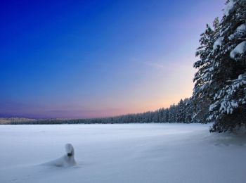
![Trail On foot Suomussalmi - Hakokosken Hujaus - Photo](https://media.geolcdn.com/t/350/260/5a1d67e9-3b6d-4d4f-9321-2bba62d55abc.jpeg&format=jpg&maxdim=2)
![On foot On foot](https://static1.geolcdn.com/sitytour/trail-icons/100.png)
Km
On foot
![](/images/other/stat-length.png)
![](https://static1.geolcdn.com/siteimages/upload/files/1508320355ic_sort_den_pos_24dp.png)
![](https://static1.geolcdn.com/siteimages/upload/files/1508320355ic_sort_den_neg_24dp.png)
![](https://static1.geolcdn.com/siteimages/upload/files/16400158638029165_repeat_loop_refresh_sync_direction_icon.png)
• Hossan patikointireitit, reittien lähtöpisteet, reittiesittelyt ja retkeilyrakenteet. Website: https://www.luontoon....
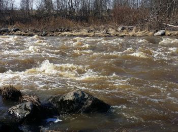
![Trail On foot Helsinki - Torpparintaival - Photo](https://media.geolcdn.com/t/350/260/002d0b9d-a2dd-4e69-ac0e-dc758ad4121d.jpeg&format=jpg&maxdim=2)
![On foot On foot](https://static1.geolcdn.com/sitytour/trail-icons/100.png)
Km
On foot
![](/images/other/stat-length.png)
![](https://static1.geolcdn.com/siteimages/upload/files/1508320355ic_sort_den_pos_24dp.png)
![](https://static1.geolcdn.com/siteimages/upload/files/1508320355ic_sort_den_neg_24dp.png)
![](https://static1.geolcdn.com/siteimages/upload/files/16400158638029165_repeat_loop_refresh_sync_direction_icon.png)
• Trail created by Torpparinmäen peruskoulu. https://www.hs.fi/lastenuutiset/art-2000006115708.html Website: https:...
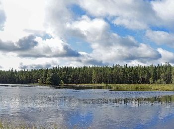
![Trail On foot Saarijärvi - Tulijärvi trail - Photo](https://media.geolcdn.com/t/350/260/683f7b65-e7c3-4951-8092-8a9308ad5467.jpeg&format=jpg&maxdim=2)
![On foot On foot](https://static1.geolcdn.com/sitytour/trail-icons/100.png)
Km
On foot
![](/images/other/stat-length.png)
![](https://static1.geolcdn.com/siteimages/upload/files/1508320355ic_sort_den_pos_24dp.png)
![](https://static1.geolcdn.com/siteimages/upload/files/1508320355ic_sort_den_neg_24dp.png)
![](https://static1.geolcdn.com/siteimages/upload/files/16400158638029165_repeat_loop_refresh_sync_direction_icon.png)
• Trail created by Metsähallitus.
![Trail On foot Saarijärvi - Kotajärvi Trail - Photo](https://media.geolcdn.com/t/350/260/dd055e6b-9c54-4441-9b8f-4633432f4f38.jpeg&format=jpg&maxdim=2)
![On foot On foot](https://static1.geolcdn.com/sitytour/trail-icons/100.png)
Km
On foot
![](/images/other/stat-length.png)
![](https://static1.geolcdn.com/siteimages/upload/files/1508320355ic_sort_den_pos_24dp.png)
![](https://static1.geolcdn.com/siteimages/upload/files/1508320355ic_sort_den_neg_24dp.png)
![](https://static1.geolcdn.com/siteimages/upload/files/16400158638029165_repeat_loop_refresh_sync_direction_icon.png)
• Reitit Website: https://www.luontoon.fi/pyha-hakki/reitit
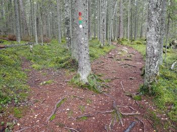
![Trail On foot Saarijärvi - Mastomäki Trail - Photo](https://media.geolcdn.com/t/350/260/01d67d04-43d7-4348-824a-1d5c0e081dd2.jpeg&format=jpg&maxdim=2)
![On foot On foot](https://static1.geolcdn.com/sitytour/trail-icons/100.png)
Km
On foot
![](/images/other/stat-length.png)
![](https://static1.geolcdn.com/siteimages/upload/files/1508320355ic_sort_den_pos_24dp.png)
![](https://static1.geolcdn.com/siteimages/upload/files/1508320355ic_sort_den_neg_24dp.png)
![](https://static1.geolcdn.com/siteimages/upload/files/16400158638029165_repeat_loop_refresh_sync_direction_icon.png)
• Reitit Website: https://www.luontoon.fi/pyha-hakki/reitit
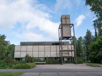
![Trail On foot Kouvola - Kymijoen ulkoilureitti - Photo](https://media.geolcdn.com/t/350/260/0f545207-5f3c-49fd-839c-a8d1bd175a5a.jpeg&format=jpg&maxdim=2)
![On foot On foot](https://static1.geolcdn.com/sitytour/trail-icons/100.png)
Km
On foot
![](/images/other/stat-length.png)
![](https://static1.geolcdn.com/siteimages/upload/files/1508320355ic_sort_den_pos_24dp.png)
![](https://static1.geolcdn.com/siteimages/upload/files/1508320355ic_sort_den_neg_24dp.png)
![](https://static1.geolcdn.com/siteimages/upload/files/16400158638029165_repeat_loop_refresh_sync_direction_icon.png)
• Trail created by Kouvolan kaupunki.
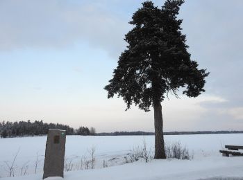
![Trail On foot Kouvola - Alakylän luontopolku - Photo](https://media.geolcdn.com/t/350/260/b358065d-f197-4008-9003-b6a3e053ff31.jpeg&format=jpg&maxdim=2)
![On foot On foot](https://static1.geolcdn.com/sitytour/trail-icons/100.png)
Km
On foot
![](/images/other/stat-length.png)
![](https://static1.geolcdn.com/siteimages/upload/files/1508320355ic_sort_den_pos_24dp.png)
![](https://static1.geolcdn.com/siteimages/upload/files/1508320355ic_sort_den_neg_24dp.png)
![](https://static1.geolcdn.com/siteimages/upload/files/16400158638029165_repeat_loop_refresh_sync_direction_icon.png)
• Korian sillalta lähtee reitti, joka myötäilee Kymijokea melko luonnontilaisena säilyneessä kapeassa metsikössä. Webs...
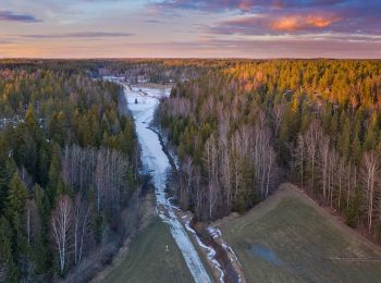
![Trail On foot Sipoo - Kalkkiruukki - Fiskträsk - Photo](https://media.geolcdn.com/t/350/260/76646939-8998-4a43-a7af-b0af5712ff6a.jpeg&format=jpg&maxdim=2)
![On foot On foot](https://static1.geolcdn.com/sitytour/trail-icons/100.png)
Km
On foot
![](/images/other/stat-length.png)
![](https://static1.geolcdn.com/siteimages/upload/files/1508320355ic_sort_den_pos_24dp.png)
![](https://static1.geolcdn.com/siteimages/upload/files/1508320355ic_sort_den_neg_24dp.png)
![](https://static1.geolcdn.com/siteimages/upload/files/16400158638029165_repeat_loop_refresh_sync_direction_icon.png)
• Trail created by Metsähallitus. Symbol: yellow diamond
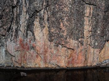
![Trail On foot Suomussalmi - Värikallion kaarros - Photo](https://media.geolcdn.com/t/350/260/f2c633dc-b318-49ca-a6f1-98a2c85c9244.jpeg&format=jpg&maxdim=2)
![On foot On foot](https://static1.geolcdn.com/sitytour/trail-icons/100.png)
Km
On foot
![](/images/other/stat-length.png)
![](https://static1.geolcdn.com/siteimages/upload/files/1508320355ic_sort_den_pos_24dp.png)
![](https://static1.geolcdn.com/siteimages/upload/files/1508320355ic_sort_den_neg_24dp.png)
![](https://static1.geolcdn.com/siteimages/upload/files/16400158638029165_repeat_loop_refresh_sync_direction_icon.png)
• Hossan patikointireitit, reittien lähtöpisteet, reittiesittelyt ja retkeilyrakenteet. Website: https://www.luontoon....
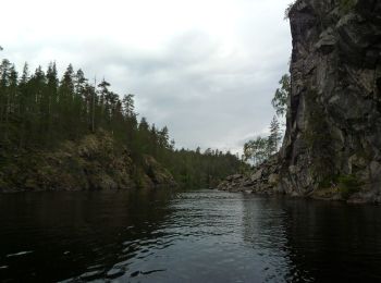
![Trail On foot Kuusamo - Ölökyn ylitys - Photo](https://media.geolcdn.com/t/350/260/a8f5e1bc-69be-4283-8381-a3e770e876a7.jpeg&format=jpg&maxdim=2)
![On foot On foot](https://static1.geolcdn.com/sitytour/trail-icons/100.png)
Km
On foot
![](/images/other/stat-length.png)
![](https://static1.geolcdn.com/siteimages/upload/files/1508320355ic_sort_den_pos_24dp.png)
![](https://static1.geolcdn.com/siteimages/upload/files/1508320355ic_sort_den_neg_24dp.png)
![](https://static1.geolcdn.com/siteimages/upload/files/16400158638029165_repeat_loop_refresh_sync_direction_icon.png)
• Hossan patikointireitit, reittien lähtöpisteet, reittiesittelyt ja retkeilyrakenteet. Website: https://www.luontoon....
![Trail On foot Kuusamo - Ölökyn ähkäsy - Photo](https://media.geolcdn.com/t/350/260/a8f5e1bc-69be-4283-8381-a3e770e876a7.jpeg&format=jpg&maxdim=2)
![On foot On foot](https://static1.geolcdn.com/sitytour/trail-icons/100.png)
Km
On foot
![](/images/other/stat-length.png)
![](https://static1.geolcdn.com/siteimages/upload/files/1508320355ic_sort_den_pos_24dp.png)
![](https://static1.geolcdn.com/siteimages/upload/files/1508320355ic_sort_den_neg_24dp.png)
![](https://static1.geolcdn.com/siteimages/upload/files/16400158638029165_repeat_loop_refresh_sync_direction_icon.png)
• Hossan patikointireitit, reittien lähtöpisteet, reittiesittelyt ja retkeilyrakenteet. Website: https://www.luontoon....
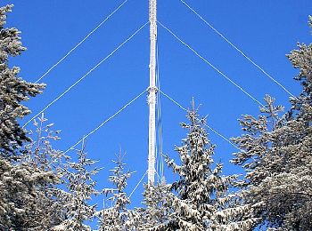
![Trail On foot Hollola - Tiirismaan kierros - Photo](https://media.geolcdn.com/t/350/260/065da3d7-6ca2-4475-81b0-bc4ba2ff43b6.jpeg&format=jpg&maxdim=2)
![On foot On foot](https://static1.geolcdn.com/sitytour/trail-icons/100.png)
Km
On foot
![](/images/other/stat-length.png)
![](https://static1.geolcdn.com/siteimages/upload/files/1508320355ic_sort_den_pos_24dp.png)
![](https://static1.geolcdn.com/siteimages/upload/files/1508320355ic_sort_den_neg_24dp.png)
![](https://static1.geolcdn.com/siteimages/upload/files/16400158638029165_repeat_loop_refresh_sync_direction_icon.png)
• Tiirismaan kierros on 4,5 km:n pituinen ympyräreitti Hollolassa. Vaihtelevassa ja paikoin kivikkoisessa maastossa kul...
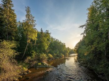
![Trail On foot Helsinki - Haltiavuoren luontopolku - Photo](https://media.geolcdn.com/t/350/260/4b6dad3d-94f4-4221-9fd4-d09a14822f0b.jpeg&format=jpg&maxdim=2)
![On foot On foot](https://static1.geolcdn.com/sitytour/trail-icons/100.png)
Km
On foot
![](/images/other/stat-length.png)
![](https://static1.geolcdn.com/siteimages/upload/files/1508320355ic_sort_den_pos_24dp.png)
![](https://static1.geolcdn.com/siteimages/upload/files/1508320355ic_sort_den_neg_24dp.png)
![](https://static1.geolcdn.com/siteimages/upload/files/16400158638029165_repeat_loop_refresh_sync_direction_icon.png)
• Pohjois-Helsingin Haltialassa on kolme luontopolkua ja lisäksi Niskalassa puulajipuisto. Website: https://www.hel.fi...
20 trails displayed on 222
FREE GPS app for hiking