![](/images/other/stat-length.png)
- Trails
- Outdoor
- Germany
- Lower Saxony
- Landkreis Celle
- Eschede
Eschede, Landkreis Celle: Best trails, routes and walks
Eschede: Discover the best trails: 15 hiking trails. All these trails, routes and outdoor activities are available in our SityTrail applications for smartphones and tablets.
The best trails (15)
![Trail On foot Eschede - Südheide 'Beim Hecht im Karpfenteich' W14l (lange Tour) - Photo](https://media.geolcdn.com/t/350/260/cd2db2d9-fbcf-4fe7-90c0-c5d9a667393a.jpeg&format=jpg&maxdim=2)
![On foot On foot](https://static1.geolcdn.com/sitytour/trail-icons/100.png)
Km
On foot
![](/images/other/stat-length.png)
![](https://static1.geolcdn.com/siteimages/upload/files/1508320355ic_sort_den_pos_24dp.png)
![](https://static1.geolcdn.com/siteimages/upload/files/1508320355ic_sort_den_neg_24dp.png)
![](https://static1.geolcdn.com/siteimages/upload/files/16400158638029165_repeat_loop_refresh_sync_direction_icon.png)
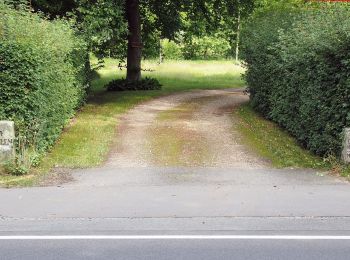
• Die beiden Wanderungen des W14 „Beim Hecht im Karpfenteich“ führen durch die ausgedehnte Wasserlandschaft der Aschau-...
![Trail On foot Eschede - Südheide 'Beim Hecht im Karpfenteich' W14k (kurze Tour) - Photo](https://media.geolcdn.com/t/350/260/cd2db2d9-fbcf-4fe7-90c0-c5d9a667393a.jpeg&format=jpg&maxdim=2)
![On foot On foot](https://static1.geolcdn.com/sitytour/trail-icons/100.png)
Km
On foot
![](/images/other/stat-length.png)
![](https://static1.geolcdn.com/siteimages/upload/files/1508320355ic_sort_den_pos_24dp.png)
![](https://static1.geolcdn.com/siteimages/upload/files/1508320355ic_sort_den_neg_24dp.png)
![](https://static1.geolcdn.com/siteimages/upload/files/16400158638029165_repeat_loop_refresh_sync_direction_icon.png)
• Die beiden Wanderungen des W14 „Beim Hecht im Karpfenteich“ führen durch die ausgedehnte Wasserlandschaft der Aschaut...
![Trail On foot Eschede - Südheide 'Im Land der Esche' W19k (kurze Tour) - Photo](https://media.geolcdn.com/t/350/260/97d45ee2-293d-43ca-8309-4bfb97482e63.jpeg&format=jpg&maxdim=2)
![On foot On foot](https://static1.geolcdn.com/sitytour/trail-icons/100.png)
Km
On foot
![](/images/other/stat-length.png)
![](https://static1.geolcdn.com/siteimages/upload/files/1508320355ic_sort_den_pos_24dp.png)
![](https://static1.geolcdn.com/siteimages/upload/files/1508320355ic_sort_den_neg_24dp.png)
![](https://static1.geolcdn.com/siteimages/upload/files/16400158638029165_repeat_loop_refresh_sync_direction_icon.png)
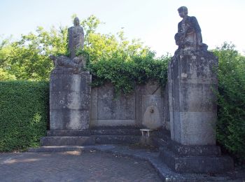
• Die Wanderung des Rundwanderweges W19 "Im Land der Esche" führt in den südöstlichen Teil des Naturparks Südheide, ent...
![Trail On foot Eschede - Südheide 'Im Land der Esche' W19m (mittlere Tour) - Photo](https://media.geolcdn.com/t/350/260/97d45ee2-293d-43ca-8309-4bfb97482e63.jpeg&format=jpg&maxdim=2)
![On foot On foot](https://static1.geolcdn.com/sitytour/trail-icons/100.png)
Km
On foot
![](/images/other/stat-length.png)
![](https://static1.geolcdn.com/siteimages/upload/files/1508320355ic_sort_den_pos_24dp.png)
![](https://static1.geolcdn.com/siteimages/upload/files/1508320355ic_sort_den_neg_24dp.png)
![](https://static1.geolcdn.com/siteimages/upload/files/16400158638029165_repeat_loop_refresh_sync_direction_icon.png)
• Die Wanderung des Rundwanderweges W19 "Im Land der Esche" führt in den südöstlichen Teil des Naturparks Südheide, ent...
![Trail On foot Eschede - Südheide 'Im Land der Esche' W19l (lange Tour) - Photo](https://media.geolcdn.com/t/350/260/38f1fdfc-f42b-4a99-ab3b-c8046922951c.jpeg&format=jpg&maxdim=2)
![On foot On foot](https://static1.geolcdn.com/sitytour/trail-icons/100.png)
Km
On foot
![](/images/other/stat-length.png)
![](https://static1.geolcdn.com/siteimages/upload/files/1508320355ic_sort_den_pos_24dp.png)
![](https://static1.geolcdn.com/siteimages/upload/files/1508320355ic_sort_den_neg_24dp.png)
![](https://static1.geolcdn.com/siteimages/upload/files/16400158638029165_repeat_loop_refresh_sync_direction_icon.png)
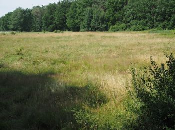
• Die Wanderung des Rundwanderweges W19 "Im Land der Esche" führt in den südöstlichen Teil des Naturparks Südheide, ent...
![Trail On foot Eschede - Südheide 'Magische Orte längs des Weges' W20l (lange Tour) - Photo](https://media.geolcdn.com/t/350/260/571c1a85-4b8a-478a-86a5-9aab9cbd21e0.jpeg&format=jpg&maxdim=2)
![On foot On foot](https://static1.geolcdn.com/sitytour/trail-icons/100.png)
Km
On foot
![](/images/other/stat-length.png)
![](https://static1.geolcdn.com/siteimages/upload/files/1508320355ic_sort_den_pos_24dp.png)
![](https://static1.geolcdn.com/siteimages/upload/files/1508320355ic_sort_den_neg_24dp.png)
![](https://static1.geolcdn.com/siteimages/upload/files/16400158638029165_repeat_loop_refresh_sync_direction_icon.png)
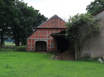
• Die Wanderung führt in den südöstlichen Bereich des Naturparks Südheide, durch die Felder und Wälder im Umfeld von Sc...
![Trail On foot Eschede - Südheide 'Magische Orte längs des Weges' W20m (mittere Tour) - Photo](https://media.geolcdn.com/t/350/260/38f1fdfc-f42b-4a99-ab3b-c8046922951c.jpeg&format=jpg&maxdim=2)
![On foot On foot](https://static1.geolcdn.com/sitytour/trail-icons/100.png)
Km
On foot
![](/images/other/stat-length.png)
![](https://static1.geolcdn.com/siteimages/upload/files/1508320355ic_sort_den_pos_24dp.png)
![](https://static1.geolcdn.com/siteimages/upload/files/1508320355ic_sort_den_neg_24dp.png)
![](https://static1.geolcdn.com/siteimages/upload/files/16400158638029165_repeat_loop_refresh_sync_direction_icon.png)
• Die Wanderung führt in den südöstlichen Bereich des Naturparks Südheide, durch die Felder und Wälder im Umfeld von Sc...
![Trail On foot Eschede - Südheide 'Reine Luft zu sehen' W18l (lange Tour) - Photo](https://media.geolcdn.com/t/350/260/b607a840-ed82-432b-bd02-7c8fc2b0a01e.jpeg&format=jpg&maxdim=2)
![On foot On foot](https://static1.geolcdn.com/sitytour/trail-icons/100.png)
Km
On foot
![](/images/other/stat-length.png)
![](https://static1.geolcdn.com/siteimages/upload/files/1508320355ic_sort_den_pos_24dp.png)
![](https://static1.geolcdn.com/siteimages/upload/files/1508320355ic_sort_den_neg_24dp.png)
![](https://static1.geolcdn.com/siteimages/upload/files/16400158638029165_repeat_loop_refresh_sync_direction_icon.png)
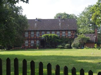
• Die Wanderung des Rundwanderweges W18 "Reine Luft zu sehen" führt in den südwestlichen Teil des Naturparks Südheide, ...
![Trail On foot Eschede - Südheide 'Reine Luft zu sehen' W18m (mittlere Tour) - Photo](https://media.geolcdn.com/t/350/260/b607a840-ed82-432b-bd02-7c8fc2b0a01e.jpeg&format=jpg&maxdim=2)
![On foot On foot](https://static1.geolcdn.com/sitytour/trail-icons/100.png)
Km
On foot
![](/images/other/stat-length.png)
![](https://static1.geolcdn.com/siteimages/upload/files/1508320355ic_sort_den_pos_24dp.png)
![](https://static1.geolcdn.com/siteimages/upload/files/1508320355ic_sort_den_neg_24dp.png)
![](https://static1.geolcdn.com/siteimages/upload/files/16400158638029165_repeat_loop_refresh_sync_direction_icon.png)
• Die Wanderung des Rundwanderweges W18 "Reine Luft zu sehen" führt in den südwestlichen Teil des Naturparks Südheide, ...
![Trail On foot Eschede - Südheide 'Reine Luft zu sehen' W18k (kurze Tour) - Photo](https://media.geolcdn.com/t/350/260/b607a840-ed82-432b-bd02-7c8fc2b0a01e.jpeg&format=jpg&maxdim=2)
![On foot On foot](https://static1.geolcdn.com/sitytour/trail-icons/100.png)
Km
On foot
![](/images/other/stat-length.png)
![](https://static1.geolcdn.com/siteimages/upload/files/1508320355ic_sort_den_pos_24dp.png)
![](https://static1.geolcdn.com/siteimages/upload/files/1508320355ic_sort_den_neg_24dp.png)
![](https://static1.geolcdn.com/siteimages/upload/files/16400158638029165_repeat_loop_refresh_sync_direction_icon.png)
• Die Wanderung des Rundwanderweges W18 "Reine Luft zu sehen" führt in den südwestlichen Teil des Naturparks Südheide, ...
![Trail On foot Eschede - Südheide 'Dem Förster über die Schulter geschaut' W12l (lange Tour) - Photo](https://media.geolcdn.com/t/350/260/8ea2d961-7f4f-41b3-9ce6-e49a68c13c58.jpeg&format=jpg&maxdim=2)
![On foot On foot](https://static1.geolcdn.com/sitytour/trail-icons/100.png)
Km
On foot
![](/images/other/stat-length.png)
![](https://static1.geolcdn.com/siteimages/upload/files/1508320355ic_sort_den_pos_24dp.png)
![](https://static1.geolcdn.com/siteimages/upload/files/1508320355ic_sort_den_neg_24dp.png)
![](https://static1.geolcdn.com/siteimages/upload/files/16400158638029165_repeat_loop_refresh_sync_direction_icon.png)
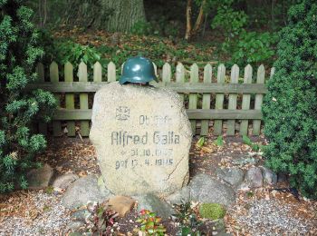
• Die Wanderungen des W12 "Dem Förster über die Schulter geschaut" führen durch ausgedehnte Wälder der Südheide, in den...
![Trail On foot Eschede - Südheide 'Im Skandinavien der Südheide' W13k (kurze Tour) - Photo](https://media.geolcdn.com/t/350/260/133ba32a-386a-43aa-bf75-d45397cbf060.jpeg&format=jpg&maxdim=2)
![On foot On foot](https://static1.geolcdn.com/sitytour/trail-icons/100.png)
Km
On foot
![](/images/other/stat-length.png)
![](https://static1.geolcdn.com/siteimages/upload/files/1508320355ic_sort_den_pos_24dp.png)
![](https://static1.geolcdn.com/siteimages/upload/files/1508320355ic_sort_den_neg_24dp.png)
![](https://static1.geolcdn.com/siteimages/upload/files/16400158638029165_repeat_loop_refresh_sync_direction_icon.png)
• Die Wanderung führt durch ausgedehnte Nadelwälder der Südheide, die mit ihrem Kieferbestand an Skandinavien erinnern....
![Trail On foot Eschede - Südheide 'Im Skandinavien der Südheide' W13l (lange Tour) - Photo](https://media.geolcdn.com/t/350/260/07e5b7c3-219f-479d-9728-cc242d341547.jpeg&format=jpg&maxdim=2)
![On foot On foot](https://static1.geolcdn.com/sitytour/trail-icons/100.png)
Km
On foot
![](/images/other/stat-length.png)
![](https://static1.geolcdn.com/siteimages/upload/files/1508320355ic_sort_den_pos_24dp.png)
![](https://static1.geolcdn.com/siteimages/upload/files/1508320355ic_sort_den_neg_24dp.png)
![](https://static1.geolcdn.com/siteimages/upload/files/16400158638029165_repeat_loop_refresh_sync_direction_icon.png)
• Die Wanderung führt durch ausgedehnte, leicht hügelige Nadelwälder der Südheide, die mit ihrem Kieferbestand an Skand...
![Trail On foot Eschede - Südheide 'Dem Förster über die Schulter geschaut' W12k (kurze Tour) - Photo](https://media.geolcdn.com/t/350/260/ext.jpg?maxdim=2&url=https%3A%2F%2Fstatic1.geolcdn.com%2Fsiteimages%2Fupload%2Ffiles%2F1545311037marcheuse_200dpi.jpg)
![On foot On foot](https://static1.geolcdn.com/sitytour/trail-icons/100.png)
Km
On foot
![](/images/other/stat-length.png)
![](https://static1.geolcdn.com/siteimages/upload/files/1508320355ic_sort_den_pos_24dp.png)
![](https://static1.geolcdn.com/siteimages/upload/files/1508320355ic_sort_den_neg_24dp.png)
![](https://static1.geolcdn.com/siteimages/upload/files/16400158638029165_repeat_loop_refresh_sync_direction_icon.png)
• Die Wanderungen des W12 "Dem Förster über die Schulter geschaut" führen durch ausgedehnte Wälder der Südheide, in den...
![Trail On foot Eschede - Südheide 'Dem Förster über die Schulter geschaut' W12m (mittlere Tour) - Photo](https://media.geolcdn.com/t/350/260/ext.jpg?maxdim=2&url=https%3A%2F%2Fstatic1.geolcdn.com%2Fsiteimages%2Fupload%2Ffiles%2F1545311037marcheuse_200dpi.jpg)
![On foot On foot](https://static1.geolcdn.com/sitytour/trail-icons/100.png)
Km
On foot
![](/images/other/stat-length.png)
![](https://static1.geolcdn.com/siteimages/upload/files/1508320355ic_sort_den_pos_24dp.png)
![](https://static1.geolcdn.com/siteimages/upload/files/1508320355ic_sort_den_neg_24dp.png)
![](https://static1.geolcdn.com/siteimages/upload/files/16400158638029165_repeat_loop_refresh_sync_direction_icon.png)
• Die Wanderungen des W12 "Dem Förster über die Schulter geschaut" führen durch ausgedehnte Wälder der Südheide, in den...
15 trails displayed on 15
FREE GPS app for hiking