![](/images/other/stat-length.png)
- Trails
- Outdoor
- Germany
- Hesse
- Landkreis Darmstadt-Dieburg
- Seeheim-Jugenheim
Seeheim-Jugenheim, Landkreis Darmstadt-Dieburg: Best trails, routes and walks
Seeheim-Jugenheim: Discover the best trails: 18 hiking trails. All these trails, routes and outdoor activities are available in our SityTrail applications for smartphones and tablets.
The best trails (18)
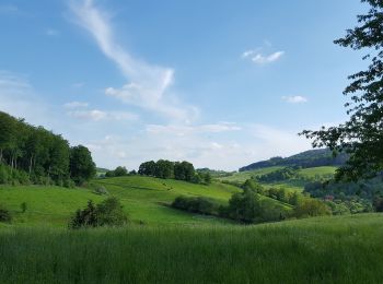
![Trail On foot Seeheim-Jugenheim - Rundwanderweg Seeheim-Jugenheim Talhof 7: Kisselsgrund-Weg - Photo](https://media.geolcdn.com/t/350/260/fb4f8fb3-e36d-4b1a-b06d-2d9c2b3bd5a3.jpeg&format=jpg&maxdim=2)
![On foot On foot](https://static1.geolcdn.com/sitytour/trail-icons/100.png)
Km
On foot
![](/images/other/stat-length.png)
![](https://static1.geolcdn.com/siteimages/upload/files/1508320355ic_sort_den_pos_24dp.png)
![](https://static1.geolcdn.com/siteimages/upload/files/1508320355ic_sort_den_neg_24dp.png)
![](https://static1.geolcdn.com/siteimages/upload/files/16400158638029165_repeat_loop_refresh_sync_direction_icon.png)
• Trail created by Geo-Naturpark Bergstraße-Odenwald. Symbol: Gelbe 7 im gelben Kreis
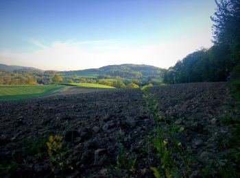
![Trail On foot Seeheim-Jugenheim - Ortsrundwanderweg Ober-Beerbach 2: Panorama Weg - Photo](https://media.geolcdn.com/t/350/260/df15baf5-8168-4b83-80ba-8ae88a9bf519.jpeg&format=jpg&maxdim=2)
![On foot On foot](https://static1.geolcdn.com/sitytour/trail-icons/100.png)
Km
On foot
![](/images/other/stat-length.png)
![](https://static1.geolcdn.com/siteimages/upload/files/1508320355ic_sort_den_pos_24dp.png)
![](https://static1.geolcdn.com/siteimages/upload/files/1508320355ic_sort_den_neg_24dp.png)
![](https://static1.geolcdn.com/siteimages/upload/files/16400158638029165_repeat_loop_refresh_sync_direction_icon.png)
• Trail created by Geo-Naturpark Bergstraße-Odenwald. Symbol: white 2 in a white circle with OB in a break at the top ...
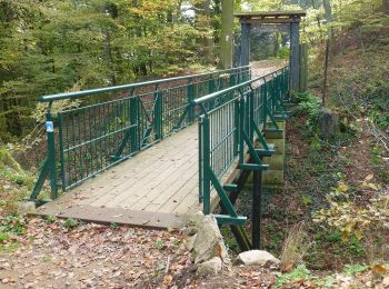
![Trail On foot Seeheim-Jugenheim - Rundwanderweg 3: Sachsenberg - Weg - Photo](https://media.geolcdn.com/t/350/260/f0c6298d-0912-422e-8a7f-d1df93980542.jpeg&format=jpg&maxdim=2)
![On foot On foot](https://static1.geolcdn.com/sitytour/trail-icons/100.png)
Km
On foot
![](/images/other/stat-length.png)
![](https://static1.geolcdn.com/siteimages/upload/files/1508320355ic_sort_den_pos_24dp.png)
![](https://static1.geolcdn.com/siteimages/upload/files/1508320355ic_sort_den_neg_24dp.png)
![](https://static1.geolcdn.com/siteimages/upload/files/16400158638029165_repeat_loop_refresh_sync_direction_icon.png)
• Trail created by Geo-Naturpark Bergstraße-Odenwald. Symbol: yellow 3 in yellow circle
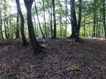
![Trail On foot Seeheim-Jugenheim - Rundwanderweg 2: Hofgrund - Weg - Photo](https://media.geolcdn.com/t/350/260/5bcebc29-94c5-4dff-b0d8-9f4af164c630.jpeg&format=jpg&maxdim=2)
![On foot On foot](https://static1.geolcdn.com/sitytour/trail-icons/100.png)
Km
On foot
![](/images/other/stat-length.png)
![](https://static1.geolcdn.com/siteimages/upload/files/1508320355ic_sort_den_pos_24dp.png)
![](https://static1.geolcdn.com/siteimages/upload/files/1508320355ic_sort_den_neg_24dp.png)
![](https://static1.geolcdn.com/siteimages/upload/files/16400158638029165_repeat_loop_refresh_sync_direction_icon.png)
• Trail created by Geo-Naturpark Bergstraße-Odenwald. Symbol: yellow 2 in yellow circle
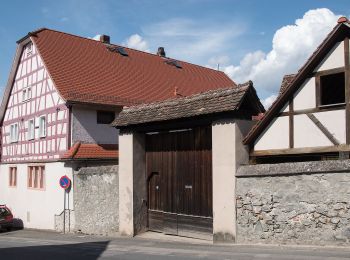
![Trail On foot Seeheim-Jugenheim - Rundwanderweg Seeheim-Jugenheim 4 - Photo](https://media.geolcdn.com/t/350/260/df77e341-97cd-4bc4-a0f8-026e4dd70876.jpeg&format=jpg&maxdim=2)
![On foot On foot](https://static1.geolcdn.com/sitytour/trail-icons/100.png)
Km
On foot
![](/images/other/stat-length.png)
![](https://static1.geolcdn.com/siteimages/upload/files/1508320355ic_sort_den_pos_24dp.png)
![](https://static1.geolcdn.com/siteimages/upload/files/1508320355ic_sort_den_neg_24dp.png)
![](https://static1.geolcdn.com/siteimages/upload/files/16400158638029165_repeat_loop_refresh_sync_direction_icon.png)
• Trail created by Geo-Naturpark Bergstraße-Odenwald. Symbol: white 4 in a white circle with SJ in a break at the top ...
![Trail On foot Seeheim-Jugenheim - Rundwanderweg Seeheim-Jugenheim Talhof 6: Goschenrod-Weg - Photo](https://media.geolcdn.com/t/350/260/fb4f8fb3-e36d-4b1a-b06d-2d9c2b3bd5a3.jpeg&format=jpg&maxdim=2)
![On foot On foot](https://static1.geolcdn.com/sitytour/trail-icons/100.png)
Km
On foot
![](/images/other/stat-length.png)
![](https://static1.geolcdn.com/siteimages/upload/files/1508320355ic_sort_den_pos_24dp.png)
![](https://static1.geolcdn.com/siteimages/upload/files/1508320355ic_sort_den_neg_24dp.png)
![](https://static1.geolcdn.com/siteimages/upload/files/16400158638029165_repeat_loop_refresh_sync_direction_icon.png)
• Trail created by Geo-Naturpark Bergstraße-Odenwald. Symbol: yellow 6 in yellow circle
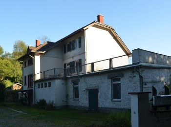
![Trail On foot Seeheim-Jugenheim - Rundwanderweg Seeheim-Jugenheim Nonnenbrunnen 3: Balkhäuser-Tal-Weg - Photo](https://media.geolcdn.com/t/350/260/1d3b42cb-87df-4346-900d-5d4fb7673406.jpeg&format=jpg&maxdim=2)
![On foot On foot](https://static1.geolcdn.com/sitytour/trail-icons/100.png)
Km
On foot
![](/images/other/stat-length.png)
![](https://static1.geolcdn.com/siteimages/upload/files/1508320355ic_sort_den_pos_24dp.png)
![](https://static1.geolcdn.com/siteimages/upload/files/1508320355ic_sort_den_neg_24dp.png)
![](https://static1.geolcdn.com/siteimages/upload/files/16400158638029165_repeat_loop_refresh_sync_direction_icon.png)
• Trail created by Geo-Naturpark Bergstraße-Odenwald. Symbol: Gelbe 3 im gelben Kreis
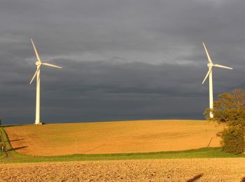
![Trail On foot Seeheim-Jugenheim - Ortsrundwanderweg Ober-Beerbach 1: Rund um die Neutscher Höhe - Photo](https://media.geolcdn.com/t/350/260/9e0193bf-5576-420d-9d8d-c44f24bb4204.jpeg&format=jpg&maxdim=2)
![On foot On foot](https://static1.geolcdn.com/sitytour/trail-icons/100.png)
Km
On foot
![](/images/other/stat-length.png)
![](https://static1.geolcdn.com/siteimages/upload/files/1508320355ic_sort_den_pos_24dp.png)
![](https://static1.geolcdn.com/siteimages/upload/files/1508320355ic_sort_den_neg_24dp.png)
![](https://static1.geolcdn.com/siteimages/upload/files/16400158638029165_repeat_loop_refresh_sync_direction_icon.png)
• Trail created by Geo-Naturpark Bergstraße-Odenwald. Symbol: white 1 in a white circle with OB in a break at the top ...
![Trail On foot Seeheim-Jugenheim - Rundwanderweg Seeheim-Jugenheim 1 - Photo](https://media.geolcdn.com/t/350/260/f0c6298d-0912-422e-8a7f-d1df93980542.jpeg&format=jpg&maxdim=2)
![On foot On foot](https://static1.geolcdn.com/sitytour/trail-icons/100.png)
Km
On foot
![](/images/other/stat-length.png)
![](https://static1.geolcdn.com/siteimages/upload/files/1508320355ic_sort_den_pos_24dp.png)
![](https://static1.geolcdn.com/siteimages/upload/files/1508320355ic_sort_den_neg_24dp.png)
![](https://static1.geolcdn.com/siteimages/upload/files/16400158638029165_repeat_loop_refresh_sync_direction_icon.png)
• Trail created by Geo-Naturpark Bergstraße-Odenwald. Symbol: white 1 in a white circle with SJ in a break at the top ...
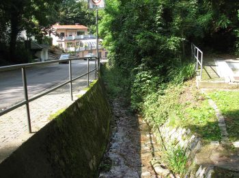
![Trail On foot Seeheim-Jugenheim - Rundwanderweg Alsbach-Hähnlein Sperbergrund 8: Jossa-Weg - Photo](https://media.geolcdn.com/t/350/260/8d73ab9b-11ce-49e1-86db-69d3d4347c79.jpeg&format=jpg&maxdim=2)
![On foot On foot](https://static1.geolcdn.com/sitytour/trail-icons/100.png)
Km
On foot
![](/images/other/stat-length.png)
![](https://static1.geolcdn.com/siteimages/upload/files/1508320355ic_sort_den_pos_24dp.png)
![](https://static1.geolcdn.com/siteimages/upload/files/1508320355ic_sort_den_neg_24dp.png)
![](https://static1.geolcdn.com/siteimages/upload/files/16400158638029165_repeat_loop_refresh_sync_direction_icon.png)
• Trail created by Geo-Naturpark Bergstraße-Odenwald. Symbol: yellow 8 in yellow circle
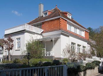
![Trail On foot Seeheim-Jugenheim - Rundwanderweg Seeheim-Jugenheim Friedensquelle 6: Galgen-Weg - Photo](https://media.geolcdn.com/t/350/260/4ba5fe0f-0c30-4380-b084-3451d3bc5ff9.jpeg&format=jpg&maxdim=2)
![On foot On foot](https://static1.geolcdn.com/sitytour/trail-icons/100.png)
Km
On foot
![](/images/other/stat-length.png)
![](https://static1.geolcdn.com/siteimages/upload/files/1508320355ic_sort_den_pos_24dp.png)
![](https://static1.geolcdn.com/siteimages/upload/files/1508320355ic_sort_den_neg_24dp.png)
![](https://static1.geolcdn.com/siteimages/upload/files/16400158638029165_repeat_loop_refresh_sync_direction_icon.png)
• Trail created by Geo-Naturpark Bergstraße-Odenwald. Symbol: yellow 6 in yellow circle
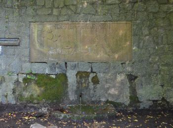
![Trail On foot Seeheim-Jugenheim - Rundwanderweg Seeheim-Jugenheim Friedensquelle 5: Tannenberg-Weg - Photo](https://media.geolcdn.com/t/350/260/c9b3dfc9-0ae0-4a8e-ad09-c0fbd81f9d0b.jpeg&format=jpg&maxdim=2)
![On foot On foot](https://static1.geolcdn.com/sitytour/trail-icons/100.png)
Km
On foot
![](/images/other/stat-length.png)
![](https://static1.geolcdn.com/siteimages/upload/files/1508320355ic_sort_den_pos_24dp.png)
![](https://static1.geolcdn.com/siteimages/upload/files/1508320355ic_sort_den_neg_24dp.png)
![](https://static1.geolcdn.com/siteimages/upload/files/16400158638029165_repeat_loop_refresh_sync_direction_icon.png)
• Trail created by Geo-Naturpark Bergstraße-Odenwald. Symbol: yellow 5 in yellow circle
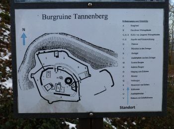
![Trail On foot Seeheim-Jugenheim - Ortsrundwanderweg Ober-Beerbach 3: Bannwald Weg - Photo](https://media.geolcdn.com/t/350/260/0679ddfb-a925-4c45-8240-acc013d30c5b.jpeg&format=jpg&maxdim=2)
![On foot On foot](https://static1.geolcdn.com/sitytour/trail-icons/100.png)
Km
On foot
![](/images/other/stat-length.png)
![](https://static1.geolcdn.com/siteimages/upload/files/1508320355ic_sort_den_pos_24dp.png)
![](https://static1.geolcdn.com/siteimages/upload/files/1508320355ic_sort_den_neg_24dp.png)
![](https://static1.geolcdn.com/siteimages/upload/files/16400158638029165_repeat_loop_refresh_sync_direction_icon.png)
• Trail created by Geo-Naturpark Bergstraße-Odenwald. Symbol: white 3 in a white circle with OB in a break at the top ...
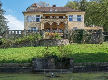
![Trail On foot Seeheim-Jugenheim - Lufthansa Wanderweg 2 - Photo](https://media.geolcdn.com/t/350/260/a2161074-be21-4440-9220-9662c2885051.jpeg&format=jpg&maxdim=2)
![On foot On foot](https://static1.geolcdn.com/sitytour/trail-icons/100.png)
Km
On foot
![](/images/other/stat-length.png)
![](https://static1.geolcdn.com/siteimages/upload/files/1508320355ic_sort_den_pos_24dp.png)
![](https://static1.geolcdn.com/siteimages/upload/files/1508320355ic_sort_den_neg_24dp.png)
![](https://static1.geolcdn.com/siteimages/upload/files/16400158638029165_repeat_loop_refresh_sync_direction_icon.png)
• Trail created by Geo-Naturpark Bergstraße-Odenwald. Symbol: blue with a yellow 2 in a yellow circle with LH in a bre...
![Trail On foot Seeheim-Jugenheim - Lufthansa Wanderweg 1 - Photo](https://media.geolcdn.com/t/350/260/c9b3dfc9-0ae0-4a8e-ad09-c0fbd81f9d0b.jpeg&format=jpg&maxdim=2)
![On foot On foot](https://static1.geolcdn.com/sitytour/trail-icons/100.png)
Km
On foot
![](/images/other/stat-length.png)
![](https://static1.geolcdn.com/siteimages/upload/files/1508320355ic_sort_den_pos_24dp.png)
![](https://static1.geolcdn.com/siteimages/upload/files/1508320355ic_sort_den_neg_24dp.png)
![](https://static1.geolcdn.com/siteimages/upload/files/16400158638029165_repeat_loop_refresh_sync_direction_icon.png)
• Trail created by Geo-Naturpark Bergstraße-Odenwald. Symbol: blue with a yellow 1 in a yellow circle with LH in a bre...
![Trail On foot Seeheim-Jugenheim - Rundwanderweg Seeheim-Jugenheim 3 - Photo](https://media.geolcdn.com/t/350/260/4e034831-b671-4be2-b2dc-10a182cf7697.jpeg&format=jpg&maxdim=2)
![On foot On foot](https://static1.geolcdn.com/sitytour/trail-icons/100.png)
Km
On foot
![](/images/other/stat-length.png)
![](https://static1.geolcdn.com/siteimages/upload/files/1508320355ic_sort_den_pos_24dp.png)
![](https://static1.geolcdn.com/siteimages/upload/files/1508320355ic_sort_den_neg_24dp.png)
![](https://static1.geolcdn.com/siteimages/upload/files/16400158638029165_repeat_loop_refresh_sync_direction_icon.png)
• Trail created by Geo-Naturpark Bergstraße-Odenwald. Symbol: white 3 in a white circle with SJ in a break at the top ...
![Trail On foot Seeheim-Jugenheim - Rundwanderweg Seeheim-Jugenheim Friedensquelle 4: Kühlkopf-Weg - Photo](https://media.geolcdn.com/t/350/260/c9b3dfc9-0ae0-4a8e-ad09-c0fbd81f9d0b.jpeg&format=jpg&maxdim=2)
![On foot On foot](https://static1.geolcdn.com/sitytour/trail-icons/100.png)
Km
On foot
![](/images/other/stat-length.png)
![](https://static1.geolcdn.com/siteimages/upload/files/1508320355ic_sort_den_pos_24dp.png)
![](https://static1.geolcdn.com/siteimages/upload/files/1508320355ic_sort_den_neg_24dp.png)
![](https://static1.geolcdn.com/siteimages/upload/files/16400158638029165_repeat_loop_refresh_sync_direction_icon.png)
• Trail created by Geo-Naturpark Bergstraße-Odenwald. Symbol: yellow 4 in yellow circle
![Trail On foot Seeheim-Jugenheim - Rundwanderweg Seeheim-Jugenheim Klingenwald 4 - Photo](https://media.geolcdn.com/t/350/260/ext.jpg?maxdim=2&url=https%3A%2F%2Fstatic1.geolcdn.com%2Fsiteimages%2Fupload%2Ffiles%2F1545311037marcheuse_200dpi.jpg)
![On foot On foot](https://static1.geolcdn.com/sitytour/trail-icons/100.png)
Km
On foot
![](/images/other/stat-length.png)
![](https://static1.geolcdn.com/siteimages/upload/files/1508320355ic_sort_den_pos_24dp.png)
![](https://static1.geolcdn.com/siteimages/upload/files/1508320355ic_sort_den_neg_24dp.png)
![](https://static1.geolcdn.com/siteimages/upload/files/16400158638029165_repeat_loop_refresh_sync_direction_icon.png)
• Trail created by Geo-Naturpark Bergstraße-Odenwald. Symbol: yellow 4 in yellow circle
18 trails displayed on 18
FREE GPS app for hiking