![](/images/other/stat-length.png)
- Trails
- Outdoor
- Germany
- Hesse
- Werra-Meißner-Kreis
- Waldkappel
Waldkappel, Werra-Meißner-Kreis: Best trails, routes and walks
Waldkappel: Discover the best trails: 3 hiking trails. All these trails, routes and outdoor activities are available in our SityTrail applications for smartphones and tablets.
The best trails (3)
![Trail On foot Waldkappel - Premiumweg P17 Waldkappeler Berge - Photo](https://media.geolcdn.com/t/350/260/ext.jpg?maxdim=2&url=https%3A%2F%2Fmedia.geolcdn.com%2Ff%2Fa8400b31-1405-4dce-9ab9-05316836d4cd.jpeg)
![On foot On foot](https://static1.geolcdn.com/sitytour/trail-icons/100.png)
Km
#1 - Premiumweg P17 Waldkappeler Berge
On foot
Medium
Waldkappel,
Hesse,
Werra-Meißner-Kreis,
Germany
![](/images/other/stat-length.png)
17.8 km | 26 km-effort
5h 59min
![](https://static1.geolcdn.com/siteimages/upload/files/1508320355ic_sort_den_pos_24dp.png)
643 m
![](https://static1.geolcdn.com/siteimages/upload/files/1508320355ic_sort_den_neg_24dp.png)
627 m
![](https://static1.geolcdn.com/siteimages/upload/files/16400158638029165_repeat_loop_refresh_sync_direction_icon.png)
Yes
SityTrail - itinéraires balisés pédestres
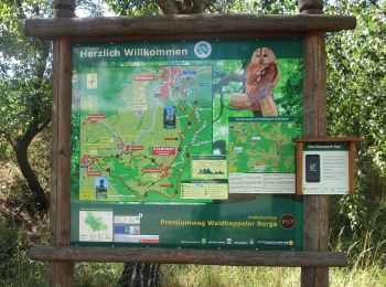
• Trail created by Werratalverein. Symbol: gelbe P17 auf grünem Grund
![Trail On foot Waldkappel - Rundweg Ziegenküppel - Photo](https://media.geolcdn.com/t/350/260/ext.jpg?maxdim=2&url=https%3A%2F%2Fmedia.geolcdn.com%2Ff%2Fa8400b31-1405-4dce-9ab9-05316836d4cd.jpeg)
![On foot On foot](https://static1.geolcdn.com/sitytour/trail-icons/100.png)
Km
#2 - Rundweg Ziegenküppel
On foot
Easy
Waldkappel,
Hesse,
Werra-Meißner-Kreis,
Germany
![](/images/other/stat-length.png)
7.5 km | 10.8 km-effort
2h 26min
![](https://static1.geolcdn.com/siteimages/upload/files/1508320355ic_sort_den_pos_24dp.png)
247 m
![](https://static1.geolcdn.com/siteimages/upload/files/1508320355ic_sort_den_neg_24dp.png)
247 m
![](https://static1.geolcdn.com/siteimages/upload/files/16400158638029165_repeat_loop_refresh_sync_direction_icon.png)
Yes
SityTrail - itinéraires balisés pédestres
• Wanderweg ist vom Parkplatz Rechtebach bis Beginn Rundweg 2 nicht ausgeschildert
![Trail On foot Waldkappel - Rundweg Centbuche - Photo](https://media.geolcdn.com/t/350/260/ext.jpg?maxdim=2&url=https%3A%2F%2Fstatic1.geolcdn.com%2Fsiteimages%2Fupload%2Ffiles%2F1545311037marcheuse_200dpi.jpg)
![On foot On foot](https://static1.geolcdn.com/sitytour/trail-icons/100.png)
Km
#3 - Rundweg Centbuche
On foot
Easy
Waldkappel,
Hesse,
Werra-Meißner-Kreis,
Germany
![](/images/other/stat-length.png)
3.1 km | 5.2 km-effort
1h 10min
![](https://static1.geolcdn.com/siteimages/upload/files/1508320355ic_sort_den_pos_24dp.png)
154 m
![](https://static1.geolcdn.com/siteimages/upload/files/1508320355ic_sort_den_neg_24dp.png)
160 m
![](https://static1.geolcdn.com/siteimages/upload/files/16400158638029165_repeat_loop_refresh_sync_direction_icon.png)
Yes
SityTrail - itinéraires balisés pédestres
3 trails displayed on 3
FREE GPS app for hiking