


12 km | 15.4 km-effort
Gutsbezirk Reinhardswald: Discover the best trails: 15 hiking trails. All these trails, routes and outdoor activities are available in our SityTrail applications for smartphones and tablets.
On foot


• Die Eco Pfade im Landkreis Kassel sollen dazu anregen, sich mit der Geschichte der Region zu beschäftigen, Zeugen der...
On foot
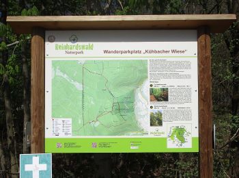
• Trail created by Naturpark Reinhardswald. Website: https://www.tourinfra.com/geocFramework_np_reinhardswald_leafle...
On foot
• Trail created by Hessisch-Waldeckischer Gebirgs- und Heimatverein(HWGHV).
On foot
• Website: https://www.tourinfra.com/geocFramework_np_reinhardswald_leaflet/samples/details.php?id=113969
On foot
On foot
On foot
• Trail created by Naturpark Reinhardswald. Website: https://www.tourinfra.com/geocFramework_np_reinhardswald_leafle...

On foot
• Die Eco Pfade im Landkreis Kassel sollen dazu anregen, sich mit der Geschichte der Region zu beschäftigen, Zeugen der...
On foot
• Die Eco Pfade im Landkreis Kassel sollen dazu anregen, sich mit der Geschichte der Region zu beschäftigen, Zeugen der...
On foot
• Mystische Hute-Eichen, weite Buchenwälder und die Flüsse Weser, Fulda und Diemel verzaubern die Besucher im Naturpark...
On foot
On foot
On foot
On foot
On foot
15 trails displayed on 15
FREE GPS app for hiking
 SityTrail
IGN / Geographical institutes
SityTrail World
The world is yours!