![](/images/other/stat-length.png)
- Trails
- Outdoor
- Germany
- Rhineland-Palatinate
- Landkreis Mainz-Bingen
Landkreis Mainz-Bingen, Rhineland-Palatinate: Best trails, routes and walks
Landkreis Mainz-Bingen: Discover the best trails: 53 hiking trails. All these trails, routes and outdoor activities are available in our SityTrail applications for smartphones and tablets.
The best trails (53)
![Trail On foot Bingen am Rhein - Schönhölle Spelzenberg - Photo](https://media.geolcdn.com/t/350/260/aebd98b5-bd26-4cfe-a768-0233ed14c752.jpeg&format=jpg&maxdim=2)
![On foot On foot](https://static1.geolcdn.com/sitytour/trail-icons/100.png)
Km
On foot
![](/images/other/stat-length.png)
![](https://static1.geolcdn.com/siteimages/upload/files/1508320355ic_sort_den_pos_24dp.png)
![](https://static1.geolcdn.com/siteimages/upload/files/1508320355ic_sort_den_neg_24dp.png)
![](https://static1.geolcdn.com/siteimages/upload/files/16400158638029165_repeat_loop_refresh_sync_direction_icon.png)
• Trail created by Gemeindeverwaltung Ockenheim. Symbol: Grün Logo Ockenheim mit Aufschrift Rundweg Schönhölle Spelzen...
![Trail On foot Ockenheim - Generationenweg - Photo](https://media.geolcdn.com/t/350/260/61dae334-bc68-4664-87ce-cbe8bf1a4704.jpeg&format=jpg&maxdim=2)
![On foot On foot](https://static1.geolcdn.com/sitytour/trail-icons/100.png)
Km
On foot
![](/images/other/stat-length.png)
![](https://static1.geolcdn.com/siteimages/upload/files/1508320355ic_sort_den_pos_24dp.png)
![](https://static1.geolcdn.com/siteimages/upload/files/1508320355ic_sort_den_neg_24dp.png)
![](https://static1.geolcdn.com/siteimages/upload/files/16400158638029165_repeat_loop_refresh_sync_direction_icon.png)
• Trail created by Gemeindeverwaltung Ockenheim. Symbol: Blau Logo Ockenheim mit Aufschrift Rundweg Generationenweg
![Trail On foot Ockenheim - Scharfes Gericht - Photo](https://media.geolcdn.com/t/350/260/61dae334-bc68-4664-87ce-cbe8bf1a4704.jpeg&format=jpg&maxdim=2)
![On foot On foot](https://static1.geolcdn.com/sitytour/trail-icons/100.png)
Km
On foot
![](/images/other/stat-length.png)
![](https://static1.geolcdn.com/siteimages/upload/files/1508320355ic_sort_den_pos_24dp.png)
![](https://static1.geolcdn.com/siteimages/upload/files/1508320355ic_sort_den_neg_24dp.png)
![](https://static1.geolcdn.com/siteimages/upload/files/16400158638029165_repeat_loop_refresh_sync_direction_icon.png)
• Trail created by Gemeindeverwaltung Ockenheim. Symbol: Orange Logo Ockenheim mit Aufschrift Rundweg Scharfes Gericht
![Trail On foot Ingelheim am Rhein - Kaiserpfalzweg - Photo](https://media.geolcdn.com/t/350/260/fce84757-c52f-41cd-87c3-4d4da52e38d6.jpeg&format=jpg&maxdim=2)
![On foot On foot](https://static1.geolcdn.com/sitytour/trail-icons/100.png)
Km
On foot
![](/images/other/stat-length.png)
![](https://static1.geolcdn.com/siteimages/upload/files/1508320355ic_sort_den_pos_24dp.png)
![](https://static1.geolcdn.com/siteimages/upload/files/1508320355ic_sort_den_neg_24dp.png)
![](https://static1.geolcdn.com/siteimages/upload/files/16400158638029165_repeat_loop_refresh_sync_direction_icon.png)
• Trail created by Stadt Ingelheim. Symbol: Violette Markierung mit Kaiserkrone
![Trail On foot Zornheim - Hiwweltour Zornheimer Berg - Photo](https://media.geolcdn.com/t/350/260/df97a525-789e-43e2-8e9c-e190eea16e11.jpeg&format=jpg&maxdim=2)
![On foot On foot](https://static1.geolcdn.com/sitytour/trail-icons/100.png)
Km
On foot
![](/images/other/stat-length.png)
![](https://static1.geolcdn.com/siteimages/upload/files/1508320355ic_sort_den_pos_24dp.png)
![](https://static1.geolcdn.com/siteimages/upload/files/1508320355ic_sort_den_neg_24dp.png)
![](https://static1.geolcdn.com/siteimages/upload/files/16400158638029165_repeat_loop_refresh_sync_direction_icon.png)
• Trail created by Rheinhessen-Touristik GmbH. Symbol: kleines Schreibschrift-h auf blau-grünem Grund
![Trail On foot Gau-Algesheim - Gau-Algesheim: Rundweg Rabenschule - Photo](https://media.geolcdn.com/t/350/260/ca85e123-7982-43a9-a7b9-cf5438cdde51.jpeg&format=jpg&maxdim=2)
![On foot On foot](https://static1.geolcdn.com/sitytour/trail-icons/100.png)
Km
On foot
![](/images/other/stat-length.png)
![](https://static1.geolcdn.com/siteimages/upload/files/1508320355ic_sort_den_pos_24dp.png)
![](https://static1.geolcdn.com/siteimages/upload/files/1508320355ic_sort_den_neg_24dp.png)
![](https://static1.geolcdn.com/siteimages/upload/files/16400158638029165_repeat_loop_refresh_sync_direction_icon.png)
• Symbol: weißes Schild mit schwarzem Rahmen, darin schwarzer, nach links schauender Rabe im Profil, darunter 2-zeilig ...
![Trail On foot Appenheim - Appenheim: 7-Quellenweg - Photo](https://media.geolcdn.com/t/350/260/ea6e14d4-4768-4e66-812e-25c56d02cbc0.jpeg&format=jpg&maxdim=2)
![On foot On foot](https://static1.geolcdn.com/sitytour/trail-icons/100.png)
Km
On foot
![](/images/other/stat-length.png)
![](https://static1.geolcdn.com/siteimages/upload/files/1508320355ic_sort_den_pos_24dp.png)
![](https://static1.geolcdn.com/siteimages/upload/files/1508320355ic_sort_den_neg_24dp.png)
![](https://static1.geolcdn.com/siteimages/upload/files/16400158638029165_repeat_loop_refresh_sync_direction_icon.png)
• Symbol: Weißes Schild, daruaf Ziffer 7 in schwarz, umrundet von 7 blauen Punkten, darunter eine blaue, doppelte Welle...
![Trail On foot Ingelheim am Rhein - Weinmeile - Photo](https://media.geolcdn.com/t/350/260/4accd213-898c-47e0-aedf-5ca5e51d22f5.jpeg&format=jpg&maxdim=2)
![On foot On foot](https://static1.geolcdn.com/sitytour/trail-icons/100.png)
Km
On foot
![](/images/other/stat-length.png)
![](https://static1.geolcdn.com/siteimages/upload/files/1508320355ic_sort_den_pos_24dp.png)
![](https://static1.geolcdn.com/siteimages/upload/files/1508320355ic_sort_den_neg_24dp.png)
![](https://static1.geolcdn.com/siteimages/upload/files/16400158638029165_repeat_loop_refresh_sync_direction_icon.png)
• Symbol: grünes Irgendwas mit rechtsseitig im Dreieck, Spitze nach links, angeordneten 6 roten Tupfen, vermutlich rote...
![Trail On foot Oberheimbach - Oberheimbach Panoramaweg - Photo](https://media.geolcdn.com/t/350/260/69ecfca3-9b8c-484e-a109-480d6d16b470.jpeg&format=jpg&maxdim=2)
![On foot On foot](https://static1.geolcdn.com/sitytour/trail-icons/100.png)
Km
On foot
![](/images/other/stat-length.png)
![](https://static1.geolcdn.com/siteimages/upload/files/1508320355ic_sort_den_pos_24dp.png)
![](https://static1.geolcdn.com/siteimages/upload/files/1508320355ic_sort_den_neg_24dp.png)
![](https://static1.geolcdn.com/siteimages/upload/files/16400158638029165_repeat_loop_refresh_sync_direction_icon.png)
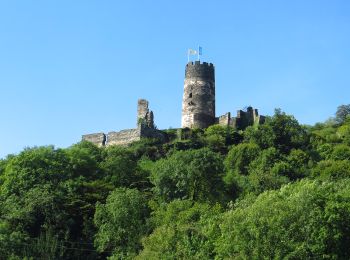
• Symbol: Burg in grüner Hügellandschaft vor blauem Fluß
![Trail On foot Ingelheim am Rhein - Wanderweg Mainzer Berg - Photo](https://media.geolcdn.com/t/350/260/b2dea8bf-12a6-4c90-89f4-3306a67cdad5.jpeg&format=jpg&maxdim=2)
![On foot On foot](https://static1.geolcdn.com/sitytour/trail-icons/100.png)
Km
On foot
![](/images/other/stat-length.png)
![](https://static1.geolcdn.com/siteimages/upload/files/1508320355ic_sort_den_pos_24dp.png)
![](https://static1.geolcdn.com/siteimages/upload/files/1508320355ic_sort_den_neg_24dp.png)
![](https://static1.geolcdn.com/siteimages/upload/files/16400158638029165_repeat_loop_refresh_sync_direction_icon.png)
• Trail created by Ingelheim am Rhein. Symbol: weißes Schild mit braunem Rahmen und symbolischem Apfel in rot und Grün
![Trail On foot Ingelheim am Rhein - Panoramaweg - Photo](https://media.geolcdn.com/t/350/260/b2dea8bf-12a6-4c90-89f4-3306a67cdad5.jpeg&format=jpg&maxdim=2)
![On foot On foot](https://static1.geolcdn.com/sitytour/trail-icons/100.png)
Km
On foot
![](/images/other/stat-length.png)
![](https://static1.geolcdn.com/siteimages/upload/files/1508320355ic_sort_den_pos_24dp.png)
![](https://static1.geolcdn.com/siteimages/upload/files/1508320355ic_sort_den_neg_24dp.png)
![](https://static1.geolcdn.com/siteimages/upload/files/16400158638029165_repeat_loop_refresh_sync_direction_icon.png)
• Trail created by Ingelheim am Rhein. Symbol: weißes Schild mit rotem Rahmen, darin ein schwarzer Kirchengrundriss
![Trail On foot Oberdiebach - RheinBurgenWeg Rundtour - Schellengang - Photo](https://media.geolcdn.com/t/350/260/ab1c5980-3609-4345-84e0-20fc2d09d28e.jpeg&format=jpg&maxdim=2)
![On foot On foot](https://static1.geolcdn.com/sitytour/trail-icons/100.png)
Km
On foot
![](/images/other/stat-length.png)
![](https://static1.geolcdn.com/siteimages/upload/files/1508320355ic_sort_den_pos_24dp.png)
![](https://static1.geolcdn.com/siteimages/upload/files/1508320355ic_sort_den_neg_24dp.png)
![](https://static1.geolcdn.com/siteimages/upload/files/16400158638029165_repeat_loop_refresh_sync_direction_icon.png)
• Symbol: weiß auf rot: von den Zinnen eines Burgturmes gekröntes R
![Trail On foot Appenheim - Appenheim: Panoramaweg - Photo](https://media.geolcdn.com/t/350/260/454466a3-386a-45d7-a5e7-da121bcbe225.jpeg&format=jpg&maxdim=2)
![On foot On foot](https://static1.geolcdn.com/sitytour/trail-icons/100.png)
Km
On foot
![](/images/other/stat-length.png)
![](https://static1.geolcdn.com/siteimages/upload/files/1508320355ic_sort_den_pos_24dp.png)
![](https://static1.geolcdn.com/siteimages/upload/files/1508320355ic_sort_den_neg_24dp.png)
![](https://static1.geolcdn.com/siteimages/upload/files/16400158638029165_repeat_loop_refresh_sync_direction_icon.png)
• Symbol: weißes Schild mit oranger Sonne über 3 roten Dächern (davon 1 Kirche) und grünen Hügeln. Darunter schwarzer T...
![Trail On foot Gau-Algesheim - Gau-Algesheim: Dreibächeweg - Photo](https://media.geolcdn.com/t/350/260/9443a4b9-c146-4f82-b83a-f1fe6729c76f.jpeg&format=jpg&maxdim=2)
![On foot On foot](https://static1.geolcdn.com/sitytour/trail-icons/100.png)
Km
On foot
![](/images/other/stat-length.png)
![](https://static1.geolcdn.com/siteimages/upload/files/1508320355ic_sort_den_pos_24dp.png)
![](https://static1.geolcdn.com/siteimages/upload/files/1508320355ic_sort_den_neg_24dp.png)
![](https://static1.geolcdn.com/siteimages/upload/files/16400158638029165_repeat_loop_refresh_sync_direction_icon.png)
• Symbol: weißes Schild, der Rest hellblau: Rahmen, oben ein 2-Zeiliger Text "Dreibäche-" und darunter "weg", im untere...
![Trail On foot Nieder-Olm - Nordic Walking Nieder-Olm Nr. 6 - Photo](https://media.geolcdn.com/t/350/260/4f877ad0-4ef8-40ba-ad20-1c1b38adc4c7.jpeg&format=jpg&maxdim=2)
![On foot On foot](https://static1.geolcdn.com/sitytour/trail-icons/100.png)
Km
On foot
![](/images/other/stat-length.png)
![](https://static1.geolcdn.com/siteimages/upload/files/1508320355ic_sort_den_pos_24dp.png)
![](https://static1.geolcdn.com/siteimages/upload/files/1508320355ic_sort_den_neg_24dp.png)
![](https://static1.geolcdn.com/siteimages/upload/files/16400158638029165_repeat_loop_refresh_sync_direction_icon.png)
• Trail created by Verbandsgemeinde Nieder-Olm. Symbol: Nordic Walkingwegweiser mit Nr. 6 auf schwarzem Grund
![Trail On foot Nieder-Olm - Nordic Walking Nieder-Olm Nr. 5 - Photo](https://media.geolcdn.com/t/350/260/63b79289-74ac-45f9-9b15-6214460ea3d0.jpeg&format=jpg&maxdim=2)
![On foot On foot](https://static1.geolcdn.com/sitytour/trail-icons/100.png)
Km
On foot
![](/images/other/stat-length.png)
![](https://static1.geolcdn.com/siteimages/upload/files/1508320355ic_sort_den_pos_24dp.png)
![](https://static1.geolcdn.com/siteimages/upload/files/1508320355ic_sort_den_neg_24dp.png)
![](https://static1.geolcdn.com/siteimages/upload/files/16400158638029165_repeat_loop_refresh_sync_direction_icon.png)
• Trail created by Verbandsgemeinde Nieder-Olm. Symbol: Nordic Walkingwegweiser mit Nr. 5
![Trail On foot Nieder-Olm - Nordic Walking Sörgenloch Nr. 4 - Photo](https://media.geolcdn.com/t/350/260/4f877ad0-4ef8-40ba-ad20-1c1b38adc4c7.jpeg&format=jpg&maxdim=2)
![On foot On foot](https://static1.geolcdn.com/sitytour/trail-icons/100.png)
Km
On foot
![](/images/other/stat-length.png)
![](https://static1.geolcdn.com/siteimages/upload/files/1508320355ic_sort_den_pos_24dp.png)
![](https://static1.geolcdn.com/siteimages/upload/files/1508320355ic_sort_den_neg_24dp.png)
![](https://static1.geolcdn.com/siteimages/upload/files/16400158638029165_repeat_loop_refresh_sync_direction_icon.png)
• Trail created by Verbandsgemeinde Nieder-Olm. Symbol: Nordic Walkingwegweiser mit Nr. 4
![Trail On foot Zornheim - Nordic Walking Zornheim Nr. 3 - Photo](https://media.geolcdn.com/t/350/260/df97a525-789e-43e2-8e9c-e190eea16e11.jpeg&format=jpg&maxdim=2)
![On foot On foot](https://static1.geolcdn.com/sitytour/trail-icons/100.png)
Km
On foot
![](/images/other/stat-length.png)
![](https://static1.geolcdn.com/siteimages/upload/files/1508320355ic_sort_den_pos_24dp.png)
![](https://static1.geolcdn.com/siteimages/upload/files/1508320355ic_sort_den_neg_24dp.png)
![](https://static1.geolcdn.com/siteimages/upload/files/16400158638029165_repeat_loop_refresh_sync_direction_icon.png)
• Trail created by Gemeinde Zornheim.
![Trail On foot Zornheim - Nordic Walking Zornheim Nr. 2 - Photo](https://media.geolcdn.com/t/350/260/ec2f7315-9175-4f2f-9b0f-017f43864c1e.jpeg&format=jpg&maxdim=2)
![On foot On foot](https://static1.geolcdn.com/sitytour/trail-icons/100.png)
Km
On foot
![](/images/other/stat-length.png)
![](https://static1.geolcdn.com/siteimages/upload/files/1508320355ic_sort_den_pos_24dp.png)
![](https://static1.geolcdn.com/siteimages/upload/files/1508320355ic_sort_den_neg_24dp.png)
![](https://static1.geolcdn.com/siteimages/upload/files/16400158638029165_repeat_loop_refresh_sync_direction_icon.png)
• Trail created by Gemeinde Zornheim.
![Trail On foot Zornheim - Nordic Walking Zornheim Nr. 1 - Photo](https://media.geolcdn.com/t/350/260/df97a525-789e-43e2-8e9c-e190eea16e11.jpeg&format=jpg&maxdim=2)
![On foot On foot](https://static1.geolcdn.com/sitytour/trail-icons/100.png)
Km
On foot
![](/images/other/stat-length.png)
![](https://static1.geolcdn.com/siteimages/upload/files/1508320355ic_sort_den_pos_24dp.png)
![](https://static1.geolcdn.com/siteimages/upload/files/1508320355ic_sort_den_neg_24dp.png)
![](https://static1.geolcdn.com/siteimages/upload/files/16400158638029165_repeat_loop_refresh_sync_direction_icon.png)
• Trail created by Gemeinde Zornheim.
20 trails displayed on 53
FREE GPS app for hiking
Activities
Nearby regions
- Appenheim
- Bacharach
- Bingen am Rhein
- Gau-Algesheim
- Gau-Bischofsheim
- Ingelheim am Rhein
- Jugenheim
- Klein-Winternheim
- Lörzweiler
- Nackenheim
- Nieder-Olm
- Niederheimbach
- Nierstein
- Oberdiebach
- Oberheimbach
- Ockenheim
- Schwabenheim an der Selz
- Stadecken-Elsheim
- Trechtingshausen
- Waldalgesheim
- Weiler bei Bingen
- Zornheim