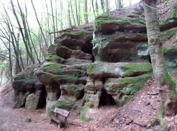
![](/images/other/stat-length.png)
- Trails
- Outdoor
- Germany
- Saarland
- Saarpfalz-Kreis
- Blieskastel
- Blieskastel
Blieskastel, Blieskastel: Best trails, routes and walks
Blieskastel: Discover the best trails: 7 hiking trails. All these trails, routes and outdoor activities are available in our SityTrail applications for smartphones and tablets.
The best trails (7)
![Trail On foot Blieskastel - Erlebnisweg](https://media.geolcdn.com/t/350/260/ce79857c-ba71-4dc2-b57a-e23652e6ffb4.jpeg&format=jpg&maxdim=2)
![On foot On foot](https://static1.geolcdn.com/sitytour/trail-icons/100.png)
Km
On foot
![](/images/other/stat-length.png)
![](https://static1.geolcdn.com/siteimages/upload/files/1508320355ic_sort_den_pos_24dp.png)
![](https://static1.geolcdn.com/siteimages/upload/files/1508320355ic_sort_den_neg_24dp.png)
![](https://static1.geolcdn.com/siteimages/upload/files/16400158638029165_repeat_loop_refresh_sync_direction_icon.png)
• Website: https://www.biosphaere-bliesgau.eu/index.php/de/bildung-und-forschung/erlebnisregion-bliesgau/erlebnisweg-...
![Trail On foot Blieskastel - Mariannenweg - Photo](https://media.geolcdn.com/t/350/260/70f9901f-1c2b-4386-acf8-e2d9d316f39d.jpeg&format=jpg&maxdim=2)
![On foot On foot](https://static1.geolcdn.com/sitytour/trail-icons/100.png)
Km
On foot
![](/images/other/stat-length.png)
![](https://static1.geolcdn.com/siteimages/upload/files/1508320355ic_sort_den_pos_24dp.png)
![](https://static1.geolcdn.com/siteimages/upload/files/1508320355ic_sort_den_neg_24dp.png)
![](https://static1.geolcdn.com/siteimages/upload/files/16400158638029165_repeat_loop_refresh_sync_direction_icon.png)
• Symbol: gelbe Krone auf weißem Grund
![Trail On foot Blieskastel - Vogel-Rundwanderweg Lautzkirchen - Photo](https://media.geolcdn.com/t/350/260/ce79857c-ba71-4dc2-b57a-e23652e6ffb4.jpeg&format=jpg&maxdim=2)
![On foot On foot](https://static1.geolcdn.com/sitytour/trail-icons/100.png)
Km
On foot
![](/images/other/stat-length.png)
![](https://static1.geolcdn.com/siteimages/upload/files/1508320355ic_sort_den_pos_24dp.png)
![](https://static1.geolcdn.com/siteimages/upload/files/1508320355ic_sort_den_neg_24dp.png)
![](https://static1.geolcdn.com/siteimages/upload/files/16400158638029165_repeat_loop_refresh_sync_direction_icon.png)
• Symbol: roter Vogel auf weißem Grund
![Trail On foot Blieskastel - Löffelsberg-Tour - Photo](https://media.geolcdn.com/t/350/260/ce79857c-ba71-4dc2-b57a-e23652e6ffb4.jpeg&format=jpg&maxdim=2)
![On foot On foot](https://static1.geolcdn.com/sitytour/trail-icons/100.png)
Km
On foot
![](/images/other/stat-length.png)
![](https://static1.geolcdn.com/siteimages/upload/files/1508320355ic_sort_den_pos_24dp.png)
![](https://static1.geolcdn.com/siteimages/upload/files/1508320355ic_sort_den_neg_24dp.png)
![](https://static1.geolcdn.com/siteimages/upload/files/16400158638029165_repeat_loop_refresh_sync_direction_icon.png)
![Trail On foot Blieskastel - Gänshorn-Tour - Photo](https://media.geolcdn.com/t/350/260/ce79857c-ba71-4dc2-b57a-e23652e6ffb4.jpeg&format=jpg&maxdim=2)
![On foot On foot](https://static1.geolcdn.com/sitytour/trail-icons/100.png)
Km
On foot
![](/images/other/stat-length.png)
![](https://static1.geolcdn.com/siteimages/upload/files/1508320355ic_sort_den_pos_24dp.png)
![](https://static1.geolcdn.com/siteimages/upload/files/1508320355ic_sort_den_neg_24dp.png)
![](https://static1.geolcdn.com/siteimages/upload/files/16400158638029165_repeat_loop_refresh_sync_direction_icon.png)
![Trail On foot Blieskastel - Bliestal-Kliniken-Tour - Photo](https://media.geolcdn.com/t/350/260/ce79857c-ba71-4dc2-b57a-e23652e6ffb4.jpeg&format=jpg&maxdim=2)
![On foot On foot](https://static1.geolcdn.com/sitytour/trail-icons/100.png)
Km
On foot
![](/images/other/stat-length.png)
![](https://static1.geolcdn.com/siteimages/upload/files/1508320355ic_sort_den_pos_24dp.png)
![](https://static1.geolcdn.com/siteimages/upload/files/1508320355ic_sort_den_neg_24dp.png)
![](https://static1.geolcdn.com/siteimages/upload/files/16400158638029165_repeat_loop_refresh_sync_direction_icon.png)
![Trail On foot Blieskastel - Hasen-Rundwanderweg Niederwürzbach - Photo](https://media.geolcdn.com/t/350/260/ce79857c-ba71-4dc2-b57a-e23652e6ffb4.jpeg&format=jpg&maxdim=2)
![On foot On foot](https://static1.geolcdn.com/sitytour/trail-icons/100.png)
Km
On foot
![](/images/other/stat-length.png)
![](https://static1.geolcdn.com/siteimages/upload/files/1508320355ic_sort_den_pos_24dp.png)
![](https://static1.geolcdn.com/siteimages/upload/files/1508320355ic_sort_den_neg_24dp.png)
![](https://static1.geolcdn.com/siteimages/upload/files/16400158638029165_repeat_loop_refresh_sync_direction_icon.png)
7 trails displayed on 7
FREE GPS app for hiking