Bottrop, North Rhine-Westphalia: Best trails, routes and walks

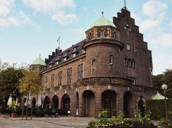
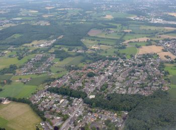
Bottrop: Discover the best trails: 12 hiking trails. All these trails, routes and outdoor activities are available in our SityTrail applications for smartphones and tablets.


The best trails (12)

Trail On foot  - Pilgerweg Ge-E - Photo
On foot 16.081
Km
GUIDE+

On foot

Easy
, North Rhine-Westphalia, Bottrop, Germany
16.1 km | 18.1 km-effort
4h 6min
156 m
132 m
No
SityTrail - itinéraires balisés pédestres

• Trail created by Bistum Essen. Symbol: weisser Fisch auf pinkem Grund

Trail On foot  - Naturfreundeweg Bottrop - Ruhrtalhaus - Photo
On foot 7.628
Km
GUIDE+

On foot

Easy
, North Rhine-Westphalia, Bottrop, Germany
7.6 km | 8.6 km-effort
1h 57min
77 m
69 m
No
SityTrail - itinéraires balisés pédestres

• Trail created by Die Naturfreunde. Symbol: weißer Buchstabe "N" auf schwarzem Grund

Trail On foot  - Schloß Beck Rundweg A1 - Photo
On foot 4.34
Km
GUIDE+

On foot

Easy
, North Rhine-Westphalia, Bottrop, Germany
4.3 km | 4.8 km-effort
1h 5min
35 m
36 m
Yes
SityTrail - itinéraires balisés pédestres

• Trail created by Sauerländischer Gebirgsverein.

Trail On foot  - Schloß Beck Rundweg A2 - Photo
On foot 4.351
Km
GUIDE+

On foot

Easy
, North Rhine-Westphalia, Bottrop, Germany
4.4 km | 5 km-effort
1h 7min
47 m
48 m
Yes
SityTrail - itinéraires balisés pédestres

• Trail created by Sauerländischer Gebirgsverein.

Trail On foot  - Rotbach Rundweg A8 - Photo
On foot 3.868
Km
GUIDE+

On foot

Easy
, North Rhine-Westphalia, Bottrop, Germany
3.9 km | 4.3 km-effort
58min
28 m
40 m
No
SityTrail - itinéraires balisés pédestres

• Trail created by Sauerländischer Gebirgsverein.

Trail On foot  - Rotbach Rundweg A5 - Photo
On foot 4.232
Km
GUIDE+

On foot

Easy
, North Rhine-Westphalia, Bottrop, Germany
4.2 km | 4.7 km-effort
1h 3min
28 m
42 m
No
SityTrail - itinéraires balisés pédestres

• Trail created by Sauerländischer Gebirgsverein.

Trail On foot  - Rotbach Rundweg A1 - Photo
On foot 3.747
Km
GUIDE+

On foot

Easy
, North Rhine-Westphalia, Bottrop, Germany
3.7 km | 4.2 km-effort
57min
35 m
35 m
Yes
SityTrail - itinéraires balisés pédestres

• Trail created by Sauerländischer Gebirgsverein.

Trail On foot  - Grafenmühle Rundweg A1 - Photo
On foot 6.598
Km
GUIDE+

On foot

Easy
, North Rhine-Westphalia, Bottrop, Germany
6.6 km | 7.3 km-effort
1h 40min
55 m
57 m
Yes
SityTrail - itinéraires balisés pédestres

• Trail created by Sauerländischer Gebirgsverein.

Trail On foot  - Bottroper Stadtwald Rundweg A1 - Photo
On foot 4.01
Km
GUIDE+

On foot

Easy
, North Rhine-Westphalia, Bottrop, Germany
4 km | 4.7 km-effort
1h 3min
48 m
50 m
Yes
SityTrail - itinéraires balisés pédestres

• Trail created by Sauerländischer Gebirgsverein.

Trail On foot  - Heidhofsee Rundweg A2 - Photo
On foot 7.096
Km
GUIDE+

On foot

Easy
, North Rhine-Westphalia, Bottrop, Germany
7.1 km | 7.8 km-effort
1h 46min
54 m
54 m
Yes
SityTrail - itinéraires balisés pédestres

• Trail created by Sauerländischer Gebirgsverein.

Trail On foot  - Heidhofsee Rundweg A9 - Photo
On foot 4.328
Km
GUIDE+

On foot

Easy
, North Rhine-Westphalia, Bottrop, Germany
4.3 km | 4.8 km-effort
1h 4min
32 m
31 m
Yes
SityTrail - itinéraires balisés pédestres

• Trail created by Sauerländischer Gebirgsverein.

Trail Walking  - Tétraédrique - Photo
Walking 3.185
Km

Walking

Easy
, North Rhine-Westphalia, Bottrop, Germany
3.2 km | 4.2 km-effort
1h 16min
77 m
79 m
Yes
natacha.brion69

12 trails displayed on 12

FREE GPS app for hiking

Logo SityTrail SityTrail

IGN / Geographical institutes

Download SityTrail from the App Store Download SityTrail from Google Play

Logo SityTrail SityTrail World

The world is yours!

Download SityTrail from the App Store Download SityTrail from Google Play Download SityTrail on Huawei AppGallery

Activities

Close
My subscriptions