Steinheim, Kreis Höxter: Best trails, routes and walks

Steinheim: Discover the best trails: 11 hiking trails. All these trails, routes and outdoor activities are available in our SityTrail applications for smartphones and tablets.
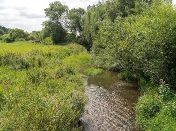

The best trails (11)

Trail On foot Steinheim - Rundwanderweg A1 [Grevenhagen] - Photo
On foot 8.331
Km
GUIDE+

On foot

Easy
Steinheim, North Rhine-Westphalia, Kreis Höxter, Germany
8.3 km | 11 km-effort
2h 30min
203 m
206 m
Yes
SityTrail - itinéraires balisés pédestres

• Symbol: weiße Schrift "A1" auf schwarzem Grund

Trail On foot Steinheim - Rundwanderweg A4 bei Steinheim - Photo
On foot 6.131
Km
GUIDE+

On foot

Easy
Steinheim, North Rhine-Westphalia, Kreis Höxter, Germany
6.1 km | 7.4 km-effort
1h 41min
97 m
100 m
Yes
SityTrail - itinéraires balisés pédestres

• Symbol: weißes A4 auf schwarzem Grund

Trail On foot Steinheim - Rundwanderweg A3 bei Steinheim - Photo
On foot 3.422
Km
GUIDE+

On foot

Easy
Steinheim, North Rhine-Westphalia, Kreis Höxter, Germany
3.4 km | 4.3 km-effort
58min
62 m
65 m
Yes
SityTrail - itinéraires balisés pédestres

• Symbol: weißes A3 auf schwarzem Grund

Trail On foot Steinheim - Vinsebeck - Photo
On foot 3.798
Km
GUIDE+

On foot

Easy
Steinheim, North Rhine-Westphalia, Kreis Höxter, Germany
3.8 km | 4.8 km-effort
1h 5min
74 m
74 m
Yes
SityTrail - itinéraires balisés pédestres

Trail On foot Steinheim - Vinsebeck - Photo
On foot 3.651
Km
GUIDE+

On foot

Easy
Steinheim, North Rhine-Westphalia, Kreis Höxter, Germany
3.7 km | 4.7 km-effort
1h 4min
81 m
82 m
Yes
SityTrail - itinéraires balisés pédestres

Trail On foot Steinheim - Vinsebeck - Photo
On foot 3.621
Km
GUIDE+

On foot

Easy
Steinheim, North Rhine-Westphalia, Kreis Höxter, Germany
3.6 km | 3.9 km-effort
52min
20 m
18 m
Yes
SityTrail - itinéraires balisés pédestres

Trail On foot Steinheim - Rundwanderweg A2 [Bergheim] - Photo
On foot 8.487
Km
GUIDE+

On foot

Easy
Steinheim, North Rhine-Westphalia, Kreis Höxter, Germany
8.5 km | 11.6 km-effort
2h 38min
236 m
237 m
Yes
SityTrail - itinéraires balisés pédestres

Trail On foot Steinheim - Rundwanderweg A6 [Sandebeck] - Photo
On foot 3.089
Km
GUIDE+

On foot

Easy
Steinheim, North Rhine-Westphalia, Kreis Höxter, Germany
3.1 km | 3.7 km-effort
50min
47 m
48 m
Yes
SityTrail - itinéraires balisés pédestres

Trail On foot Steinheim - Rundwanderweg A5 [Sandebeck] - Photo
On foot 3.859
Km
GUIDE+

On foot

Easy
Steinheim, North Rhine-Westphalia, Kreis Höxter, Germany
3.9 km | 4.8 km-effort
1h 4min
67 m
69 m
Yes
SityTrail - itinéraires balisés pédestres

Trail On foot Steinheim - Auf aussichtsreichen Höhen - Photo
On foot 6.541
Km
GUIDE+

On foot

Easy
Steinheim, North Rhine-Westphalia, Kreis Höxter, Germany
6.5 km | 7.6 km-effort
1h 43min
23 m
251 m
No
SityTrail - itinéraires balisés pédestres

• Trail created by www.hermannshoehen.de. Website: https://www.teutonavigator.com/de/tour/wandern/auf-aussichtsreich...

Trail On foot Steinheim - Rundwanderweg A2 [Sandebeck/Grevenhagen] - Photo
On foot 3.259
Km
GUIDE+

On foot

Easy
Steinheim, North Rhine-Westphalia, Kreis Höxter, Germany
3.3 km | 3.9 km-effort
52min
31 m
91 m
No
SityTrail - itinéraires balisés pédestres

11 trails displayed on 11

FREE GPS app for hiking

Logo SityTrail SityTrail

IGN / Geographical institutes

Download SityTrail from the App Store Download SityTrail from Google Play

Logo SityTrail SityTrail World

The world is yours!

Download SityTrail from the App Store Download SityTrail from Google Play Download SityTrail on Huawei AppGallery

Activities

Close
My subscriptions