Kirchhundem, Kreis Olpe: Best trails, routes and walks

Kirchhundem: Discover the best trails: 16 hiking trails. All these trails, routes and outdoor activities are available in our SityTrail applications for smartphones and tablets.


The best trails (16)

Trail On foot Kirchhundem - südlicher Rothaarsteig-Zuweg Heinsberg - Photo
On foot 4.125
Km
PRO

On foot

Easy
Kirchhundem, North Rhine-Westphalia, Kreis Olpe, Germany
4.1 km | 6.4 km-effort
1h 27min
220 m
18 m
No
SityTrail - itinéraires balisés pédestres

• Trail created by Rothaarsteigverein.

Trail On foot Kirchhundem - Krenkeltal und Goldener Zapfen - Photo
On foot 11.413
Km
PRO

On foot

Easy
Kirchhundem, North Rhine-Westphalia, Kreis Olpe, Germany
11.4 km | 15.7 km-effort
3h 33min
318 m
318 m
Yes
SityTrail - itinéraires balisés pédestres

• Trail created by Sauerländischer Gebirgsverein.

Trail On foot Kirchhundem - Rothaarsteig-Spur Oberhundemer Bergtour - Photo
On foot 11.535
Km
PRO

On foot

Easy
Kirchhundem, North Rhine-Westphalia, Kreis Olpe, Germany
11.5 km | 16.9 km-effort
3h 49min
399 m
401 m
Yes
SityTrail - itinéraires balisés pédestres

• Trail created by Rothaarsteigverein. Symbol: weißes liegendes R auf schwarzem Grund

Trail On foot Kirchhundem - Rundweg Oberhundem - Photo
On foot 8.17
Km
PRO

On foot

Easy
Kirchhundem, North Rhine-Westphalia, Kreis Olpe, Germany
8.2 km | 12 km-effort
2h 43min
279 m
305 m
No
SityTrail - itinéraires balisés pédestres

• Trail created by SGV. Symbol: Weißes Vollquadrat auf schwarzem Grund

Trail On foot Kirchhundem - Hilchenbacher Höhenring - Photo
On foot 12.456
Km
PRO

On foot

Easy
Kirchhundem, North Rhine-Westphalia, Kreis Olpe, Germany
12.5 km | 16.6 km-effort
3h 46min
252 m
485 m
No
SityTrail - itinéraires balisés pédestres

• Trail created by Tourismus- und Kneippverein Hilchenbach. Symbol: Weißer Kreis mit weißem H auf schwarzem Hintergrund
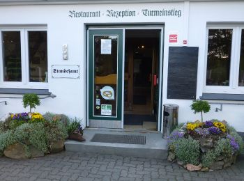
Trail On foot Kirchhundem - T Oberhundem - Rüspe - Photo
On foot 5.703
Km
PRO

On foot

Easy
Kirchhundem, North Rhine-Westphalia, Kreis Olpe, Germany
5.7 km | 7 km-effort
1h 36min
87 m
141 m
No
SityTrail - itinéraires balisés pédestres

• Trail created by Sauerländischer Gebirgsverein.

Trail On foot Kirchhundem - (K) Rundweg Kirchhundem - Photo
On foot 67.746
Km
PRO

On foot

Very difficult
Kirchhundem, North Rhine-Westphalia, Kreis Olpe, Germany
68 km | 92 km-effort
20h 59min
1847 m
1848 m
Yes
SityTrail - itinéraires balisés pédestres

• Trail created by Sauerländischer Gebirgsverein.

Trail On foot Kirchhundem - Heinsberg Rundweg A2 - Photo
On foot 6.175
Km
PRO

On foot

Easy
Kirchhundem, North Rhine-Westphalia, Kreis Olpe, Germany
6.2 km | 8.4 km-effort
1h 54min
165 m
167 m
Yes
SityTrail - itinéraires balisés pédestres

• Symbol: Weißes A2 auf schwarzem Grund

Trail On foot Kirchhundem - Kirchhundem - Oberhundem - Photo
On foot 4.016
Km
PRO

On foot

Easy
Kirchhundem, North Rhine-Westphalia, Kreis Olpe, Germany
4 km | 5.4 km-effort
1h 14min
95 m
145 m
No
SityTrail - itinéraires balisés pédestres

• Trail created by Sauerländischer Gebirgsverein. Symbol: weißes U auf schwarzem Grund

Trail On foot Kirchhundem - Böminghauser Rundweg A2 - Photo
On foot 4.085
Km
PRO

On foot

Easy
Kirchhundem, North Rhine-Westphalia, Kreis Olpe, Germany
4.1 km | 5.9 km-effort
1h 20min
137 m
130 m
Yes
SityTrail - itinéraires balisés pédestres

• Trail created by Sauerländischer Gebirgsverein. Symbol: blue:black:black_rectangle:A2:white

Trail On foot Kirchhundem - Raute Altenhundem - Rhein-Weser-Turm - Photo
On foot 5.297
Km
PRO

On foot

Easy
Kirchhundem, North Rhine-Westphalia, Kreis Olpe, Germany
5.3 km | 8.5 km-effort
1h 56min
273 m
156 m
No
SityTrail - itinéraires balisés pédestres

Trail On foot Kirchhundem - Ferndorfquelle Rundweg A9 (Oberndorfer Höhe) - Photo
On foot 3.446
Km
PRO

On foot

Easy
Kirchhundem, North Rhine-Westphalia, Kreis Olpe, Germany
3.4 km | 4.5 km-effort
1h 1min
79 m
78 m
Yes
SityTrail - itinéraires balisés pédestres

• Symbol: Weißes A9

Trail On foot Kirchhundem - Vogelsberg Rundweg A4 - Photo
On foot 6.963
Km
PRO

On foot

Easy
Kirchhundem, North Rhine-Westphalia, Kreis Olpe, Germany
7 km | 9.3 km-effort
2h 6min
174 m
170 m
No
SityTrail - itinéraires balisés pédestres

• Trail created by Sauerländischer Gebirgsverein.

Trail On foot Kirchhundem - Doppelbalken Marmecke - Röspe - Photo
On foot 5.468
Km
PRO

On foot

Easy
Kirchhundem, North Rhine-Westphalia, Kreis Olpe, Germany
5.5 km | 7.4 km-effort
1h 40min
171 m
66 m
No
SityTrail - itinéraires balisés pédestres

• Trail created by Sauerländischer Gebirgsverein.

Trail On foot Kirchhundem - Rothaarsteig Zugang Birkelbach - Photo
On foot 5.986
Km
PRO

On foot

Easy
Kirchhundem, North Rhine-Westphalia, Kreis Olpe, Germany
6 km | 7.2 km-effort
1h 37min
71 m
142 m
No
SityTrail - itinéraires balisés pédestres

• Trail created by Rothaarsteigverein.

Trail On foot Kirchhundem - nördlicher Rothaarsteig-Zuweg Heinsberg - Photo
On foot 3.58
Km
PRO

On foot

Easy
Kirchhundem, North Rhine-Westphalia, Kreis Olpe, Germany
3.6 km | 5.3 km-effort
1h 12min
104 m
198 m
No
SityTrail - itinéraires balisés pédestres

• Trail created by Rothaarsteigverein.

16 trails displayed on 16

FREE GPS app for hiking

Logo SityTrail SityTrail

IGN / Geographical institutes

Download SityTrail from the App Store Download SityTrail from Google Play

Logo SityTrail SityTrail World

The world is yours!

Download SityTrail from the App Store Download SityTrail from Google Play Download SityTrail on Huawei AppGallery

Activities

Close
My subscriptions