Odenthal, Rheinisch-Bergischer Kreis: Best trails, routes and walks

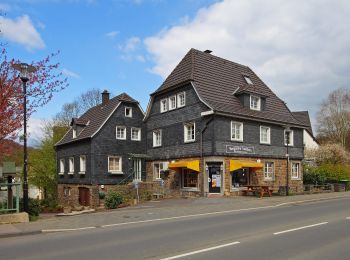
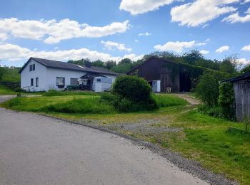
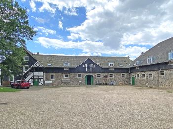
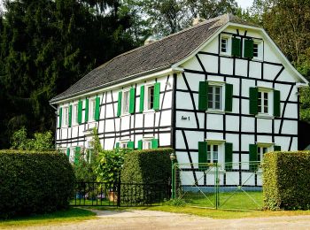
Odenthal: Discover the best trails: 24 hiking trails. All these trails, routes and outdoor activities are available in our SityTrail applications for smartphones and tablets.


The best trails (24)

Trail On foot Odenthal - Odenthal Rundweg A3 - Photo
On foot 6.785
Km
GUIDE+

On foot

Easy
Odenthal, North Rhine-Westphalia, Rheinisch-Bergischer Kreis, Germany
6.8 km | 9.4 km-effort
2h 8min
207 m
175 m
No
SityTrail - itinéraires balisés pédestres

• Trail created by Sauerländischer Gebirgsverein, Bezirk Bergisches Land. Symbol: Weißes A3 auf schwarzem Grund Webs...

Trail On foot Odenthal - Odenthal Rundweg A2 - Photo
On foot 7.787
Km
GUIDE+

On foot

Easy
Odenthal, North Rhine-Westphalia, Rheinisch-Bergischer Kreis, Germany
7.8 km | 11.1 km-effort
2h 31min
249 m
250 m
Yes
SityTrail - itinéraires balisés pédestres

• Trail created by Sauerländischer Gebirgsverein, Bezirk Bergisches Land. Symbol: Weißes A2 auf schwarzem Grund Webs...

Trail On foot Odenthal - D8 - Über den Bömberg - Photo
On foot 4.587
Km
GUIDE+

On foot

Easy
Odenthal, North Rhine-Westphalia, Rheinisch-Bergischer Kreis, Germany
4.6 km | 5.8 km-effort
1h 18min
89 m
87 m
Yes
SityTrail - itinéraires balisés pédestres

• Trail created by Sauerländischer Gebirgsverein. Symbol: Weißes "D8" auf scharzem Grund Website: https://www.wermel...

Trail On foot Odenthal - Hüttchen Rundweg A2 - Photo
On foot 5.522
Km
GUIDE+

On foot

Easy
Odenthal, North Rhine-Westphalia, Rheinisch-Bergischer Kreis, Germany
5.5 km | 6.9 km-effort
1h 34min
105 m
104 m
Yes
SityTrail - itinéraires balisés pédestres

• Trail created by Sauerländischer Gebirgsverein. Symbol: Weißes A2 auf scharzem Grund

Trail On foot Odenthal - Eifgenbachtalweg - Photo
On foot 15.369
Km
GUIDE+

On foot

Easy
Odenthal, North Rhine-Westphalia, Rheinisch-Bergischer Kreis, Germany
15.4 km | 20 km-effort
4h 32min
378 m
243 m
No
SityTrail - itinéraires balisés pédestres

• Trail created by Das Bergische gGmbH. Auch mit Symbol "Weißer Wasserlauf auf grünem Grund und Schriftzug Eifgen Sym...

Trail On foot Odenthal - Hüttchen Rundweg A1 - Photo
On foot 7.19
Km
GUIDE+

On foot

Easy
Odenthal, North Rhine-Westphalia, Rheinisch-Bergischer Kreis, Germany
7.2 km | 9.8 km-effort
2h 13min
197 m
197 m
Yes
SityTrail - itinéraires balisés pédestres

• Trail created by Sauerländischer Gebirgsverein. Symbol: Weißes A1 auf scharzem Grund Website: http://www.sgv-bergi...

Trail On foot Odenthal - Wasserroute - Photo
On foot 15.372
Km
GUIDE+

On foot

Easy
Odenthal, North Rhine-Westphalia, Rheinisch-Bergischer Kreis, Germany
15.4 km | 20 km-effort
4h 32min
344 m
349 m
Yes
SityTrail - itinéraires balisés pédestres

• Trail created by Gemeinde Odenthal. Symbol: Weißes leeres Rechteck auf schwarzem Grund

Trail On foot Odenthal - Schwarzpulverroute - Photo
On foot 6.772
Km
GUIDE+

On foot

Easy
Odenthal, North Rhine-Westphalia, Rheinisch-Bergischer Kreis, Germany
6.8 km | 9 km-effort
2h 2min
169 m
166 m
Yes
SityTrail - itinéraires balisés pédestres

• Trail created by Gemeinde Odenthal. Symbol: Weißes P auf schwarzem Grund

Trail On foot Odenthal - Hexenroute - Photo
On foot 11.461
Km
GUIDE+

On foot

Easy
Odenthal, North Rhine-Westphalia, Rheinisch-Bergischer Kreis, Germany
11.5 km | 13.9 km-effort
3h 9min
180 m
182 m
Yes
SityTrail - itinéraires balisés pédestres

• Trail created by Gemeinde Odenthal. Symbol: weiße Hexe auf Besen auf schwarzem Grund

Trail On foot Odenthal - Denkmalroute - Photo
On foot 22.703
Km
GUIDE+

On foot

Medium
Odenthal, North Rhine-Westphalia, Rheinisch-Bergischer Kreis, Germany
23 km | 31 km-effort
6h 58min
598 m
601 m
Yes
SityTrail - itinéraires balisés pédestres

• Trail created by Gemeinde Odenthal. Symbol: weißes Fachwerkhaus auf schwarzem Grund

Trail On foot Odenthal - Mühlenroute - Photo
On foot 22.227
Km
GUIDE+

On foot

Medium
Odenthal, North Rhine-Westphalia, Rheinisch-Bergischer Kreis, Germany
22 km | 28 km-effort
6h 26min
460 m
463 m
Yes
SityTrail - itinéraires balisés pédestres

• Trail created by Gemeinde Odenthal. Symbol: weißes Mühlrad auf schwarzem Grund

Trail On foot Odenthal - Höffe Rundweg A6 - Photo
On foot 3.288
Km
GUIDE+

On foot

Easy
Odenthal, North Rhine-Westphalia, Rheinisch-Bergischer Kreis, Germany
3.3 km | 4.8 km-effort
1h 5min
114 m
111 m
Yes
SityTrail - itinéraires balisés pédestres

• Trail created by Sauerländischer Gebirgsverein, Bezirk Bergisches Land.

Trail On foot Odenthal - Odenthal Rundweg A1 - Photo
On foot 4.154
Km
GUIDE+

On foot

Easy
Odenthal, North Rhine-Westphalia, Rheinisch-Bergischer Kreis, Germany
4.2 km | 5.5 km-effort
1h 15min
105 m
104 m
Yes
SityTrail - itinéraires balisés pédestres

• Trail created by Sauerländischer Gebirgsverein, Bezirk Bergisches Land. Symbol: Weißes A1 auf schwarzem Grund Webs...

Trail On foot Odenthal - Odenthal Rundweg A4 - Photo
On foot 6.0
Km
GUIDE+

On foot

Easy
Odenthal, North Rhine-Westphalia, Rheinisch-Bergischer Kreis, Germany
6 km | 7.9 km-effort
1h 47min
140 m
138 m
Yes
SityTrail - itinéraires balisés pédestres

• Trail created by Sauerländischer Gebirgsverein, Bezirk Bergisches Land. Symbol: Weißes A4 auf schwarzem Grund Webs...

Trail On foot Odenthal - Höffe Rundweg A1 - Photo
On foot 3.295
Km
GUIDE+

On foot

Easy
Odenthal, North Rhine-Westphalia, Rheinisch-Bergischer Kreis, Germany
3.3 km | 4 km-effort
53min
20 m
137 m
No
SityTrail - itinéraires balisés pédestres

• Symbol: A1

Trail On foot Odenthal - Klasmühle Rundweg A2 - Photo
On foot 6.943
Km
GUIDE+

On foot

Easy
Odenthal, North Rhine-Westphalia, Rheinisch-Bergischer Kreis, Germany
6.9 km | 9.9 km-effort
2h 15min
224 m
224 m
Yes
SityTrail - itinéraires balisés pédestres

• Symbol: A2

Trail On foot Odenthal - Altenberg Rundweg A6 - Photo
On foot 3.652
Km
GUIDE+

On foot

Easy
Odenthal, North Rhine-Westphalia, Rheinisch-Bergischer Kreis, Germany
3.7 km | 4.7 km-effort
1h 3min
61 m
117 m
No
SityTrail - itinéraires balisés pédestres

• Symbol: A6

Trail On foot Odenthal - Altenberg Rundweg A10 - Photo
On foot 4.007
Km
GUIDE+

On foot

Easy
Odenthal, North Rhine-Westphalia, Rheinisch-Bergischer Kreis, Germany
4 km | 5.5 km-effort
1h 14min
111 m
101 m
Yes
SityTrail - itinéraires balisés pédestres

• Symbol: A10

Trail On foot Odenthal - Altenberg Rundweg A5 - Photo
On foot 5.465
Km
GUIDE+

On foot

Easy
Odenthal, North Rhine-Westphalia, Rheinisch-Bergischer Kreis, Germany
5.5 km | 7.3 km-effort
1h 39min
136 m
135 m
Yes
SityTrail - itinéraires balisés pédestres

• Symbol: A5

Trail On foot Odenthal - Altenberg Rundweg A8 - Photo
On foot 8.345
Km
GUIDE+

On foot

Easy
Odenthal, North Rhine-Westphalia, Rheinisch-Bergischer Kreis, Germany
8.3 km | 11 km-effort
2h 29min
198 m
200 m
Yes
SityTrail - itinéraires balisés pédestres

• Trail created by Sauerländischer Gebirgsverein. Symbol: A8

20 trails displayed on 24

FREE GPS app for hiking

Logo SityTrail SityTrail

IGN / Geographical institutes

Download SityTrail from the App Store Download SityTrail from Google Play

Logo SityTrail SityTrail World

The world is yours!

Download SityTrail from the App Store Download SityTrail from Google Play Download SityTrail on Huawei AppGallery

Activities

Close
My subscriptions