Gailingen am Hochrhein, Landkreis Konstanz: Best trails, routes and walks

Gailingen am Hochrhein: Discover the best trails: 3 bike and mountain-bike routes. All these trails, routes and outdoor activities are available in our SityTrail applications for smartphones and tablets.


The best trails (4)
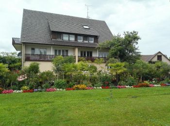
Trail Cycle Gailingen am Hochrhein - Le lac de Constance de Gailingen à Bodman en passant par Reichenau et Mainau - Photo
Cycle 101.358
Km

Cycle

Medium
Gailingen am Hochrhein, Baden-Württemberg, Landkreis Konstanz, Germany
101 km | 116 km-effort
6h 47min
1072 m
1121 m
No
destras

• Autour du lac en passant par la presqu'ile de Reichenau et l'ile de Mainau

Trail Other activity Gailingen am Hochrhein - bdr12_dSchaffhausen - Photo
Other activity 114.031
Km
GUIDE+

Other activity

Very easy
Gailingen am Hochrhein, Baden-Württemberg, Landkreis Konstanz, Germany
114 km | 158 km-effort
35h 24min
3290 m
3314 m
No
My Switzerland

Trail Bicycle tourism Gailingen am Hochrhein - 240710_Gailingen-Chutes du Rhin by JMH - Photo
Bicycle tourism 39.428
Km

Bicycle tourism

Easy
Gailingen am Hochrhein, Baden-Württemberg, Landkreis Konstanz, Germany
39 km | 47 km-effort
4h 49min
563 m
556 m
Yes
JM Heine

Trail Bicycle tourism Gailingen am Hochrhein - 090724_Konstanz - Steckborn - Gailingen - Photo
Bicycle tourism 39.952
Km

Bicycle tourism

Very easy
Gailingen am Hochrhein, Baden-Württemberg, Landkreis Konstanz, Germany
40 km | 45 km-effort
Unknown
334 m
385 m
No
JM Heine

4 trails displayed on 4

FREE GPS app for hiking

Logo SityTrail SityTrail

IGN / Geographical institutes

Download SityTrail from the App Store Download SityTrail from Google Play

Logo SityTrail SityTrail World

The world is yours!

Download SityTrail from the App Store Download SityTrail from Google Play Download SityTrail on Huawei AppGallery

Activities

Close
My subscriptions