![](/images/other/stat-length.png)
- Trails
- Outdoor
- Germany
- Baden-Württemberg
- Landkreis Böblingen
- Sindelfingen
- Sindelfingen (Stadt)
Sindelfingen (Stadt), Sindelfingen: Best trails, routes and walks
Sindelfingen (Stadt): Discover the best trails: 3 hiking trails. All these trails, routes and outdoor activities are available in our SityTrail applications for smartphones and tablets.
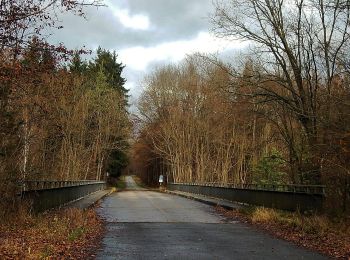
The best trails (3)
![Trail On foot Sindelfingen - DE-SAV Roter Punkt, Musberg - Römer-/Panzerstraße - Photo](https://media.geolcdn.com/t/350/260/8b8fe815-4a4d-438d-934f-7546790bd496.jpeg&format=jpg&maxdim=2)
![On foot On foot](https://static1.geolcdn.com/sitytour/trail-icons/100.png)
Km
On foot
![](/images/other/stat-length.png)
![](https://static1.geolcdn.com/siteimages/upload/files/1508320355ic_sort_den_pos_24dp.png)
![](https://static1.geolcdn.com/siteimages/upload/files/1508320355ic_sort_den_neg_24dp.png)
![](https://static1.geolcdn.com/siteimages/upload/files/16400158638029165_repeat_loop_refresh_sync_direction_icon.png)
• Trail created by Schwäbischer Albverein. SAV Roter Punkt, Musberg - Römer-/Panzerstraße
![Trail On foot Sindelfingen - DE-SAV Roter Punkt, Möhringen - Mahdental - Photo](https://media.geolcdn.com/t/350/260/52a55099-d89b-4462-96e2-3a00ca0e81ed.jpeg&format=jpg&maxdim=2)
![On foot On foot](https://static1.geolcdn.com/sitytour/trail-icons/100.png)
Km
On foot
![](/images/other/stat-length.png)
![](https://static1.geolcdn.com/siteimages/upload/files/1508320355ic_sort_den_pos_24dp.png)
![](https://static1.geolcdn.com/siteimages/upload/files/1508320355ic_sort_den_neg_24dp.png)
![](https://static1.geolcdn.com/siteimages/upload/files/16400158638029165_repeat_loop_refresh_sync_direction_icon.png)
• Trail created by Schwäbischer Albverein. SAV Roter Punkt, Möhringen - Mahdental
![Trail On foot Sindelfingen - DE-Rundweg Blau-Rote Ellipse Sindelfingen-Maichingen - Photo](https://media.geolcdn.com/t/350/260/ext.jpg?maxdim=2&url=https%3A%2F%2Fstatic1.geolcdn.com%2Fsiteimages%2Fupload%2Ffiles%2F1545311037marcheuse_200dpi.jpg)
![On foot On foot](https://static1.geolcdn.com/sitytour/trail-icons/100.png)
Km
On foot
![](/images/other/stat-length.png)
![](https://static1.geolcdn.com/siteimages/upload/files/1508320355ic_sort_den_pos_24dp.png)
![](https://static1.geolcdn.com/siteimages/upload/files/1508320355ic_sort_den_neg_24dp.png)
![](https://static1.geolcdn.com/siteimages/upload/files/16400158638029165_repeat_loop_refresh_sync_direction_icon.png)
• Rundweg Blau-Rote Ellipse Sindelfingen-Maichingen Symbol: Blaue Ellipse mit Innenkreis aus 4 roten Pfeilen
3 trails displayed on 3
FREE GPS app for hiking