![](/images/other/stat-length.png)
- Trails
- Outdoor
- Germany
- Baden-Württemberg
- Landkreis Böblingen
- Böblingen
Böblingen, Landkreis Böblingen: Best trails, routes and walks
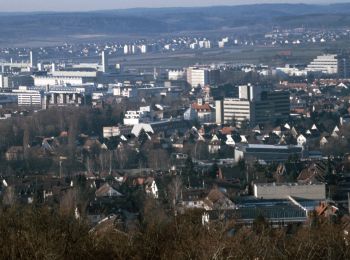
Böblingen: Discover the best trails: 5 hiking trails. All these trails, routes and outdoor activities are available in our SityTrail applications for smartphones and tablets.
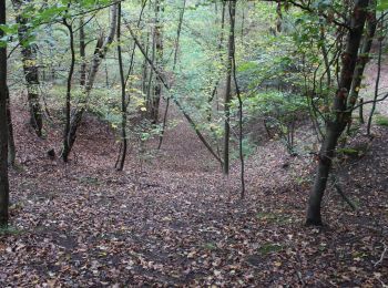
The best trails (5)
![Trail On foot Böblingen - DE-SAV Blauer Punkt, von Böblingen Lange Schläge - Thermalbadkreuzung - Photo](https://media.geolcdn.com/t/350/260/1f045c08-5b03-49d6-b4c2-4a2ef82b4dae.jpeg&format=jpg&maxdim=2)
![On foot On foot](https://static1.geolcdn.com/sitytour/trail-icons/100.png)
Km
On foot
![](/images/other/stat-length.png)
![](https://static1.geolcdn.com/siteimages/upload/files/1508320355ic_sort_den_pos_24dp.png)
![](https://static1.geolcdn.com/siteimages/upload/files/1508320355ic_sort_den_neg_24dp.png)
![](https://static1.geolcdn.com/siteimages/upload/files/16400158638029165_repeat_loop_refresh_sync_direction_icon.png)
• Trail created by Schwäbischer Albverein. SAV Blauer Punkt, von Böblingen Lange Schläge - Thermalbadkreuzung Symbol:...
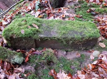
![Trail On foot Böblingen - DE-SAV Blauer Punkt, Böblingen Lange Schläge - Katzenbacher Hof - Büsnau - Photo](https://media.geolcdn.com/t/350/260/f28b25ee-3924-496e-a383-577f49417668.jpeg&format=jpg&maxdim=2)
![On foot On foot](https://static1.geolcdn.com/sitytour/trail-icons/100.png)
Km
On foot
![](/images/other/stat-length.png)
![](https://static1.geolcdn.com/siteimages/upload/files/1508320355ic_sort_den_pos_24dp.png)
![](https://static1.geolcdn.com/siteimages/upload/files/1508320355ic_sort_den_neg_24dp.png)
![](https://static1.geolcdn.com/siteimages/upload/files/16400158638029165_repeat_loop_refresh_sync_direction_icon.png)
• Trail created by Schwäbischer Albverein. SAV Blauer Punkt, Böblingen Lange Schläge - Katzenbacher Hof - Büsnau Symb...
![Trail On foot Böblingen - DE-SAV Blaues Kreuz, Vaihingen - Böblingen - Photo](https://media.geolcdn.com/t/350/260/719ce257-d0b8-41c6-b029-cd0f5c446db1.jpeg&format=jpg&maxdim=2)
![On foot On foot](https://static1.geolcdn.com/sitytour/trail-icons/100.png)
Km
On foot
![](/images/other/stat-length.png)
![](https://static1.geolcdn.com/siteimages/upload/files/1508320355ic_sort_den_pos_24dp.png)
![](https://static1.geolcdn.com/siteimages/upload/files/1508320355ic_sort_den_neg_24dp.png)
![](https://static1.geolcdn.com/siteimages/upload/files/16400158638029165_repeat_loop_refresh_sync_direction_icon.png)
• Trail created by Schwäbischer Albverein. SAV Blaues Kreuz, Vaihingen - Böblingen Symbol: Blaues Kreuz auf weißem Gr...
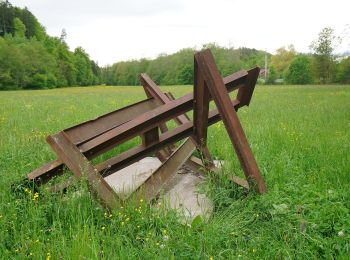
![Trail On foot Böblingen - DE-SAV Blaues Kreuz, Böblingen - Waldenbuch - Photo](https://media.geolcdn.com/t/350/260/2809e53d-7bd4-4507-ac67-c0b5b3606b4c.jpeg&format=jpg&maxdim=2)
![On foot On foot](https://static1.geolcdn.com/sitytour/trail-icons/100.png)
Km
On foot
![](/images/other/stat-length.png)
![](https://static1.geolcdn.com/siteimages/upload/files/1508320355ic_sort_den_pos_24dp.png)
![](https://static1.geolcdn.com/siteimages/upload/files/1508320355ic_sort_den_neg_24dp.png)
![](https://static1.geolcdn.com/siteimages/upload/files/16400158638029165_repeat_loop_refresh_sync_direction_icon.png)
• Trail created by Schwäbischer Albverein. SAV Blaues Kreuz, Böblingen - Waldenbuch Symbol: blaues Kreuz auf weißem G...
![Trail On foot Böblingen - Walderlebnispfad Böblingen - Photo](https://media.geolcdn.com/t/350/260/ext.jpg?maxdim=2&url=https%3A%2F%2Fstatic1.geolcdn.com%2Fsiteimages%2Fupload%2Ffiles%2F1545311037marcheuse_200dpi.jpg)
![On foot On foot](https://static1.geolcdn.com/sitytour/trail-icons/100.png)
Km
On foot
![](/images/other/stat-length.png)
![](https://static1.geolcdn.com/siteimages/upload/files/1508320355ic_sort_den_pos_24dp.png)
![](https://static1.geolcdn.com/siteimages/upload/files/1508320355ic_sort_den_neg_24dp.png)
![](https://static1.geolcdn.com/siteimages/upload/files/16400158638029165_repeat_loop_refresh_sync_direction_icon.png)
5 trails displayed on 5
FREE GPS app for hiking