![](/images/other/stat-length.png)
Ansbach (district), Bavaria: Best trails, routes and walks
Ansbach (district): Discover the best trails: 29 hiking trails. All these trails, routes and outdoor activities are available in our SityTrail applications for smartphones and tablets.
The best trails (29)
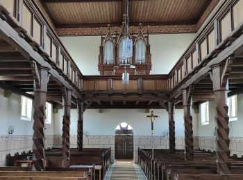
![Trail On foot Diebach - Krone - Photo](https://media.geolcdn.com/t/350/260/85c9ea59-24b4-4aff-b9cc-7992c08d3550.jpeg&format=jpg&maxdim=2)
![On foot On foot](https://static1.geolcdn.com/sitytour/trail-icons/100.png)
Km
On foot
![](/images/other/stat-length.png)
![](https://static1.geolcdn.com/siteimages/upload/files/1508320355ic_sort_den_pos_24dp.png)
![](https://static1.geolcdn.com/siteimages/upload/files/1508320355ic_sort_den_neg_24dp.png)
![](https://static1.geolcdn.com/siteimages/upload/files/16400158638029165_repeat_loop_refresh_sync_direction_icon.png)
• Trail created by Gemeinde Diebach. Symbol: Silberne Krone auf blauem Grund
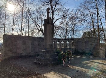
![Trail On foot Leutershausen - Milanweg Leutershausen - Photo](https://media.geolcdn.com/t/350/260/fbf0b22b-2ca1-4a3a-9a7c-87dbe6ddd43b.jpeg&format=jpg&maxdim=2)
![On foot On foot](https://static1.geolcdn.com/sitytour/trail-icons/100.png)
Km
On foot
![](/images/other/stat-length.png)
![](https://static1.geolcdn.com/siteimages/upload/files/1508320355ic_sort_den_pos_24dp.png)
![](https://static1.geolcdn.com/siteimages/upload/files/1508320355ic_sort_den_neg_24dp.png)
![](https://static1.geolcdn.com/siteimages/upload/files/16400158638029165_repeat_loop_refresh_sync_direction_icon.png)
• Trail created by Stadt Leutershausen. Symbol: Milan auf mehrfarbigem Hintergrund
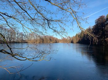
![Trail On foot Leutershausen - Eichhörnchenweg Leutershausen - Photo](https://media.geolcdn.com/t/350/260/a026c2f5-edb7-4b08-8198-455f832b9327.jpeg&format=jpg&maxdim=2)
![On foot On foot](https://static1.geolcdn.com/sitytour/trail-icons/100.png)
Km
On foot
![](/images/other/stat-length.png)
![](https://static1.geolcdn.com/siteimages/upload/files/1508320355ic_sort_den_pos_24dp.png)
![](https://static1.geolcdn.com/siteimages/upload/files/1508320355ic_sort_den_neg_24dp.png)
![](https://static1.geolcdn.com/siteimages/upload/files/16400158638029165_repeat_loop_refresh_sync_direction_icon.png)
• Trail created by Stadt Leutershausen. Symbol: Eichhörnchen auf mehrfarbigem Hintergrund
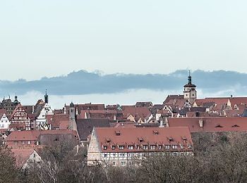
![Trail On foot Rothenburg ob der Tauber - Rothenburger W4 - Natursteig - Photo](https://media.geolcdn.com/t/350/260/d569b6e8-20ae-4c7f-9f17-9f200af7a901.jpeg&format=jpg&maxdim=2)
![On foot On foot](https://static1.geolcdn.com/sitytour/trail-icons/100.png)
Km
On foot
![](/images/other/stat-length.png)
![](https://static1.geolcdn.com/siteimages/upload/files/1508320355ic_sort_den_pos_24dp.png)
![](https://static1.geolcdn.com/siteimages/upload/files/1508320355ic_sort_den_neg_24dp.png)
![](https://static1.geolcdn.com/siteimages/upload/files/16400158638029165_repeat_loop_refresh_sync_direction_icon.png)
• Trail created by Verkehrsverein Rothenburg ob der Tauber e.V..
![Trail On foot Rothenburg ob der Tauber - Rothenburger W3 - Kleiner Taubertalweg - Photo](https://media.geolcdn.com/t/350/260/2d219dd4-d118-4615-825c-f1e0ab382514.jpeg&format=jpg&maxdim=2)
![On foot On foot](https://static1.geolcdn.com/sitytour/trail-icons/100.png)
Km
On foot
![](/images/other/stat-length.png)
![](https://static1.geolcdn.com/siteimages/upload/files/1508320355ic_sort_den_pos_24dp.png)
![](https://static1.geolcdn.com/siteimages/upload/files/1508320355ic_sort_den_neg_24dp.png)
![](https://static1.geolcdn.com/siteimages/upload/files/16400158638029165_repeat_loop_refresh_sync_direction_icon.png)
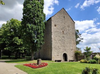
• Trail created by Verkehrsverein Rothenburg ob der Tauber e.V..
![Trail On foot Rothenburg ob der Tauber - Rothenburger W1 - Detwanger Weg - Photo](https://media.geolcdn.com/t/350/260/3855134a-1211-4ce0-bb69-11a7db59eccd.jpeg&format=jpg&maxdim=2)
![On foot On foot](https://static1.geolcdn.com/sitytour/trail-icons/100.png)
Km
On foot
![](/images/other/stat-length.png)
![](https://static1.geolcdn.com/siteimages/upload/files/1508320355ic_sort_den_pos_24dp.png)
![](https://static1.geolcdn.com/siteimages/upload/files/1508320355ic_sort_den_neg_24dp.png)
![](https://static1.geolcdn.com/siteimages/upload/files/16400158638029165_repeat_loop_refresh_sync_direction_icon.png)
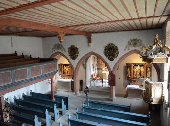
• Trail created by Verkehrsverein Rothenburg ob der Tauber e.V..
![Trail On foot Rothenburg ob der Tauber - Rothenburger W2 - Zu den Rothenburger Mühlen - Photo](https://media.geolcdn.com/t/350/260/fd08601b-fa2a-4d50-9433-292f77fe7f6e.jpeg&format=jpg&maxdim=2)
![On foot On foot](https://static1.geolcdn.com/sitytour/trail-icons/100.png)
Km
On foot
![](/images/other/stat-length.png)
![](https://static1.geolcdn.com/siteimages/upload/files/1508320355ic_sort_den_pos_24dp.png)
![](https://static1.geolcdn.com/siteimages/upload/files/1508320355ic_sort_den_neg_24dp.png)
![](https://static1.geolcdn.com/siteimages/upload/files/16400158638029165_repeat_loop_refresh_sync_direction_icon.png)
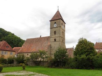
• Trail created by Verkehrsverein Rothenburg ob der Tauber e.V..
![Trail On foot Unterschwaningen - Imperium Romanum - Photo](https://media.geolcdn.com/t/350/260/1d56cd5d-fb12-4d51-97cb-64a6113433f0.jpeg&format=jpg&maxdim=2)
![On foot On foot](https://static1.geolcdn.com/sitytour/trail-icons/100.png)
Km
On foot
![](/images/other/stat-length.png)
![](https://static1.geolcdn.com/siteimages/upload/files/1508320355ic_sort_den_pos_24dp.png)
![](https://static1.geolcdn.com/siteimages/upload/files/1508320355ic_sort_den_neg_24dp.png)
![](https://static1.geolcdn.com/siteimages/upload/files/16400158638029165_repeat_loop_refresh_sync_direction_icon.png)
• Trail created by Stadt Gunzenhausen. Symbol: Weisse 8 auf blauem Grund
![Trail On foot Rothenburg ob der Tauber - DE-NW blau - Photo](https://media.geolcdn.com/t/350/260/fd08601b-fa2a-4d50-9433-292f77fe7f6e.jpeg&format=jpg&maxdim=2)
![On foot On foot](https://static1.geolcdn.com/sitytour/trail-icons/100.png)
Km
On foot
![](/images/other/stat-length.png)
![](https://static1.geolcdn.com/siteimages/upload/files/1508320355ic_sort_den_pos_24dp.png)
![](https://static1.geolcdn.com/siteimages/upload/files/1508320355ic_sort_den_neg_24dp.png)
![](https://static1.geolcdn.com/siteimages/upload/files/16400158638029165_repeat_loop_refresh_sync_direction_icon.png)
• Trail created by Stadt Rothenburg ob der Tauber. Symbol: Nordic Walking + blauer Punkt
![Trail On foot Rothenburg ob der Tauber - DE-NW rot - Photo](https://media.geolcdn.com/t/350/260/ad83b47e-3323-4ea1-8fe2-a79eaf813dd4.jpeg&format=jpg&maxdim=2)
![On foot On foot](https://static1.geolcdn.com/sitytour/trail-icons/100.png)
Km
On foot
![](/images/other/stat-length.png)
![](https://static1.geolcdn.com/siteimages/upload/files/1508320355ic_sort_den_pos_24dp.png)
![](https://static1.geolcdn.com/siteimages/upload/files/1508320355ic_sort_den_neg_24dp.png)
![](https://static1.geolcdn.com/siteimages/upload/files/16400158638029165_repeat_loop_refresh_sync_direction_icon.png)
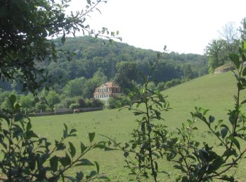
• Trail created by Stadt Rothenburg ob der Tauber. Symbol: Nordic Walking + roter Punkt
![Trail On foot Neuendettelsau - Heilsbronner Rundweg 9 - Photo](https://media.geolcdn.com/t/350/260/86c5fbf8-d0a6-41d3-8ef6-e8e79ec3b6e2.jpeg&format=jpg&maxdim=2)
![On foot On foot](https://static1.geolcdn.com/sitytour/trail-icons/100.png)
Km
On foot
![](/images/other/stat-length.png)
![](https://static1.geolcdn.com/siteimages/upload/files/1508320355ic_sort_den_pos_24dp.png)
![](https://static1.geolcdn.com/siteimages/upload/files/1508320355ic_sort_den_neg_24dp.png)
![](https://static1.geolcdn.com/siteimages/upload/files/16400158638029165_repeat_loop_refresh_sync_direction_icon.png)
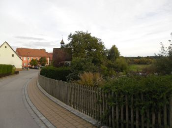
• Symbol: Weißer Text "9" mit je einem Punkt links und rechts auf grünem Grund
![Trail On foot Heilsbronn - Heilsbronner Rundweg 8 - Photo](https://media.geolcdn.com/t/350/260/2a2d8d08-c1bb-413b-a44d-7efc85188843.jpeg&format=jpg&maxdim=2)
![On foot On foot](https://static1.geolcdn.com/sitytour/trail-icons/100.png)
Km
On foot
![](/images/other/stat-length.png)
![](https://static1.geolcdn.com/siteimages/upload/files/1508320355ic_sort_den_pos_24dp.png)
![](https://static1.geolcdn.com/siteimages/upload/files/1508320355ic_sort_den_neg_24dp.png)
![](https://static1.geolcdn.com/siteimages/upload/files/16400158638029165_repeat_loop_refresh_sync_direction_icon.png)
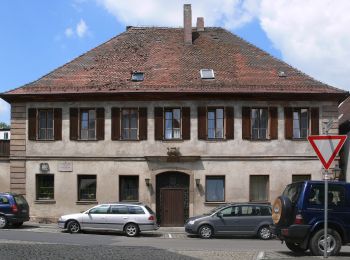
• Symbol: Weißer Text "8" mit je einem Punkt links und rechts auf grünem Grund
![Trail On foot Heilsbronn - Heilsbronner Rundweg 7 - Photo](https://media.geolcdn.com/t/350/260/2a2d8d08-c1bb-413b-a44d-7efc85188843.jpeg&format=jpg&maxdim=2)
![On foot On foot](https://static1.geolcdn.com/sitytour/trail-icons/100.png)
Km
On foot
![](/images/other/stat-length.png)
![](https://static1.geolcdn.com/siteimages/upload/files/1508320355ic_sort_den_pos_24dp.png)
![](https://static1.geolcdn.com/siteimages/upload/files/1508320355ic_sort_den_neg_24dp.png)
![](https://static1.geolcdn.com/siteimages/upload/files/16400158638029165_repeat_loop_refresh_sync_direction_icon.png)
• Symbol: Weißer Text "7" mit je einem Punkt links und rechts auf grünem Grund
![Trail On foot Heilsbronn - Heilsbronner Rundweg 6 - Photo](https://media.geolcdn.com/t/350/260/2a2d8d08-c1bb-413b-a44d-7efc85188843.jpeg&format=jpg&maxdim=2)
![On foot On foot](https://static1.geolcdn.com/sitytour/trail-icons/100.png)
Km
On foot
![](/images/other/stat-length.png)
![](https://static1.geolcdn.com/siteimages/upload/files/1508320355ic_sort_den_pos_24dp.png)
![](https://static1.geolcdn.com/siteimages/upload/files/1508320355ic_sort_den_neg_24dp.png)
![](https://static1.geolcdn.com/siteimages/upload/files/16400158638029165_repeat_loop_refresh_sync_direction_icon.png)
• Symbol: Weißer Text "6" mit je einem Punkt links und rechts auf grünem Grund
![Trail On foot Heilsbronn - Heilsbronner Rundweg 5 - Photo](https://media.geolcdn.com/t/350/260/2a2d8d08-c1bb-413b-a44d-7efc85188843.jpeg&format=jpg&maxdim=2)
![On foot On foot](https://static1.geolcdn.com/sitytour/trail-icons/100.png)
Km
On foot
![](/images/other/stat-length.png)
![](https://static1.geolcdn.com/siteimages/upload/files/1508320355ic_sort_den_pos_24dp.png)
![](https://static1.geolcdn.com/siteimages/upload/files/1508320355ic_sort_den_neg_24dp.png)
![](https://static1.geolcdn.com/siteimages/upload/files/16400158638029165_repeat_loop_refresh_sync_direction_icon.png)
• Symbol: Weißer Text "5" mit je einem Punkt links und rechts auf grünem Grund
![Trail On foot Heilsbronn - Heilsbronner Rundweg 4 - Photo](https://media.geolcdn.com/t/350/260/2a2d8d08-c1bb-413b-a44d-7efc85188843.jpeg&format=jpg&maxdim=2)
![On foot On foot](https://static1.geolcdn.com/sitytour/trail-icons/100.png)
Km
On foot
![](/images/other/stat-length.png)
![](https://static1.geolcdn.com/siteimages/upload/files/1508320355ic_sort_den_pos_24dp.png)
![](https://static1.geolcdn.com/siteimages/upload/files/1508320355ic_sort_den_neg_24dp.png)
![](https://static1.geolcdn.com/siteimages/upload/files/16400158638029165_repeat_loop_refresh_sync_direction_icon.png)
• Symbol: Weißer Text "4" mit je einem Punkt links und rechts auf grünem Grund
![Trail On foot Heilsbronn - Heilsbronner Rundweg 3 - Photo](https://media.geolcdn.com/t/350/260/2a2d8d08-c1bb-413b-a44d-7efc85188843.jpeg&format=jpg&maxdim=2)
![On foot On foot](https://static1.geolcdn.com/sitytour/trail-icons/100.png)
Km
On foot
![](/images/other/stat-length.png)
![](https://static1.geolcdn.com/siteimages/upload/files/1508320355ic_sort_den_pos_24dp.png)
![](https://static1.geolcdn.com/siteimages/upload/files/1508320355ic_sort_den_neg_24dp.png)
![](https://static1.geolcdn.com/siteimages/upload/files/16400158638029165_repeat_loop_refresh_sync_direction_icon.png)
• Symbol: Weißer Text "3" mit je einem Punkt links und rechts auf grünem Grund
![Trail On foot Heilsbronn - Heilsbronner Rundweg 1 - Photo](https://media.geolcdn.com/t/350/260/2a2d8d08-c1bb-413b-a44d-7efc85188843.jpeg&format=jpg&maxdim=2)
![On foot On foot](https://static1.geolcdn.com/sitytour/trail-icons/100.png)
Km
On foot
![](/images/other/stat-length.png)
![](https://static1.geolcdn.com/siteimages/upload/files/1508320355ic_sort_den_pos_24dp.png)
![](https://static1.geolcdn.com/siteimages/upload/files/1508320355ic_sort_den_neg_24dp.png)
![](https://static1.geolcdn.com/siteimages/upload/files/16400158638029165_repeat_loop_refresh_sync_direction_icon.png)
• Symbol: Weißer Text "1" mit je einem Punkt links und rechts auf grünem Grund
![Trail On foot Heilsbronn - Heilsbronner Rundweg 2 - Photo](https://media.geolcdn.com/t/350/260/2a2d8d08-c1bb-413b-a44d-7efc85188843.jpeg&format=jpg&maxdim=2)
![On foot On foot](https://static1.geolcdn.com/sitytour/trail-icons/100.png)
Km
On foot
![](/images/other/stat-length.png)
![](https://static1.geolcdn.com/siteimages/upload/files/1508320355ic_sort_den_pos_24dp.png)
![](https://static1.geolcdn.com/siteimages/upload/files/1508320355ic_sort_den_neg_24dp.png)
![](https://static1.geolcdn.com/siteimages/upload/files/16400158638029165_repeat_loop_refresh_sync_direction_icon.png)
• Symbol: Weißer Text "2" mit je einem Punkt links und rechts auf grünem Grund
![Trail On foot Neusitz - Rothenburger W11 - Lug ins Land - Photo](https://media.geolcdn.com/t/350/260/1193c70e-1492-40c9-a8f0-1f45d7068679.jpeg&format=jpg&maxdim=2)
![On foot On foot](https://static1.geolcdn.com/sitytour/trail-icons/100.png)
Km
On foot
![](/images/other/stat-length.png)
![](https://static1.geolcdn.com/siteimages/upload/files/1508320355ic_sort_den_pos_24dp.png)
![](https://static1.geolcdn.com/siteimages/upload/files/1508320355ic_sort_den_neg_24dp.png)
![](https://static1.geolcdn.com/siteimages/upload/files/16400158638029165_repeat_loop_refresh_sync_direction_icon.png)
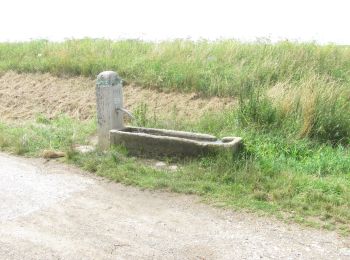
• Trail created by Stadt Rothenburg ob der Tauber. Symbol: Weiße 11 auf rotem Schild
20 trails displayed on 29
FREE GPS app for hiking