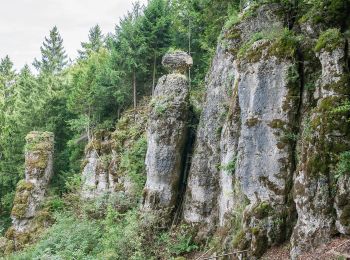
![](/images/other/stat-length.png)
Velburg, Landkreis Neumarkt in der Oberpfalz: Best trails, routes and walks
Velburg: Discover the best trails: 7 hiking trails. All these trails, routes and outdoor activities are available in our SityTrail applications for smartphones and tablets.
The best trails (7)
![Trail On foot Velburg - Lengenfeld - Tropfsteinhöhle - Photo](https://media.geolcdn.com/t/350/260/edebbad1-4b15-4533-a041-24fb90c88cd2.jpeg&format=jpg&maxdim=2)
![On foot On foot](https://static1.geolcdn.com/sitytour/trail-icons/100.png)
Km
On foot
![](/images/other/stat-length.png)
![](https://static1.geolcdn.com/siteimages/upload/files/1508320355ic_sort_den_pos_24dp.png)
![](https://static1.geolcdn.com/siteimages/upload/files/1508320355ic_sort_den_neg_24dp.png)
![](https://static1.geolcdn.com/siteimages/upload/files/16400158638029165_repeat_loop_refresh_sync_direction_icon.png)
• Trail created by Stadt Velburg. Symbol: Rosa Punkt auf weißem Grund
![Trail On foot Velburg - Rundweg um den Kramertsbügel - Photo](https://media.geolcdn.com/t/350/260/e2427d42-8615-4fa2-933e-3f2a45d4b750.jpeg&format=jpg&maxdim=2)
![On foot On foot](https://static1.geolcdn.com/sitytour/trail-icons/100.png)
Km
On foot
![](/images/other/stat-length.png)
![](https://static1.geolcdn.com/siteimages/upload/files/1508320355ic_sort_den_pos_24dp.png)
![](https://static1.geolcdn.com/siteimages/upload/files/1508320355ic_sort_den_neg_24dp.png)
![](https://static1.geolcdn.com/siteimages/upload/files/16400158638029165_repeat_loop_refresh_sync_direction_icon.png)
• Trail created by Stadt Velburg. abgeschlossen (Mai 2013 by cycling_zno) Symbol: Blauer Punkt auf weißem Grund
![Trail On foot Velburg - Rundweg um den Sperlasberg - Photo](https://media.geolcdn.com/t/350/260/f2f78ca1-d241-4cc6-b912-4a523283ad00.jpeg&format=jpg&maxdim=2)
![On foot On foot](https://static1.geolcdn.com/sitytour/trail-icons/100.png)
Km
On foot
![](/images/other/stat-length.png)
![](https://static1.geolcdn.com/siteimages/upload/files/1508320355ic_sort_den_pos_24dp.png)
![](https://static1.geolcdn.com/siteimages/upload/files/1508320355ic_sort_den_neg_24dp.png)
![](https://static1.geolcdn.com/siteimages/upload/files/16400158638029165_repeat_loop_refresh_sync_direction_icon.png)
• Trail created by Stadt Velburg. abgeschlossen (Mai 2013 by cycling_zno) Symbol: Gelber Punkt auf weißem Grund
![Trail On foot Velburg - Velburg-St.Colomann - Photo](https://media.geolcdn.com/t/350/260/edebbad1-4b15-4533-a041-24fb90c88cd2.jpeg&format=jpg&maxdim=2)
![On foot On foot](https://static1.geolcdn.com/sitytour/trail-icons/100.png)
Km
On foot
![](/images/other/stat-length.png)
![](https://static1.geolcdn.com/siteimages/upload/files/1508320355ic_sort_den_pos_24dp.png)
![](https://static1.geolcdn.com/siteimages/upload/files/1508320355ic_sort_den_neg_24dp.png)
![](https://static1.geolcdn.com/siteimages/upload/files/16400158638029165_repeat_loop_refresh_sync_direction_icon.png)
• Trail created by Stadt Velburg. abgeschlossen (Mai 2013 by cycling_zno) Symbol: Blauer Punkt auf weißem Grund
![Trail On foot Velburg - Jurasteig König-Otto-Schlaufe - Photo](https://media.geolcdn.com/t/350/260/edebbad1-4b15-4533-a041-24fb90c88cd2.jpeg&format=jpg&maxdim=2)
![On foot On foot](https://static1.geolcdn.com/sitytour/trail-icons/100.png)
Km
On foot
![](/images/other/stat-length.png)
![](https://static1.geolcdn.com/siteimages/upload/files/1508320355ic_sort_den_pos_24dp.png)
![](https://static1.geolcdn.com/siteimages/upload/files/1508320355ic_sort_den_neg_24dp.png)
![](https://static1.geolcdn.com/siteimages/upload/files/16400158638029165_repeat_loop_refresh_sync_direction_icon.png)
• Trail created by Gebietsgemeinschaft Bayerischer Jura. geprüft (April 2014, by cycling_zno) Symbol: Gelbe Schleife ...
![Trail On foot Velburg - Rundweg um den Eichelberg - Photo](https://media.geolcdn.com/t/350/260/d19b2504-afa7-43d5-b3fe-f3f7d6c127d2.jpeg&format=jpg&maxdim=2)
![On foot On foot](https://static1.geolcdn.com/sitytour/trail-icons/100.png)
Km
On foot
![](/images/other/stat-length.png)
![](https://static1.geolcdn.com/siteimages/upload/files/1508320355ic_sort_den_pos_24dp.png)
![](https://static1.geolcdn.com/siteimages/upload/files/1508320355ic_sort_den_neg_24dp.png)
![](https://static1.geolcdn.com/siteimages/upload/files/16400158638029165_repeat_loop_refresh_sync_direction_icon.png)
• Trail created by Stadt Velburg. abgeschlossen (Mai 2013 by cycling_zno) Symbol: Gelber Ring auf weißem Grund
![Trail On foot Velburg - Jurasteig Kuppenalb-Schlaufe - Photo](https://media.geolcdn.com/t/350/260/df2abf45-3872-46b2-90ce-626a58036dce.jpeg&format=jpg&maxdim=2)
![On foot On foot](https://static1.geolcdn.com/sitytour/trail-icons/100.png)
Km
On foot
![](/images/other/stat-length.png)
![](https://static1.geolcdn.com/siteimages/upload/files/1508320355ic_sort_den_pos_24dp.png)
![](https://static1.geolcdn.com/siteimages/upload/files/1508320355ic_sort_den_neg_24dp.png)
![](https://static1.geolcdn.com/siteimages/upload/files/16400158638029165_repeat_loop_refresh_sync_direction_icon.png)
• Trail created by Gebietsgemeinschaft Bayerischer Jura. geprüft (April 2014, by cycling_zno) Symbol: Gelbe Schleife ...
7 trails displayed on 7
FREE GPS app for hiking