![](/images/other/stat-length.png)
- Trails
- Outdoor
- Germany
- Bavaria
- Weißenburg-Gunzenhausen
- Weißenburg i. Bay.
Weißenburg i. Bay., Weißenburg-Gunzenhausen: Best trails, routes and walks
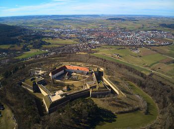
Weißenburg i. Bay.: Discover the best trails: 10 hiking trails. All these trails, routes and outdoor activities are available in our SityTrail applications for smartphones and tablets.
The best trails (10)
![Trail On foot Weißenburg i. Bay. - Naturlehrpfad Nagelberg - Photo](https://media.geolcdn.com/t/350/260/10272107-3913-40d2-a592-a69b41135a6f.jpeg&format=jpg&maxdim=2)
![On foot On foot](https://static1.geolcdn.com/sitytour/trail-icons/100.png)
Km
On foot
![](/images/other/stat-length.png)
![](https://static1.geolcdn.com/siteimages/upload/files/1508320355ic_sort_den_pos_24dp.png)
![](https://static1.geolcdn.com/siteimages/upload/files/1508320355ic_sort_den_neg_24dp.png)
![](https://static1.geolcdn.com/siteimages/upload/files/16400158638029165_repeat_loop_refresh_sync_direction_icon.png)
• Trail created by Stadt Treuchtlingen. abgeschlossen (August 2014, by cycling_zno) Symbol: Grüne 4 auf gelbem Grund
![Trail On foot Weißenburg i. Bay. - Römerweg Weißenburg - Photo](https://media.geolcdn.com/t/350/260/b843aa0c-f6d8-42a6-95ab-6325a8468339.jpeg&format=jpg&maxdim=2)
![On foot On foot](https://static1.geolcdn.com/sitytour/trail-icons/100.png)
Km
On foot
![](/images/other/stat-length.png)
![](https://static1.geolcdn.com/siteimages/upload/files/1508320355ic_sort_den_pos_24dp.png)
![](https://static1.geolcdn.com/siteimages/upload/files/1508320355ic_sort_den_neg_24dp.png)
![](https://static1.geolcdn.com/siteimages/upload/files/16400158638029165_repeat_loop_refresh_sync_direction_icon.png)
• Trail created by Stadt Weißenburg. Symbol: Grüne Schrift auf gelbem Grund
![Trail On foot Weißenburg i. Bay. - Sternschanzweg - Photo](https://media.geolcdn.com/t/350/260/c14a344c-ae81-4e23-a296-d5a7c5dc06c1.jpeg&format=jpg&maxdim=2)
![On foot On foot](https://static1.geolcdn.com/sitytour/trail-icons/100.png)
Km
On foot
![](/images/other/stat-length.png)
![](https://static1.geolcdn.com/siteimages/upload/files/1508320355ic_sort_den_pos_24dp.png)
![](https://static1.geolcdn.com/siteimages/upload/files/1508320355ic_sort_den_neg_24dp.png)
![](https://static1.geolcdn.com/siteimages/upload/files/16400158638029165_repeat_loop_refresh_sync_direction_icon.png)
• Trail created by Stadt Weißenburg. abgeschlossen (Juli 2014, by cycling_zno) Symbol: Gelber Pfeil mit Ammonit und N...
![Trail On foot Weißenburg i. Bay. - Weißenburg Nr. 13 - Photo](https://media.geolcdn.com/t/350/260/2fdaed71-ab83-4126-bc1c-7a51ab57f31f.jpeg&format=jpg&maxdim=2)
![On foot On foot](https://static1.geolcdn.com/sitytour/trail-icons/100.png)
Km
On foot
![](/images/other/stat-length.png)
![](https://static1.geolcdn.com/siteimages/upload/files/1508320355ic_sort_den_pos_24dp.png)
![](https://static1.geolcdn.com/siteimages/upload/files/1508320355ic_sort_den_neg_24dp.png)
![](https://static1.geolcdn.com/siteimages/upload/files/16400158638029165_repeat_loop_refresh_sync_direction_icon.png)
• Trail created by Stadt Weißenburg. abgeschlossen (März 2014, by cycling_zno) Symbol: Grüne 13 auf gelbem Grund
![Trail On foot Weißenburg i. Bay. - Gunthildisweg - Photo](https://media.geolcdn.com/t/350/260/6f8a43af-97e4-49a8-a334-8950b0ffa5fe.jpeg&format=jpg&maxdim=2)
![On foot On foot](https://static1.geolcdn.com/sitytour/trail-icons/100.png)
Km
On foot
![](/images/other/stat-length.png)
![](https://static1.geolcdn.com/siteimages/upload/files/1508320355ic_sort_den_pos_24dp.png)
![](https://static1.geolcdn.com/siteimages/upload/files/1508320355ic_sort_den_neg_24dp.png)
![](https://static1.geolcdn.com/siteimages/upload/files/16400158638029165_repeat_loop_refresh_sync_direction_icon.png)
• Trail created by Stadt Weißenburg. abgeschlossen (März 2014, by cycling_zno) Symbol: Grüne 6 auf gelbem Grund
![Trail On foot Weißenburg i. Bay. - Laubentalweg - Photo](https://media.geolcdn.com/t/350/260/9ef9fbe8-97f1-49a5-96c5-72d1ee393dac.jpeg&format=jpg&maxdim=2)
![On foot On foot](https://static1.geolcdn.com/sitytour/trail-icons/100.png)
Km
On foot
![](/images/other/stat-length.png)
![](https://static1.geolcdn.com/siteimages/upload/files/1508320355ic_sort_den_pos_24dp.png)
![](https://static1.geolcdn.com/siteimages/upload/files/1508320355ic_sort_den_neg_24dp.png)
![](https://static1.geolcdn.com/siteimages/upload/files/16400158638029165_repeat_loop_refresh_sync_direction_icon.png)
• Trail created by Stadt Weißenburg. abgeschlossen (März 2014, by cycling_zno) Symbol: Grüne 1 auf gelbem Grund
![Trail On foot Weißenburg i. Bay. - Wülzburgweg - Photo](https://media.geolcdn.com/t/350/260/2fdaed71-ab83-4126-bc1c-7a51ab57f31f.jpeg&format=jpg&maxdim=2)
![On foot On foot](https://static1.geolcdn.com/sitytour/trail-icons/100.png)
Km
On foot
![](/images/other/stat-length.png)
![](https://static1.geolcdn.com/siteimages/upload/files/1508320355ic_sort_den_pos_24dp.png)
![](https://static1.geolcdn.com/siteimages/upload/files/1508320355ic_sort_den_neg_24dp.png)
![](https://static1.geolcdn.com/siteimages/upload/files/16400158638029165_repeat_loop_refresh_sync_direction_icon.png)
• Trail created by Stadt Weißenburg. abgeschlossen (März 2014, by cycling_zno) Symbol: Grüne 2 auf gelbem Grund
![Trail On foot Weißenburg i. Bay. - Hohllochweg - Photo](https://media.geolcdn.com/t/350/260/2fdaed71-ab83-4126-bc1c-7a51ab57f31f.jpeg&format=jpg&maxdim=2)
![On foot On foot](https://static1.geolcdn.com/sitytour/trail-icons/100.png)
Km
On foot
![](/images/other/stat-length.png)
![](https://static1.geolcdn.com/siteimages/upload/files/1508320355ic_sort_den_pos_24dp.png)
![](https://static1.geolcdn.com/siteimages/upload/files/1508320355ic_sort_den_neg_24dp.png)
![](https://static1.geolcdn.com/siteimages/upload/files/16400158638029165_repeat_loop_refresh_sync_direction_icon.png)
• Trail created by Stadt Weißenburg. abgeschlossen (März 2014, by cycling_zno) Symbol: Grüne 5 auf gelbem Grund
![Trail On foot Weißenburg i. Bay. - Eichelbergweg - Photo](https://media.geolcdn.com/t/350/260/ext.jpg?maxdim=2&url=https%3A%2F%2Fstatic1.geolcdn.com%2Fsiteimages%2Fupload%2Ffiles%2F1545311037marcheuse_200dpi.jpg)
![On foot On foot](https://static1.geolcdn.com/sitytour/trail-icons/100.png)
Km
On foot
![](/images/other/stat-length.png)
![](https://static1.geolcdn.com/siteimages/upload/files/1508320355ic_sort_den_pos_24dp.png)
![](https://static1.geolcdn.com/siteimages/upload/files/1508320355ic_sort_den_neg_24dp.png)
![](https://static1.geolcdn.com/siteimages/upload/files/16400158638029165_repeat_loop_refresh_sync_direction_icon.png)
• Trail created by Stadt Weißenburg. abgeschlossen (Juli 2014, by cycling_zno) Symbol: Gelber Pfeil mit Ammonit und N...
![Trail On foot Weißenburg i. Bay. - Eulennestweg - Photo](https://media.geolcdn.com/t/350/260/ext.jpg?maxdim=2&url=https%3A%2F%2Fstatic1.geolcdn.com%2Fsiteimages%2Fupload%2Ffiles%2F1545311037marcheuse_200dpi.jpg)
![On foot On foot](https://static1.geolcdn.com/sitytour/trail-icons/100.png)
Km
On foot
![](/images/other/stat-length.png)
![](https://static1.geolcdn.com/siteimages/upload/files/1508320355ic_sort_den_pos_24dp.png)
![](https://static1.geolcdn.com/siteimages/upload/files/1508320355ic_sort_den_neg_24dp.png)
![](https://static1.geolcdn.com/siteimages/upload/files/16400158638029165_repeat_loop_refresh_sync_direction_icon.png)
• Trail created by Stadt Weißenburg. abgeschlossen (Juli 2014, by cycling_zno) Symbol: Gelber Pfeil mit Ammonit und N...
10 trails displayed on 10
FREE GPS app for hiking