![](/images/other/stat-length.png)
Landkreis Erlangen-Höchstadt, Bavaria: Best trails, routes and walks
Landkreis Erlangen-Höchstadt: Discover the best trails: 60 hiking trails. All these trails, routes and outdoor activities are available in our SityTrail applications for smartphones and tablets.
The best trails (60)
![Trail On foot Baiersdorf - Meerrettichweg - Photo](https://media.geolcdn.com/t/350/260/92896cfd-f5cd-48c4-b2fd-c760b6de8ffd.jpeg&format=jpg&maxdim=2)
![On foot On foot](https://static1.geolcdn.com/sitytour/trail-icons/100.png)
Km
On foot
![](/images/other/stat-length.png)
![](https://static1.geolcdn.com/siteimages/upload/files/1508320355ic_sort_den_pos_24dp.png)
![](https://static1.geolcdn.com/siteimages/upload/files/1508320355ic_sort_den_neg_24dp.png)
![](https://static1.geolcdn.com/siteimages/upload/files/16400158638029165_repeat_loop_refresh_sync_direction_icon.png)
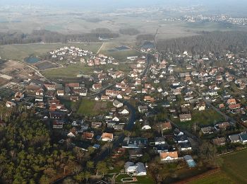
• Trail created by Fränkischer Albverein. Durch Baiersdorf fehlt aktuell (Juni 2020) eine durchgängige Markierung Sym...
![Trail On foot Bubenreuth - Hochwasserweg - Photo](https://media.geolcdn.com/t/350/260/0d4ced9c-0240-4646-a9bb-3ad2a492dab7.jpeg&format=jpg&maxdim=2)
![On foot On foot](https://static1.geolcdn.com/sitytour/trail-icons/100.png)
Km
On foot
![](/images/other/stat-length.png)
![](https://static1.geolcdn.com/siteimages/upload/files/1508320355ic_sort_den_pos_24dp.png)
![](https://static1.geolcdn.com/siteimages/upload/files/1508320355ic_sort_den_neg_24dp.png)
![](https://static1.geolcdn.com/siteimages/upload/files/16400158638029165_repeat_loop_refresh_sync_direction_icon.png)
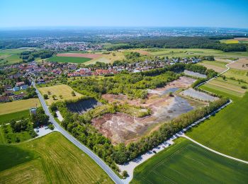
• Trail created by Gemeinde Bubenreuth.
![Trail On foot Marloffstein - Berg & Talpfad - Photo](https://media.geolcdn.com/t/350/260/0d4ced9c-0240-4646-a9bb-3ad2a492dab7.jpeg&format=jpg&maxdim=2)
![On foot On foot](https://static1.geolcdn.com/sitytour/trail-icons/100.png)
Km
On foot
![](/images/other/stat-length.png)
![](https://static1.geolcdn.com/siteimages/upload/files/1508320355ic_sort_den_pos_24dp.png)
![](https://static1.geolcdn.com/siteimages/upload/files/1508320355ic_sort_den_neg_24dp.png)
![](https://static1.geolcdn.com/siteimages/upload/files/16400158638029165_repeat_loop_refresh_sync_direction_icon.png)
• Name steht so auf den Schildern. Symbol: Vier bunte Kreise auf weißem Hintergrund (Logo VG Uttenreuth)
![Trail On foot Röttenbach - Pferdeweg - Photo](https://media.geolcdn.com/t/350/260/333824cc-3bd3-4f05-9cc7-3a117b628164.jpeg&format=jpg&maxdim=2)
![On foot On foot](https://static1.geolcdn.com/sitytour/trail-icons/100.png)
Km
On foot
![](/images/other/stat-length.png)
![](https://static1.geolcdn.com/siteimages/upload/files/1508320355ic_sort_den_pos_24dp.png)
![](https://static1.geolcdn.com/siteimages/upload/files/1508320355ic_sort_den_neg_24dp.png)
![](https://static1.geolcdn.com/siteimages/upload/files/16400158638029165_repeat_loop_refresh_sync_direction_icon.png)
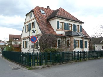
• Trail created by Verein für Naherholung und Landschaftspflege um Erlangen e.V..
![Trail On foot Röttenbach - Feldhasenweg - Photo](https://media.geolcdn.com/t/350/260/36f38197-f8ed-4eac-81b1-1e482fd0166d.jpeg&format=jpg&maxdim=2)
![On foot On foot](https://static1.geolcdn.com/sitytour/trail-icons/100.png)
Km
On foot
![](/images/other/stat-length.png)
![](https://static1.geolcdn.com/siteimages/upload/files/1508320355ic_sort_den_pos_24dp.png)
![](https://static1.geolcdn.com/siteimages/upload/files/1508320355ic_sort_den_neg_24dp.png)
![](https://static1.geolcdn.com/siteimages/upload/files/16400158638029165_repeat_loop_refresh_sync_direction_icon.png)
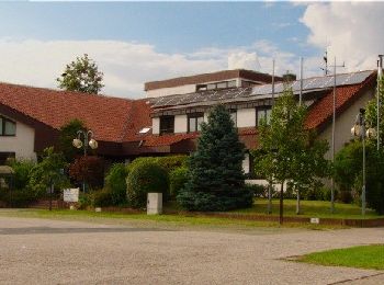
• Trail created by Verein für Naherholung und Landschaftspflege um Erlangen e.V..
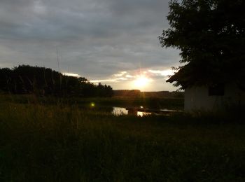
![Trail On foot Röttenbach - Storchenweg - Photo](https://media.geolcdn.com/t/350/260/592dfc71-33e6-45a2-9d4c-3c703451cd41.jpeg&format=jpg&maxdim=2)
![On foot On foot](https://static1.geolcdn.com/sitytour/trail-icons/100.png)
Km
On foot
![](/images/other/stat-length.png)
![](https://static1.geolcdn.com/siteimages/upload/files/1508320355ic_sort_den_pos_24dp.png)
![](https://static1.geolcdn.com/siteimages/upload/files/1508320355ic_sort_den_neg_24dp.png)
![](https://static1.geolcdn.com/siteimages/upload/files/16400158638029165_repeat_loop_refresh_sync_direction_icon.png)
• Trail created by Verein für Naherholung und Landschaftspflege um Erlangen e.V..
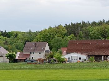
![Trail On foot Großenseebach - Seebachgrund-Wanderweg - Photo](https://media.geolcdn.com/t/350/260/05fc564c-b140-4d73-a3aa-37738d45d384.jpeg&format=jpg&maxdim=2)
![On foot On foot](https://static1.geolcdn.com/sitytour/trail-icons/100.png)
Km
On foot
![](/images/other/stat-length.png)
![](https://static1.geolcdn.com/siteimages/upload/files/1508320355ic_sort_den_pos_24dp.png)
![](https://static1.geolcdn.com/siteimages/upload/files/1508320355ic_sort_den_neg_24dp.png)
![](https://static1.geolcdn.com/siteimages/upload/files/16400158638029165_repeat_loop_refresh_sync_direction_icon.png)
• Trail created by Deutscher Volkssportverband. Symbol: DVV auf weißem Grund
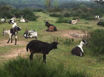
![Trail On foot Forst Tennenlohe - Rundwanderweg Heuschrecke - Photo](https://media.geolcdn.com/t/350/260/9daef759-0f7d-45b8-bd78-1a0745eed6a8.jpeg&format=jpg&maxdim=2)
![On foot On foot](https://static1.geolcdn.com/sitytour/trail-icons/100.png)
Km
On foot
![](/images/other/stat-length.png)
![](https://static1.geolcdn.com/siteimages/upload/files/1508320355ic_sort_den_pos_24dp.png)
![](https://static1.geolcdn.com/siteimages/upload/files/1508320355ic_sort_den_neg_24dp.png)
![](https://static1.geolcdn.com/siteimages/upload/files/16400158638029165_repeat_loop_refresh_sync_direction_icon.png)
• Trail created by Tennenloher Forst. geprüft (März 2015, by cycling_zno) Symbol: Schwarze Heuschrecke auf grünem Grund
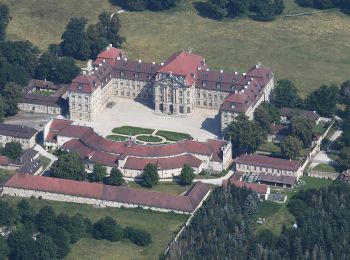
![Trail On foot Wachenroth - Weingartsgreuth W7 - Photo](https://media.geolcdn.com/t/350/260/2f696976-22ab-43fb-920d-5bced5d6d33d.jpeg&format=jpg&maxdim=2)
![On foot On foot](https://static1.geolcdn.com/sitytour/trail-icons/100.png)
Km
On foot
![](/images/other/stat-length.png)
![](https://static1.geolcdn.com/siteimages/upload/files/1508320355ic_sort_den_pos_24dp.png)
![](https://static1.geolcdn.com/siteimages/upload/files/1508320355ic_sort_den_neg_24dp.png)
![](https://static1.geolcdn.com/siteimages/upload/files/16400158638029165_repeat_loop_refresh_sync_direction_icon.png)
• Symbol: Schwarzes W7 auf gelbem Grund
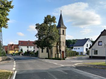
![Trail On foot Wachenroth - Weingartsgreuth W5 - Photo](https://media.geolcdn.com/t/350/260/b5f1b179-fe3e-4485-b875-c0acf4854dd8.jpeg&format=jpg&maxdim=2)
![On foot On foot](https://static1.geolcdn.com/sitytour/trail-icons/100.png)
Km
On foot
![](/images/other/stat-length.png)
![](https://static1.geolcdn.com/siteimages/upload/files/1508320355ic_sort_den_pos_24dp.png)
![](https://static1.geolcdn.com/siteimages/upload/files/1508320355ic_sort_den_neg_24dp.png)
![](https://static1.geolcdn.com/siteimages/upload/files/16400158638029165_repeat_loop_refresh_sync_direction_icon.png)
• Symbol: Schwarzes W5 auf gelbem Grund
![Trail On foot Forst Tennenlohe - Rundwanderweg Schmetterling - Photo](https://media.geolcdn.com/t/350/260/0a30d9d5-55a0-460e-915d-5a7e9ea4de8d.jpeg&format=jpg&maxdim=2)
![On foot On foot](https://static1.geolcdn.com/sitytour/trail-icons/100.png)
Km
On foot
![](/images/other/stat-length.png)
![](https://static1.geolcdn.com/siteimages/upload/files/1508320355ic_sort_den_pos_24dp.png)
![](https://static1.geolcdn.com/siteimages/upload/files/1508320355ic_sort_den_neg_24dp.png)
![](https://static1.geolcdn.com/siteimages/upload/files/16400158638029165_repeat_loop_refresh_sync_direction_icon.png)
• Trail created by Tennenloher Forst. geprüft (Feb. 2015 by cycling_zno) Symbol: Schwarzer Schmetterling auf gelbem G...
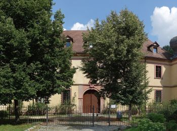
![Trail On foot Weisendorf - Weisendorfer Rundwanderweg 9 - Photo](https://media.geolcdn.com/t/350/260/f57b2e87-8a1e-4c52-a85b-dae612c7f77a.jpeg&format=jpg&maxdim=2)
![On foot On foot](https://static1.geolcdn.com/sitytour/trail-icons/100.png)
Km
On foot
![](/images/other/stat-length.png)
![](https://static1.geolcdn.com/siteimages/upload/files/1508320355ic_sort_den_pos_24dp.png)
![](https://static1.geolcdn.com/siteimages/upload/files/1508320355ic_sort_den_neg_24dp.png)
![](https://static1.geolcdn.com/siteimages/upload/files/16400158638029165_repeat_loop_refresh_sync_direction_icon.png)
• Trail created by Weisendorf. Symbol: Schwarze Schriftzeichen auf orangen Hintergrund
![Trail On foot Weisendorf - Weisendorfer Rundwanderweg 10 - Photo](https://media.geolcdn.com/t/350/260/f57b2e87-8a1e-4c52-a85b-dae612c7f77a.jpeg&format=jpg&maxdim=2)
![On foot On foot](https://static1.geolcdn.com/sitytour/trail-icons/100.png)
Km
On foot
![](/images/other/stat-length.png)
![](https://static1.geolcdn.com/siteimages/upload/files/1508320355ic_sort_den_pos_24dp.png)
![](https://static1.geolcdn.com/siteimages/upload/files/1508320355ic_sort_den_neg_24dp.png)
![](https://static1.geolcdn.com/siteimages/upload/files/16400158638029165_repeat_loop_refresh_sync_direction_icon.png)
• Trail created by Weisendorf. Symbol: Schwarze Schriftzeichen auf orangen Hintergrund
![Trail On foot Weisendorf - Weisendorfer Rundwanderweg 6 - Photo](https://media.geolcdn.com/t/350/260/f57b2e87-8a1e-4c52-a85b-dae612c7f77a.jpeg&format=jpg&maxdim=2)
![On foot On foot](https://static1.geolcdn.com/sitytour/trail-icons/100.png)
Km
On foot
![](/images/other/stat-length.png)
![](https://static1.geolcdn.com/siteimages/upload/files/1508320355ic_sort_den_pos_24dp.png)
![](https://static1.geolcdn.com/siteimages/upload/files/1508320355ic_sort_den_neg_24dp.png)
![](https://static1.geolcdn.com/siteimages/upload/files/16400158638029165_repeat_loop_refresh_sync_direction_icon.png)
• Trail created by Weisendorf. Symbol: Schwarze Schriftzeichen auf orangen Hintergrund
![Trail On foot Weisendorf - Weisendorfer Rundwanderweg 5 - Photo](https://media.geolcdn.com/t/350/260/f57b2e87-8a1e-4c52-a85b-dae612c7f77a.jpeg&format=jpg&maxdim=2)
![On foot On foot](https://static1.geolcdn.com/sitytour/trail-icons/100.png)
Km
On foot
![](/images/other/stat-length.png)
![](https://static1.geolcdn.com/siteimages/upload/files/1508320355ic_sort_den_pos_24dp.png)
![](https://static1.geolcdn.com/siteimages/upload/files/1508320355ic_sort_den_neg_24dp.png)
![](https://static1.geolcdn.com/siteimages/upload/files/16400158638029165_repeat_loop_refresh_sync_direction_icon.png)
• Trail created by Weisendorf. Symbol: Schwarze Schriftzeichen auf orangen Hintergrund
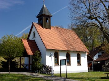
![Trail On foot Weisendorf - Weisendorfer Rundwanderweg 4 - Photo](https://media.geolcdn.com/t/350/260/c4101662-9986-440a-b4c6-bb9be8c5e368.jpeg&format=jpg&maxdim=2)
![On foot On foot](https://static1.geolcdn.com/sitytour/trail-icons/100.png)
Km
On foot
![](/images/other/stat-length.png)
![](https://static1.geolcdn.com/siteimages/upload/files/1508320355ic_sort_den_pos_24dp.png)
![](https://static1.geolcdn.com/siteimages/upload/files/1508320355ic_sort_den_neg_24dp.png)
![](https://static1.geolcdn.com/siteimages/upload/files/16400158638029165_repeat_loop_refresh_sync_direction_icon.png)
• Trail created by Weisendorf. Symbol: Schwarze Schriftzeichen auf orangen Hintergrund
![Trail On foot Weisendorf - Weisendorfer Rundwanderweg 1 - Photo](https://media.geolcdn.com/t/350/260/f57b2e87-8a1e-4c52-a85b-dae612c7f77a.jpeg&format=jpg&maxdim=2)
![On foot On foot](https://static1.geolcdn.com/sitytour/trail-icons/100.png)
Km
On foot
![](/images/other/stat-length.png)
![](https://static1.geolcdn.com/siteimages/upload/files/1508320355ic_sort_den_pos_24dp.png)
![](https://static1.geolcdn.com/siteimages/upload/files/1508320355ic_sort_den_neg_24dp.png)
![](https://static1.geolcdn.com/siteimages/upload/files/16400158638029165_repeat_loop_refresh_sync_direction_icon.png)
• Trail created by Weisendorf. Symbol: Schwarze Schriftzeichen auf orangen Hintergrund
![Trail On foot Buckenhofer Forst - Kreuzeiche Trail - Photo](https://media.geolcdn.com/t/350/260/b4b6bb74-7819-4b5c-9ec1-7ba33dbaf327.jpeg&format=jpg&maxdim=2)
![On foot On foot](https://static1.geolcdn.com/sitytour/trail-icons/100.png)
Km
On foot
![](/images/other/stat-length.png)
![](https://static1.geolcdn.com/siteimages/upload/files/1508320355ic_sort_den_pos_24dp.png)
![](https://static1.geolcdn.com/siteimages/upload/files/1508320355ic_sort_den_neg_24dp.png)
![](https://static1.geolcdn.com/siteimages/upload/files/16400158638029165_repeat_loop_refresh_sync_direction_icon.png)
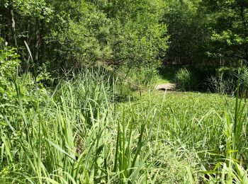
• Trail created by Nordic Walking Park Buckenhof Uttenreuth. geprüft (Feb. 2015 by cycling_zno) Symbol: Nordic Walker...
![Trail On foot Buckenhofer Forst - Hirschlecke Trail - Photo](https://media.geolcdn.com/t/350/260/b4b6bb74-7819-4b5c-9ec1-7ba33dbaf327.jpeg&format=jpg&maxdim=2)
![On foot On foot](https://static1.geolcdn.com/sitytour/trail-icons/100.png)
Km
On foot
![](/images/other/stat-length.png)
![](https://static1.geolcdn.com/siteimages/upload/files/1508320355ic_sort_den_pos_24dp.png)
![](https://static1.geolcdn.com/siteimages/upload/files/1508320355ic_sort_den_neg_24dp.png)
![](https://static1.geolcdn.com/siteimages/upload/files/16400158638029165_repeat_loop_refresh_sync_direction_icon.png)
• Trail created by Nordic Walking Park Buckenhof Uttenreuth. geprüft (Feb. 2015 by cycling_zno) Symbol: Nordic Walker...
![Trail On foot Eckental - Rundweg Ebach – Lillinghof - Photo](https://media.geolcdn.com/t/350/260/d8693fb8-1f77-4414-84a2-770b5fc77d38.jpeg&format=jpg&maxdim=2)
![On foot On foot](https://static1.geolcdn.com/sitytour/trail-icons/100.png)
Km
On foot
![](/images/other/stat-length.png)
![](https://static1.geolcdn.com/siteimages/upload/files/1508320355ic_sort_den_pos_24dp.png)
![](https://static1.geolcdn.com/siteimages/upload/files/1508320355ic_sort_den_neg_24dp.png)
![](https://static1.geolcdn.com/siteimages/upload/files/16400158638029165_repeat_loop_refresh_sync_direction_icon.png)
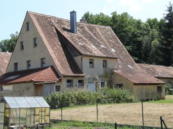
• Trail created by Gemeinde Eckental. abgeschlossen (Dez. 2012 by cycling_zno)
20 trails displayed on 60
FREE GPS app for hiking