![](/images/other/stat-length.png)
Landkreis Haßberge, Bavaria: Best trails, routes and walks
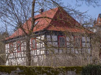
Landkreis Haßberge: Discover the best trails: 113 hiking trails. All these trails, routes and outdoor activities are available in our SityTrail applications for smartphones and tablets.
The best trails (113)
![Trail On foot Knetzgau - Rundwanderweg Sand S 5 - Photo](https://media.geolcdn.com/t/350/260/31e55d28-2691-4b8e-b538-95a75c0cd3bf.jpeg&format=jpg&maxdim=2)
![On foot On foot](https://static1.geolcdn.com/sitytour/trail-icons/100.png)
Km
On foot
![](/images/other/stat-length.png)
![](https://static1.geolcdn.com/siteimages/upload/files/1508320355ic_sort_den_pos_24dp.png)
![](https://static1.geolcdn.com/siteimages/upload/files/1508320355ic_sort_den_neg_24dp.png)
![](https://static1.geolcdn.com/siteimages/upload/files/16400158638029165_repeat_loop_refresh_sync_direction_icon.png)
• Trail created by Gemeinde Sand am Main. Symbol: Schwarze S5 auf gelbem Hintergrund
![Trail On foot Haßfurt - Lauftour HAS4 - Photo](https://media.geolcdn.com/t/350/260/076e4c13-279b-43ee-8078-8a52f31d58bb.jpeg&format=jpg&maxdim=2)
![On foot On foot](https://static1.geolcdn.com/sitytour/trail-icons/100.png)
Km
On foot
![](/images/other/stat-length.png)
![](https://static1.geolcdn.com/siteimages/upload/files/1508320355ic_sort_den_pos_24dp.png)
![](https://static1.geolcdn.com/siteimages/upload/files/1508320355ic_sort_den_neg_24dp.png)
![](https://static1.geolcdn.com/siteimages/upload/files/16400158638029165_repeat_loop_refresh_sync_direction_icon.png)
• Trail created by Landkreis Haßberge/Laufparadies Haßberge. Symbol: Blaue HAS4 auf weißem Hintergrund
![Trail On foot Haßfurt - Lauftour HAS3 - Photo](https://media.geolcdn.com/t/350/260/b29d640c-a0ea-49b0-8aeb-072fa3a8e909.jpeg&format=jpg&maxdim=2)
![On foot On foot](https://static1.geolcdn.com/sitytour/trail-icons/100.png)
Km
On foot
![](/images/other/stat-length.png)
![](https://static1.geolcdn.com/siteimages/upload/files/1508320355ic_sort_den_pos_24dp.png)
![](https://static1.geolcdn.com/siteimages/upload/files/1508320355ic_sort_den_neg_24dp.png)
![](https://static1.geolcdn.com/siteimages/upload/files/16400158638029165_repeat_loop_refresh_sync_direction_icon.png)
• Trail created by Landkreis Haßberge/Laufparadies Haßberge. Symbol: Blaue HAS3 auf weißem Hintergrund
![Trail On foot Haßfurt - Lauftour HAS2 - Photo](https://media.geolcdn.com/t/350/260/bf8a675b-b9f3-487b-8272-ecc8c93198e3.jpeg&format=jpg&maxdim=2)
![On foot On foot](https://static1.geolcdn.com/sitytour/trail-icons/100.png)
Km
On foot
![](/images/other/stat-length.png)
![](https://static1.geolcdn.com/siteimages/upload/files/1508320355ic_sort_den_pos_24dp.png)
![](https://static1.geolcdn.com/siteimages/upload/files/1508320355ic_sort_den_neg_24dp.png)
![](https://static1.geolcdn.com/siteimages/upload/files/16400158638029165_repeat_loop_refresh_sync_direction_icon.png)
• Trail created by Landkreis Haßberge/Laufparadies Haßberge. Symbol: Blaue HAS2 auf weißem Hintergrund
![Trail On foot Haßfurt - Lauftour HAS5 - Photo](https://media.geolcdn.com/t/350/260/c13b2b94-147c-4957-b7f1-56901bee32f8.jpeg&format=jpg&maxdim=2)
![On foot On foot](https://static1.geolcdn.com/sitytour/trail-icons/100.png)
Km
On foot
![](/images/other/stat-length.png)
![](https://static1.geolcdn.com/siteimages/upload/files/1508320355ic_sort_den_pos_24dp.png)
![](https://static1.geolcdn.com/siteimages/upload/files/1508320355ic_sort_den_neg_24dp.png)
![](https://static1.geolcdn.com/siteimages/upload/files/16400158638029165_repeat_loop_refresh_sync_direction_icon.png)
• Trail created by Landkreis Haßberge/Laufparadies Haßberge. Symbol: Blaue HAS5 auf weißem Hintergrund
![Trail On foot Zeil am Main - Rundwanderweg Hase Zeil - Photo](https://media.geolcdn.com/t/350/260/c13b2b94-147c-4957-b7f1-56901bee32f8.jpeg&format=jpg&maxdim=2)
![On foot On foot](https://static1.geolcdn.com/sitytour/trail-icons/100.png)
Km
On foot
![](/images/other/stat-length.png)
![](https://static1.geolcdn.com/siteimages/upload/files/1508320355ic_sort_den_pos_24dp.png)
![](https://static1.geolcdn.com/siteimages/upload/files/1508320355ic_sort_den_neg_24dp.png)
![](https://static1.geolcdn.com/siteimages/upload/files/16400158638029165_repeat_loop_refresh_sync_direction_icon.png)
• Trail created by Stadt Zeil a. Main. Symbol: Schwarzer Hase auf gelbem Hintergrund
![Trail On foot Haßfurt - Rund um die Hohe Wann - Photo](https://media.geolcdn.com/t/350/260/9805a2ac-3994-4e43-bd25-ac7e09fd749a.jpeg&format=jpg&maxdim=2)
![On foot On foot](https://static1.geolcdn.com/sitytour/trail-icons/100.png)
Km
On foot
![](/images/other/stat-length.png)
![](https://static1.geolcdn.com/siteimages/upload/files/1508320355ic_sort_den_pos_24dp.png)
![](https://static1.geolcdn.com/siteimages/upload/files/1508320355ic_sort_den_neg_24dp.png)
![](https://static1.geolcdn.com/siteimages/upload/files/16400158638029165_repeat_loop_refresh_sync_direction_icon.png)
• Trail created by Stadt Haßfurt; Stadt Zeil. Symbol: Zwei grüne Hügel auf gelbem Hintergrund
![Trail On foot Königsberg in Bayern - Wolftour Altershausen - Photo](https://media.geolcdn.com/t/350/260/4d65154f-15d2-4180-92b8-1e81f8230968.jpeg&format=jpg&maxdim=2)
![On foot On foot](https://static1.geolcdn.com/sitytour/trail-icons/100.png)
Km
On foot
![](/images/other/stat-length.png)
![](https://static1.geolcdn.com/siteimages/upload/files/1508320355ic_sort_den_pos_24dp.png)
![](https://static1.geolcdn.com/siteimages/upload/files/1508320355ic_sort_den_neg_24dp.png)
![](https://static1.geolcdn.com/siteimages/upload/files/16400158638029165_repeat_loop_refresh_sync_direction_icon.png)
• Trail created by Haßbergverein Altershausen. Symbol: Stilisierter schwarzer Wolfskopf auf gelbem Hintergrund
![Trail On foot Ebelsbach - Rundwanderweg Milan Rudendorf - Photo](https://media.geolcdn.com/t/350/260/caeb0628-07aa-48cc-9718-d1fd0de5c211.jpeg&format=jpg&maxdim=2)
![On foot On foot](https://static1.geolcdn.com/sitytour/trail-icons/100.png)
Km
On foot
![](/images/other/stat-length.png)
![](https://static1.geolcdn.com/siteimages/upload/files/1508320355ic_sort_den_pos_24dp.png)
![](https://static1.geolcdn.com/siteimages/upload/files/1508320355ic_sort_den_neg_24dp.png)
![](https://static1.geolcdn.com/siteimages/upload/files/16400158638029165_repeat_loop_refresh_sync_direction_icon.png)
• Trail created by Haßbergverein Rudendorf. Symbol: Schwarzer Milan auf gelbem Hintergrund
![Trail On foot Breitbrunn - Rundwanderweg Hase Lußberg - Photo](https://media.geolcdn.com/t/350/260/7b754189-9687-4740-acc0-8c8b14bd3099.jpeg&format=jpg&maxdim=2)
![On foot On foot](https://static1.geolcdn.com/sitytour/trail-icons/100.png)
Km
On foot
![](/images/other/stat-length.png)
![](https://static1.geolcdn.com/siteimages/upload/files/1508320355ic_sort_den_pos_24dp.png)
![](https://static1.geolcdn.com/siteimages/upload/files/1508320355ic_sort_den_neg_24dp.png)
![](https://static1.geolcdn.com/siteimages/upload/files/16400158638029165_repeat_loop_refresh_sync_direction_icon.png)
• Trail created by Haßbergverein Veitenstein/Breitbrunn. Symbol: Schwarzer Hase auf gelbem Hintergrund
![Trail On foot Königsberg in Bayern - Hirschkäferweg Königsberg - Photo](https://media.geolcdn.com/t/350/260/bf8a675b-b9f3-487b-8272-ecc8c93198e3.jpeg&format=jpg&maxdim=2)
![On foot On foot](https://static1.geolcdn.com/sitytour/trail-icons/100.png)
Km
On foot
![](/images/other/stat-length.png)
![](https://static1.geolcdn.com/siteimages/upload/files/1508320355ic_sort_den_pos_24dp.png)
![](https://static1.geolcdn.com/siteimages/upload/files/1508320355ic_sort_den_neg_24dp.png)
![](https://static1.geolcdn.com/siteimages/upload/files/16400158638029165_repeat_loop_refresh_sync_direction_icon.png)
• Trail created by Haßbergverein Königsberg in Bayern. Symbol: Schwarzer Hirschkäfer auf gelbem Hintergrund
![Trail On foot Königsberg in Bayern - Historischer Rundwanderweg Königsberg - Photo](https://media.geolcdn.com/t/350/260/8f36938e-c33a-4143-8939-ceef0920a133.jpeg&format=jpg&maxdim=2)
![On foot On foot](https://static1.geolcdn.com/sitytour/trail-icons/100.png)
Km
On foot
![](/images/other/stat-length.png)
![](https://static1.geolcdn.com/siteimages/upload/files/1508320355ic_sort_den_pos_24dp.png)
![](https://static1.geolcdn.com/siteimages/upload/files/1508320355ic_sort_den_neg_24dp.png)
![](https://static1.geolcdn.com/siteimages/upload/files/16400158638029165_repeat_loop_refresh_sync_direction_icon.png)
• Trail created by Haßbergverein Königsberg in Bayern. Symbol: Schwarzes Stadttor auf gelbem Hintergrund
![Trail On foot Königsberg in Bayern - Hasenweg Königsberg - Photo](https://media.geolcdn.com/t/350/260/8f36938e-c33a-4143-8939-ceef0920a133.jpeg&format=jpg&maxdim=2)
![On foot On foot](https://static1.geolcdn.com/sitytour/trail-icons/100.png)
Km
On foot
![](/images/other/stat-length.png)
![](https://static1.geolcdn.com/siteimages/upload/files/1508320355ic_sort_den_pos_24dp.png)
![](https://static1.geolcdn.com/siteimages/upload/files/1508320355ic_sort_den_neg_24dp.png)
![](https://static1.geolcdn.com/siteimages/upload/files/16400158638029165_repeat_loop_refresh_sync_direction_icon.png)
• Trail created by Haßbergverein Königsberg in Bayern. Symbol: Schwarzer Hase auf gelbem Hintergrund
![Trail On foot Königsberg in Bayern - Lauftour KÖN3 - Photo](https://media.geolcdn.com/t/350/260/584f47d8-9960-489f-a683-e92a35da710b.jpeg&format=jpg&maxdim=2)
![On foot On foot](https://static1.geolcdn.com/sitytour/trail-icons/100.png)
Km
On foot
![](/images/other/stat-length.png)
![](https://static1.geolcdn.com/siteimages/upload/files/1508320355ic_sort_den_pos_24dp.png)
![](https://static1.geolcdn.com/siteimages/upload/files/1508320355ic_sort_den_neg_24dp.png)
![](https://static1.geolcdn.com/siteimages/upload/files/16400158638029165_repeat_loop_refresh_sync_direction_icon.png)
• Trail created by Landkreis Haßberge/Laufparadies Haßberge. Symbol: Blaues KÖN3 auf weißem Hintergrund
![Trail On foot Königsberg in Bayern - Lauftour KÖN1 - Photo](https://media.geolcdn.com/t/350/260/db1c6497-fa85-47fd-ba4a-9fc180ce68dc.jpeg&format=jpg&maxdim=2)
![On foot On foot](https://static1.geolcdn.com/sitytour/trail-icons/100.png)
Km
On foot
![](/images/other/stat-length.png)
![](https://static1.geolcdn.com/siteimages/upload/files/1508320355ic_sort_den_pos_24dp.png)
![](https://static1.geolcdn.com/siteimages/upload/files/1508320355ic_sort_den_neg_24dp.png)
![](https://static1.geolcdn.com/siteimages/upload/files/16400158638029165_repeat_loop_refresh_sync_direction_icon.png)
• Trail created by Landkreis Haßberge/Laufparadies Haßberge. Symbol: Blaues KÖN1 auf weißem Hintergrund
![Trail On foot Ebern - Rundwanderweg Fuchs Ebern - Photo](https://media.geolcdn.com/t/350/260/165d2066-6818-4585-b90f-324c67da351e.jpeg&format=jpg&maxdim=2)
![On foot On foot](https://static1.geolcdn.com/sitytour/trail-icons/100.png)
Km
On foot
![](/images/other/stat-length.png)
![](https://static1.geolcdn.com/siteimages/upload/files/1508320355ic_sort_den_pos_24dp.png)
![](https://static1.geolcdn.com/siteimages/upload/files/1508320355ic_sort_den_neg_24dp.png)
![](https://static1.geolcdn.com/siteimages/upload/files/16400158638029165_repeat_loop_refresh_sync_direction_icon.png)
• Trail created by Bürgerverein e.V. Ebern. Symbol: Schwarzer Fuchs auf gelbem Hintergrund
![Trail On foot Ebern - Großer Rundweg Fledermaus - Photo](https://media.geolcdn.com/t/350/260/0fad520f-e4c1-408c-8d22-9c04a6a706b7.jpeg&format=jpg&maxdim=2)
![On foot On foot](https://static1.geolcdn.com/sitytour/trail-icons/100.png)
Km
On foot
![](/images/other/stat-length.png)
![](https://static1.geolcdn.com/siteimages/upload/files/1508320355ic_sort_den_pos_24dp.png)
![](https://static1.geolcdn.com/siteimages/upload/files/1508320355ic_sort_den_neg_24dp.png)
![](https://static1.geolcdn.com/siteimages/upload/files/16400158638029165_repeat_loop_refresh_sync_direction_icon.png)
• Trail created by Stadt Ebern. Symbol: Weiße Fledermaus auf rotem Hintergrund
![Trail On foot Bundorf - Lauftour BUN2 - Photo](https://media.geolcdn.com/t/350/260/b03679f7-79c7-46df-941e-d9f45914fc5f.jpeg&format=jpg&maxdim=2)
![On foot On foot](https://static1.geolcdn.com/sitytour/trail-icons/100.png)
Km
On foot
![](/images/other/stat-length.png)
![](https://static1.geolcdn.com/siteimages/upload/files/1508320355ic_sort_den_pos_24dp.png)
![](https://static1.geolcdn.com/siteimages/upload/files/1508320355ic_sort_den_neg_24dp.png)
![](https://static1.geolcdn.com/siteimages/upload/files/16400158638029165_repeat_loop_refresh_sync_direction_icon.png)
• Trail created by Landkreis Haßberge/Laufparadies Haßberge. Symbol: Blaue BUN2 auf weißem Hintergrund
![Trail On foot Burgpreppach - Lauftour BGP1 - Photo](https://media.geolcdn.com/t/350/260/b4e1cf09-e2cb-4072-8c2b-63c476546bad.jpeg&format=jpg&maxdim=2)
![On foot On foot](https://static1.geolcdn.com/sitytour/trail-icons/100.png)
Km
On foot
![](/images/other/stat-length.png)
![](https://static1.geolcdn.com/siteimages/upload/files/1508320355ic_sort_den_pos_24dp.png)
![](https://static1.geolcdn.com/siteimages/upload/files/1508320355ic_sort_den_neg_24dp.png)
![](https://static1.geolcdn.com/siteimages/upload/files/16400158638029165_repeat_loop_refresh_sync_direction_icon.png)
• Trail created by Landkreis Haßberge/Laufparadies Haßberge. Symbol: Blaue BGP1 auf weißem Hintergrund
![Trail On foot Burgpreppach - Lauftour BGP2 - Photo](https://media.geolcdn.com/t/350/260/9bc30701-fd49-4661-96e4-b25467d91d85.jpeg&format=jpg&maxdim=2)
![On foot On foot](https://static1.geolcdn.com/sitytour/trail-icons/100.png)
Km
On foot
![](/images/other/stat-length.png)
![](https://static1.geolcdn.com/siteimages/upload/files/1508320355ic_sort_den_pos_24dp.png)
![](https://static1.geolcdn.com/siteimages/upload/files/1508320355ic_sort_den_neg_24dp.png)
![](https://static1.geolcdn.com/siteimages/upload/files/16400158638029165_repeat_loop_refresh_sync_direction_icon.png)
• Trail created by Landkreis Haßberge/Laufparadies Haßberge. Symbol: Blaue BGP2 auf weißem Hintergrund
20 trails displayed on 113
FREE GPS app for hiking