![](/images/other/stat-length.png)
- Trails
- Outdoor
- Germany
- Bavaria
- Landkreis Aschaffenburg
- Heigenbrücken
Heigenbrücken, Landkreis Aschaffenburg: Best trails, routes and walks
Heigenbrücken: Discover the best trails: 6 hiking trails. All these trails, routes and outdoor activities are available in our SityTrail applications for smartphones and tablets.
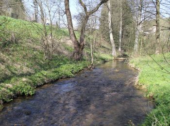
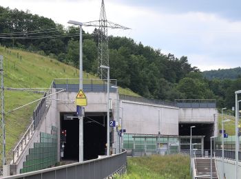
The best trails (6)
![Trail On foot Heigenbrücken - Schwarzer Keiler, Rundwanderweg Heigenbrücken - Kalter Grund - Photo](https://media.geolcdn.com/t/350/260/14877042-c02b-4e79-be7e-aa0b37b11b5e.jpeg&format=jpg&maxdim=2)
![On foot On foot](https://static1.geolcdn.com/sitytour/trail-icons/100.png)
Km
On foot
![](/images/other/stat-length.png)
![](https://static1.geolcdn.com/siteimages/upload/files/1508320355ic_sort_den_pos_24dp.png)
![](https://static1.geolcdn.com/siteimages/upload/files/1508320355ic_sort_den_neg_24dp.png)
![](https://static1.geolcdn.com/siteimages/upload/files/16400158638029165_repeat_loop_refresh_sync_direction_icon.png)
• Trail created by Naturpark Spessart. Symbol: Schwarzes Wildschwein auf weißem Grund
![Trail On foot Heigenbrücken - Roter Schmetterling, Rundwanderweg Sailauf - Photo](https://media.geolcdn.com/t/350/260/98e10225-4b92-4819-9887-ee487c0aaf52.jpeg&format=jpg&maxdim=2)
![On foot On foot](https://static1.geolcdn.com/sitytour/trail-icons/100.png)
Km
On foot
![](/images/other/stat-length.png)
![](https://static1.geolcdn.com/siteimages/upload/files/1508320355ic_sort_den_pos_24dp.png)
![](https://static1.geolcdn.com/siteimages/upload/files/1508320355ic_sort_den_neg_24dp.png)
![](https://static1.geolcdn.com/siteimages/upload/files/16400158638029165_repeat_loop_refresh_sync_direction_icon.png)
• Trail created by Naturpark Spessart. Symbol: Roter Schmetterling auf weißem Grund
![Trail On foot Heigenbrücken - Kulturweg Heigenbrücken - Photo](https://media.geolcdn.com/t/350/260/14877042-c02b-4e79-be7e-aa0b37b11b5e.jpeg&format=jpg&maxdim=2)
![On foot On foot](https://static1.geolcdn.com/sitytour/trail-icons/100.png)
Km
On foot
![](/images/other/stat-length.png)
![](https://static1.geolcdn.com/siteimages/upload/files/1508320355ic_sort_den_pos_24dp.png)
![](https://static1.geolcdn.com/siteimages/upload/files/1508320355ic_sort_den_neg_24dp.png)
![](https://static1.geolcdn.com/siteimages/upload/files/16400158638029165_repeat_loop_refresh_sync_direction_icon.png)
• Trail created by Archäologisches Spessartprojekt. Symbol: Gelbes EU-Schiffchen auf blauem Grund Website: http://ww...
![Trail On foot Heigenbrücken - Nordic Walking 1 Heigenbrücken - Photo](https://media.geolcdn.com/t/350/260/14877042-c02b-4e79-be7e-aa0b37b11b5e.jpeg&format=jpg&maxdim=2)
![On foot On foot](https://static1.geolcdn.com/sitytour/trail-icons/100.png)
Km
On foot
![](/images/other/stat-length.png)
![](https://static1.geolcdn.com/siteimages/upload/files/1508320355ic_sort_den_pos_24dp.png)
![](https://static1.geolcdn.com/siteimages/upload/files/1508320355ic_sort_den_neg_24dp.png)
![](https://static1.geolcdn.com/siteimages/upload/files/16400158638029165_repeat_loop_refresh_sync_direction_icon.png)
• Trail created by Spessartbund. Symbol: Blauer Walker und 1 auf weißem Grund
![Trail On foot Heigenbrücken - Glücksweg - Photo](https://media.geolcdn.com/t/350/260/f2e6f8e0-ee23-4d5f-8c4d-0e971ec5796f.jpeg&format=jpg&maxdim=2)
![On foot On foot](https://static1.geolcdn.com/sitytour/trail-icons/100.png)
Km
On foot
![](/images/other/stat-length.png)
![](https://static1.geolcdn.com/siteimages/upload/files/1508320355ic_sort_den_pos_24dp.png)
![](https://static1.geolcdn.com/siteimages/upload/files/1508320355ic_sort_den_neg_24dp.png)
![](https://static1.geolcdn.com/siteimages/upload/files/16400158638029165_repeat_loop_refresh_sync_direction_icon.png)
• Symbol: Kleeblatt
![Trail On foot Heigenbrücken - Wasserlernpfad - Photo](https://media.geolcdn.com/t/350/260/f2e6f8e0-ee23-4d5f-8c4d-0e971ec5796f.jpeg&format=jpg&maxdim=2)
![On foot On foot](https://static1.geolcdn.com/sitytour/trail-icons/100.png)
Km
On foot
![](/images/other/stat-length.png)
![](https://static1.geolcdn.com/siteimages/upload/files/1508320355ic_sort_den_pos_24dp.png)
![](https://static1.geolcdn.com/siteimages/upload/files/1508320355ic_sort_den_neg_24dp.png)
![](https://static1.geolcdn.com/siteimages/upload/files/16400158638029165_repeat_loop_refresh_sync_direction_icon.png)
• Trail created by Gemeinde Heigenbrücken. Symbol: Schwarzer Uhu auf Ast, Blauer Fisch in Sprechblase
6 trails displayed on 6
FREE GPS app for hiking