![](/images/other/stat-length.png)
Thalmässing, Roth: Best trails, routes and walks
Thalmässing: Discover the best trails: 17 hiking trails. All these trails, routes and outdoor activities are available in our SityTrail applications for smartphones and tablets.
The best trails (17)
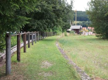
![Trail On foot Thalmässing - Mittelalterweg - Photo](https://media.geolcdn.com/t/350/260/1855eaef-aa06-48e6-b75a-d4d8913fddea.jpeg&format=jpg&maxdim=2)
![On foot On foot](https://static1.geolcdn.com/sitytour/trail-icons/100.png)
Km
On foot
![](/images/other/stat-length.png)
![](https://static1.geolcdn.com/siteimages/upload/files/1508320355ic_sort_den_pos_24dp.png)
![](https://static1.geolcdn.com/siteimages/upload/files/1508320355ic_sort_den_neg_24dp.png)
![](https://static1.geolcdn.com/siteimages/upload/files/16400158638029165_repeat_loop_refresh_sync_direction_icon.png)
• Trail created by Markt Thalmässing. Symbol: t.b.d.
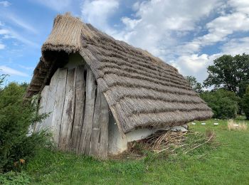
![Trail On foot Thalmässing - Keltenweg - Photo](https://media.geolcdn.com/t/350/260/e1bc8072-2425-4a9d-be91-f33e76d5ed4e.jpeg&format=jpg&maxdim=2)
![On foot On foot](https://static1.geolcdn.com/sitytour/trail-icons/100.png)
Km
On foot
![](/images/other/stat-length.png)
![](https://static1.geolcdn.com/siteimages/upload/files/1508320355ic_sort_den_pos_24dp.png)
![](https://static1.geolcdn.com/siteimages/upload/files/1508320355ic_sort_den_neg_24dp.png)
![](https://static1.geolcdn.com/siteimages/upload/files/16400158638029165_repeat_loop_refresh_sync_direction_icon.png)
• Trail created by Markt Thalmässing. Symbol: Weißes K auf blauem Grund
![Trail On foot Thalmässing - Thalmässing D - Photo](https://media.geolcdn.com/t/350/260/1855eaef-aa06-48e6-b75a-d4d8913fddea.jpeg&format=jpg&maxdim=2)
![On foot On foot](https://static1.geolcdn.com/sitytour/trail-icons/100.png)
Km
On foot
![](/images/other/stat-length.png)
![](https://static1.geolcdn.com/siteimages/upload/files/1508320355ic_sort_den_pos_24dp.png)
![](https://static1.geolcdn.com/siteimages/upload/files/1508320355ic_sort_den_neg_24dp.png)
![](https://static1.geolcdn.com/siteimages/upload/files/16400158638029165_repeat_loop_refresh_sync_direction_icon.png)
• Trail created by Markt Thalmässing. abgeschlossen (Nov. 2013 by cycling_zno) Symbol: Grünes D auf gelbem Grund
![Trail On foot Thalmässing - Vorgeschichtsweg - Photo](https://media.geolcdn.com/t/350/260/1855eaef-aa06-48e6-b75a-d4d8913fddea.jpeg&format=jpg&maxdim=2)
![On foot On foot](https://static1.geolcdn.com/sitytour/trail-icons/100.png)
Km
On foot
![](/images/other/stat-length.png)
![](https://static1.geolcdn.com/siteimages/upload/files/1508320355ic_sort_den_pos_24dp.png)
![](https://static1.geolcdn.com/siteimages/upload/files/1508320355ic_sort_den_neg_24dp.png)
![](https://static1.geolcdn.com/siteimages/upload/files/16400158638029165_repeat_loop_refresh_sync_direction_icon.png)
• Trail created by Markt Thalmässing. Symbol: ?
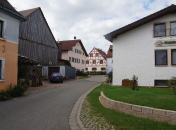
![Trail On foot Thalmässing - Thalmässing Spassweg 3 - Photo](https://media.geolcdn.com/t/350/260/09cbb0ed-9a00-4d04-adeb-5ecff4ef2a36.jpeg&format=jpg&maxdim=2)
![On foot On foot](https://static1.geolcdn.com/sitytour/trail-icons/100.png)
Km
On foot
![](/images/other/stat-length.png)
![](https://static1.geolcdn.com/siteimages/upload/files/1508320355ic_sort_den_pos_24dp.png)
![](https://static1.geolcdn.com/siteimages/upload/files/1508320355ic_sort_den_neg_24dp.png)
![](https://static1.geolcdn.com/siteimages/upload/files/16400158638029165_repeat_loop_refresh_sync_direction_icon.png)
• Trail created by Markt Thalmässing. Symbol: ?
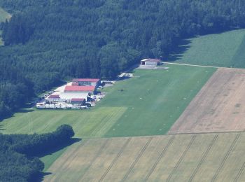
![Trail On foot Thalmässing - Spaßwanderweg Rundweg 2 - Photo](https://media.geolcdn.com/t/350/260/1c25d3dd-c328-4492-8c07-8a2affb10467.jpeg&format=jpg&maxdim=2)
![On foot On foot](https://static1.geolcdn.com/sitytour/trail-icons/100.png)
Km
On foot
![](/images/other/stat-length.png)
![](https://static1.geolcdn.com/siteimages/upload/files/1508320355ic_sort_den_pos_24dp.png)
![](https://static1.geolcdn.com/siteimages/upload/files/1508320355ic_sort_den_neg_24dp.png)
![](https://static1.geolcdn.com/siteimages/upload/files/16400158638029165_repeat_loop_refresh_sync_direction_icon.png)
• Trail created by Markt Thalmässing.
![Trail On foot Thalmässing - Thalmässing Spassweg 1 - Photo](https://media.geolcdn.com/t/350/260/1c25d3dd-c328-4492-8c07-8a2affb10467.jpeg&format=jpg&maxdim=2)
![On foot On foot](https://static1.geolcdn.com/sitytour/trail-icons/100.png)
Km
On foot
![](/images/other/stat-length.png)
![](https://static1.geolcdn.com/siteimages/upload/files/1508320355ic_sort_den_pos_24dp.png)
![](https://static1.geolcdn.com/siteimages/upload/files/1508320355ic_sort_den_neg_24dp.png)
![](https://static1.geolcdn.com/siteimages/upload/files/16400158638029165_repeat_loop_refresh_sync_direction_icon.png)
• Trail created by Markt Thalmässing.
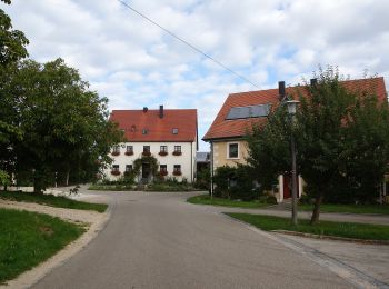
![Trail On foot Thalmässing - Thalmässing K - Photo](https://media.geolcdn.com/t/350/260/b28ba69c-1091-43fd-b590-dc8a445dc3ba.jpeg&format=jpg&maxdim=2)
![On foot On foot](https://static1.geolcdn.com/sitytour/trail-icons/100.png)
Km
On foot
![](/images/other/stat-length.png)
![](https://static1.geolcdn.com/siteimages/upload/files/1508320355ic_sort_den_pos_24dp.png)
![](https://static1.geolcdn.com/siteimages/upload/files/1508320355ic_sort_den_neg_24dp.png)
![](https://static1.geolcdn.com/siteimages/upload/files/16400158638029165_repeat_loop_refresh_sync_direction_icon.png)
• Trail created by Markt Thalmässing. abgeschlossen (Nov. 2013 by cycling_zno) Symbol: Grünes K auf gelbem Grund
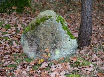
![Trail On foot Thalmässing - Thalmässing 9 (Grenzwanderweg) - Photo](https://media.geolcdn.com/t/350/260/b2884459-842e-4a5d-ba11-90d17e9f6f75.jpeg&format=jpg&maxdim=2)
![On foot On foot](https://static1.geolcdn.com/sitytour/trail-icons/100.png)
Km
On foot
![](/images/other/stat-length.png)
![](https://static1.geolcdn.com/siteimages/upload/files/1508320355ic_sort_den_pos_24dp.png)
![](https://static1.geolcdn.com/siteimages/upload/files/1508320355ic_sort_den_neg_24dp.png)
![](https://static1.geolcdn.com/siteimages/upload/files/16400158638029165_repeat_loop_refresh_sync_direction_icon.png)
• Trail created by Markt Thalmässing. abgeschlossen (Nov. 2013 by cycling_zno) Symbol: Amonit mit grüner 9 auf gelbem...
![Trail On foot Thalmässing - Thalmässing 8 - Photo](https://media.geolcdn.com/t/350/260/1855eaef-aa06-48e6-b75a-d4d8913fddea.jpeg&format=jpg&maxdim=2)
![On foot On foot](https://static1.geolcdn.com/sitytour/trail-icons/100.png)
Km
On foot
![](/images/other/stat-length.png)
![](https://static1.geolcdn.com/siteimages/upload/files/1508320355ic_sort_den_pos_24dp.png)
![](https://static1.geolcdn.com/siteimages/upload/files/1508320355ic_sort_den_neg_24dp.png)
![](https://static1.geolcdn.com/siteimages/upload/files/16400158638029165_repeat_loop_refresh_sync_direction_icon.png)
• Trail created by Markt Thalmässing. abgeschlossen (Nov. 2013 by cycling_zno) Symbol: Amonit mit grüner 8 auf gelbem...
![Trail On foot Thalmässing - Thalmässing 6 - Photo](https://media.geolcdn.com/t/350/260/1855eaef-aa06-48e6-b75a-d4d8913fddea.jpeg&format=jpg&maxdim=2)
![On foot On foot](https://static1.geolcdn.com/sitytour/trail-icons/100.png)
Km
On foot
![](/images/other/stat-length.png)
![](https://static1.geolcdn.com/siteimages/upload/files/1508320355ic_sort_den_pos_24dp.png)
![](https://static1.geolcdn.com/siteimages/upload/files/1508320355ic_sort_den_neg_24dp.png)
![](https://static1.geolcdn.com/siteimages/upload/files/16400158638029165_repeat_loop_refresh_sync_direction_icon.png)
• Trail created by Markt Thalmässing. abgeschlossen (Nov. 2013 by cycling_zno) Symbol: Amonit mit grüner 6 auf gelbem...
![Trail On foot Thalmässing - Thalmässing 5 Thalachtal Panoramaweg - Photo](https://media.geolcdn.com/t/350/260/1855eaef-aa06-48e6-b75a-d4d8913fddea.jpeg&format=jpg&maxdim=2)
![On foot On foot](https://static1.geolcdn.com/sitytour/trail-icons/100.png)
Km
On foot
![](/images/other/stat-length.png)
![](https://static1.geolcdn.com/siteimages/upload/files/1508320355ic_sort_den_pos_24dp.png)
![](https://static1.geolcdn.com/siteimages/upload/files/1508320355ic_sort_den_neg_24dp.png)
![](https://static1.geolcdn.com/siteimages/upload/files/16400158638029165_repeat_loop_refresh_sync_direction_icon.png)
• Trail created by Markt Thalmässing. abgeschlossen (Nov. 2013 by cycling_zno, updated 2016) Symbol: Amonit mit grüne...
![Trail On foot Thalmässing - Thalmässing 4 - Photo](https://media.geolcdn.com/t/350/260/1855eaef-aa06-48e6-b75a-d4d8913fddea.jpeg&format=jpg&maxdim=2)
![On foot On foot](https://static1.geolcdn.com/sitytour/trail-icons/100.png)
Km
On foot
![](/images/other/stat-length.png)
![](https://static1.geolcdn.com/siteimages/upload/files/1508320355ic_sort_den_pos_24dp.png)
![](https://static1.geolcdn.com/siteimages/upload/files/1508320355ic_sort_den_neg_24dp.png)
![](https://static1.geolcdn.com/siteimages/upload/files/16400158638029165_repeat_loop_refresh_sync_direction_icon.png)
• Trail created by Markt Thalmässing. abgeschlossen (Nov. 2013 by cycling_zno) Symbol: Amonit mit grüner 4 auf gelbem...
![Trail On foot Thalmässing - Thalmässing 3 - Photo](https://media.geolcdn.com/t/350/260/1855eaef-aa06-48e6-b75a-d4d8913fddea.jpeg&format=jpg&maxdim=2)
![On foot On foot](https://static1.geolcdn.com/sitytour/trail-icons/100.png)
Km
On foot
![](/images/other/stat-length.png)
![](https://static1.geolcdn.com/siteimages/upload/files/1508320355ic_sort_den_pos_24dp.png)
![](https://static1.geolcdn.com/siteimages/upload/files/1508320355ic_sort_den_neg_24dp.png)
![](https://static1.geolcdn.com/siteimages/upload/files/16400158638029165_repeat_loop_refresh_sync_direction_icon.png)
• Trail created by Markt Thalmässing. abgeschlossen (Nov. 2013 by cycling_zno) Symbol: Amonit mit grüner 3 auf gelbem...
![Trail On foot Thalmässing - Thalmässing 1 - Photo](https://media.geolcdn.com/t/350/260/1855eaef-aa06-48e6-b75a-d4d8913fddea.jpeg&format=jpg&maxdim=2)
![On foot On foot](https://static1.geolcdn.com/sitytour/trail-icons/100.png)
Km
On foot
![](/images/other/stat-length.png)
![](https://static1.geolcdn.com/siteimages/upload/files/1508320355ic_sort_den_pos_24dp.png)
![](https://static1.geolcdn.com/siteimages/upload/files/1508320355ic_sort_den_neg_24dp.png)
![](https://static1.geolcdn.com/siteimages/upload/files/16400158638029165_repeat_loop_refresh_sync_direction_icon.png)
• Trail created by Markt Thalmässing. abgeschlossen (Nov. 2013 by cycling_zno) Symbol: Amonit mit grüner 1 auf gelbem...
![Trail On foot Thalmässing - Vor- und Frühgeschichte erleben - Photo](https://media.geolcdn.com/t/350/260/1855eaef-aa06-48e6-b75a-d4d8913fddea.jpeg&format=jpg&maxdim=2)
![On foot On foot](https://static1.geolcdn.com/sitytour/trail-icons/100.png)
Km
On foot
![](/images/other/stat-length.png)
![](https://static1.geolcdn.com/siteimages/upload/files/1508320355ic_sort_den_pos_24dp.png)
![](https://static1.geolcdn.com/siteimages/upload/files/1508320355ic_sort_den_neg_24dp.png)
![](https://static1.geolcdn.com/siteimages/upload/files/16400158638029165_repeat_loop_refresh_sync_direction_icon.png)
![Trail On foot Thalmässing - Thalmässing 7 - Photo](https://media.geolcdn.com/t/350/260/e047244d-4838-478f-8d6a-91c81dfc3066.jpeg&format=jpg&maxdim=2)
![On foot On foot](https://static1.geolcdn.com/sitytour/trail-icons/100.png)
Km
On foot
![](/images/other/stat-length.png)
![](https://static1.geolcdn.com/siteimages/upload/files/1508320355ic_sort_den_pos_24dp.png)
![](https://static1.geolcdn.com/siteimages/upload/files/1508320355ic_sort_den_neg_24dp.png)
![](https://static1.geolcdn.com/siteimages/upload/files/16400158638029165_repeat_loop_refresh_sync_direction_icon.png)
• Trail created by Markt Thalmässing. abgeschlossen (Nov. 2013 by cycling_zno) Symbol: Amonit mit grüner 7 auf gelbem...
17 trails displayed on 17
FREE GPS app for hiking